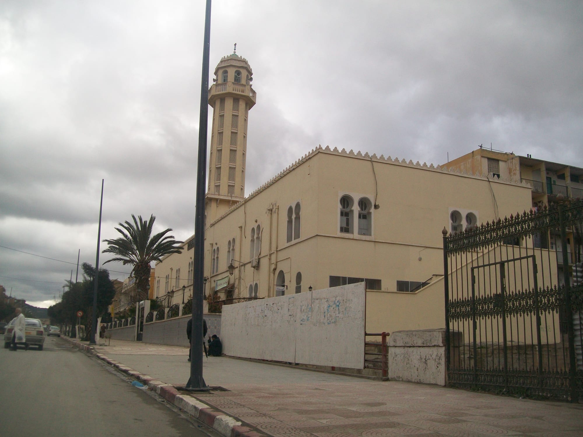
A pale stone mosque with a tall slender minaret on a wide city street under a grey sky, with palms along the railings

Constantine & the East, Algeria

Batna

The Abdelhamid Ben Badis Mosque on a central street in Batna. (Omar Ilyes / Wikimedia Commons · CC BY-SA 3.0)

The main city of the Aurès mountains in eastern Algeria, laid out as a French military camp in the 1840s and grown into a large regional capital above 1,000 metres. It is the base for the Roman city of Timgad, the legionary town of Lambaesis and the Numidian mausoleum of Medracen, and the gateway to Chaoui Berber country.

Neighbourhoods

  • The city centre
    • First-time visitors
    • Cafés
    • Close to public transport

    The 19th-century grid around the main avenues, with shops, banks, patisseries, the market streets and most of the hotels. Batna has no old medina, so this planned colonial core is the historic heart of the city, walkable end to end in a quarter of an hour.

    Open in Maps
  • Bouakal
    • Local life
    • Markets

    A large, densely built popular district west of the centre, one of the biggest in the city, with busy street markets, small workshops and a strong local identity.

    Open in Maps
  • Parc à Fourrage
    • Quiet and residential
    • Close to public transport

    A central-east district of apartment blocks and services named after the old army forage yards, close to the main transport routes and everyday shops.

    Open in Maps
  • Kechida
    • Quiet and residential
    • Students

    A residential quarter on the northern side of the city, a mixture of older housing and newer estates, near university facilities and the roads out towards Constantine.

    Open in Maps
  • Hamla and the southern estates
    • Quiet and residential
    • Modern city

    Newer planned housing on the southern edge of Batna, built to absorb the city's rapid growth, with wide roads, schools and views towards the mountains of the Aurès.

    Open in Maps

Things to do

In and around the city

  • The central avenues and marketsmarket

    The grid of streets at the centre, where clothing, spice and produce markets, cafés and patisseries make up most of the city's daily life.

    Open in Maps
  • Belezma National Parkpark

    A protected range of hills immediately north-west of the city, holding one of Algeria's largest remaining Atlas cedar forests along with oak woodland and mountain wildlife.

    Open in Maps
  • Tazoultattraction

    A small town a short way south of Batna, set among orchards below the mountains and built beside the Roman legionary site.

    Open in Maps

Roman and Numidian sites

  • Timgadlandmark

    A Roman colony founded under Trajan around 100 AD, about 35 kilometres east, laid out on a near-perfect grid with a theatre, forum, library and triumphal arch; a UNESCO World Heritage Site since 1982.

    Open in Maps
  • Lambaesislandmark

    The headquarters camp of the Third Augustan Legion, established under Hadrian beside modern Tazoult, where the great central building, the camp walls, triumphal arches and the remains of an amphitheatre still stand.

    Open in Maps
  • Medracenlandmark

    A circular stepped stone mausoleum on the plain north-east of Batna, the oldest of the royal tombs of the Berber Numidian kingdom, dated to the fourth century BC or to the time of King Masinissa.

    Open in Maps

The Aurès mountains

  • Ghoufiviewpoint

    A canyon south of Batna, cut by the Abiod river, where terraced cliff dwellings and granaries were carved into the rock above an oasis; they were lived in until the 1970s and now stand empty.

    Open in Maps
  • The Aurès road to Arristrail

    The mountain road south from Batna through high passes, cedar woods and Chaoui villages of stone and earth, the classic drive into the range.

    Open in Maps
  • Chéliatrail

    The highest point of the Aurès and, after Mount Tahat in the Sahara, the highest peak in Algeria, rising above cedar forest in the east of the range, with snow lying into spring.

    Open in Maps

Seasonal events

  • Commemorations of 1 NovemberNovember

    The start of the war of independence in 1954, which began with attacks in the Aurès, is marked each year with ceremonies at memorials in the city and the mountain villages.

  • Cherry and apricot harvestslate spring and early summer

    Fruit from the orchards of the Aurès valleys comes into the markets, and roadside stalls appear along the mountain roads.

  • Ramadan eveningsvaries with the lunar calendar

    Days are quiet and the centre fills after sunset, with sweet shops, cafés and market streets busy late into the night.

  • Summer cultural weeksJuly and August

    Concerts of Chaoui music, craft fairs and theatre are staged in the city and at the Roman sites during the school holidays.

Eat and drink

Long-standing places and food districts in Batna. Hours, ratings and directions come from your maps app, always current.

Aurès classics

  • Couscous and chakhchoukharestaurant

    Mountain versions of the eastern staples — couscous with mutton and vegetables, and torn flatbread in a spiced lamb and chickpea sauce — served in simple places around the centre.

    Open in Maps
  • Grilled meatsrestaurant

    Lamb from the high plains, grilled as chops, skewers and merguez sausages over charcoal and eaten with flatbread and salad.

    Open in Maps

Markets and sweet shops

  • The central marketmarket

    Cereals, pulses, dried figs and apricots from the Aurès, dates brought up from the desert fringe, olives, vegetables and meat, in the covered market and the streets around it.

    Open in Maps
  • Patisseries of the centrecafe

    Trays of baklawa, date-filled makroud and honey-dipped griwech, made in quantity before Eid and for weddings, sold along the main avenues.

    Open in Maps

Experience Batna

History

Batna is a young city in an ancient landscape. The plain below the Aurès has been settled since antiquity: the Numidian kings raised the Medracen mausoleum on it before Rome arrived, around 100 AD the emperor Trajan founded the veterans' colony of Thamugadi — Timgad — on the edge of the mountains, a town of straight streets, a forum, a library and a theatre, buried by sand after the late antique centuries and excavated from the 1880s onwards, and a generation later, under Hadrian, the Third Augustan Legion built its headquarters camp at Lambaesis.

The town of Batna itself was founded in 1844, when French forces established a camp on the route between Constantine and Biskra to control the Aurès, which had resisted every outside power from the Romans onwards. The camp became a garrison town with a grid of streets, and civilian settlement followed; the name was fixed in the following years. It grew slowly as an administrative and market centre for the mountains.

On 1 November 1954 the war of independence began with coordinated attacks across Algeria, many of them in the Aurès, and the mountains remained a guerrilla stronghold until 1962; the region's part in the war is central to how it is remembered nationally. After independence Batna expanded very quickly as people moved down from the mountain villages, becoming one of the largest cities of the interior, with a university, industry on its outskirts and new districts spreading across the plain.

Culture & Customs

Batna is the urban centre of the Chaoui, the Berber people of the Aurès, and Chaouia is spoken in the city and throughout the mountains alongside Algerian Arabic. The culture is markedly its own: music built on the gasba, an open reed flute, and the bendir frame drum, with a repertoire of sung poetry about exile, love and the mountains that singers such as Aïssa Djermouni carried to a wider audience in the 20th century.

Mountain crafts remain part of everyday life — heavy wool carpets and blankets woven on upright looms in patterns particular to the Aurès, silver jewellery, and the stone and earth building of the cliff villages. Women's traditional dress is distinctive, with bright layered cloth, heavy silver ornament and, among older generations, facial tattoos that are no longer made.

Society here is conservative, tribal in its older structures and strongly attached to family and village of origin, even for households that have lived in the city for two generations. Hospitality is emphatic, weddings are long and loud, and the memory of the war of independence is woven into local identity, marked in street names, monuments and the annual ceremonies of November. Religious life is Sunni Islam of the Maliki school, and Friday prayer and Ramadan order the week and the year.

Daily Life

About 290,000 people lived in the city at the 2008 census, making it one of Algeria's largest, and well over a million live in the province, most of them within reach of the Aurès. Growth has been rapid, and the districts around the old colonial grid — Bouakal above all — are densely built and busy, while newer estates spread across the plain to the south and north.

The economy rests on trade, administration, education and agriculture. The high plains grow cereals and raise sheep; the mountain valleys produce apricots, figs, apples and cherries; and the city handles the processing and distribution, along with textiles and light industry on its edges. The city's two universities give it a young population.

The rhythm is set by altitude and season: early markets, a long summer afternoon pause, and winters cold enough to shape daily life, with heating costs, snow on the mountain roads and villages cut off for a day or two at a time. Migration from the mountain villages into the city continues, and emigration to France is common enough that summers bring a visible return of families from abroad. Youth unemployment, housing and water supply are the standing local concerns.

Food

Batna's cooking is the plain, filling food of the mountains and high plains. Couscous is the foundation, steamed semolina under a stew of mutton, chickpeas and seasonal vegetables, and in the Aurès it is also eaten in simpler forms with buttermilk or with dried meat preserved for winter. Chakhchoukha — flatbread torn by hand into a spiced lamb and chickpea sauce — is the dish of gatherings, shared with the plateaus to the north and with Biskra to the south.

Bread is made at home as much as bought: kesra and matlou, flat semolina breads cooked on a griddle or in ashes, are eaten with olive oil, honey or butter. Soups of lentils, chickpeas and cracked wheat carry the cold months, and chorba frik breaks the fast in Ramadan. Dried figs and apricots from the valleys, walnuts and the dates brought up from the Saharan fringe at Biskra are everyday sweet things.

Festive food follows the eastern Algerian repertoire — baklawa, makroud filled with dates, griwech dipped in honey, and rfiss, crumbled semolina bread worked with butter and honey — made in quantity for Eid and for weddings, when whole sheep are roasted for méchoui. Strong coffee and mint tea are drunk all day, and in the mountain villages fresh and fermented milk is still served to guests.

Planning tools

Budget

Batna is inexpensive and has enough hotels to serve people visiting the Roman sites, mostly plain places in the centre with a few larger ones. The main cost is transport, since Timgad, Medracen and the mountain roads are best reached by hired car or a car with a driver. Cash is used for almost everything.

Daily Budget Midrange
USD 85–170 (mid-range hotel, restaurant meals, a driver for Timgad, Lambaesis and the Aurès)
Daily Budget Shoestring
USD 30–55 (simple hotel, café meals, buses and shared taxis)

Bring euros or US dollars to change; foreign cards are rarely accepted and ATMs taking them are scarce outside the largest cities.

Best Time to Visit

April to June and September to October are the best months, when the mountains are green or golden and the Roman sites are bearable. Summer is hot and glaring on the open plain, with little shade at Timgad. Winter is cold, windy and often snowy, and mountain roads can be blocked for days.

Suggested Number of Days

The city itself takes a day. Three or four allow for the ancient sites on the plain and a drive into the mountains, each of which fills most of a day once the travel is counted. Snow or heavy rain can add time in winter.

First Visit
1 day
With Surroundings
3–4 days

Transportation

Buses and shared taxis cover the city and reach the surrounding towns, and the bus station has frequent coaches to Constantine, Sétif, Biskra and Algiers. A railway line serves the city. Almost everyone visiting the Roman sites or the mountains hires a car or a car with a driver, as public transport to them is slow and infrequent.

Shared taxis run to Timgad and Tazoult from the city, but returning late in the day can be difficult.

Airport & Station Connections

Mostépha Ben Boulaid Airport, also called Batna International, lies a short drive from the city. By road Batna is roughly two hours from Constantine and about an hour and a half from Biskra on the edge of the Sahara, and coaches connect it with Sétif and Algiers. Trains run on the line through the high plains.

Walkability

The centre is flat, laid out on a grid and easy to walk, with the markets, cafés and hotels close together. Beyond it the city spreads into large districts better reached by taxi or bus. Nothing of the region's ancient sites is within walking distance, and winter wind and cold make walking uncomfortable for months at a time.

Safety

Batna is a calm regional city with the ordinary petty crime of markets and bus stations. The practical hazards are on the roads — mountain routes in the Aurès are narrow, winding and prone to snow and rockfall in winter — and at the ancient sites, which have uneven ground and little shade. Police checkpoints on the roads are routine.

Identification should be carried for checkpoints, police and military sites should not be photographed, and the mountain roads are best driven in daylight. Keep to main roads in the border provinces, cooperate with checkpoints and escorts, and avoid lonely mountain walks without a local guide. Check current official travel advice before travelling.

Climate

A semi-arid highland climate at about 1,050 metres, on the northern edge of the Aurès. Days and nights differ sharply all year, rain falls mainly between autumn and spring, and the mountains south and west of the city hold snow through the winter.

Summer
hot and dry, often 32–36°C by day on the plain, with much cooler nights
Winter
cold, roughly 2–12°C by day, with frost, wind and snow on the higher ground

Local Customs

The Aurès is conservative and family-centred, and hospitality is a strong obligation — refusing tea or a meal outright is awkward. Modest dress is expected, greetings are formal and unhurried, and Chaoui, a Berber language, is widely spoken here alongside Algerian Arabic. Mosques are generally not open to non-Muslim visitors.

Ask before photographing people, especially women and village houses, dress with shoulders and knees covered, expect a changed rhythm during Ramadan, and note that alcohol is not sold openly and public drinking is unacceptable.

Common Payment Methods

The currency is the Algerian dinar. Cash is needed for practically everything, including hotels, taxis, guides and site entry; foreign cards are rarely accepted and ATMs that take them are hard to find. Travellers change euros or US dollars and keep small notes for daily use.