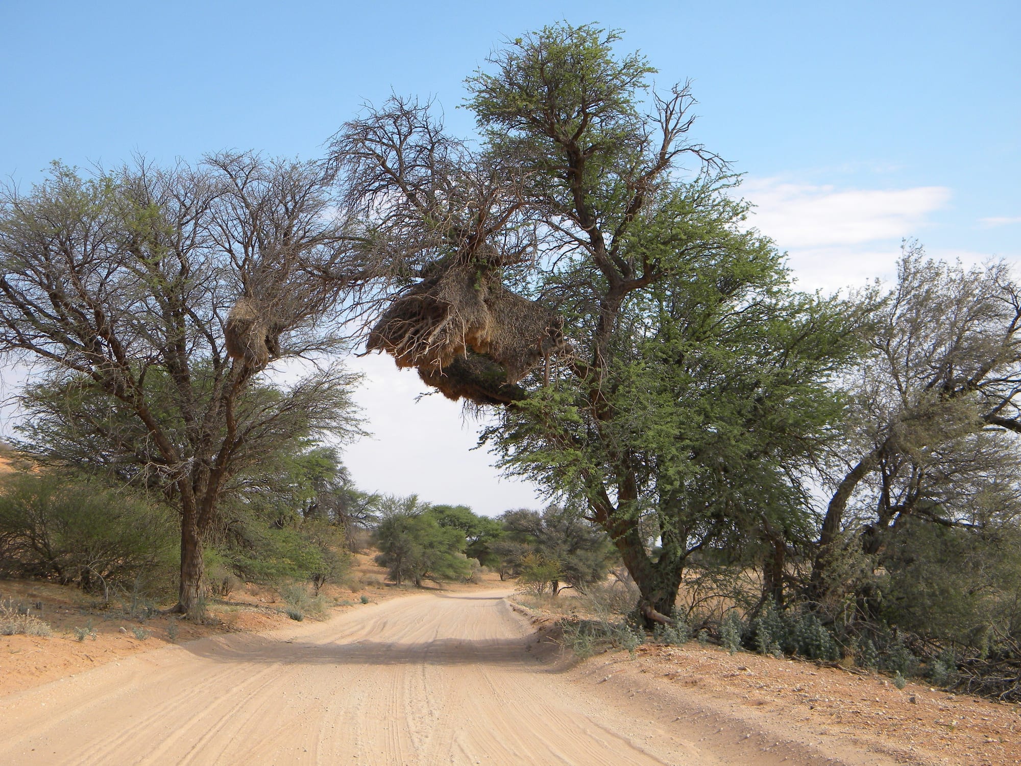
A sandy track running between camelthorn trees in dry Kalahari scrub, with a large sociable weaver nest in the branches

Gaborone, the Kalahari & the South, Botswana

Tsabong

A sand track through camelthorn trees in the Mabuasehube area of the southern Kalahari, the country north-west of Tsabong. (NeilMoll / Wikimedia Commons · CC0)

The administrative centre of Botswana's Kgalagadi District, set among red sand dunes near the dry bed of the Molopo River in the far south-west of the country. It is a small, hot government and cattle town with a camel park on its outskirts, and the last place with banks and fuel before the Kgalagadi Transfrontier Park.

Neighbourhoods

  • The town centre
    • First-time visitors
    • Supplies and fuel
    • Banks

    District offices, the hospital, schools, a bank, supermarkets, takeaways and filling stations sit within a few streets of each other. This is the last town of any size before the desert parks, so it is busiest in the morning when people come in from the outlying villages.

    Open in Maps
  • The wards and cattle posts
    • Local life
    • Quiet and residential

    Around the centre, houses on sandy plots spread into wards that fade into grazing land, with donkeys and goats on the streets. Families keep cattle at posts out in the dunes, and much of the town's daily traffic runs between the two.

    Open in Maps
  • The Molopo road
    • Camping
    • Local life
    • Border crossings

    South and east of town, the road follows the dry Molopo valley towards the South African border, passing the campsites and the villages strung along the riverbed.

    Open in Maps

Things to do

In and around the town

  • Tsabong Airporttransit hub

    The airstrip serving the district, used by light aircraft, government flights and the occasional charter into the Kalahari.

    Open in Maps
  • Tsabong Camel Parkpark

    The town's camel park, a fenced area of 3,200 hectares about 10 kilometres out, lying just north of and parallel to the main highway.

    Open in Maps

Short trips from the town

  • Makopongattraction

    One of the string of villages along the Molopo valley east of Tsabong, with a border post into South Africa and cattle country around it.

    Open in Maps
  • Werdaattraction

    A village on the road out of the Kgalagadi towards the east, a stop on the long drive to Gaborone.

    Open in Maps

Seasonal events

  • President's Day holidayJuly

    A long mid-winter public holiday weekend, marked in the district with sports, choral and traditional dance competitions and family gatherings.

  • Botswana Independence DaySeptember

    The anniversary of independence on 30 September, celebrated with kgotla gatherings, parades, church services and slaughtered cattle for family feasts.

Eat and drink

Long-standing places and food districts in Tsabong. Hours, ratings and directions come from your maps app, always current.

Tsabong classics

  • Seswaa and bogoberestaurant

    Salted beef boiled until it falls apart and pounded in a wooden bowl, eaten with a stiff sorghum or maize porridge — the dish of every gathering in the district.

    Open in Maps
  • Goat and Kalahari beefrestaurant

    Herding country food — goat stewed slowly with little more than salt, beef grilled over coals, and biltong dried at home in strips.

    Open in Maps
  • Desert gathered foodsmarket

    After good rains the sandveld yields tsamma melons, morama beans, wild berries and truffle-like fungi, foods long gathered by San and Bakgalagadi households.

    Open in Maps

Where to shop and eat

  • The centre's shops and takeawaysneighborhood

    Supermarkets, butchers, bakeries, bottle stores and a handful of takeaway counters on the main streets supply the town, the outlying villages and anyone heading for the parks.

    Open in Maps

Experience Tsabong

History

The southern Kalahari was San country long before any town stood here, and its pans and dry riverbeds were used by hunting bands whose descendants still live in the district. Bakgalagadi herders moved into the sandveld from the east over centuries, digging wells and keeping cattle and goats where the grazing allowed, and the Molopo valley became the region's line of settlement because water could be reached beneath its sand.

Tsabong itself grew as an administrative post in the Bechuanaland Protectorate, chosen as the centre for a district of enormous size and very few people. Its hospital came to serve an outlying area of scattered villages and cattle posts hundreds of kilometres across, and near the town lies the Tshabong kimberlite field, one of the largest diamond-bearing kimberlite fields in the world.

After independence in 1966 the town gained the apparatus of a district capital — offices, a hospital, secondary schools, a police headquarters — and boreholes made permanent settlement possible over a wider area. Paving the road to Kanye and Gaborone ended the worst of its isolation, and the creation of the Kgalagadi Transfrontier Park with South Africa in 2000 gave the district a slow but growing tourist trade based on the desert to its north and west.

Culture & Customs

Tsabong is a quiet, conservative town where Setswana and Shekgalagadi are heard together and Afrikaans is common near the border. Bakgalagadi identity is strong in the surrounding villages, San communities live in and around several of them, and families on both sides of the Molopo are related to one another, with the border a recent administrative line across long-standing ties.

Livestock is the measure of most things. Cattle, goats and donkeys are wealth, inheritance and the reason for much of the district's movement, and questions about rain and grazing open most conversations. The kgotla still hears village disputes, funerals draw whole communities for days, and church attendance is high. Winter nights are famously cold here — the lowest temperature ever recorded in Botswana was measured at Tsabong — and life gathers round fires when they come.

Craft here is practical: leatherwork, karosses, ostrich-eggshell beads and grass work made largely by women's groups and sold from homes and cooperatives. Visitors are few enough to be noticed, and a greeting and a short conversation before any request are expected — arriving with a camera in hand and no introduction is the quickest way to be refused. Photographs of people and homesteads should always be asked for.

Daily Life

About 9,000 people lived in Tsabong at the 2011 census, making it the largest place in a district that covers a vast, thinly peopled stretch of the Kalahari. Government is the biggest employer — the district administration, hospital, schools, police and veterinary services — with shops, transport and small businesses around it, and livestock farming supporting most rural households.

The day starts before the heat, with school runs, queues at the offices and the early bus out to Gaborone, slows through the middle hours, and picks up again in the late afternoon when people come out to the shops and the football pitch. Households move between town plots and cattle posts in the dunes, and water — from boreholes, tankered to some villages in bad years — is the constant preoccupation.

Drought is the recurring crisis. Poor rains thin the herds and push families onto government drought-relief work, and foot-and-mouth restrictions can shut the beef trade for months at a time. Unemployment is high, especially for young people, and many leave for Gaborone or the mines. What has changed the town most in recent decades is the paved road and mobile coverage; tourism to the Kgalagadi parks adds a modest but growing number of jobs as guides, campsite staff and drivers.

Food

Food in the southern Kalahari comes from the herd. Goat and beef are stewed or grilled, offal is used carefully, and biltong hangs drying in many kitchens. Seswaa, salted meat boiled for hours and pounded into shreds, is served at weddings, funerals and public holidays with bogobe, the stiff porridge of sorghum or maize that accompanies nearly every meal, and with morogo, the gathered or garden greens cooked down with tomato and onion.

Milk matters in a herding district: madila, soured and thickened milk, is eaten with porridge, and mageu, a lightly fermented maize drink, is drunk cold through the hot months. The desert adds its own foods when the rains are good — the tsamma melon, valued as much for the water it holds as for its flesh, morama beans roasted for their kernels, wild cucumbers, berries and the truffle-like fungi that push through the sand after heavy storms.

In town, the food is straightforward: magwinya, the fried dough balls sold in the morning, takeaway plates of chicken or beef with pap, rice and coleslaw, bread and maize meal from the supermarkets, and braai over coals at weekends. Chibuku sorghum beer in cartons, home-brewed bojalwa and South African lagers are the usual drinks, and Afrikaans-speaking families near the border bring their own habits of potjiekos and rusks.

Planning tools

Budget

Tsabong is cheap to stay in — a few small guesthouses, lodges and campsites, and inexpensive food — but reaching it and going on from it is not. Fuel over very long distances, a capable vehicle and park fees for the Kgalagadi are what a trip here actually costs.

Daily Budget Midrange
USD 110–230 (guesthouse or lodge, meals, a share of a 4x4, a guided drive)
Daily Budget Shoestring
USD 30–70 (camping or a basic guesthouse room, supermarket food, buses on the paved road)

Draw cash and fill up here: there are no banks, fuel or supplies inside the Kgalagadi parks or in most of the villages beyond the town.

Best Time to Visit

April to August brings the most bearable weather — clear, dry days around 22–26°C and nights that often fall below freezing in the dunes. The rains between December and March are brief and unreliable but turn the sandveld green and bring antelope to the pans. October to early December is relentlessly hot, regularly above 38°C.

Suggested Number of Days

A night is enough for the town itself, which most people use as a staging post. Three or four days make sense for anyone combining it with the Molopo villages and the long drive to a Kgalagadi gate, where campsites must be booked well in advance.

First Visit
1 day
With Surroundings
3–4 days

Transportation

A paved road links Tsabong north-east towards Werda, Kanye and Gaborone and south to the South African border, and buses and minibuses use it. Almost everything else is deep sand: the tracks west and north to the Kgalagadi park gates and the Mabuasehube pans need a fully equipped four-wheel-drive vehicle, ideally travelling in convoy. The town itself is walkable.

Reduce tyre pressure for sand tracks, carry extra fuel and water, and do not attempt the park routes in a two-wheel-drive vehicle.

Airport & Station Connections

Tsabong lies roughly six to seven hours by road from Gaborone through Kanye, Werda and the Kgalagadi villages, and is also reached from Upington and the Northern Cape in South Africa through nearby border posts. Buses run to Gaborone, while the airstrip handles light aircraft rather than scheduled flights. Most visitors arrive in their own vehicle.

Walkability

The centre is small, flat and covered on foot in a few minutes, with sandy verges rather than pavements on most streets. Heat and glare are the real constraint in the middle of the day, and there is little shade. Anything outside town — the cattle posts, the river villages and the park tracks — needs a vehicle.

Safety

Crime is not the issue here; distance and heat are. Fuel, water, mobile signal and help are far apart, tracks are soft sand, and a breakdown in the dunes is serious. Dehydration, sunstroke and driving into livestock or antelope on the road are the common causes of trouble, and the desert nights are genuinely cold in winter.

Carry recovery gear, two spare tyres, extra fuel and water for the Kalahari parks, leave a route plan with the park office, and never walk outside camp at night. Drive only in daylight and tell someone in town which route is being taken. Check current official travel advice before travelling.

Climate

The driest and hottest corner of Botswana, with erratic summer thunderstorms between about December and March and long rainless spells the rest of the year. Days and nights differ sharply, and winter frost is common in the dunes. In the southern hemisphere summer runs December to February and winter June to August.

Summer
very hot, often 35–40°C by day, with dust, glare and occasional violent storms
Winter
dry, sunny days around 20–25°C, with nights frequently below freezing

Local Customs

The district's people are largely Bakgalagadi, Batswana and San, with Shekgalagadi, Setswana and Afrikaans all in use alongside English. Greetings come first — dumela rra, dumela mma — and business follows. Cattle and goats carry social as well as financial weight, elders are addressed with care, and the kgotla remains the place where village matters are settled.

Ask before photographing people, homesteads or livestock; dress modestly, greet before asking directions, and expect Sunday to be a quiet day given over to church.

Common Payment Methods

The currency is the Botswana pula (BWP). Tsabong has a bank and ATMs and cards are accepted at supermarkets and fuel stations, but cash is needed for campsites, craft, village shops and any service beyond the town. South African rand is sometimes taken near the border but at a poor rate.