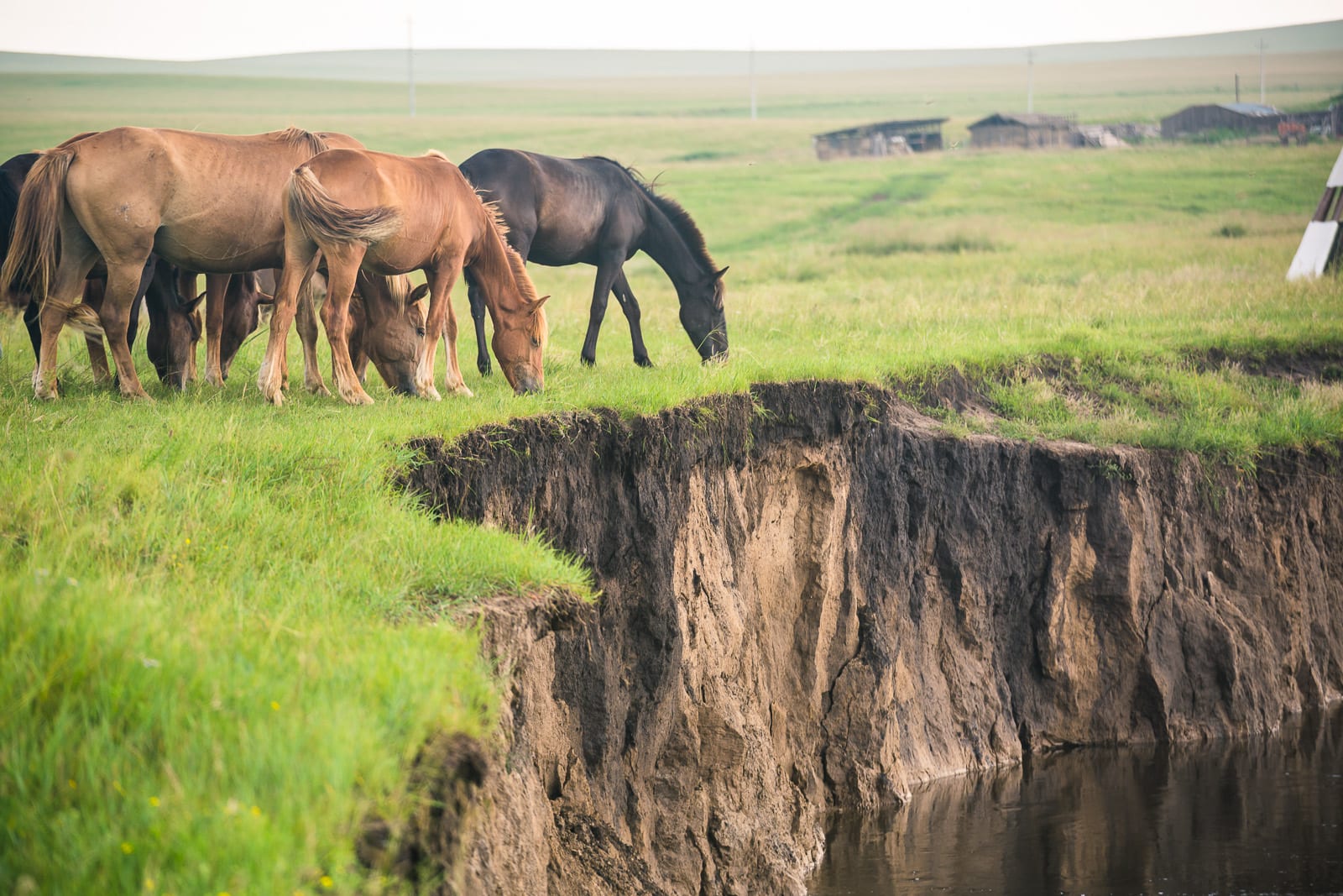
Brown and black horses grazing on green grassland at the edge of an eroded riverbank, with wooden sheds on the horizon

Inner Mongolia, China

Hulunbuir

Horses grazing above a river cutting on the Hulunbuir grasslands. (Sergio Tittarini / Wikimedia Commons · CC BY 2.0)

A city in the far north-east of Inner Mongolia whose urban centre, Hailar, sits on a river bend among some of the best grassland in China. The name comes from two lakes, Hulun and Buir, and the municipality is vast: grassland in the west and south, birch and larch forest in the Greater Khingan range to the east, and the Russian border along the Argun.

Neighbourhoods

  • Hailar District
    • First-time visitors
    • Close to public transport
    • Best for food

    The urban core and the only sizeable town, set on the Hailar River with the airport, the railway station, hotels and restaurants. It is compact, low-rise at its edges and the base from which almost every trip into the grassland starts.

    Open in Maps
  • Ewenki Autonomous Banner
    • Grassland
    • Culture
    • Quiet and residential

    The banner immediately south of Hailar, named for the Ewenki people and centred on the town of Bayan Tohoi. Its pastures hold yurt camps, herding families and a museum of Ewenki reindeer and hunting traditions.

    Open in Maps
  • Chen Barag Banner
    • Grassland
    • Horse riding
    • Day trips

    Open pasture about 28 kilometres from Hailar, with wide meandering rivers, summer camps and the wrestling and racing fairs that draw people in from the banners.

    Open in Maps
  • Hailar's riverside and southern suburbs
    • Quiet and residential
    • Walks
    • Local life

    The newer blocks spreading south and east of the old centre along the Hailar River, with embankment parks, schools and the roads out towards the airport and the grassland. Quieter than the central grid and where most residents actually live.

    Open in Maps

Things to do

Grassland and water

  • Hulun Lakeattraction

    One of the five largest freshwater lakes in China, some 2,300 square kilometres of shallow water, reeds and birds on the steppe south-west of the city, and one of the country's main reed-producing areas.

    Open in Maps
  • Argun Riverviewpoint

    The river forming the border with Russia along the northern edge of the municipality, its meanders and wetlands among the best-known landscapes of the region.

    Open in Maps

Forest and mountains

  • Greater Khinganviewpoint

    The forested range east of the grassland, under conifer and birch woods that turn gold in September, and the source of the berries and mushrooms sold in Hailar's markets.

    Open in Maps
  • Genheattraction

    A forest city north-east of Hailar, one of the coldest inhabited places in China with an annual mean below freezing, known for its wetlands, birch woods and the Evenki reindeer herders of Aoluguya township.

    Open in Maps

Town sights

  • Manzhouliattraction

    The border city towards Russia, grown up around the station where the railway from Siberia entered Manchuria in 1901 and now a major land port of entry, with a border tourist area of matryoshka dolls and Hulun Lake on the road out.

    Open in Maps
  • Hulunbuir Hailar International Airporttransit hub

    The regional airport a few kilometres from the centre, known as Hailar Dongshan until 2011 and the usual way in and out of a region far from any high-speed line.

    Open in Maps

Seasonal events

  • NaadamJuly and August

    Banner-level festivals of wrestling, horse racing and archery held on the grassland through the short summer, with singing, milk tea and horse-head fiddle music alongside.

  • Grassland seasonlate June to early September

    The weeks when the pasture is green and yurt camps, riding, barbecues and lake trips are running; this is also when domestic visitor numbers peak.

  • Autumn colour in the KhinganSeptember

    Birch and larch forests east and north of the grassland turn yellow and gold for a short season that draws photographers from across China.

  • Ice and snow seasonDecember to February

    Winter festivals, ice sculpture, sledging and reindeer and horse displays are staged in and around Hailar in temperatures far below freezing.

Eat and drink

Long-standing places and food districts in Hulunbuir. Hours, ratings and directions come from your maps app, always current.

Hulunbuir classics

  • Mutton restaurantsrestaurant

    Grassland lamb is the region's export and its pride: boiled shoulder eaten off the bone with a knife, whole roast lamb at banquets, cumin-dusted skewers, and hotpots of paper-thin slices in winter.

    Open in Maps
  • Milk tea and dairy shopscafe

    Salty milk tea with fried millet, butter and curd is drunk all day, and shops sell milk skin, milk tofu and hard dried curds by the block.

    Open in Maps

Markets and food streets

  • Hailar's food streetsneighborhood

    The central blocks hold grill houses, Mongol and northeastern Chinese restaurants and Russian-influenced bakeries selling dark bread and pickles.

    Open in Maps
  • Forest produce stallsmarket

    Blueberries, lingonberries, pine nuts and wild mushrooms gathered in the Greater Khingan are sold fresh in late summer and as juice, jam and dried goods all year.

    Open in Maps

Experience Hulunbuir

History

The grasslands between the Argun and the Greater Khingan have been herding country for as long as there are records of them, and the region is often described as a cradle of the steppe peoples: the Xianbei, the Shiwei from whom the Mongols emerged, and later the Khitans all pastured here. Genghis Khan's early campaigns were fought across these rivers, and the Barga Mongols, the Daur, the Ewenki and the Oroqen have all held parts of the region for centuries, some as herders and others as forest hunters.

Modern Hailar dates from 1734, when the Qing built a walled garrison to hold the northern frontier and to oversee the banner troops of the Barga. It grew into a trading post on the tea and fur routes to Siberia. The Chinese Eastern Railway, built by Russia across Manchuria at the end of the 19th century, ran through the town and tied it to Harbin and to the border at Manzhouli, bringing Russian merchants, railway workers and architecture with it.

The 20th century was turbulent. The area changed hands between Chinese, Russian and Mongol authorities after 1911, and the Japanese occupied it in the 1930s, and the Kwantung Army completed a huge underground fortress on the edge of Hailar in 1937 using forced Chinese labour; some of the heaviest fighting of the Soviet campaign of August 1945 took place around the town, and the tunnels are now part of a war memorial park and museum. Under the People's Republic, Hulunbuir was administered variously from Heilongjiang and Inner Mongolia before settling within the autonomous region, and the banner system of local government survives in its names. Coal, forestry and, since the 2000s, tourism have reshaped an economy once based entirely on livestock.

Culture & Customs

This is the most Mongol-feeling corner of Inner Mongolia, and also the most mixed. Barga Mongols herd the western pastures, the Daur farm and fish along the rivers, and the Ewenki and Oroqen of the forests kept hunting and, in one small group, reindeer-herding traditions into living memory. Russian-descended families in the border villages gave the region a line of wooden houses, kvass and dark bread, and the Han majority arrived mostly with the railway and the state farms.

Summer is the season of the naadam, held at banner and camp level as well as in the larger regional gatherings: wrestling in heavy embroidered jackets, long-distance horse racing ridden by children, archery, and singing that goes on long after the events finish. The morin khuur, the two-stringed horse-head fiddle, and the drawn-out Mongolian long song belong to the grassland here as much as anywhere. Oboo cairns stand on the rises, with ceremonies in early summer.

Hospitality is taken seriously in a place where the nearest neighbour may be far off. Milk tea appears before any conversation, refusing food outright is awkward, and spirits are offered with a song and a flick of the fingers towards sky and earth. Livestock is the measure of a family's standing, and the calendar still turns on lambing, shearing, hay-cutting and the move between winter shelter and summer pasture.

Daily Life

Something over two million people live in the prefecture-level city, whose 264,000 square kilometres make it larger than most Chinese provinces, and about 365,000 of them in Hailar itself. Most residents are Han Chinese; Mongols are the largest minority, with Daur, Ewenki, Oroqen and Russian communities in the banners and forest districts. Outside Hailar, settlement is a scatter of banner towns, mining and forestry centres and herding camps.

The economy rests on livestock, coal, forestry and tourism. Hulunbuir lamb and dairy are sold across China as premium products; open-cast coal mines and power stations operate in the south; and logging in the Greater Khingan has been cut back sharply since a national ban on commercial felling in natural forests, pushing former forestry towns towards tourism and berry and mushroom gathering. Wind farms have spread along the ridges.

Life follows the extremes of the climate. Heating runs for seven months, houses have double doors and deep windows, and cars are fitted for deep cold. The summer weeks are crowded with visitors, weddings and festivals; by November the grassland is brown and empty and the towns turn inward. Young people leave for Hailar, Hohhot or the cities of the north-east, and the shrinking of herding households, grassland degradation and the search for work after the end of logging are the region's constant concerns.

Food

Meat and milk dominate, and the local lamb is the best-known product of the region. Shouba rou, boiled mutton cut off the bone with a knife and eaten with salt and garlic, is the everyday dish; whole roast lamb is brought out for guests; and skewers dusted with cumin and chilli are grilled on every street in summer. Winter brings the copper-pot hotpot of thin mutton slices, cabbage and vermicelli.

The white foods are the other half of the table. Milk tea, suutei tsai, is salty and often thickened with fried millet and butter; milk skin, milk tofu, dried curds and clotted cream are eaten at breakfast or carried as travelling food; and airag, lightly fermented mare's milk, is a summer drink of the camps rather than the town.

Two other influences show up in Hailar. Northeastern Chinese cooking brings stewed pork with vermicelli, dumplings and pickled cabbage, and Russian contact along the border has left dark bread, sausage, pickles and kvass, with restaurants in the border towns serving a Chinese version of Russian food. From the forests come blueberries, lingonberries, pine nuts, wild mushrooms and berry wines and juices, sold in the markets in late summer and given as gifts across China.

Planning tools

Budget

Hailar itself is cheap, with simple hotels and canteens, but this is an expensive region to travel in because everything is far apart. A hired car and driver, or a place on a tour, is the main expense, followed by yurt camps, which vary widely in comfort and rise steeply in July and August. Flights are often the only practical way in.

Daily Budget Midrange
USD 90–180 (mid-range hotel or yurt camp, a hired car and driver, entry tickets)
Daily Budget Shoestring
USD 30–50 (budget hotel, noodle and mutton canteens, long-distance buses and trains)

Fix the full route and a day rate with a driver before setting out; distances of 200 to 300 kilometres a day are normal here.

Best Time to Visit

Late June to early September is the grassland season, when the pasture is green, the festivals are held and the nights are cool rather than freezing. September brings gold forests and thinner crowds. From October to May the grass is brown and the cold is extreme, which suits snow festivals and reindeer country but little else.

Suggested Number of Days

Two days are enough for the town and a stretch of nearby grassland. Four to six suit the wider loops north to the forests and the border river or south-west to the lake, all of which involve long drives. Winter shortens what is practical.

First Visit
2 days
With Surroundings
4–6 days

Transportation

Hailar is small enough for taxis and buses, but the municipality is one of the largest in China, and getting around it means a hired car with a driver or a tour. Roads are good and empty, distances long, and petrol stations sparse. Trains run west to the border and east towards Qiqihar and Harbin, and buses link the banner towns slowly.

Hire a driver who knows the grassland tracks rather than driving off the sealed roads alone, and refuel whenever the chance arises.

Airport & Station Connections

Hulunbuir Hailar International Airport, a few kilometres from the town, has flights to Beijing, Hohhot, Harbin and other Chinese cities, and is how most visitors arrive. There is no high-speed line; conventional trains run east towards Qiqihar and Harbin and west to the Russian border crossing at Manzhouli, a little under 200 kilometres away. Driving from Hohhot takes two long days.

Walkability

Central Hailar is easy on foot, with a compact grid, riverside paths and restaurants within a few blocks of the hotels. Everything else in the region is measured in hours of driving, and the grassland has no footpaths or shade. Winter ice and wind make even short walks in town demanding.

Safety

Crime is low and the towns are calm. The dangers are environmental: winter temperatures far below −30°C, sudden summer storms, sunburn and dehydration on open steppe, and breakdowns on empty roads with no phone signal. This is a border region with Russia and Mongolia, so restricted zones, checkpoints and frequent identity checks are normal, and dogs guarding herding camps should be given a wide berth.

Carry a passport at all times for checkpoints and hotels, take water, warm layers and a full tank on any drive out of town, and do not approach or photograph border installations. Check current official travel advice before travelling.

Climate

One of the coldest inhabited parts of China, with a short, mild summer and a long, dry, severe winter. Rain falls mainly in July and August, when the grass is green; snow cover lasts from November into April, and spring is windy and brown.

Summer
mild and pleasant, generally 18–27°C by day with cold nights, and long hours of daylight
Winter
extreme, commonly −20 to −32°C and colder at night, with dry snow and strong winds

Local Customs

Mongol herding etiquette shapes hospitality. Guests entering a yurt move clockwise, avoid stepping on the threshold, and accept milk tea, dairy snacks and sometimes a bowl of spirits with the right hand; a blue silk khadag may be offered as a greeting. Stone cairns, oboo, on the hilltops are shrines — circle them clockwise and add a stone rather than climbing on them. Ask before photographing people, animals or camps, and do not drive across pasture or through herds.

Tipping is not expected, though drivers and camp hosts appreciate a small gift. Politics, Taiwan, Tibet, Xinjiang, language policy and the Party are sensitive subjects, and security forces, border posts and military sites should not be photographed.

Common Payment Methods

The currency is the Chinese yuan renminbi, colloquially kuai. Alipay and WeChat Pay QR codes are used everywhere in town and both now let foreign visitors link an overseas card, but mobile signal is patchy on the grassland and some camps and drivers prefer cash. Foreign cards are little use outside a few hotels, so draw money in Hailar before heading out.