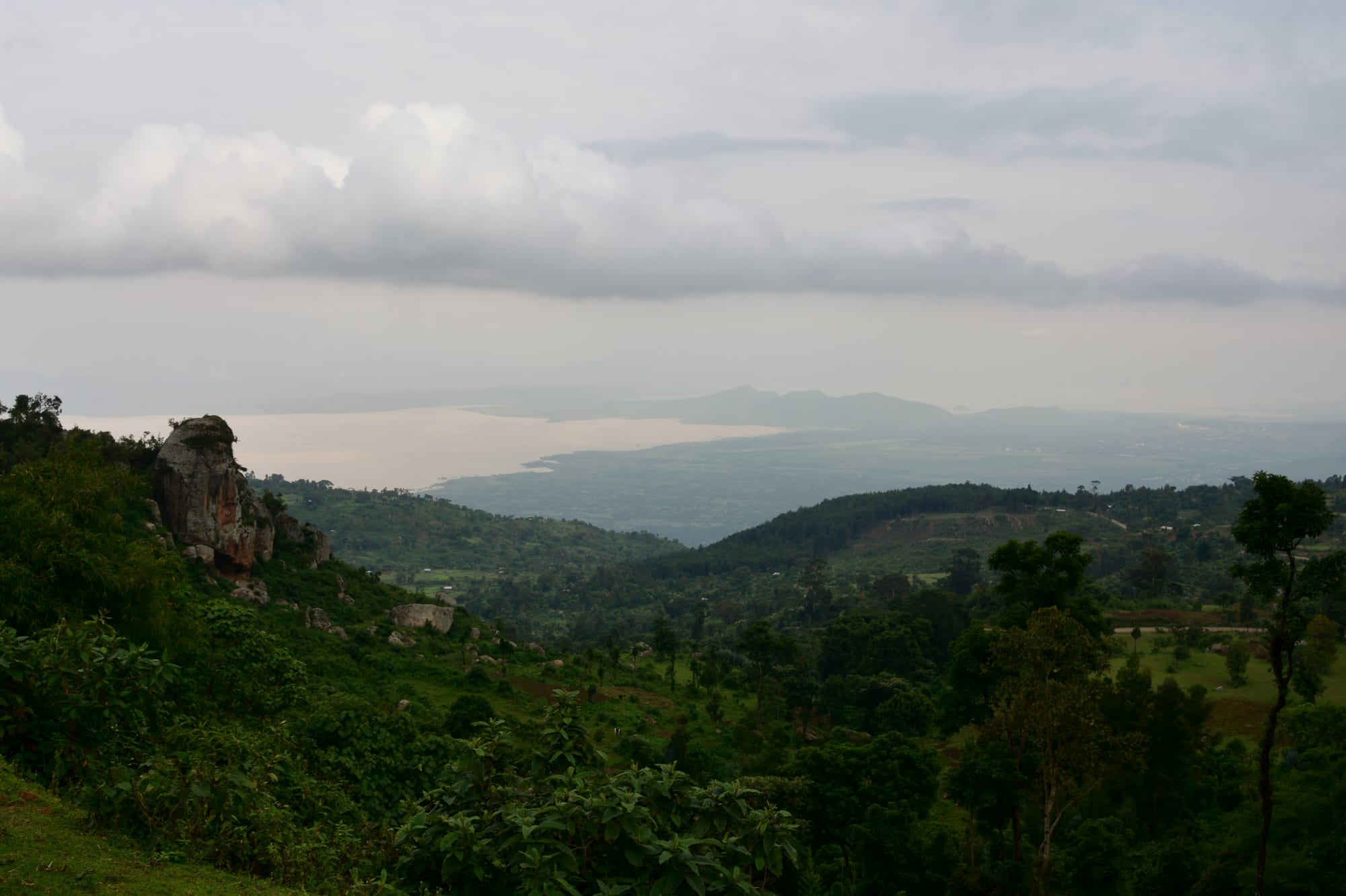
A wide view from a green wooded escarpment over a pale rift valley lake and hazy hills beyond

The Omo Valley & the South, Ethiopia

Arba Minch

The view from the escarpment at Arba Minch towards the rift valley lakes and the hills beyond. (Richard Mortel from Riyadh, Saudi Arabia / Wikimedia Commons · CC BY 2.0)

A southern Ethiopian town strung along a ridge above the Rift Valley floor, between Lake Abaya to the north and Lake Chamo to the south, with the plains of Nechisar National Park between them. Its name means 'forty springs', after the groundwater rising in the forest below the escarpment, and it serves as the administrative centre and gateway to the Gamo highlands and the roads south.

Neighbourhoods

  • Sikela
    • Markets
    • Transport connections
    • Local life

    The lower half of the town, spread over the flat ground towards the lakes, with the main market, the bus station and most of the shops, workshops and small hotels. It is the busier and hotter of the two halves, and the place where the town does its trading.

    Open in Maps
  • Shecha
    • Views
    • Quiet and residential
    • Government offices

    The upper town on the ridge, a few kilometres from Sikela, holding administrative offices, schools and older residential streets. It is cooler and calmer, and the ground falls away nearby towards the lakes and the park.

    Open in Maps
  • The escarpment edge
    • Views
    • Birdwatching
    • Sunsets

    The strip along the rim above the Rift Valley, where the ground drops to the forest of the forty springs and the isthmus between the lakes. Most of the town's lodges and viewpoints are here, and the wind comes up off the water in the afternoon.

    Open in Maps
  • The university quarter
    • Students
    • Budget stays
    • Cafés

    The area around Arba Minch University's campuses on the edge of town, with student cafés, cheap lunch places, photocopy shops and rented rooms. It fills up in term time and empties in the holidays.

    Open in Maps

Things to do

Lakes and wildlife

  • Nechisar National Parkpark

    A park of grass plains, hot springs and hills between the two lakes, known for plains zebra, greater kudu, Grant's gazelle and the pale 'white grass' plains that give it its name.

    Open in Maps
  • Lake Chamoattraction

    The southern lake, reached by boat from a landing below the town, known for its Nile crocodiles and hippos, and for the Nile perch and catfish taken from it.

    Open in Maps
  • The Bridge of Godviewpoint

    The narrow forested isthmus separating the two lakes, seen from the escarpment above the town and crossed by the track into the national park.

    Open in Maps

Springs, walks and viewpoints

  • The forty springsattraction

    The groundwater springs rising in the dense forest below the escarpment that give the town its name and supply its water.

    Open in Maps
  • Arba Minch Universityattraction

    A national university with four main campuses around the town, known above all for its water technology institute.

    Open in Maps

Short trips from the town

  • Lake Abayaattraction

    The larger northern lake, coloured reddish-brown by suspended sediment, with the Gidicho islands offshore and fishing villages along its edge.

    Open in Maps
  • Dorzeneighborhood

    A weaving people of the Gamo highlands above the town, living in villages near Chencha, known for cotton cloth, terraced fields of enset and tall beehive-shaped houses of bamboo.

    Open in Maps
  • Chenchaattraction

    The main highland town above the escarpment, cool and often misty, at the centre of the Gamo weaving country and its market trade.

    Open in Maps
  • Konso Cultural Landscapelandmark

    Walled hilltop towns, dry-stone agricultural terraces and carved wooden waga grave markers about 80 kilometres to the south, inscribed on the UNESCO World Heritage List in 2011 and the first place in Ethiopia recognised as a cultural landscape.

    Open in Maps

Seasonal events

  • Meskellate September

    The Orthodox feast of the Finding of the True Cross, marked with a bonfire of branches and singing at the end of the rains.

  • EnkutatashSeptember

    Ethiopian New Year, at the close of the long rains, celebrated with flowers, family meals and processions of singing children.

  • TimkatJanuary

    Epiphany, when Orthodox priests carry the tabot in procession to water for a blessing, drawing crowds from the surrounding villages.

Eat and drink

Long-standing places and food districts in Arba Minch. Hours, ratings and directions come from your maps app, always current.

Arba Minch classics

  • Lake fish grillsrestaurant

    Restaurants around the town serve Nile perch and catfish from Lake Chamo, grilled, fried in strips as asa cutlet or cooked into a peppery stew.

    Open in Maps
  • Kocho and kitfo housesrestaurant

    Traditional kitchens serving kocho, the dense flatbread made from fermented enset, with kitfo, minced beef with spiced butter, and ayib cheese.

    Open in Maps

Markets and food streets

  • Sikela marketmarket

    The town's main market, with bananas, mangoes and avocados from the irrigated plain, enset, honey, chillies, and Gamo cloth brought down from the highlands.

    Open in Maps
  • Cafés and juice barscafe

    Macchiato, spiced tea and layered avocado and mango juice, the southern lowlands' everyday drink, sold in small cafés in both halves of the town.

    Open in Maps

Experience Arba Minch

History

The ridge between Lakes Abaya and Chamo has long been a meeting point between the Gamo highlands above and the pastoral lowlands below, with weavers, farmers and cattle keepers trading at the foot of the escarpment. The kingdoms and chiefdoms of the Gamo hills, organised around ritual leaders and assemblies rather than a single throne, were brought into the Ethiopian empire during Menelik II's southern conquests at the end of the nineteenth century, and northern administrators, soldiers and settlers followed.

The town itself is young. It was established in the late imperial period as an administrative centre for the surrounding province, and its name — 'forty springs' in Amharic — comes from the many springs that rise in the groundwater forest below the ridge. It grew in two separate parts, Sikela on the lower ground and Shecha above, a division that still shapes the place. Nechisar National Park was established in 1974 on the plains and hills across the isthmus, and the airport and the paved road from the north made the town the natural base for travel into the far south.

Under the Derg and afterwards, Arba Minch became a regional education centre: a water technology institute grew into Arba Minch University, now a national university spread over four campuses around the town. Irrigated banana, mango and cotton farms spread across the valley floor, and the town became the administrative seat of successive regional arrangements as the south was reorganised, most recently into the South Ethiopia regional state in 2023.

Culture & Customs

Arba Minch is a Gamo town on the edge of a much wider mix of peoples. Gamo is the everyday language of the highlands above the escarpment, and the Gamo social order of clan elders, ritual leaders and village assemblies still shapes life in the hill villages, where disputes may be settled in public meetings before they reach any court. In the town, Amharic is the common language of trade, administration and the university, and people from all over the south live alongside one another.

Weaving is the region's best-known craft. The Dorze, in the hills above the town, are famous across Ethiopia for finely woven cotton shammas and gabis, worked on pit looms, and their tall beehive-shaped houses of bamboo and enset leaves are rebuilt and moved as the base rots away. Highland markets are as much social gatherings as places of trade, with cloth, pots, enset and livestock changing hands and news carried between villages.

Religion is mixed. Protestant churches, very strong across southern Ethiopia, fill on Sundays with long services and choirs; Orthodox parishes keep the fasts and the feast days of Meskel and Timkat; and there are Muslim congregations in the town. Hospitality follows the national pattern — greetings and enquiries after family before business, the coffee ceremony as the frame for a serious conversation, and the right hand used for eating from a shared platter.

Daily Life

The 2007 census counted about 74,900 people in Arba Minch, nearly twice the 1994 figure, and the town has continued to grow with migration from the surrounding countryside and with the university. Work is in administration, teaching, trade, irrigation farming on the plain — bananas, mangoes, cotton and maize — fishing on the two lakes, and a tourism trade of guides, drivers, boatmen and lodge staff that rises and falls with the security situation and the state of the roads.

Life is split between the two halves of the town. Sikela's market, bus station and workshops start before dawn, when buses leave for Addis Ababa and traders bring produce down from the highlands; Shecha, on the ridge, keeps government offices, schools and quieter residential streets. Bajaj three-wheelers shuttle constantly between them. Water, drawn from the springs below the escarpment, and electricity supply are both subjects of regular complaint.

The days are shaped by heat and by the rains. Trading and building happen early, the middle of the day is slow, and the late afternoon brings people out to cafés, juice bars and the viewpoints along the ridge. Pressure on land in the crowded highlands, the health of the lakes and their fish stocks, and the effect of changing rainfall on the irrigated farms are the issues people discuss.

Food

Enset is the foundation of the local diet. The 'false banana' is not eaten as fruit: its stem and root are scraped, fermented for weeks in a pit and then baked as kocho, a dense, slightly sour flatbread, or ground finer into bulla, which is cooked into a smooth porridge. Kocho is eaten with cabbage and kale, with ayib, a crumbly fresh cheese, and above all with kitfo, minced beef warmed with spiced butter and mitmita chilli, which is the celebratory dish of the southern highlands.

The lakes give the town its other speciality. Nile perch and catfish come up from Lake Chamo and are grilled whole, fried in breadcrumbed strips as asa cutlet, or cooked into asa wat with berbere; fasting-day menus lean on fish, shiro and lentils. On the valley floor, irrigated farms produce bananas, mangoes, papaya and avocados in quantity, and the thick layered fruit juice known as spris, often with avocado at the bottom, is the drink of the hot afternoon.

Everyday eating otherwise follows the national pattern: injera with shiro, lentils and greens, tibs of sautéed meat in the evening, and the fasting platter of beyaynetu. Local drinks include tella, the home-brewed barley beer flavoured with gesho, and honey wine, while coffee is roasted over charcoal and brewed in a clay jebena, served in three rounds and often taken with popcorn or roasted barley.

Planning tools

Budget

Arba Minch is one of the cheaper places in Ethiopia to spend time: modest hotels, lake fish and market fruit all cost little. The expenses that add up are the boat trip on Lake Chamo, park entry and scout fees for Nechisar, and the hired 4x4 that most visitors use for the park, the Dorze villages or the road south towards Konso and the Omo.

Daily Budget Midrange
USD 85–170 (a lodge on the ridge, a hired vehicle with driver, park fees and boat trips)
Daily Budget Shoestring
USD 20–35 (basic hotel, local eateries, minibuses and bajaj)

Share a boat or a vehicle with other travellers where possible, and carry small notes, as change is scarce outside the bigger hotels.

Best Time to Visit

December to February is the most reliable season, with dry tracks in Nechisar and clear views over the lakes. The heavier rains fall from about March to May and can make the park tracks and the highland roads difficult, with lighter rains around October and November. The highlands above the town are cool and often cloudy at any time of year.

Suggested Number of Days

Two days cover the town, the lakes and the escarpment views. Four or five allow the national park and the highland villages as well, or a longer stop on the way south. Road conditions and the time of year change the number more than anything else.

First Visit
2 days
With Surroundings
4–5 days

Transportation

Bajaj three-wheelers are the way to move between Sikela and Shecha, which are several kilometres apart, and shared minibuses run along the main road and out to nearby villages. Long-distance buses leave early in the morning from the Sikela bus station for Addis Ababa, Hawassa, Konso and Jinka. Vehicles with drivers are hired for the park and for the Omo road.

Agree the bajaj fare before setting off, and book long-distance bus seats the day before, as departures are early.

Airport & Station Connections

Arba Minch Airport is about 5 kilometres north-east of the centre, near Lake Abaya, and receives domestic flights from Addis Ababa; schedules change, so flights are worth confirming shortly before travel. By road the town is about 500 kilometres from Addis Ababa on a mostly paved highway through Hawassa or Sodo, a long day's drive or a full day by bus, and the paved road continues south towards Konso.

Walkability

Each half of the town is walkable in itself — the market, hotels and restaurants of Sikela sit close together, as do the offices of Shecha — but the two are separated by several kilometres of climbing road, and almost nobody walks between them. The heat on the lower ground is strong in the middle of the day, and the forest and lakeshore below the escarpment are reached by vehicle or with a guide rather than on foot.

Safety

The south is generally calmer than the north of Ethiopia, but not uniformly so: intercommunal clashes over land and cattle occur in the Omo lowlands to the south-west, and roads can close at short notice. In the town itself the practical risks are petty theft, road accidents and the water: crocodiles and hippos make swimming in the lakes dangerous.

Check current advisories closely and route around conflict-affected regions. Travel with a reputable local guide in the national park and on the roads south, do not drive after dark, and keep away from the lake shore outside organised boat trips. Check current official travel advice before travelling.

Climate

Warm all year at about 1,285 metres, and noticeably cooler on the ridge and in the highlands above. The south has two rainy seasons: heavier rains from about March to May and lighter ones around October and November.

Summer
warm and often cloudy, commonly 25–30°C by day, with showers in the wetter months
Winter
dry and warm, around 27–32°C by day on the lower ground, cooler on the ridge

Local Customs

Gamo is the main local language, Amharic is the language of administration and trade, and English is spoken at the university and in the lodges. Protestant churches are strong here alongside Orthodox and Muslim communities. Greetings come before business, and the coffee ceremony marks any visit of consequence. Modest dress is expected in villages and places of worship.

Ask before photographing people, especially in the highland villages and at markets, and accept a refusal; in villages where photography is paid for, agree the arrangement through a guide beforehand.

Common Payment Methods

The currency is the Ethiopian birr, and cash is needed for almost everything: the market, boats, bajaj fares and small hotels. A few larger hotels take cards. Banks and ATMs are in the town, mainly in Sikela, but they can be out of service, so it is worth arriving with enough cash and keeping small notes.