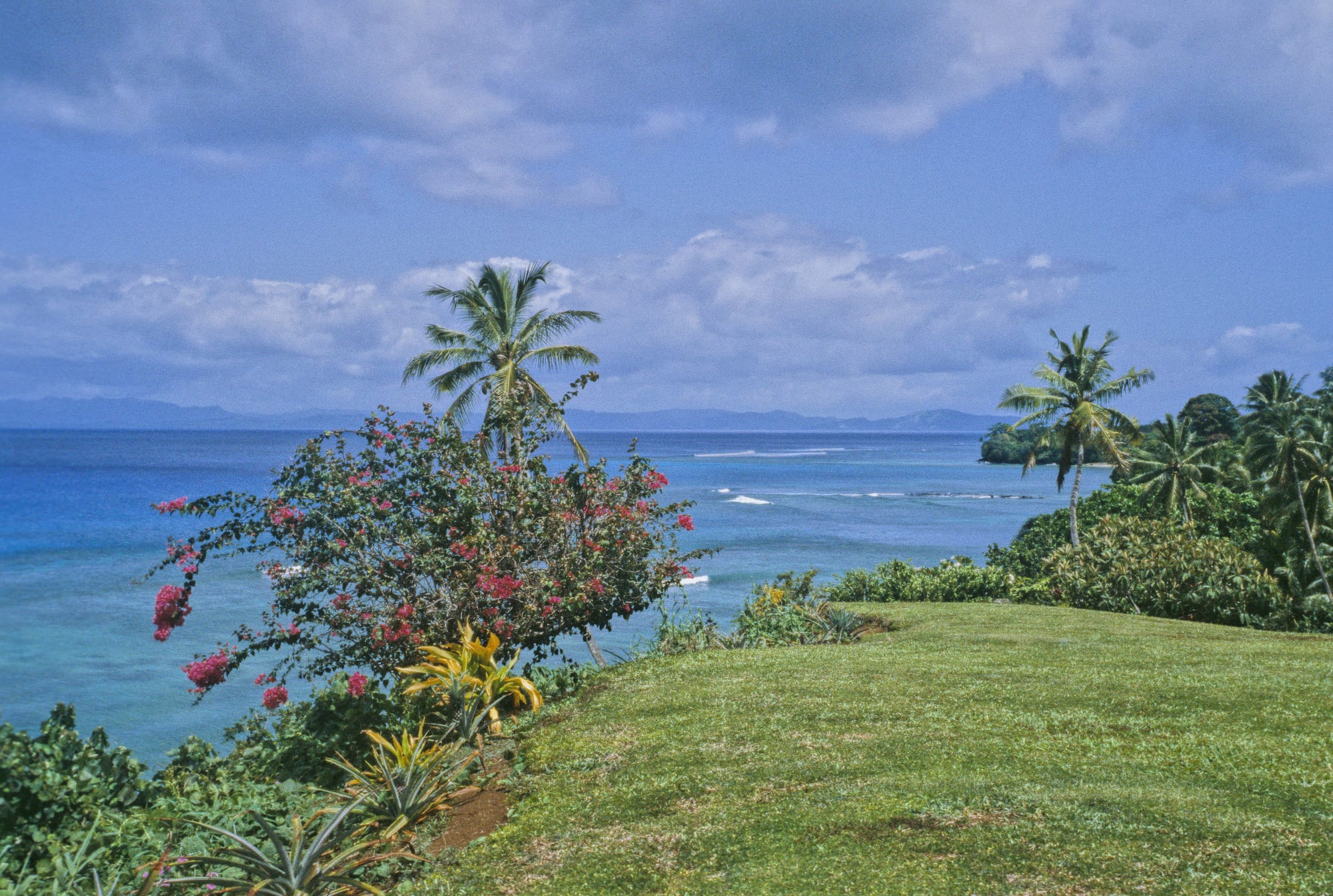
A mown grass headland with bougainvillea and coconut palms above a blue lagoon, a line of reef surf and distant hills across the water

Vanua Levu, Taveuni & the North, Fiji

Taveuni

The coast of Taveuni looking out over the reef towards the islands off its northern end. (Barry Peters / Wikimedia Commons · CC BY 2.0)

Fiji's third-largest island, a long volcanic ridge east of Vanua Levu across the Somosomo Strait. Heavy rainfall on its eastern slopes has earned it the name the Garden Island, and its rainforest, waterfalls, crater lake and soft-coral diving in the strait draw most of its visitors. Villages, farms and small resorts line the single coast road.

Neighbourhoods

  • Matei
    • First-time visitors
    • Beaches
    • Close to the airport

    The island's northern tip, where the airstrip is, with a scattering of small resorts, guesthouses and restaurants along the shore and the easiest swimming beaches on the island. Drier than the east coast and the most visitor-oriented part of Taveuni.

    Open in Maps
  • Waiyevo, Naqara and Somosomo
    • Local life
    • Close to public transport

    The island's middle, facing Vanua Levu across the strait: Waiyevo has the government station and hospital, Naqara the shops, banks and market, and Somosomo is the large village that is the seat of the Tui Cakau, Cakaudrove's paramount chief. Buses and the ferry landing serve this stretch.

    Open in Maps
  • Bouma and Lavena
    • Rainforest and waterfalls
    • Quiet and residential

    The north-east coast, wet and green, where several villages manage their rainforest, waterfalls and coastal track as a heritage park. Accommodation is limited to homestays and small lodges, and the road is rougher than in the west.

    Open in Maps
  • Vuna and the south
    • Quiet and residential
    • Diving

    The southern end of the island, with copra and dalo farms, villages along the coast, reefs offshore and the black lava rocks of South Cape, where the island's last eruption reached the sea about five hundred years ago. Little visited, thinly served by transport, and the long way from the airstrip.

    Open in Maps
  • Soqulu and the hillside estates
    • Quiet and residential
    • Views

    A settlement laid out on former plantation land in the hills south of Waiyevo, with houses, gardens and long views across the strait, quieter and greener than the coast below.

    Open in Maps

Things to do

Rainforest and waterfalls

  • Bouma National Heritage Parkpark

    Rainforest on the north-east coast, established in 1990 as Bouma Forest Park after the landowning clans became concerned by the threat of logging, covering waterfalls, forest trails and a coastal walk.

    Open in Maps
  • Bouma Fallsattraction

    Fiji's most famous waterfalls, on Tavoro Creek inside the heritage park, reached one after another by a forest path, the first only a short walk from the road and each with a pool to swim in.

    Open in Maps
  • Lavena Coastal Walktrail

    A track along the south-eastern shore from the village of Lavena, past beaches, bush and a river, ending at a waterfall.

    Open in Maps
  • Lake Tagimauciaattraction

    A lake in a volcanic crater at about 800 metres, the habitat of the rare tagimaucia flower, surrounded by upland forest and reached by a long, muddy guided climb.

    Open in Maps

Walks and viewpoints

  • Des Voeux Peakviewpoint

    At 1,195 metres, the island's second summit after Uluigalau, itself Fiji's second-highest peak at 1,241 metres; a track climbs from near Waiyevo, giving views over the strait and, in clear weather, towards the interior.

    Open in Maps
  • Waitavala water slideattraction

    A natural streambed chute about twenty minutes on foot from Waiyevo, dropping some fifty metres down the hillside, ridden by local children and by braver visitors.

    Open in Maps

Diving, reefs and beaches

  • Rainbow Reefattraction

    The reef system in the Somosomo Strait, called the soft coral capital of the world and one of the most famous dive areas in the South Pacific, with the Great White Wall among its sites; it is dived on the tidal currents from both shores.

    Open in Maps
  • Matei beachesbeach

    Short strips of sand and coral shallows along the northern shore, the most accessible places to swim and snorkel from the land on Taveuni.

    Open in Maps
  • Vuna Reefattraction

    The reef and horseshoe-shaped lagoon at the island's southern end, valued for snorkelling as much as for diving, reached from the southern villages and lodges.

    Open in Maps

Villages and landmarks

  • Somosomoneighborhood

    With neighbouring Naqara the island's largest settlement, the traditional seat of the Tui Cakau, one of Fiji's highest-ranked chiefs, and regarded as the capital of the Tovata confederacy.

    Open in Maps
  • Wairikiattraction

    A village on the coast south of Waiyevo, remembered as the place where a Tongan war party was destroyed and its commander shot dead on the beach in the fighting of the late 1860s.

    Open in Maps
  • The 180th meridianlandmark

    A signposted spot near Waiyevo where the 180th meridian crosses the island, long treated as the line where a new day begins, though the date line itself bends east around Fiji.

    Open in Maps

Seasonal events

  • The diving seasonMay to October

    The drier months bring the clearest water and the calmest crossings, and the dive operators on both sides of the Somosomo Strait are at their busiest.

  • Fiji Day10 October

    The national holiday marking a double anniversary — the cession of 1874 and independence in 1970, both on 10 October — observed with church services, school parades and village gatherings.

  • Christmas and New YearDecember and January

    Choirs, church services and family feasts fill the villages as relatives return from Suva and overseas during the school holidays.

Eat and drink

Long-standing places and food districts in Taveuni. Hours, ratings and directions come from your maps app, always current.

Eating on Taveuni

  • Naqara shops and eating housesneighborhood

    The island's commercial strip, with supermarkets, bakeries and small kitchens serving curry and roti, chop suey, fried fish and cassava.

    Open in Maps
  • Matei restaurantsneighborhood

    A handful of independent restaurants and resort dining rooms near the airstrip, cooking reef fish, lobster when available, curries and pizza.

    Open in Maps
  • Taveuni market producemarket

    Stalls selling the island's dalo, which has a reputation across Fiji, along with cassava, greens, coconuts, tropical fruit and bundles of kava.

    Open in Maps

Experience Taveuni

History

Taveuni belongs to the chiefdom of Cakaudrove, whose paramount chief, the Tui Cakau, has his seat at Somosomo on the island's west coast, facing Vanua Levu across the strait; Vuna in the south was the paramount village earlier, until warfare established Somosomo's supremacy. In the late 1860s a Tongan force under Wainiqolo, a lieutenant of the warlord Enele Maʻafu, attacked the island while Maʻafu was in Tonga and was defeated by the Tui Cakau's army, Wainiqolo shot dead on the beach at Wairiki.

The Methodist missionary John Hunt established a mission at Somosomo on 29 July 1839, was received cordially and housed by the Tui Cakau, made very few converts, and after three years left for Viwa. From the 1860s and 1870s European settlers, many from Australia and New Zealand, bought or leased land for cotton and then coconuts, and Taveuni was planted with palms on a scale that shaped its western half; copra shipped from its jetties supported the island for a century.

Two things spared Taveuni's forests and wildlife. The mongoose introduced elsewhere in Fiji never reached the island — it is the second largest in the Pacific to be free of it — so land crabs, bats and birds survived in unusual numbers, with about a hundred bird species recorded, twenty-two of them regional endemics; and in 1990 the landowning clans of the Bouma villages chose to protect their rainforest as a park rather than sell logging rights. Copra gave way to taro, kava, vanilla, fruit and coffee, and diving on the Rainbow Reef brought a tourism industry of small resorts and lodges. Cyclones remain the great disruption: Ami crossed the island in 2003, Gene caused widespread damage in 2008, Tomas struck in 2010, and Winston in 2016 was severe across northern Fiji.

Culture & Customs

This is a strongly traditional part of Fiji, and the chiefly order of Cakaudrove still organises much of island life. Somosomo is a ceremonial centre where installations, funerals and formal presentations draw people from across the north, and the village-based control of land is felt daily by visitors, since the walks, waterfalls and viewpoints are on clan land and are entered by permission. The sevusevu, in which a bundle of kava root is presented and accepted, remains the correct way to arrive anywhere.

Religion is central. Methodist and Catholic congregations dominate, Sunday is quiet, and choral singing in harmony is part of the sound of the villages. Meke, the combination of dance, chant and story, is performed at weddings, church events and for guests, and the lovo earth oven marks every celebration. Rugby is the main sport, played on village grounds cut out of the coconut plantations.

Taveuni also has a small resident foreign community on the hillside estates and in the tourism business, and returning islanders bring back money and habits from Suva, New Zealand and Australia. Local pride attaches to the island's produce, above all its dalo, to the tagimaucia flower — Fiji's floral emblem, found wild only in Taveuni's highland forest above about six hundred metres, flowering between October and December — and to the accident of geography that puts the 180th meridian across the island.

Daily Life

The 2017 census counted 13,774 people on Taveuni, though estimates run between twelve and twenty thousand; more than eight in ten are indigenous Fijians, and they live in villages and settlements along the coast road rather than in any town. Naqara, an Indo-Fijian settlement, is the commercial centre, Waiyevo the administrative one with the island's main hospital, and Somosomo the chiefly village. Farming is the backbone: dalo and kava for sale to Viti Levu and for export, coconuts, vanilla, fruit and vegetables, with fishing on the reefs and a tourism sector of resorts, dive shops and guides.

The day starts before dawn in the gardens and on the boats, the buses and carriers run to the market and the school in the morning, and the afternoon is for household work and sport. Shops close early, mobile phones have replaced much of the island's radio traffic, and evenings are given to kava circles and church groups. Electricity and water supplies are improving but interruptions are routine, and many households still cook over wood or gas.

The island's difficulties are distance and weather. Freight and fuel are expensive, the unsealed roads and the state of the jetties limit what farmers can move, serious illness means a flight to Suva, and young people leave for the capital or overseas, sending money home. Cyclone damage to houses, crops and reefs has been severe in recent years, and rebuilding is a recurring part of life.

Food

Taveuni's dalo, the taro grown on its volcanic soils, is the food the island is known for across Fiji, sold in Suva markets and exported to Fijian communities abroad. It is boiled or baked and eaten with almost everything, alongside cassava, breadfruit and yams. Rourou, taro leaves simmered in coconut cream, and palusami, leaf parcels baked with coconut cream, are the standard accompaniments, and a lovo — food cooked on hot stones in an earth oven — is the centrepiece of any feast.

Fish and shellfish come off the reefs daily: reef fish grilled or fried, octopus, crab, prawns from the streams and lobster when the weather has allowed diving for it. Kokoda, raw fish cured in lime juice and coconut cream, appears on every visitor menu and many family tables. Coconut runs through the cooking as cream, oil and drinking nuts, a legacy of the plantations.

The island also grows kava, vanilla and tropical fruit, so pineapple, papaya, mango, bananas and citrus are cheap in season, and vanilla turns up in resort kitchens. Indo-Fijian curries with roti and dhal are the everyday alternative in the shops around Naqara, along with Chinese-influenced dishes such as chop suey. Yaqona, drunk from a tanoa bowl in the evening, is the island's social ritual as much as its cash crop.

Planning tools

Budget

Costs split sharply. Village homestays, backpacker cottages and guesthouses with market food are cheap, while the island's boutique resorts and dive lodges are among the most expensive places in Fiji. About a dozen small resorts operate in all. Diving, guides and park entry fees are the main extras, and getting to the island is a fixed cost in itself.

Daily Budget Midrange
USD 110–250 (mid-range resort or dive lodge, a day's diving or a guided walk, taxis or a hire car)
Daily Budget Shoestring
USD 40–65 (homestay or backpacker cottage, buses and carriers, market and eating-house meals)

Carry Fijian dollars in small notes for village entry fees, guides, carriers and boats, as card payment is limited outside the resorts.

Best Time to Visit

May to October is drier, less humid and the main season for diving the Somosomo Strait, with the calmest crossings and firmer trails. The wet months from November to April make the rainforest and waterfalls at their fullest and the island greenest, at the cost of heavy rain, mud on the paths and the risk of cyclones.

Suggested Number of Days

Three or four days allow for the rainforest, a walk or two and a day on the water without rushing between ends of a long island. Divers and anyone adding the interior or the offshore islands should plan five to seven, and rain can close plans down for a day.

First Visit
3–4 days
With Surroundings
5–7 days

Transportation

One road follows the coast, sealed along the western side and rough elsewhere, and it does not go all the way round the island. Buses run a few times a day between Matei, Naqara, Waiyevo and the southern and north-eastern villages, with shared carriers filling the gaps; taxis wait at the airstrip and at Naqara and are often hired by the half day. Hire cars are few and four-wheel drive helps. Boats link the island with its offshore neighbours.

Ask at accommodation for the day's bus times before setting out, as services are sparse and finish early, and allow much longer than the distance suggests on the unsealed sections.

Airport & Station Connections

Small aircraft fly from Nadi and Suva to Matei Airport on the northern tip, which is the usual way in and takes well under an hour from Suva; its runway has been upgraded from gravel to tarmac. Ferries also serve the island: a vehicle and passenger service from Viti Levu by way of Vanua Levu, which takes the better part of a day, and a short boat crossing from eastern Vanua Levu, only six and a half kilometres away across the strait.

Walkability

Individual settlements are small and walkable, and the rainforest tracks are the reason many people come, but the island is long and there are no footpaths along the coast road, so getting between villages means a bus, carrier or taxi. Trails are steep, muddy and slippery after rain, and river crossings rise quickly in heavy weather.

Safety

Crime is very low and the risks are natural. The Somosomo Strait has powerful tidal currents, and dive sites are a long way from a decompression chamber; rainforest paths are slippery, waterfall pools have submerged rocks and rivers flood after rain; and medical facilities beyond the small hospital at Waiyevo mean a flight to Suva. Cyclones between November and April can cut power, water and transport.

Dive only with operators who know the tides, take a guide for the interior and Lake Tagimaucia, avoid rivers and waterfalls during heavy rain, and ask permission before entering village land. Check current official travel advice before travelling.

Climate

Tropical, warm and often wet: the central mountains force the south-east trade winds upwards, so the ridge and the eastern side are among the rainiest places in Fiji — close to 10,000 millimetres a year has been recorded near Mount Koroturanga — while the northern and western coasts are noticeably drier. Rain can fall in any month. Southern-hemisphere seasons mean summer runs from December to February.

Summer
hot and humid — November to April brings daytime highs near 30°C, heavy rain, especially on the east coast, and cyclone risk
Winter
warm and drier — May to October brings highs of about 26–29°C, breezier, with the clearest water for diving

Local Customs

Almost all the land, including the forests, waterfalls and most beaches, belongs to villages, and access is granted rather than assumed: a visit normally begins with a sevusevu, the presentation of kava to the village head, and the heritage park villages charge an entry fee that supports them. Dress modestly away from a resort beach, with shoulders covered and a sulu or long shorts, remove hats and sunglasses in a village, and take off shoes before entering a house. Sunday is for church and rest.

Tipping is not expected; ask before photographing people, houses or services; and accept a bowl of kava with both hands and a single clap.

Common Payment Methods

The currency is the Fijian dollar. Banks and cash machines are found around Naqara and Waiyevo and near the airstrip, but not in the villages, and they can be out of service. Resorts, dive operators and larger shops take cards; buses, carriers, guides, village fees and market stalls do not, so arrive with enough cash for the stay.