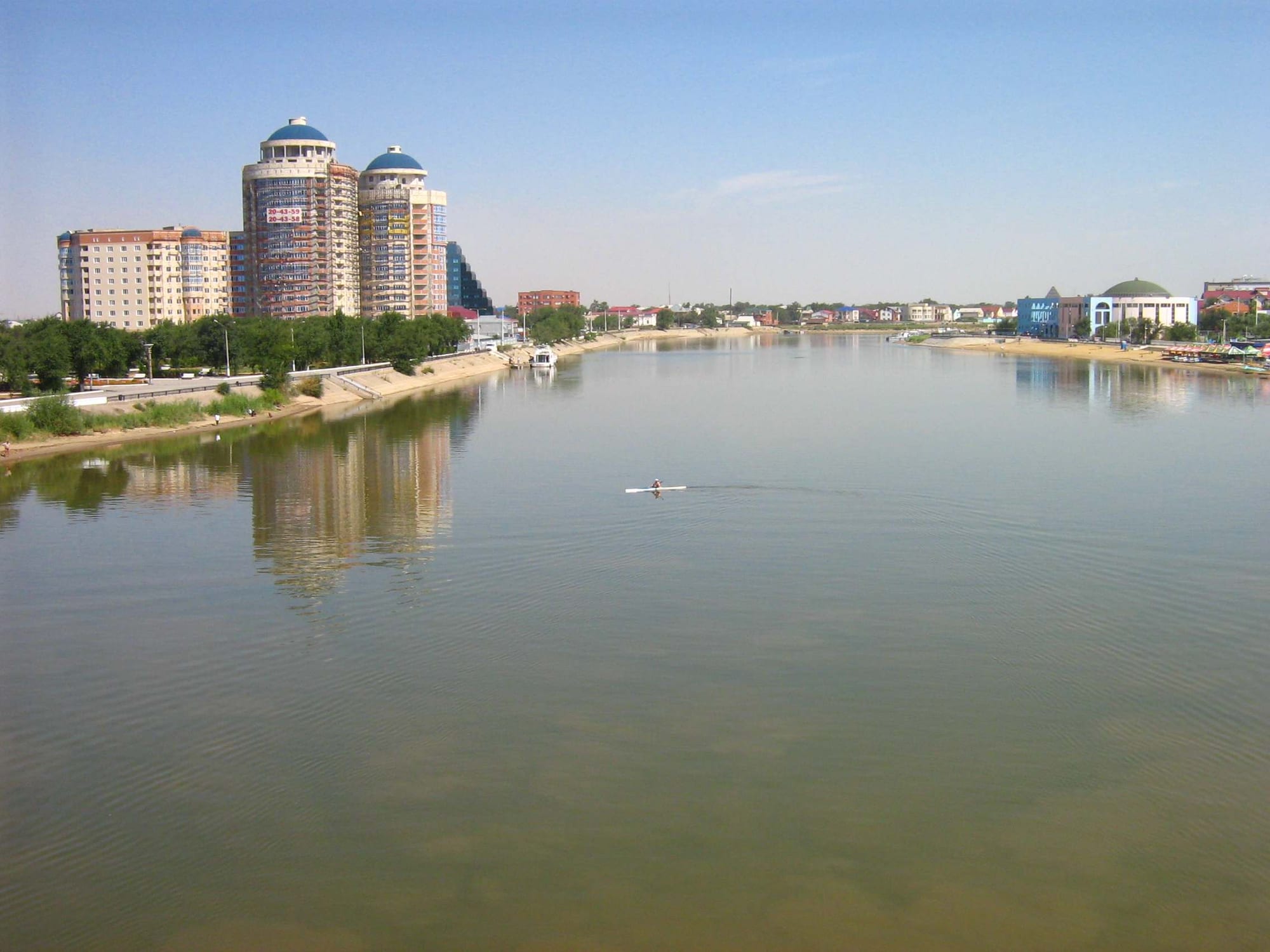
The wide brown Ural river running through Atyrau, with blue-domed apartment towers and a low embankment on the left bank

The West & the Caspian, Kazakhstan

Atyrau

The Ural river in the centre of Atyrau. (Ds02006 / Wikimedia Commons · Public domain)

The centre of Kazakhstan's oil industry, standing on both banks of the Ural river a short way above the Caspian Sea. Founded as a Russian fort and trading post in 1645 and known as Guryev until 1991, it is a flat, hot city of refineries, offices and rotation workers, with bridges said to link Europe and Asia.

Neighbourhoods

  • The left bank centre
    • First-time visitors
    • Close to public transport
    • Evenings out

    The administrative heart of the city on the western side of the river, with government buildings, the main square, hotels, offices and the riverside embankment. Most business visitors stay within a few streets of it.

    Open in Maps
  • The right bank
    • Local life
    • Quiet and residential

    Across the river to the east lie older housing, markets and the streets where much of the city's working population lives. The bridges between the two banks carry signs marking the notional boundary between Europe and Asia.

    Open in Maps
  • The riverside embankments
    • Walks and viewpoints
    • Families

    Paved walks, lawns and cafés follow the Ural through the centre on both sides, with benches, fountains and fishing spots. This is where the city goes in the evening once the heat of the day has broken.

    Open in Maps
  • The industrial outskirts
    • Transport connections

    Refinery installations, pipe yards, contractor camps and company compounds spread around the edges of the city towards the airport and the road out to the Tengiz field. Rotation workers pass through here rather than staying.

    Open in Maps

Things to do

The river and the city

  • Ural river embankmentviewpoint

    The paved walks along both banks in the centre, the city's main public space, with fishing, cafés and views up and down the water.

    Open in Maps
  • The Europe-Asia bridgeslandmark

    Road bridges over the Ural in the centre, marked with signs for Europe on one bank and Asia on the other, following the convention that puts the continental boundary along the river.

    Open in Maps
  • Uralattraction

    The river that rises in the Ural mountains and reaches the Caspian just below the city, long famous for its sturgeon fisheries.

    Open in Maps

The delta and the coast

  • The Ural delta wetlandspark

    Protected wetland where the Ural's tree-like delta meets the Caspian south of the city, a stop on the Asian flyway for migrating birds and a spawning route for Caspian fish.

    Open in Maps
  • The Ural deltaattraction

    Reed beds, channels and shallow lagoons between the city and the sea, fished from small boats and best known for its birdlife in spring and autumn.

    Open in Maps

Short trips from the city

  • Saraishyklandmark

    The site of a Golden Horde city on the Ural where several khans were buried, later a Nogai centre, with a museum and memorial complex on the riverbank.

    Open in Maps

Seasonal events

  • Nauryzlate March

    The spring new year, marked with yurts, swings, wrestling and cauldrons of nauryz köje in the squares and on the embankment.

  • Kurban Aitvaries with the Islamic calendar

    The feast of sacrifice, a public holiday spent visiting relatives and sharing meat, widely kept across the region.

  • Riverside summerJune to August

    The season when the embankments, fountains and cafés along the Ural stay busy late into the night because the days are too hot to be outdoors.

Eat and drink

Long-standing places and food districts in Atyrau. Hours, ratings and directions come from your maps app, always current.

Atyrau classics

  • Fish restaurantsneighborhood

    Ural and Caspian fish, fried, baked and made into soup, is the city's speciality, and cured and smoked fillets known as balyk are the traditional gift to take home.

    Open in Maps
  • International restaurants of the oil cityneighborhood

    Decades of foreign engineers have left the centre with Turkish, Georgian, Italian, Indian and Chinese kitchens alongside Kazakh and Russian ones.

    Open in Maps

Markets

  • The city bazaarsmarket

    Fish, mutton, horse meat and camel meat, dried curd and shubat, with melons and vegetables brought up from the irrigated south in season.

    Open in Maps

Experience Atyrau

History

The city began as a fishing and trading post at the mouth of the Yaik, as the Ural was then called. The Russian trader Gury Nazarov built a wooden fort there in 1645; after Cossacks plundered it his family rebuilt it in stone, and the settlement that grew around it took the name Guryev from them. Its wealth came from the river: sturgeon and the caviar they yielded, salted and shipped upriver to Russia, along with seal hunting and the salt trade on the Caspian.

Guryev remained a modest river town under the Russian Empire, caught up in the Cossack risings of the Yaik; the river itself was renamed the Ural by Catherine II in 1775, after Pugachev's rebellion was suppressed. The town's transformation came with oil. A field was found on the Emba river inland in 1892, pipelines and a railway followed, and in 1945 the Atyrau Refinery opened, today one of the three largest in Kazakhstan. The town served the Soviet war effort as a link to the front and a route for evacuating people and industry.

The decisive change came after independence. The giant Tengiz field some 350 kilometres south of the city, and later Kashagan offshore in the Caspian, brought international consortiums, thousands of foreign staff and a long construction boom. Guryev had been renamed Atyrau in 1991, and within a decade it was the wealthiest and fastest-growing city in western Kazakhstan, with new offices, hotels and housing on both banks and an airport rebuilt for the traffic. The river fisheries that once made it, meanwhile, have shrunk almost to nothing.

Culture & Customs

Atyrau is a Kazakh city with an international working population, and the two sit side by side without blending much. The surrounding region is among the most Kazakh-speaking in the country, with strong clan memory, large weddings and memorial feasts, and strict customs of respect for elders. In the centre, company compounds, expatriate clubs and restaurants serve engineers on rotation from Europe, Turkey, the Caucasus and Asia, many of whom spend years here.

The river shapes local identity as much as the oil. People fish from the embankments, ice fishing continues through the winter, and older residents remember when sturgeon and caviar were ordinary food rather than a scarce and regulated commodity. The bridges, with their signs for Europe and Asia, are the city's favourite photograph and a standing local joke about crossing continents on the way to work.

Western Kazakhstan has its own musical tradition, the dombra school of the Junior Horde and the zhyrau who sang long epic poems, and the instrument is still taught and played at celebrations. Hospitality is emphatic: guests are fed before they are questioned, tea is refilled constantly, and an invitation to a family event is not lightly declined. Islam is part of ordinary life, observed without display, and Nauryz in March is the year's largest public celebration.

Daily Life

About 330,000 people live in Atyrau, the administrative centre of Atyrau Region, and the city has grown with the oil industry. The city is flat, low and hot, spread along both banks of the Ural, with Soviet blocks, newer apartment towers and districts of single-storey houses, and it has expanded outwards faster than its roads, drainage and water supply have kept up.

Oil dominates everything. The refinery, the service companies, the contractors and the government offices that regulate them provide most of the formal work, and a large part of the workforce spends weeks at a time at Tengiz, Kashagan or other fields before returning home for a block of days. Wages in the industry are high and prices in the city follow them, which is a persistent grievance for those outside the sector: teachers, medical staff and traders.

Daily life bends around the heat. Work starts early, the middle of the day is spent indoors in summer, and the embankments fill in the evening with families, cyclists and anglers. Winter brings wind off the open steppe and a frozen river. Air quality, flaring, the state of the river and the health of the Caspian are recurring public concerns, alongside housing costs and the traffic that builds at the bridges twice a day.

Food

Fish defines the local table, even after the collapse of the old fisheries. Ural and Caspian fish are fried, baked whole with onion and tomato, or simmered into soup, and the cured and smoked fillets known by the Russian word balyk are the classic gift from Atyrau. Sturgeon and caviar made the city's name and its early fortune, but overfishing and poaching have made both scarce, protected and strictly controlled.

Away from the water the cooking is that of herders. Beshbarmak — boiled mutton or horse meat with broad sheets of pasta and onion broth — is the dish for guests, kuyrdak of fried offal and onion is everyday food, and horse sausages such as kazy appear at celebrations. Camel herding on the surrounding steppe supplies shubat, fermented camel's milk, while kurt, hard balls of dried salted curd, and baursak, small pieces of fried dough, accompany tea.

The oil industry has broadened the city's restaurants further than its size would suggest, with Turkish, Georgian, Caucasian, Italian and Asian kitchens in the centre beside canteens serving plov, lagman noodles, manty dumplings and samsa baked in a tandoor. Melons and watermelons from southern Kazakhstan arrive in late summer, and tea, black and with milk, is poured through the day.

Planning tools

Budget

Atyrau is one of the most expensive cities in Kazakhstan because hotels and restaurants are priced for the oil industry rather than for visitors, and rooms are scarce during shift changes and conferences. Canteens, bazaars and city transport remain cheap, so costs depend almost entirely on where a visitor sleeps and eats.

Daily Budget Midrange
USD 90–180 (business hotel, restaurant meals, taxis and a car for trips out of the city)
Daily Budget Shoestring
USD 35–55 (simple hotel or guesthouse, canteen food, city buses and shared taxis)

Book accommodation well ahead, since business demand fills the better hotels, and expect prices to sit above the national average.

Best Time to Visit

May and September to early October are the most comfortable months, warm but not punishing, with the delta at its best for birdwatching in spring and autumn migration. July and August are extremely hot, with mosquitoes near the water. Winter is cold and windy on this open plain and the river freezes.

Suggested Number of Days

A day or two covers the city comfortably. Three or four make sense for anyone adding the surrounding steppe and delta, where distances are long and roads slow, or combining the visit with travel further along the Caspian coast.

First Visit
1–2 days
With Surroundings
3–4 days

Transportation

The city is flat and low, served by municipal buses and plentiful taxis, most easily booked through a ride-hailing app. Traffic concentrates on the few bridges over the Ural and slows badly at the start and end of the working day. Trips into the delta or along the steppe roads need a hired car and driver.

Allow extra time for crossing the river at peak hours, and agree a fare in advance for any taxi not booked through an app.

Airport & Station Connections

Atyrau Airport lies about 8 kilometres north-west of the centre and has flights to Astana, Almaty and a number of regional destinations, with traffic driven by the oil industry. Trains connect the city with western Kazakhstan and Russia, but journeys are long, and highways run north-west towards the Russian border, east to Aktobe and south along the Caspian towards Aktau.

Walkability

The central streets and the embankments are flat and easy to walk, and the two banks are linked by bridges within the centre. Beyond that the city spreads out along wide roads with limited shade, and summer heat, winter wind and mosquitoes near the water make walking uncomfortable for much of the year.

Safety

The city is generally safe, and the main nuisances are ordinary ones: street taxis, crowded markets and poorly lit outer streets at night. Summer heat, mosquitoes in the delta and industrial traffic on the roads out of town are the practical hazards, and labour disputes in the oil sector can lead to protests.

Avoid demonstrations, use app-booked taxis after dark, carry insect repellent near the river in summer, and follow the rules at any industrial site. Check current official travel advice before travelling.

Climate

A dry continental climate on a flat, exposed plain near the Caspian, with very hot summers, cold winters and wind in every season. Rainfall is low and dust is common.

Summer
hot and dry, often 30–40°C in July, with warm nights and mosquitoes near the water
Winter
cold and windy, regularly -10°C or below, with the river freezing over

Local Customs

Atyrau Region is strongly Kazakh-speaking and observant, although the oil industry has made the city used to foreigners. Elders are greeted and served first, guests are fed generously, and shoes are removed in homes. Modest dress is expected at mosques, and alcohol, while available, is drunk more discreetly than in northern cities.

Accept tea when it is offered, ask before photographing people, and do not photograph refineries, pipelines or other industrial installations.

Common Payment Methods

The currency is the Kazakhstani tenge. Cards and Kazakh mobile payment apps work in hotels, shops and most restaurants, while bazaars, small canteens and street taxis run on cash. Cash machines are easy to find in the centre, and banks will change dollars and euros.