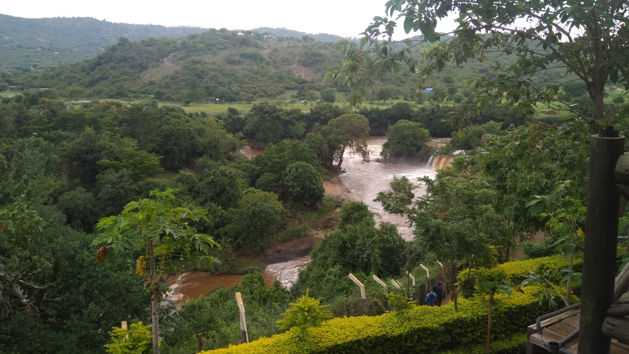
A brown river running between wooded banks and green hills, with a low fall of white water in the distance

Nairobi & the Central Highlands, Kenya

Sagana

The Sagana, the upper course of the Tana, running below green hills near the town. (Sambaza2 / Wikimedia Commons · CC BY-SA 4.0)

A small river town in Kirinyaga County, central Kenya, where the Nairobi road divides for Nyeri and for Mount Kenya and crosses the upper Tana. Its rapids have made it a centre of Kenyan white-water rafting, and the farms around it grow rice, coffee, bananas and horticultural crops for the capital.

Neighbourhoods

  • Town centre and the junction
    • First-time visitors
    • Close to public transport

    A single busy strip of shops, kiosks, matatu stages and petrol stations where the highway from Nairobi splits towards Nyeri and towards Embu and Mount Kenya. Almost everything in the town is on or just off this road.

    Open in Maps
  • The riverside
    • Rafting and the river
    • Quiet and residential

    The ground falling away from the town to the Tana, where camps, lodges and rafting operators sit above the water among trees and smallholdings. It is quieter than the junction and several kilometres from the shops.

    Open in Maps
  • Kagio
    • Markets
    • Local life

    A trading centre a short way east of Sagana whose market draws farmers and traders from the surrounding rice and banana country on its main days.

    Open in Maps

Things to do

The river

  • Sagana rapidsattraction

    The stretch of white water on the upper Tana below the town, run by the rafting and kayaking operators based along the river.

    Open in Maps
  • Tana Riverattraction

    Kenya's longest river, rising on Mount Kenya and known as the Sagana along this stretch, before turning south and east on its long run to the Indian Ocean.

    Open in Maps
  • Sagana State Lodgelandmark

    A state lodge used by Kenya's president, built in 1949–50 in the Mount Kenya foothills at Kiganjo, north-west of the town, and given to Princess Elizabeth and the Duke of Edinburgh as a wedding present from the colony in 1947; it is not open to visitors.

    Open in Maps

Short trips from the town

  • Mwea Irrigation Schemeattraction

    The flat rice country south-east of the town, the Mwea-Tebere scheme founded in 1954, where some 12,300 hectares of paddy are watered by canals from the Thiba river.

    Open in Maps
  • Kerugoyaneighborhood

    The largest town in Kirinyaga County, on higher ground above Sagana and about 10 kilometres east of Karatina, with a large market; the county's administrative headquarters are at neighbouring Kutus.

    Open in Maps
  • Karatinamarket

    A market town north-west of Sagana whose open-air market is the largest in Kenya, trading highland produce in bulk.

    Open in Maps
  • Mount Kenya National Parkpark

    Africa's second-highest mountain, with forest, moorland and glaciers, reached from the roads that fork at Sagana towards Nanyuki and Chogoria.

    Open in Maps

Eat and drink

Long-standing places and food districts in Sagana. Hours, ratings and directions come from your maps app, always current.

Roadside kitchens

  • Junction cafésrestaurant

    Small hotelis along the highway serve drivers and matatu crews all day, with beef or goat stew and ugali or chapati, githeri, beans and rice, and chai.

    Open in Maps
  • Nyama choma and fish grillsrestaurant

    Roast goat by the kilo with kachumbari, and, unusually for the highlands, fried tilapia from the fish ponds and dams of Kirinyaga.

    Open in Maps

Markets

  • Kagio marketmarket

    A large open-air produce market a short way from Sagana, piled with bananas, tomatoes, rice, mangoes and vegetables from the surrounding farms.

    Open in Maps

Experience Sagana

History

Sagana owes its existence to two things: a river crossing and a railway. The Kikuyu ridges around it were farmed long before either, but the town itself took grew in the colonial period around a station on the branch line built north from Nairobi through Thika towards Nanyuki, and as the place where the road to the highlands crossed the upper Tana, which is called the Sagana along this stretch. Goods from the coffee and later the rice country were loaded here, and the junction drew shops, workshops and lodgings to the roadside.

The best-known building associated with the town, the Sagana State Lodge, dates from the same era. Built in 1949–50 in the Mount Kenya foothills at Kiganjo, it was a wedding present from the colony in 1947 to Princess Elizabeth and the Duke of Edinburgh, and the couple were staying there in February 1952, on their return from Treetops, when King George VI died and Elizabeth succeeded to the throne. It is now a Kenyan state lodge, used by the president on official tours of the country.

The wider district changed decisively in the 1950s for another reason. The Mwea-Tebere irrigation scheme, founded in 1954 on the flat land south-east of Sagana, turned dry plains into paddy fields and made the district Kenya's rice country. Sagana grew as the market and transport point for that new agriculture. Rafting companies later began running the rapids below the town, adding a modest tourist trade to a place that had always lived on passing traffic.

Culture & Customs

Sagana's culture is that of rural Kirinyaga — Kikuyu, farming, and organised around church, school and cooperative society. The county's name comes from Kĩrĩnyaga, the Gĩkũyũ name for Mount Kenya, traditionally regarded as the dwelling place of Ngai, and the mountain is visible from the higher ground on clear mornings, a presence in local speech as well as on the horizon.

Life turns on the farming calendar. Planting, the rice harvest on the Mwea scheme, coffee picking and the market days at Kagio and Kerugoya set the rhythm of the weeks, and cooperative meetings and harambee fundraisers for school fees, church roofs and hospital bills are the main public gatherings. Weddings and funerals draw very large crowds, and contributions to them are a social obligation.

At weekends the bars along the highway play mugithi, the guitar-led Kikuyu dance music of the highlands, and benga and gospel are heard everywhere else. The river has given the town a second, quite separate culture of rafting guides, kayakers and weekend visitors from Nairobi, which sits alongside the farming town without much mixing. Manners are formal: greetings first, elders addressed by title, and modest dress expected away from the water.

Daily Life

Sagana is a small town rather than a city, and its population swells by day with traders, travellers and farm workers passing through. Kirinyaga County around it had 610,411 people at the 2019 census, most of them on smallholdings, and the county's largest town, Kerugoya, the county headquarters at Kutus and the trading centre of Kagio are the larger settlements nearby.

The economy is agricultural and commercial. Rice from the Mwea scheme, bananas, tomatoes, French beans and other horticultural crops for Nairobi and for export, coffee from the higher slopes, dairy cattle and fish from ponds and dams all pass through local markets and brokers. The junction itself is a business: fuel stations, tyre repairers, cafés and lodgings serve the constant highway traffic between the capital and the mountain counties, and transport and casual labour employ many young people.

The day starts before light, when produce is loaded for the Nairobi markets and matatus fill at the stage. Midday is hot and slow; the afternoon brings the return traffic and, in the rainy months, heavy storms upstream that raise the river within hours. Water for irrigation, the price of fertiliser and rice, land subdivision and jobs for the young are the recurring concerns, along with road accidents on the highway that runs through the middle of the town.

Food

Sagana eats highland food with a Kirinyaga difference: rice. The Mwea scheme's aromatic pishori rice is the local pride, cooked plain, or as pilau with spices and meat for celebrations, and sold in sacks at the roadside. Beside it comes the standard Kikuyu farm cooking of the region — mukimo, a green mash of potatoes, maize, beans and leaves; githeri, boiled maize and beans; and ugali with sukuma wiki, braised collard greens.

Meat is eaten as stew with chapati or as nyama choma, goat roasted over charcoal and served by the kilo with kachumbari, the tomato and onion salad. The fish ponds and dams of Kirinyaga have made fried tilapia a common dish here, which is unusual so far from the lakes. Roadside stalls sell mutura, the grilled sausage of meat and blood, roasted maize cobs, boiled eggs with chilli and bhajia-style fried potatoes to passing drivers.

The markets are full of what the lower, warmer land grows: bananas of several kinds, mangoes, avocados, pawpaws, tomatoes and French beans. Chai — strong black tea boiled with milk and sugar — is drunk from early morning, coffee from the county's own cooperatives is easier to buy as beans than as a cup, and muratina, the traditional fermented brew made with sausage-tree fruit, still appears at family ceremonies.

Planning tools

Budget

Sagana is inexpensive. Guesthouses in the town cost very little and the roadside cafés less, while the river camps and lodges along the Tana charge more and often price rafting, meals and a bed together. Transport is by matatu and costs almost nothing.

Daily Budget Midrange
USD 70–150 (river camp or lodge, meals, a rafting or tubing trip)
Daily Budget Shoestring
USD 25–45 (guesthouse, roadside cafés, matatus)

Rafting is the one substantial cost in the town and is usually arranged directly with the camps along the river.

Best Time to Visit

The river is fullest and the rapids strongest in and just after the rains, from about April to June and again in November and December, while the drier spells of January to February and July to September are more comfortable for everything else and better for the mountain roads.

Suggested Number of Days

A day covers the town and a trip on the river. Two or three suit anyone using Sagana as a base for the rice country, the Kirinyaga market towns and the Mount Kenya approaches, all of which need road time.

First Visit
1 day
With Surroundings
2–3 days

Transportation

Everything runs on the highway. Matatus and buses between Nairobi, Nyeri, Embu, Karatina and Kerugoya stop at the junction through the day, and boda-boda motorcycles cover the last stretch down to the river camps and out to the villages. The railway built north from Nairobi towards Nanyuki passes through the town, whose station was long the only one in Kirinyaga.

The camps along the river are several kilometres from the junction on rough tracks, so a boda-boda or a lift from the camp is usually needed.

Airport & Station Connections

Sagana lies about 100 kilometres north of Nairobi, roughly two hours by road through Thika on the main highway, and matatus leave the capital for Nyeri, Embu and Kerugoya all day. The nearest airport with scheduled flights is at Nanyuki, north of the town, which has daily services from Nairobi's Wilson Airport.

Walkability

The town centre is one street and is easily walked from end to end, but there is little pavement and the highway traffic is heavy and fast. The river, the camps and the outlying markets are well beyond walking distance on unlit roads, so movement beyond the centre is by matatu or motorcycle.

Safety

Kirinyaga is a calm farming county with little of the street crime of the big cities, though petty theft occurs around the bus stage and market. The real risks here are the highway, where heavy lorry and matatu traffic makes this one of Kenya's busier roads, and the river, whose current is strong and whose rapids should only be run with an operator providing guides, helmets and life jackets.

Avoid the northeastern counties and the immediate Somali border, take care in Nairobi's central and eastern districts and after dark, use hotel or app-based transport, and take malaria precautions outside the highlands. Do not swim in the Tana, and cross the highway with care. Check current official travel advice before travelling.

Climate

Lower and warmer than Nyeri or Nairobi, on the plain at the southern foot of Mount Kenya, with warm middays and mild nights. Rain falls in two seasons, the long rains from March to May, peaking in April, and the short rains from October to December, when the river runs brown and high.

Summer
February to April is the warmest period, with daily averages of 19–23°C
Winter
June to August is the cool season, often overcast and driest, with daily averages of 17–19°C

Local Customs

This is Kikuyu farming country, and Gĩkũyũ and Swahili are both used, with English understood in business. Greetings come before anything else and elders are greeted first. Church attendance is high and Sunday mornings are quiet in the shops.

Tipping is not expected in small cafés, though rafting guides are often tipped. Ask before photographing people, farms or the rice paddies, and dress modestly away from the river camps.

Common Payment Methods

The currency is the Kenyan shilling and M-Pesa mobile money is used for almost everything, including fares and market purchases. There are banks and ATMs at the junction and in nearby Kerugoya; cards are accepted at the river camps but rarely in town, so cash in small notes is useful.