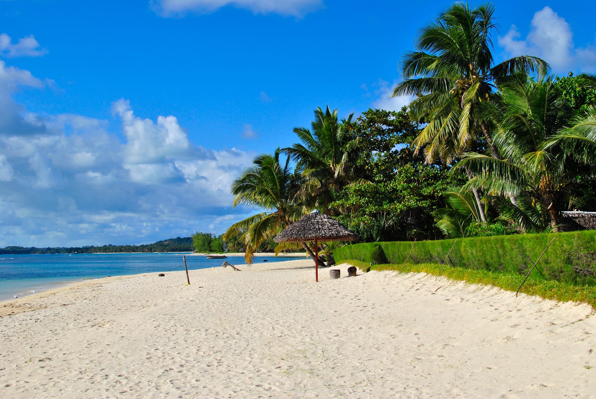
A white sand beach backed by coconut palms and a thatched shelter, with pale calm sea and a low green shore in the distance

Andasibe, Sainte-Marie & the East, Madagascar

Île Sainte-Marie

The beach on Île aux Nattes, off the southern tip of Île Sainte-Marie. (Anai171 / Wikimedia Commons · CC BY-SA 4.0)

A long, narrow island off Madagascar's east coast, known in Malagasy as Nosy Boraha. Reefs and coconut palms line a shore of small bays, a single road runs its length, and the one town, Ambodifotatra, keeps a fort, an early church and the graves of the pirates who used these waters. Humpback whales breed offshore each southern winter.

Neighbourhoods

  • Ambodifotatra
    • First-time visitors
    • Shops and banks
    • Historic buildings

    The island's only town, on the sheltered western side by the harbour, with a market, banks, the fort, the old church and the causeway to a small island in the bay. It is where boats arrive and where islanders come to trade.

    Open in Maps
  • The south and Île aux Nattes
    • Beaches
    • Quiet stays
    • Snorkelling

    The southern end has the calmest water, the airstrip and the crossing by pirogue to Île aux Nattes, a low island of palms and white sand with no roads. Bungalows and small hotels are scattered along the shore here.

    Open in Maps
  • The east coast
    • Wild scenery
    • Walks

    The ocean-facing side is rougher and emptier, with surf on the reef, rock pools and a natural sea pool sheltered from the swell. Villages are small, tracks are rough, and swimming is unsafe away from the protected inlets.

    Open in Maps
  • The north
    • Quiet and residential
    • Villages

    Beyond the town the road narrows through clove and coconut country to fishing villages and bays at the island's northern end, where visitors are fewer and the forest comes down to the shore.

    Open in Maps

Things to do

Ambodifotatra and its history

  • Ambodifotatraneighborhood

    The island's small capital, with a harbour, a market, colonial-era buildings and a causeway out to an islet in the bay.

    Open in Maps
  • The pirate cemeterylandmark

    A hillside burial ground above the bay near the town, with weathered stones from the era when European pirates used the island as a base, including one carved with a skull and crossbones.

    Open in Maps
  • The old Catholic churchlandmark

    A stone church of 1857 in Ambodifotatra, often described as the oldest Catholic church in Madagascar, built with materials brought by sea.

    Open in Maps
  • The fort at Ambodifotatralandmark

    The remains of a French fortification above the harbour, built to guard the anchorage that first drew pirates and then colonial powers to the island.

    Open in Maps

Beaches and the water

  • Île aux Nattesbeach

    A small palm-covered island off the southern tip, known in Malagasy as Nosy Nato, crossed by footpaths and reached by pirogue in a few minutes, with shallow, sheltered water.

    Open in Maps
  • The natural sea poolbeach

    A rock basin on the exposed eastern coast, filled and refreshed by the swell breaking over the reef, which makes a sheltered place to swim on a dangerous shore.

    Open in Maps
  • Ampanihy baypark

    A wide, shallow bay of mangroves and seagrass in the island's south-east, sheltered behind a peninsula and crossed by pirogue.

    Open in Maps
  • Snorkelling and diving on the reefsattraction

    Fringing reefs along the sheltered western side and around the southern tip hold corals, reef fish and turtles, reached by boat from the beaches.

    Open in Maps

Whales and the sea season

  • Humpback whale watchingattraction

    Humpback whales come to the channel between the island and the mainland to breed and calve in the southern winter, and are watched from boats and often seen from the shore.

    Open in Maps

The island road

  • Clove and coconut countrytrail

    The single road running the island's length passes clove groves, coconut plantations, rice paddies and fishing villages, and is travelled by bicycle, scooter and taxi.

    Open in Maps

Seasonal events

  • Humpback whale seasonroughly July to September

    Whales gather in the channel to breed and calve, and the island marks the season with boat trips, music and a whale festival.

  • Fête de l'Indépendance26 June

    Madagascar's national day, marked in Ambodifotatra with parades, lantern processions the evening before, music and dancing.

Eat and drink

Long-standing places and food districts in Île Sainte-Marie. Hours, ratings and directions come from your maps app, always current.

Island eating

  • Ambodifotatra market and street foodmarket

    Fish, rice, cassava, bananas, cloves and vanilla are sold in the town market, with fried cakes, brochettes and coffee from stalls around it.

    Open in Maps
  • Beach bungalow restaurantsneighborhood

    The small hotels along the west coast and the south cook the day's catch — fish, prawns, crab, lobster and squid — with coconut sauces and rice.

    Open in Maps
  • Village hotelyneighborhood

    Simple eating houses in the town and the villages serve rice with fish or zebu, noodles and soup at low prices, cooked to order.

    Open in Maps

Experience Île Sainte-Marie

History

The island was settled by people of the east coast who became the Betsimisaraka, and its Malagasy name, Nosy Boraha, is generally explained as referring to Ibrahim or Abraham, a reminder of early contact with Islamised traders on this coast. Its sheltered bay, fresh water and position on the route between the Cape and India gave it an outsized role in the Indian Ocean from the late seventeenth century.

That role was piracy. From roughly the 1690s European pirates used the island and the neighbouring bays as a base for raiding shipping, living ashore between voyages, taking local wives and leaving descendants and graves; the hillside cemetery above the harbour dates from that era, and the legend of a pirate republic on Madagascar grew out of it. In the early eighteenth century Ratsimilaho, said to be the son of an English pirate and a Malagasy woman, built the Betsimisaraka confederation on the mainland coast opposite.

In 1750 the island passed to France through his daughter Bety, and it became one of France's earliest footholds in Madagascar, used as a naval station, a penal settlement and a plantation island for cloves and coconuts; the stone church at Ambodifotatra and the fort above the harbour belong to that period. After independence the island lived from cloves, coconuts, vanilla and fishing, and from the 1990s from visitors, drawn first by the beaches and then by the whales that return to its channel each winter.

Culture & Customs

Sainte-Marie is Betsimisaraka in language and custom, with a slow, coastal rhythm and an unusual sense of its own story. Pirate lore is genuinely local here — families point to the cemetery and to names in it — and sits alongside Catholic and Protestant churches, some of the oldest in the country, and a strong ancestral practice of ceremonies for the razana with zebu, rum and long nights of music.

Fady, the system of local prohibitions, is taken seriously and varies from village to village: certain days on which no work is done, places in the forest or on the shore that are not entered, foods avoided by particular families. Burial grounds are sacred ground, and visitors are expected to take a guide and follow what they are told. Pirogues, fish traps and pandanus mats are still made by hand, and the island's name for itself, Nosy Boraha, is used as often as the French one.

The sea sets the calendar. Fishing crews leave before dawn and return in the morning; the clove harvest fills the roadsides with drying buds; and the arrival of the whales in the southern winter brings boats, music and a festival that has become the island's main annual event. Evenings are quiet, lit by generators and solar lamps in the villages, and the day's catch is eaten within hours of landing.

Daily Life

About 30,000 people live on the island, most of them in villages strung along the one road and around the bays, with Ambodifotatra the only town of any size. Houses are of timber, palm thatch and woven pandanus, built to be repaired quickly after a storm, and most families keep a plot of cassava, bananas and rice alongside whatever else they do.

The economy is fishing, cloves, coconuts and vanilla, with tourism layered over the top: bungalows, guiding, boat crews, building and transport. Work is seasonal and uneven — the whale months and the European winter bring visitors, while the cyclone season empties the island — and many young people leave for Toamasina or the capital for schooling and work.

Living here means depending on the crossing. Fuel, cement, rice and medicines come by boat, prices are higher than on the mainland, and rough weather or a cancelled ferry is felt immediately. Electricity is limited and often supplied by generators, water comes from wells and rain, and a serious cyclone can take out the clove trees, the roofs and the season's income together.

Food

Sainte-Marie eats what the reef and the channel provide. Fish, octopus, squid, prawns, crab and lobster are grilled over charcoal or simmered in coconut milk with ginger, garlic and tomato, and served with vary — rice — at almost every meal. Small hotels cook the catch the day it lands; village hotely serve the same fish with rice and a broth of greens for a fraction of the price.

The island's own crops flavour the food. Cloves are dried by the roadside and go into sweet dishes, drinks and preserves; vanilla is used in sauces for fish and chicken as well as in rum; and coconut appears in everything from curries to cakes. Cassava, breadfruit, taro and bananas fill out meals, and ravitoto, pounded cassava leaves with pork, is the standard mainland dish that travels here.

Fruit is abundant — lychees in the southern summer, jackfruit, pineapple, mango and papaya — and eaten fresh or juiced. To drink there is coconut water, strong sweet coffee, betsabetsa, the fermented cane drink of the east coast, Three Horses Beer, and rhum arrangé steeped with vanilla, clove, ginger or lychee, which is close to an island institution.

Planning tools

Budget

The island has accommodation at many levels, from village bungalows to comfortable beach hotels, and food is inexpensive outside the hotels. The costs that mount up are getting there — a flight or a boat crossing plus road transport — and boat excursions, whale trips and diving.

Daily Budget Midrange
USD 80–180 (beach hotel, seafood meals, a whale or snorkelling trip, scooter or taxi)
Daily Budget Shoestring
USD 25–40 (bungalow or guesthouse, hotely meals, shared transport and pirogues)

Bring enough cash for the stay and share boat excursions; prices rise through the whale season, when rooms are scarce.

Best Time to Visit

September to December is the driest and most settled period for the beaches and the sea. The southern winter, roughly July to September, brings the humpback whales but also frequent showers and a busier, pricier island. January to March is the cyclone season, when crossings and flights are often disrupted.

Suggested Number of Days

Three days cover the town, the south of the island and a boat trip. Five to seven suit a slower stay taking in the northern villages and the eastern coast. Transport between the island and the mainland is the main variable, so a spare day is worth allowing.

First Visit
3 days
With Surroundings
5–7 days

Transportation

One road runs the length of the island, unpaved in stretches. Shared taxis, motorbike taxis, hired scooters and bicycles cover it, and hotels arrange transfers; the island is small enough that most journeys are short but slow. Pirogues cross to Île aux Nattes and to villages around the bays.

Roads are narrow and unlit, with people, animals and potholes on them, so travel between villages before dark.

Airport & Station Connections

The island has a small airport near the southern end, with flights from Antananarivo and Toamasina. The alternative is a road journey to Soanierana-Ivongo, north of Toamasina, and a ferry or speedboat crossing of roughly an hour and a half to Ambodifotatra; the sea is usually calmest in the morning and crossings can be cancelled in rough weather.

Walkability

Ambodifotatra is small and easily walked, and Île aux Nattes has only paths. The island as a whole is about 50 kilometres long, so walking between villages is not practical, and the road has no pavement. Beaches on the sheltered side make long, flat walks; the eastern shore is rocky and exposed.

Safety

The island is calm, with opportunistic theft from bungalows and beaches the main crime risk. The sea matters more: crossings from the mainland can be rough and boats are sometimes overloaded, and swimming is unsafe away from reef-sheltered water because of currents and sharks. Malaria is intense on this coast, and cyclones between January and March can cut the island off for days.

Madagascar has a long history of political unrest — mass protests in September 2025 were followed by a military takeover and a change of government, so demonstrations can disrupt movement in the capital. Cross with an established operator in the morning, insist on life jackets, swim only where local people advise, take malaria precautions and follow cyclone warnings. Check current official travel advice before travelling.

Climate

Hot, humid and wet, with rain possible in any month and the heaviest falls and cyclone risk between January and March. Trade winds keep the eastern side breezy and the western side sheltered; the driest, calmest spell is usually September to December.

Summer
December to February is the southern summer: hot and humid, around 24–31°C, with heavy rain and cyclone risk
Winter
June to August is the southern winter: warm, around 19–27°C, with showers and cooler nights

Local Customs

The island is Betsimisaraka, rural and attached to ancestral custom, and the pirate history is part of local identity rather than a separate attraction. Fady, local taboos, vary from village to village and can cover particular days, places or foods; tombs and burial grounds are treated with respect. Beachwear belongs on the beach, not in the town.

Ask before photographing people, houses or graves, use a local guide at the cemetery and in the villages, and do not buy coral, turtle shell or other marine souvenirs.

Common Payment Methods

The currency is the Malagasy ariary and cash runs the island. There are banks and a cash machine in Ambodifotatra, but they can be out of service or out of money, and outside the town nothing takes a card except some hotels, so travellers usually arrive with cash.