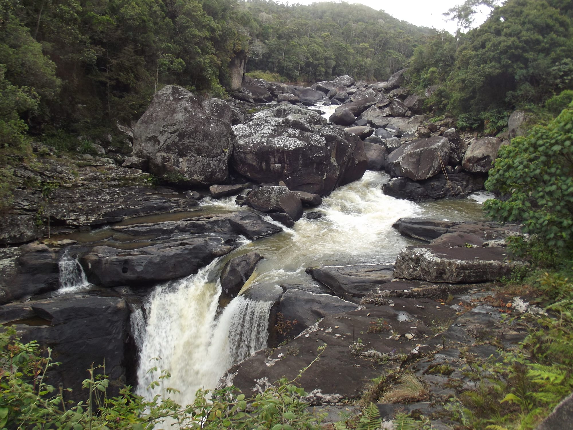
A river falling over dark rock ledges in white cascades, enclosed by steep rainforest-covered slopes

Fianarantsoa & the Southern Highlands, Madagascar

Ranomafana

The Namorona river dropping through the rainforest of Ranomafana National Park. (Smiley.toerist / Wikimedia Commons · CC BY-SA 4.0)

A small village on the eastern escarpment of Madagascar's highlands, strung along the road where the Namorona river drops towards the coast. Its name means 'hot water', for the thermal springs that first drew visitors, but it is known today as the gateway to Ranomafana National Park, the rainforest protected in 1991 after the discovery of the golden bamboo lemur.

Neighbourhoods

  • The village and the springs
    • First-time visitors
    • Local life

    A single street of shops, stalls and small guesthouses beside the Namorona, with the thermal bath house that gave the place its name a short walk away. Everything in the village is within a few minutes on foot, and the river is audible from most of it.

    Open in Maps
  • The road to the park entrance
    • Wildlife
    • Quiet

    The RN25 climbs west out of the village through forest and roadside clearings to the park's main entrance a few kilometres away. Most of the lodges are spread along this stretch, and the verges are where night walks are made after dark.

    Open in Maps
  • Vohiparara and the high forest
    • Walks and viewpoints
    • Birdwatching

    Higher up the escarpment, about ten kilometres from the village, a hamlet and a second way into the park where the forest is cooler, mossier and often in cloud. Trails from here are used for birds and for the less-visited parts of the reserve.

    Open in Maps

Things to do

The national park

  • Ranomafana National Parkpark

    More than 400 square kilometres of montane rainforest protected in 1991, home to the golden and greater bamboo lemurs among its rare wildlife and part of the Rainforests of the Atsinanana World Heritage Site.

    Open in Maps
  • Guided forest walkstrail

    All walking in the park is done with a local guide on marked trails, steep and often muddy, looking for lemurs, chameleons and birds in the early morning.

    Open in Maps
  • Night walks on the park roadtrail

    After dark, guides work the verges of the road outside the park boundary with torches, where mouse lemurs, chameleons and tree frogs are commonly seen.

    Open in Maps
  • Centre ValBioattraction

    The research station beside the park, created in 2003 by Stony Brook University for work on biodiversity, community health, education and reforestation, and a base for visiting scientists.

    Open in Maps

The village and the river

  • The thermal bathsattraction

    The hot springs that gave Ranomafana its name feed an outdoor pool and bath below the village, with a well-kept park beside them.

    Open in Maps
  • The Namorona riverattraction

    The river that drains the plateau through the park in a series of rapids and falls, crossed by the road bridge in the middle of the village.

    Open in Maps

Short trips from the village

  • Ifanadianaattraction

    The district town east of the village on the road towards the coast, a market centre for the farming country below the escarpment.

    Open in Maps
  • Fianarantsoaattraction

    The highland city about 60 kilometres west, with its hilltop old town, markets and the terminus of the railway to Manakara.

    Open in Maps
  • Sahambavyattraction

    A village on the railway line west of the escarpment, surrounded by the tea plantation that supplies the highlands.

    Open in Maps

Eat and drink

Long-standing places and food districts in Ranomafana. Hours, ratings and directions come from your maps app, always current.

Eating in the village

  • The village hotelyneighborhood

    A handful of small eating houses on the main street serve rice with a laoka of zebu, chicken or greens, and freshwater fish from the river valley.

    Open in Maps
  • The roadside stallsmarket

    Stalls by the bridge and along the road sell bananas, litchis in season, cassava, roasted peanuts and rice cakes to travellers and to villagers walking in from the hills.

    Open in Maps
  • Lodge dining roomsneighborhood

    The lodges spread along the road towards the park cook set meals for their guests, generally a French-influenced version of Malagasy cooking with local vegetables and fruit.

    Open in Maps

Experience Ranomafana

History

The village grew around its hot springs. Thermal water rising beside the Namorona gave the place its Malagasy name — ranomafana, hot water — and a bathing place was built to take advantage of it, on the road that linked the plateau at Fianarantsoa with the eastern lowlands. For most of the 20th century Ranomafana was little more than that: a staging post on the RN25, a market for the Tanala and Betsileo farmers of the escarpment, and a spa of local reputation.

The forest on the slopes above was being cut and hunted through those decades. In 1986 researchers working in it identified a lemur new to science, the golden bamboo lemur, and confirmed that the greater bamboo lemur, thought to be gone from the area, still survived there. The find, and the campaign that followed it — led by the American primatologist Patricia Wright with Malagasy colleagues — turned the forest into a conservation priority, and the national park was established in 1991.

The park changed the village. A research station, Centre ValBio, was built beside the forest in 2003 by Stony Brook University; lodges appeared along the road; and guiding, portering and park work became a significant local livelihood, alongside a continuing tension over access to land and forest products for the communities that lived from them. In 2007 the park was inscribed, with five others, as part of the Rainforests of the Atsinanana World Heritage Site.

Culture & Customs

Ranomafana sits on the boundary between two peoples. Above and west are the Betsileo of the plateau, rice terracers with elaborate ancestral tombs; below and east are the Tanala, the "people of the forest", who have long farmed the escarpment with hill rice, coffee and honey and know the forest as a source of medicine, building material and food. The village market mixes both, and its dialect and customs sit between them.

Ancestral observance is strong. Fady govern which days may be worked, which forest places may be entered and which animals may be harmed, and vary from one hamlet to the next; guides raised locally treat them as seriously as the park rules. Christianity is widespread alongside these practices, and a small church crowd fills the village on Sundays.

Conservation is now part of local identity in a complicated way. Two generations have grown up with researchers, park rangers and visitors in the village, and guiding has become a respected career passed between families, while the restrictions on clearing forest for hill rice are a real cost to households that have few alternatives. Village associations, tree nurseries and health and school projects linked to the research station are part of the bargain that keeps the park and its neighbours in balance.

Daily Life

Around ten thousand people live in the commune of Ranomafana and the hamlets around it, and life runs along the single road. Farming comes first — hill rice, cassava, bananas, coffee and vegetables on the steep slopes — followed by the tourism economy of guides, porters, drivers, cooks and guesthouse staff, and by small trade in the stalls near the bridge.

The day starts before dawn, because guides and visitors go into the forest at first light and farmers walk out to plots that may be an hour away. Water comes from the river and from standpipes, electricity is limited and unreliable, and the village has a hospital and schooling to junior secondary level, while the nearest bank and senior secondary schools are in Ifanadiana or Fianarantsoa. School attendance and health care in the district have been improved by programmes tied to the research station.

The seasons order everything: the rice calendar, the cyclone months when the RN25 can be blocked by landslips, and the visitor season from about April to November, when the village is busy and the lodges full. Out of season it returns to being a quiet farming village with a hot spring.

Food

Meals here are highland Malagasy with a lowland accent. Rice — vary — is the base of every plate, served with a laoka of zebu, pork, chicken, beans or leaves in broth; ravitoto, pounded cassava leaves cooked with pork, is common, and freshwater fish, crayfish and eels from the Namorona and its tributaries appear when the catch allows. Sakay, the fiery chilli paste, is on every table.

The escarpment grows what the plateau cannot. Bananas, litchis, jackfruit, sugarcane, pineapple and mangoes come up from the warmer land to the east, coffee is grown on smallholdings in the hills, and honey from forest-edge hives is sold by the jar at the roadside. Breakfast is vary sosoa, soft rice porridge, or mofo gasy, little rice-flour cakes fried in the early morning, with sweet coffee or ranovola, the smoky water boiled off the toasted rice crust.

Lodge kitchens along the park road cook a French-influenced version of the same ingredients — zebu in green peppercorn sauce, river fish, vegetable gratins — and serve highland wine from the hills near Fianarantsoa and tea grown at Sahambavy. Beer and toaka gasy, home-distilled rum, are the village drinks.

Planning tools

Budget

Costs here are modest apart from the park. Guesthouses in the village are cheap and the hotely meals cheaper, while the lodges on the park road cost considerably more. Park entry permits and the compulsory local guide, charged per group per walk, are the main outlay, and a hired car with driver or a taxi-brousse fare is the other.

Daily Budget Midrange
USD 55–150 (lodge on the park road, park fees and guides, a car with driver)
Daily Budget Shoestring
USD 20–35 (village guesthouse, hotely meals, taxi-brousse)

Bring cash from Fianarantsoa: there is no reliable bank or cash machine in the village, and permits and guides are paid in ariary.

Best Time to Visit

September to November is the most rewarding period, when the rain eases, lemurs are active and young animals appear. April to August is drier underfoot than the summer but cool and often misty. This is one of the wettest places in the highlands, so rain is possible in any month, and January to March brings the heaviest falls and the risk of cyclone damage to the road.

Suggested Number of Days

Most visitors stay one or two nights, enough for a morning walk in the forest and a night walk. A third night allows the higher forest and a slower pace, and adds the chance of better weather if the first walk is rained out.

First Visit
1–2 days
With Surroundings
2–3 days

Transportation

The village is walkable end to end in a few minutes. Everything beyond it is on the RN25, and visitors either arrive in a hired car with driver or take a taxi-brousse between Fianarantsoa and the east coast. Lodges run transfers to the park entrance, and there is no public transport for the last stretch to the trailheads.

Arrange the next day's transport the evening before, since bush taxis pass through the village rather than starting from it.

Airport & Station Connections

Ranomafana lies on the RN25, about 60 kilometres east of Fianarantsoa and roughly one and a half to two hours by road, on the route that continues down the escarpment towards Mananjary and the east coast. There is no airport or railway station; almost everyone arrives by road from Fianarantsoa or the RN7.

Walkability

The village itself is a short, flat walk along the river, but everything else is uphill: the road to the park entrance climbs steadily and has no pavement, and the forest trails are steep, slippery and rooty. Sturdy footwear matters more here than in most Malagasy towns.

Safety

The village is quiet and the main hazards are natural rather than criminal: slippery trails, leeches after rain, and a road with blind bends and heavy lorries. Malaria is present at this altitude and on the warmer land below, and the rains can bring landslips and cyclone damage to the RN25. Petty theft is uncommon but possible around the bus stops.

Madagascar has a long history of political unrest — mass protests in September 2025 were followed by a military takeover and a change of government, so demonstrations can disrupt movement in the capital. Walk the forest only with a park guide, take malaria precautions, keep to daylight for road journeys, and carry waterproofs and a torch. Check current official travel advice before travelling.

Climate

Wet all year on the forested escarpment, warmer than the plateau above and cooler than the coast below, with cloud sitting on the high forest for much of the year. Being in the southern hemisphere, summer runs from December to February and winter from June to August.

Summer
warm, humid and very wet, roughly 17–28°C, with the heaviest rain from January to March
Winter
mild by day and cool at night, roughly 11–23°C, with frequent drizzle and mist

Local Customs

The surrounding villages are Tanala and Betsileo farming communities, and fady — local taboos about days, foods and places in the forest — are respected; guides will explain what applies where. Guiding, portering and park work are an important income, and tipping a guide at the end of a walk is normal. Greetings are unhurried and modest dress is expected in the village.

Ask before photographing people or houses, never feed or touch lemurs, and follow a guide's instructions about staying on the trails.

Common Payment Methods

The currency is the Malagasy ariary, and cash is essential: park permits, guides, stalls and small guesthouses take nothing else. Cash machines are in Fianarantsoa rather than here, and only the larger lodges are likely to accept a card. Small notes are useful for tips and for the market.