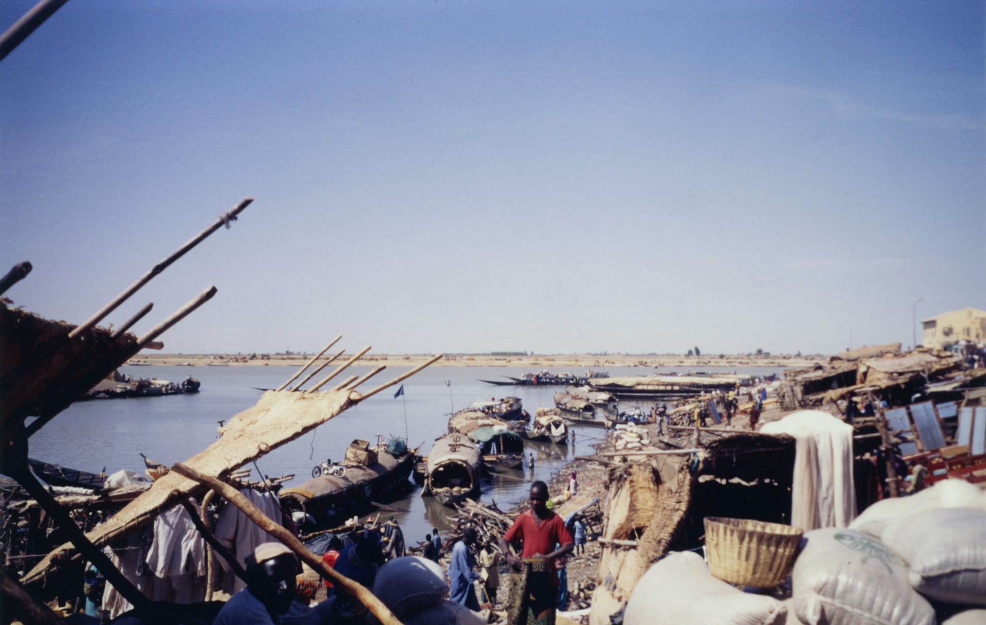
Wooden river boats with matting roofs moored along a crowded quay, with sacks and baskets stacked on the bank under a wide sky

Ségou, Mopti & the Niger Bend, Mali

Mopti

Pinasses moored at the river port of Mopti, where the Bani meets the Niger. (Jeanne Menjoulet / Wikimedia Commons · CC BY 2.0)

A port town in central Mali built on dykes and islands where the Bani river joins the Niger, about 630 kilometres north-east of Bamako. A village until the French conquest, it grew into the country's most important river port, known for its harbour of wooden pinasses, its dried fish trade and its mud-brick mosque. This page is written to explain the town, not to encourage travel.

Neighbourhoods

  • The port
    • First-time visitors
    • Markets
    • River views

    The working harbour at the confluence, where pinasses and pirogues load rice, grain, pottery and slabs of rock salt, and the fish market spreads along the bank. It is the noisiest and most concentrated part of the town, and the reason Mopti exists.

    Open in Maps
  • Komoguel
    • Historic district
    • Quiet and residential

    The older residential quarter inland from the port, built on raised ground with mud-brick houses and narrow lanes, and dominated by the town's grand mosque in the Djenné style. Daily life here is quieter than at the water's edge.

    Open in Maps
  • The causeway and the new quarters
    • Transport
    • Local life

    Mopti's dry ground is limited, so the town has grown along the dyke roads that link its islands to the mainland and on towards Sévaré. Transport yards, workshops, schools and newer housing line these approaches.

    Open in Maps
  • Sévaré
    • Transport
    • Close to the airport

    The crossroads town about 10 kilometres south-east, within the same commune, where the roads to Bamako, Bandiagara, Gao and Timbuktu meet and the region's airport stands. Most administration, aid offices and long-distance transport now work from here.

    Open in Maps

Things to do

In the town

  • Grand Mosque of Moptilandmark

    Also called the Komoguel mosque, a mud-brick building of 1933–35 in the style of the Great Mosque of Djenné, with projecting palm-wood beams and, on both its eastern and western walls, a massive central tower flanked by smaller corner towers; it was restored in 1980 and again in 2004–06, with funding from the Aga Khan Trust for Culture.

    Open in Maps
  • Mopti Airporttransit hub

    The region's airport, at Sévaré a short way south-east of the town, long the arrival point for visitors to the Dogon country.

    Open in Maps

The river and the delta

  • The river port and fish marketmarket

    The quays where pinasses are loaded and unloaded and where dried and smoked fish, rock salt from the Saharan mines at Taoudenni, pottery and grain change hands.

    Open in Maps
  • Bani Riverattraction

    The Niger's principal tributary in Mali, about 1,100 kilometres long, formed by the Baoulé and Bagoé rivers and joining the Niger at Mopti; its flood governs farming and fishing across the delta.

    Open in Maps

Short trips from the town

  • Djennéattraction

    The island town upstream on the Bani, whose Great Mosque and old quarters are a World Heritage Site, with the archaeological mound of Djenné-Djenno beside it.

    Open in Maps
  • Bandiagaraattraction

    The town on the plateau east of Mopti, chosen in 1864 as capital of the Toucouleur empire and the gateway to the Dogon villages along the cliffs.

    Open in Maps
  • Bandiagara Escarpmentattraction

    A sandstone cliff line running for about 150 kilometres, with Dogon villages, granaries and the earlier Tellem dwellings cut into the rock face, listed as a UNESCO World Heritage Site.

    Open in Maps
  • Lake Déboattraction

    The largest lake in Mali, formed by the Niger about 80 kilometres downstream of Mopti when the delta floods, important for fishing and for enormous numbers of waterbirds.

    Open in Maps

Seasonal events

  • Eid al-Fitrvaries with the lunar calendar

    The feast at the end of Ramadan, with mass prayers on open ground and visiting between households.

  • Tabaskivaries with the lunar calendar

    The sheep festival, the biggest family occasion of the year, preceded by ram markets along the roads into town.

  • The flood and the fishing seasonSeptember to December

    The annual arrival of the Niger and Bani floodwaters, which turns the delta into a waterscape, opens the main fishing season and brings the river traffic to its height.

Eat and drink

Long-standing places and food districts in Mopti. Hours, ratings and directions come from your maps app, always current.

Markets and food districts

  • The port fish marketmarket

    Fresh capitaine, catfish and tilapia from the delta, and the smoked and dried fish for which Mopti is known across West Africa, sold in stacks beside the quays.

    Open in Maps
  • The town marketmarket

    Rice, millet, onions, dates, rock salt and cooked food, along with the pottery and blankets brought in by boat from the delta villages.

    Open in Maps
  • Riverside grills and street kitchensneighborhood

    Simple places near the port serving rice with sauce, whole grilled fish and sweet tea; there is little formal restaurant life left in the town.

    Open in Maps

Experience Mopti

History

Unlike Djenné, Timbuktu and Gao, Mopti has no medieval history. It was a collection of Bozo fishing villages on islands in the flood plain where the Bani meets the Niger, whose people grew rice on the floodplains, herded livestock and fished with cotton nets, drying large quantities of their catch for sale in the markets of Djenné. The Massina state of Seku Amadu, founded in 1818 and governed from Hamdallaye nearby, brought the area under a strict Islamic administration in the 19th century, and El Hadj Umar Tall's Tukulor empire followed in the 1860s.

The French conquest made the town. Recognising the value of the confluence, the colonial administration chose Mopti rather than Djenné as the regional capital, built a 12-kilometre dyke to Sévaré between 1905 and 1912 to join the islands to the mainland, and developed the port. Trade in dried fish, rice, grain and rock salt from the Saharan mines grew with it, and by the 20th century Mopti was the most important river port in Mali. The grand mosque at Komoguel was built in the 1930s in the style of Djenné's.

After independence the town added tourism to trade: it became the base for visits to the Dogon country, Djenné and Timbuktu, with hotels, guides and boat operators. The war that began in 2012 ended that. Mopti was not taken by the rebels, but Western visitors stopped coming, and from 2015 the insurgency spread into central Mali and made the surrounding countryside dangerous. The town, still a port and a market, has since absorbed large numbers of people displaced from the villages around it.

Culture & Customs

Mopti is a river town before anything else, and its communities are defined by what they do on and around the water. The Bozo and Somono are fishermen, with their own ways of handling nets, boats and the flood calendar; the Fula, whose language Fulfulde is widely spoken here, herd cattle through the delta and swim them across the river at the seasonal crossings; Bambara and Songhai farm; Dogon traders come down from the plateau. The relationships between them were long regulated by agreements over water, grazing and fishing rights.

The town is strongly Muslim, and the Komoguel mosque, rebuilt in mud in the style of Djenné, is its centre. Quranic schools, Friday prayers and the two Eid festivals frame the year. Craft traditions serve the river trade: boatbuilding and the painting of pinasses, pottery brought in from delta villages, woollen Fula blankets, and the blacksmiths and leatherworkers of the market.

Mopti's second identity, as the gateway to the Dogon country, shaped it for decades. A generation of guides, drivers, hoteliers and craft sellers grew up around that trade and lost it after 2012, and the loss is part of how the town now sees itself. Manners are Malian: unhurried greetings, respect for elders, and long sessions over three rounds of sweet green tea.

Daily Life

The urban commune, which includes Sévaré, counted 114,296 people at the 2009 census. The town proper is squeezed onto raised ground and dykes, with little room to grow, so much of the expansion has happened at Sévaré, where the roads and the airport are and where offices and newer housing have gone.

Work follows the river. Fishing, drying and smoking fish for export across West Africa remains the signature trade; rice from the floodplains, cattle and milk from the herders, pottery, salt and grain moving through the port make up the rest, and the harbour's loading and unloading employs many. Markets around the harbour sell rock salt brought down from Taoudenni, among a great deal else. Sévaré's junction position gives it transport work and, since the war, a steady presence of aid organisations.

The conflict shapes everything. Armed groups operate across the Mopti region, roads out of town are dangerous, schools in the countryside have closed, and hundreds of thousands of people have left the villages for the safety of the towns, straining housing, water and work in Mopti and Sévaré. Fuel shortages, power cuts and rising prices have been felt here as across the country, and the tourism that once supported a large part of the population has not returned.

Food

Fish is the town's food and its trade. Capitaine, the Nile perch, is grilled whole or fried and served with rice; catfish and tilapia go into sauces; and the smoked and dried fish of the delta, stacked in the market and sent across West Africa, is broken into stews and sauces to give them depth. Rice from the flooded plains is the staple, eaten as riz au gras, cooked in oil and tomato, or plain with a sauce of groundnut, okra or baobab leaf.

The Fula contribution is dairy: fresh and soured milk, butter, and millet porridge taken with them, along with dégué, sweetened millet couscous with milk, eaten as a snack and a dessert. Millet appears as a stiff porridge and as moni, a thin gruel, at breakfast. Onions, grown in great quantity in the Dogon country and the delta, and soumbala, the fermented néré-seed seasoning, go into most sauces.

Around the port and the market the street food is fried fish, brochettes of mutton, bean fritters, fried dough and bread with sauce. Drinks are hibiscus and ginger juices, tamarind, milk, and green tea boiled with sugar and poured in three rounds. Rock salt from the desert mines, sold in grey slabs at the quay, is part of the same trade that once carried gold and is still used in cooking and for livestock.

Planning tools

Budget

Mopti was the base of Mali's tourist trade, with hotels, guides and boat operators working the delta and the Dogon country. That business has collapsed, and what a visit costs now depends almost entirely on the security arrangements it requires rather than on local prices, which for food, markets and transport remain low.

Daily Budget Midrange
USD 250–500+ (costs depend entirely on security arrangements rather than on the town)
Daily Budget Shoestring
USD 40–80 (a basic room, market food and shared transport — but no visitor services remain)

Do not plan travel to central Mali; the region's tourist infrastructure has largely closed.

Best Time to Visit

In principle from November to February, when the flood is still high, the river traffic is at its busiest and the heat is bearable. April to June is fiercely hot, often above 40°C, and the river falls to its lowest. In practice the conflict rules out travel in the region, whatever the season.

Suggested Number of Days

A day or two covers the port, the mosque and the markets. Longer stays were always about what lies around the town — the delta villages, Djenné and the Dogon cliffs — and depend entirely on whether movement in the region is possible.

First Visit
1–2 days
With Surroundings
3–5 days

Transportation

Within the town, motorbikes, shared taxis and carts do the work on the dyke roads between the port, Komoguel and Sévaré. On the water, privately run pinasses, large wooden vessels shaped like canoes, carry passengers and freight, and ferries of the Compagnie Malienne de Navigation (COMANAV) serve the port when the river is high enough.

Do not travel by road in central Mali; the risk of ambush, roadside bombs and armed checkpoints is high.

Airport & Station Connections

Mopti lies about 630 kilometres north-east of Bamako on the main road through Ségou and San, a journey of most of a day when conditions allow, and the airport at Sévaré is the region's airfield. The Niger connects the port downstream to Timbuktu and Gao, a route once travelled by ferry and pinasse in the high-water season. The region's roads have seen ambushes, roadside bombs and blockades.

Walkability

The old town is compact: the port, the market and the mosque are within a short walk of one another along the dykes, and much of it is too narrow or too crowded for cars. Sévaré is a separate walk or ride away. Heat, dust and, in the rains, mud and standing water make longer walks hard going.

Safety

Central Mali is among the most dangerous parts of the country and most governments advise against all travel. Since 2015 jihadist groups, notably the Katiba Macina within the al-Qaeda-linked JNIM coalition, have operated across the delta and the Bandiagara plateau around Mopti, fighting the army and its Russian allies, while self-defence militias and herding and farming communities have been drawn into the violence; massacres of civilians have been attributed to all sides. Attacks on Sévaré and Mopti formed part of the large coordinated offensive reported from 25 April 2026. Kidnapping, roadside bombs and sieges of villages are common.

Globeway covers Mali so its history and culture can be understood — the empires, the manuscripts, the music, the mud architecture — not to suggest that a visit is currently possible or wise. Do not travel to central Mali under any circumstances unless with professional security support. Check current official travel advice before travelling.

Climate

Sahelian, hot and dry, with a short rainy season and a long dry one. The Niger and Bani floods arrive after the rains upstream and spread across the inland delta from about September to December before falling back.

Summer
rainy season July–September, humid and hot, around 25–38°C
Winter
dry, dusty Harmattan season from November to February, around 15–33°C with cool nights; very hot from March to June, often above 40°C

Local Customs

Mopti is a meeting place of Bozo and Somono fishermen, Fula herders, Bambara and Songhai farmers and Dogon traders, and each community has its own language and customs; Fulfulde and Bambara are both widely heard. Islam is the majority faith and the mosque orders the week. Greetings are long and unhurried, the right hand is used for eating and giving, and tea is poured in three rounds.

Dress modestly, ask before photographing people and expect a request for payment, and do not photograph soldiers, police, checkpoints or the airport.

Common Payment Methods

The currency is the West African CFA franc, pegged to the euro. The town runs on cash: markets, boats and transport take nothing else, cards are not accepted and ATMs cannot be relied on, so CFA francs should be brought in. Mobile money is widely used by residents.