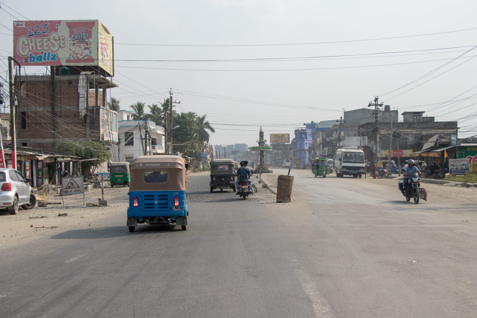
A wide hazy city road in Biratnagar with auto-rickshaws, motorbikes and a bus, shops and billboards along both sides

Everest & Eastern Nepal, Nepal

Biratnagar

Traffic on a main road through Biratnagar in Nepal's eastern Terai. (Bijay Chaurasia / Wikimedia Commons · CC BY-SA 4.0)

One of Nepal's largest cities, on the flat Terai plain a few kilometres from the Indian border in the far east of the country. Jute mills made it the cradle of Nepali industry and of the political movement that ended Rana rule, and it remains a hot, busy centre of trade, transport and provincial government rather than a sightseeing town.

Neighbourhoods

  • The central bazaar
    • First-time visitors
    • Markets
    • Close to public transport

    The commercial core around Main Road and the central chowks, a dense grid of cloth and hardware shops, gold merchants, sweet shops and hotels. It is the noisiest part of the city, thick with rickshaws and motorbikes, and most visitors stay within walking distance of it.

    Open in Maps
  • Bargachhi and the Koshi Highway
    • Close to public transport
    • Best for food

    The junction where the road north to Itahari and the hills meets the city, with the bus park, newer hotels, showrooms and roadside eating houses. Traffic runs through it all day, and long-distance buses leave from here.

    Open in Maps
  • The mill district and Rani
    • Local life

    The southern and eastern wards where the jute mills, godowns and workers' housing grew up, stretching towards the border. Industry is mixed with markets and dense residential lanes, and the area explains more about the city than any monument.

    Open in Maps
  • Tinpaini and the northern wards
    • Quiet and residential

    The quieter, more spread-out side of the city, with schools, colleges, hospitals and newer housing among open plots and ponds. Provincial and district offices and the airport road are on this side.

    Open in Maps

Things to do

In the city

  • The jute mill districtlandmark

    The southern industrial belt around the jute mill that opened in 1936, Nepal's first large factory and the setting of the 1947 strike that fed the movement against Rana rule.

    Open in Maps
  • Biratnagar Airporttransit hub

    The busy domestic airport north of the centre, the main air gateway to eastern Nepal and a base for flights and helicopters into the hills.

    Open in Maps
  • The central bazaarmarket

    Streets of cloth, brass, spice and sweet shops around the main chowks, where goods from India and the eastern hills are traded.

    Open in Maps

Towns nearby

  • Jogbanineighborhood

    The Indian border town immediately south of the city, a rail head and crossing point where cross-border trade and traffic converge.

    Open in Maps
  • Itaharineighborhood

    The crossroads town north of Biratnagar where the East–West Highway meets the road to Dharan and the hills.

    Open in Maps
  • Dharanneighborhood

    A town at the foot of the hills about an hour and a half north, cooler than the plain, long associated with British Gurkha recruitment.

    Open in Maps

The Koshi river and its wetlands

  • Koshi Tappu Wildlife Reservepark

    Wetlands and grassland on the Koshi river west of the city, a Ramsar site holding Nepal's last herd of wild water buffalo, with more than 480 recorded bird species.

    Open in Maps
  • Koshi Barragelandmark

    The long barrage across the Koshi river, built between 1958 and 1962 under a 1954 agreement with India, which controls one of the most flood-prone rivers in South Asia.

    Open in Maps
  • Dhankutaneighborhood

    An old hill bazaar on the ridge road north of Dharan, with whitewashed houses, cool air and views over the eastern hills.

    Open in Maps

Seasonal events

  • DashainSeptember or October

    The longest festival of the Nepali year, when shops close, buses fill with people travelling home and the city empties for days.

  • TiharOctober or November

    The festival of lights, with oil lamps and marigold garlands on shopfronts and singing groups going from house to house.

  • ChhathOctober or November

    A Maithili and wider Terai festival honouring the sun, kept with fasting and offerings made standing in ponds and rivers at sunset and sunrise.

  • HoliMarch

    The spring festival of colour, kept at the full moon of Phalguna, with coloured powder and water thrown in the streets.

Eat and drink

Long-standing places and food districts in Biratnagar. Hours, ratings and directions come from your maps app, always current.

Biratnagar staples

  • Eating houses around the main chowksrestaurant

    Bhojanalaya and hotel kitchens serving daal bhaat with plenty of vegetable dishes, fish curry from the Koshi, mutton and buffalo, and tandoori food in the Indian style.

    Open in Maps
  • Sweet shops and mithai counterscafe

    Mishthan bhandar counters selling the Maithili and Bengali-influenced sweets of the eastern plains, from rasbari and jeri to milk-based pedha, with samosa and hot tea.

    Open in Maps
  • Street food stalls on the bazaar streetsmarket

    Carts and small stands turning out momo, chatpate, pani puri, sel roti and fried snacks through the evening, busiest once the heat has gone out of the day.

    Open in Maps

Experience Biratnagar

History

The name Biratnagar means King Virata's city, after the ruler of the Matsya kingdom in whose court the Pandavas of the Mahabharata spent their year of concealment, though that kingdom is usually placed at Viratnagar in present-day Rajasthan. For most of its recorded history, though, this was thinly populated country: the Terai was forested, malarial and used chiefly for timber and seasonal cultivation, and the towns of eastern Nepal lay in the hills above it.

Industry made the modern city. In 1936 the Biratnagar Jute Mills opened, the first large factory in Nepal, drawing workers from the hills and from Bihar and turning a small settlement into a working town of mills, godowns and rail sidings connected to the Indian network at Jogbani. In March 1947 a strike at the mills, in which the Koirala brothers were prominent, spread into a political movement against the Rana regime, and Biratnagar's part in the events that led to the fall of the Ranas in 1951 is central to the city's sense of itself. Four of Nepal's prime ministers came from the Koirala family of this city, and Man Mohan Adhikari, the first communist prime minister, and Sushila Karki, the first woman to hold the office, were also born here.

Malaria control and resettlement schemes from the 1950s opened the Terai to migration from the hills, and the city grew quickly. The East–West Highway, built from the 1960s, tied it into the national road network, and jute was joined by sugar, textiles, rice mills, plastics and light manufacturing. Political change kept touching it: the Madhes movements of 2007 and after, the federal constitution of 2015, and the designation of the city as the seat of the provincial government of what is now Koshi Province.

Culture & Customs

Biratnagar sits on a cultural border as well as a political one. Maithili and Bhojpuri speakers of the plains, Rajbanshi and Tharu communities, Muslim traders and Marwari business families live alongside Nepali-speaking migrants from the eastern hills — Rai, Limbu, Newar, Tamang, Brahmin and Chhetri — and the mix is audible in the streets, where several languages are used in the same shop.

Its festival calendar shows both influences. Dashain and Tihar are kept as across Nepal, but Chhath, the four-day festival of the sun celebrated at ponds and riverbanks with fasting and offerings, is the one that fills the city's water places and is followed here as devotedly as in Bihar. Holi brings colour to the streets in March, Eid is marked in the Muslim quarters, and the Kirat communities keep Ubhauli and Udhauli.

The city's identity is political and industrial rather than monumental. Residents will point to the jute mill and the 1947 strike, to the Koirala family home, and to the argument that Nepali democracy began here rather than in Kathmandu. Manners are those of the plains: formal, hospitable, a little more conservative than in the capital, with women's dress and behaviour subject to more expectation. Cricket is followed as much as football, another sign of how close Bihar is.

Daily Life

About 245,000 people live in Biratnagar Metropolitan City, with many more in the built-up area spreading towards Jogbani and along the road to Itahari. It is the provincial capital of Koshi Province and the commercial capital of eastern Nepal: customs and trade with India, wholesale markets, transport, hospitals, colleges and government offices provide most of the formal work.

The industrial base has shifted since the days of the jute mills. Sugar, rice and oil mills, textiles, plastics, steel rolling and food processing operate in the belt towards the border, and a great deal of commerce is informal, moving small goods across the frontier. Remittances from the Gulf, Malaysia and India support many households, as they do across the Terai.

Days are shaped by the heat. Markets and offices start early, the middle of the day is slow from April to September, and the streets fill again in the evening when families walk out for snacks and shopping. The city's persistent problems are air and dust pollution, waterlogging and drainage in the monsoon, an unreliable power and water supply in the hot months, and the periodic strikes that shut the border and the highway. Its advantages are cheap land, a working airport and a position on Nepal's busiest trade corridor with India.

Food

Biratnagar eats the food of the eastern Terai, which is closer to Bihar and Mithila than to the Kathmandu valley. Rice is the staple, with daal, seasonal vegetables, pickles and often fish: the Koshi and its channels supply river fish cooked in mustard-heavy curries, and dried fish is a regular ingredient. Mutton and buffalo appear in curries and fried as sukuti, the dried spiced meat of the hills, and tandoori dishes are common in restaurants.

Maithili home cooking has its own dishes. Dhuska, a deep-fried cake of ground rice, litti stuffed with spiced roasted gram flour, bari, fried gram-flour dumplings in a spicy gravy, and tarua, deep-fried marinated vegetables, are found in local kitchens and at festivals. The Newar and hill communities bring momo, chatamari and sukuti; the city's Muslim quarters contribute biryani and kebabs.

Sweets are a serious business. Mishthan bhandar counters sell rasbari in syrup, jeri, laddu, peda and khurma, and the eastern plains are known for milk-based sweets that arrive in trays in the early evening. Sel roti, the ring-shaped rice doughnut, is made in quantity at Tihar. Street food runs to chatpate, pani puri, samosa and fried snacks, and drinks are chiya boiled with milk and sugar, lassi, sugarcane juice and, in the hot months, sharbat and plain cold water from earthen pots.

Planning tools

Budget

Biratnagar is an inexpensive city with business hotels rather than tourist ones, and prices reflect trade rather than sightseeing. Rooms with air conditioning cost more, and they are worth it from April to September. Meals in local eating houses are cheap, and the main variable costs are taxis, hired cars for trips to Koshi Tappu or the hills, and domestic flights.

Daily Budget Midrange
USD 50–130 (an air-conditioned hotel, restaurant meals and a car with driver for the reserve or the hills)
Daily Budget Shoestring
USD 15–20 (simple guesthouse, daal bhaat and street food, rickshaws and local buses)

Budget for cooled rooms and drinking water in the hot months, when the plains are draining to travel in.

Best Time to Visit

October to February is the comfortable season, with warm days, cool nights and the best conditions for birdwatching at Koshi Tappu. March to May is very hot and dusty, and June to September brings monsoon rain, high humidity, mosquitoes and the risk of flooding on the Koshi and its tributaries. The festival months of October and November are the liveliest.

Suggested Number of Days

The city itself takes a day, and many travellers see it only as an arrival or departure point. Two to four days make sense as a base for the wetlands, the border and the first hill towns. Heat and the length of the road journeys are what stretch the time needed.

First Visit
1 day
With Surroundings
2–4 days

Transportation

Auto-rickshaws, battery-powered tempos, cycle rickshaws and taxis cover the city, and motorbikes dominate the traffic. Buses and shared jeeps leave from the bus park for Itahari, Dharan, Kakarbhitta, Ilam and Kathmandu, and the East–West Highway meets the city road at Itahari. Rickshaw fares are agreed before setting off.

Traffic is heavy, dusty and unforgiving of pedestrians; crossing the main roads takes patience, and few vehicles have working seatbelts.

Airport & Station Connections

Biratnagar Airport is Nepal's third busiest airport, after Kathmandu and Pokhara, with frequent flights from Kathmandu taking under an hour, and connections onwards to hill airstrips. Buses from Kathmandu take roughly 12 to 14 hours on the East–West Highway, usually overnight. The Indian border at Jogbani is a few kilometres south, where the Indian railway line ends, with road links on into Bihar.

Walkability

The bazaar is flat and compact enough to walk, which is the best way to see it, but the wider city is spread out and built for vehicles. Pavements are intermittent, traffic is constant, and heat and dust make long walks uncomfortable for much of the year. Short rickshaw or auto-rickshaw rides are the normal way to move between districts.

Safety

Violent crime against visitors is uncommon, and the usual risks are road traffic, petty theft in crowded markets and the climate: heat exhaustion from April to June and mosquito-borne illness, including dengue, in and after the monsoon. Border areas see occasional strikes or protests that close roads and shops at short notice, and monsoon flooding can cut routes west of the city.

Avoid night road travel, drink treated water and use mosquito repellent, and ask locally before travelling if a bandh or strike has been called. Check current official travel advice before travelling.

Climate

A humid subtropical climate typical of the eastern Terai, and one of the wetter and hotter parts of lowland Nepal. Winters are mild with dense morning fog that can delay flights; the pre-monsoon months are oppressive; the monsoon delivers most of the year's rain between June and September.

Summer
hot and humid, roughly 30–38°C from April to August, with heavy monsoon downpours later in the season
Winter
mild and often foggy, roughly 10–24°C from December to February, cool at night and hazy in the mornings

Local Customs

The city is culturally close to Bihar as well as to the Nepali hills, and Maithili, Bhojpuri, Nepali, Rajbanshi and Urdu are all heard. Greetings are made with hands together, shoes are removed before entering homes and temples, the right hand is used for eating and passing things, and food once tasted is not shared. Dress is conservative, especially for women, and alcohol is less openly consumed than in tourist towns.

Ask before photographing people, mills or anything near the border and its checkposts, and dress modestly at Chhath and other riverside rituals.

Common Payment Methods

The currency is the Nepalese rupee. Banks and cash machines are plentiful in the centre, and hotels and larger shops accept cards, but markets, rickshaws and small eating houses are cash only. Indian rupees circulate near the border, though high-value Indian notes are not legal for use in Nepal.