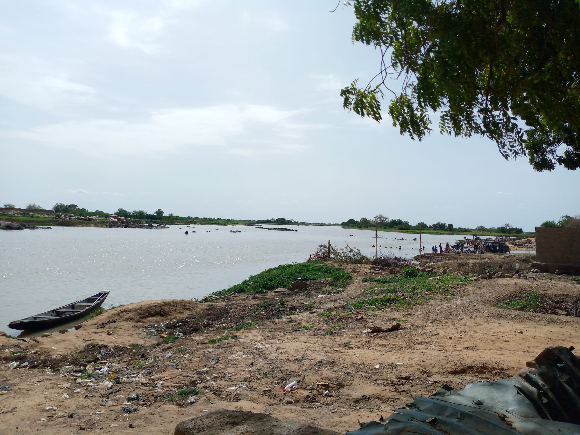
A wooden dugout canoe drawn up on a sandy bank of the wide Niger river, with low green banks and rocks in the distance

Niamey & the Southwest, Niger

Ayorou

The Niger river at Ayorou, with a pirogue pulled up on the bank. (Albertoum / Wikimedia Commons · CC BY-SA 4.0)

A river town in the Tillabéri region of western Niger, about 208 kilometres north-west of Niamey and close to the Malian border, whose old quarter stands on an island in the Niger. It is known for its weekly animal market, for the sandy islands and channels around it and for the hippopotamuses and birds in the river. This page is written to explain the city, not to encourage travel.

Neighbourhoods

  • The island old town
    • Historic district
    • Local life

    The original settlement stands on an island in the Niger, reached by pirogue, a low cluster of mud-brick and banco houses among trees. The river runs on both sides of it and rises around it in the flood season.

    Open in Maps
  • The mainland town and market ground
    • Markets
    • First-time visitors

    The newer town on the bank, where the road from Tillabéri arrives and where the weekly market spreads over open ground — livestock on one side, grain, cloth and household goods on the other, with the lorry and bus stands nearby.

    Open in Maps
  • The riverbank and the landings
    • Boats and the river
    • Local life

    The strip where pirogues are drawn up, nets are dried and fish is landed and sold, and where people cross to the islands and the far bank. Market gardens and rice plots are worked on the sandbanks when the water drops.

    Open in Maps

Things to do

The market and the river

  • Ayorou marketmarket

    The town's market day is Sunday, when the market covers much of the town from the riverbank to the main street and draws thousands of traders, some from Mali, Burkina Faso and Nigeria, with cattle, camels, goats, grain, salt and cloth.

    Open in Maps
  • The river islandsattraction

    A string of sandy islands and channels around the town, farmed and grazed when the flood drops and crossed by pirogue.

    Open in Maps
  • Hippopotamus stretches of the Nigerattraction

    The river here holds hippopotamuses and large numbers of water birds, and boat trips to watch them from a distance were the town's other draw.

    Open in Maps

Short trips from the town

  • Kandadji Damlandmark

    A dam under construction on the Niger downstream of the town, intended for electricity and irrigation, which has required the resettlement of villages along the river.

    Open in Maps
  • Tillabériattraction

    The capital of both the department and the region, downstream on the Niger about 113 kilometres north-west of Niamey, and an important market and administrative town.

    Open in Maps
  • Téraattraction

    The capital of its department, inland to the south-west in the country between the river and the Burkina Faso border, farmed by Songhai, Fulani, Gourmantche and Bouzou families.

    Open in Maps

Eat and drink

Long-standing places and food districts in Ayorou. Hours, ratings and directions come from your maps app, always current.

Ayorou staples

  • The Sunday market food stallsmarket

    Grilled mutton, rice with sauce, fried dough and tea are cooked at the edge of the market ground for traders and herders who have come in from the bush.

    Open in Maps
  • Grilled and dried river fishrestaurant

    Capitaine, catfish and tilapia from the Niger, grilled fresh over charcoal or smoked and dried for sale inland.

    Open in Maps
  • Millet porridge with baobab-leaf saucerestaurant

    The everyday meal of the river country — stiff millet porridge with a sauce of dried baobab leaves, okra or groundnut.

    Open in Maps
  • Fura da nonocafe

    Balls of millet flour crushed into soured milk from the herds, sold from calabashes and drunk in the heat of the day.

    Open in Maps

Experience Ayorou

History

Ayorou belongs to the Songhai country of the middle Niger. The river here was part of the Songhai Empire ruled from Gao, downstream in what is now Mali, and after the Moroccan invasion of 1591 broke that empire, Songhai princes withdrew along the river and founded small states in this stretch of the valley. Their descendants, and the closely related Zarma, are still the majority in the towns and villages around the town.

The settlement itself grew on an island in the Niger, a defensible site in a country crossed by raiding and by the herds. Fishing, river transport and farming on the flood-watered sandbanks supported it, and its position on the edge of the desert made it a natural meeting point between Songhai farmers and fishermen and the Tuareg, Bella and Fula herders of the country north and east. The weekly market grew out of that meeting and became one of the best known on this reach of the river.

French forces reached the valley at the end of the 19th century, and the town was administered from Tillabéri through the colonial period and after independence in 1960. Under Niger's republics it remained small — about 11,500 people in the town itself at the 2012 census, some 33,500 in the commune — and it drew a modest number of visitors for the market and the hippos. That ended as the war in the Sahel spread across the Mali and Burkina Faso borders from the late 2010s, drawing the Tillabéri region into the fighting and bringing displaced families and Malian refugees to the town.

Culture & Customs

The town's calendar turns on the market. On market day, herders bring cattle, goats, sheep and camels in from the bush, traders come up and down the river and the road, and the ground fills with animals, grain, salt, cloth and talk; transactions are made through brokers, and the day is as much a social gathering as a sale. It is one of the places where the two halves of Sahelian society — the settled farmers and fishermen of the river and the herders of the drylands — meet face to face.

Songhai and Zarma culture shapes the town. Islam is practised by almost everyone, with the long greetings, the five prayers and the fasting month that structure the year, and older river traditions survive beside it, above all the Songhai spirit-possession ceremonies, with their drumming and their dancers taken over by spirits. Griots keep genealogies and sing the deeds of the Songhai past at weddings and naming ceremonies.

Tuareg and Bella families bring their own dress, silverwork and leather to the market, and Fula herders their cattle and their milk. Craft here is practical: pirogues shaped from planks and sewn, nets, mats woven from river reeds, and calabashes. Hospitality is a duty — tea poured in three rounds for a guest, and a meal offered before questions are asked.

Daily Life

Ayorou is a small town — about 11,500 people at the 2012 census, in a rural commune of some 33,500 — built of banco and mud brick on the bank and on its island. Most households live from the river and the land: fishing with nets and traps, growing rice, millet and sorghum on the flood plain, market gardening on the sandbanks when the water drops, and keeping goats and cattle.

The market is the town's other economy, and it reaches well beyond the commune: animals bought here are driven or trucked towards Niamey and the coastal countries, and goods come back the other way. Cross-border trade with Mali, legal and informal, has always been part of that, as has seasonal migration by young men to Niamey or further afield.

The war has changed everything. Attacks on villages, on army posts and on roads in the Tillabéri region have pushed families off the land and into the town, which hosts displaced Nigeriens and refugees from Mali; markets and schools in the surrounding countryside have closed at times; and movement by road is dangerous. The visitor trade that once brought a little cash to boatmen, guides and lodgings has gone.

Food

The river provides. Fish from the Niger — capitaine, the Nile perch, along with catfish and tilapia — is grilled fresh over charcoal, fried, or smoked and dried for trade inland, and it is the town's most distinctive food. Rice grown on the flood plain is eaten with a tomato and oil sauce, sometimes with fish, and is the meal of market days and celebrations.

Millet is the everyday staple, pounded and cooked into a stiff porridge eaten with a sauce of dried baobab leaves, okra, sorrel or groundnut, and rolled into fura, balls of millet flour crushed into soured milk to make fura da nono, which herding families sell and which is drunk through the hot months. Moringa leaves go into sauces and salads with groundnut paste and onion, and dambou, a steamed millet couscous with moringa, appears on better days.

Milk, butter and cheese come from the Fula and Tuareg herds, dates and salt from the desert trade, and dried meat — kilishi, spiced and cut paper-thin — from the market. Mangoes and melons are seasonal, sold beside the road. Drinks are sweet green tea boiled on charcoal and poured in three rounds, hibiscus bissap, ginger juice and kunu; alcohol has no public place in the town.

Planning tools

Budget

Ayorou once had a small tourist trade built on the market and the hippos; that has gone with the insecurity in Tillabéri. What remains is basic lodging and cheap market food, and the real cost of any journey is a hired vehicle and the security arrangements that would be needed to make it.

Daily Budget Midrange
USD 100–230 (better Niamey hotel, a hired 4x4 and driver)
Daily Budget Shoestring
USD 35–50 (basic hotel, street food, shared taxis where travel is possible)

Carry CFA francs in cash; there is no reliable banking in the town, and any trip out of Niamey would have to be arranged through an established local operator.

Best Time to Visit

In principle November to February, when the heat is bearable, the flood is falling and the market is busiest; April and May pass 40°C, and the rains come from about June to September. In practice the security situation in Tillabéri decides whether the town can be reached at all.

Suggested Number of Days

The town is small, and the market day and the river account for most of what brings people. More time only makes sense for the river villages and islands nearby, and any stay depends entirely on security conditions.

First Visit
1 day
With Surroundings
2 days

Transportation

The road from Niamey runs north-west through Tillabéri to the town and on towards the Malian border; buses and bush taxis use it when it is open. Locally, movement is on foot, by motorbike and by pirogue between the banks and the islands. There is no airport and no railway.

Avoid all road travel west and north of Niamey, and never drive after dark outside the city.

Airport & Station Connections

Ayorou lies about 208 kilometres north-west of Niamey by the river road through Tillabéri, a journey of several hours when it is passable. The Malian border and the crossing towards Gao are a short distance further north. Roads north and west of Niamey are exposed to attack, and travel outside the capital often needs permission and an escort.

Walkability

The town is small and flat and can be walked end to end in minutes, on sandy unpaved streets with little traffic. The island quarter is reached by boat rather than on foot, and there is very little shade in the middle of the day.

Safety

The Tillabéri region, bordering Mali and Burkina Faso, is the heart of Niger's western insurgency: fighters linked to the Islamic State Sahel Province and to al-Qaeda's JNIM attack army posts, villages and markets, and kidnappings are frequent. Ayorou sits close to that border, in the district worst affected, and has taken in people displaced from villages around it and refugees from Mali. Most governments place the area under their strongest warning.

Most governments advise against all travel to Niger, or against all but essential travel to Niamey only. Stay in Niamey unless there is a pressing reason, keep a low profile and vary routines. Check current official travel advice before travelling.

Climate

Sahelian and dry, with one short rainy season and a long hot season. The Harmattan brings dust and cooler nights from December to February, and the river rises and falls with the flood, spreading around the islands from about August to October.

Summer
rainy season June–September, hot and humid, around 25–38°C
Winter
dry and dusty, 15–33°C from December to February; very hot, often above 40°C, from March to May

Local Customs

This is a Muslim, largely Songhai and Zarma town, with Tuareg, Fula and Bella families in and around it. Prayer times order the day, greetings are long and come before any business, and food is eaten and passed with the right hand. Dress is modest, and herders and traders at the market are going about their work rather than performing for visitors.

Ask before photographing people, livestock owners or the market, and never photograph soldiers, checkpoints or official buildings.

Common Payment Methods

The currency is the West African CFA franc (XOF), pegged to the euro. The town is a cash economy with no reliable banking; money is changed and withdrawn in Niamey, and Malian traders bring the same CFA francs across the border.