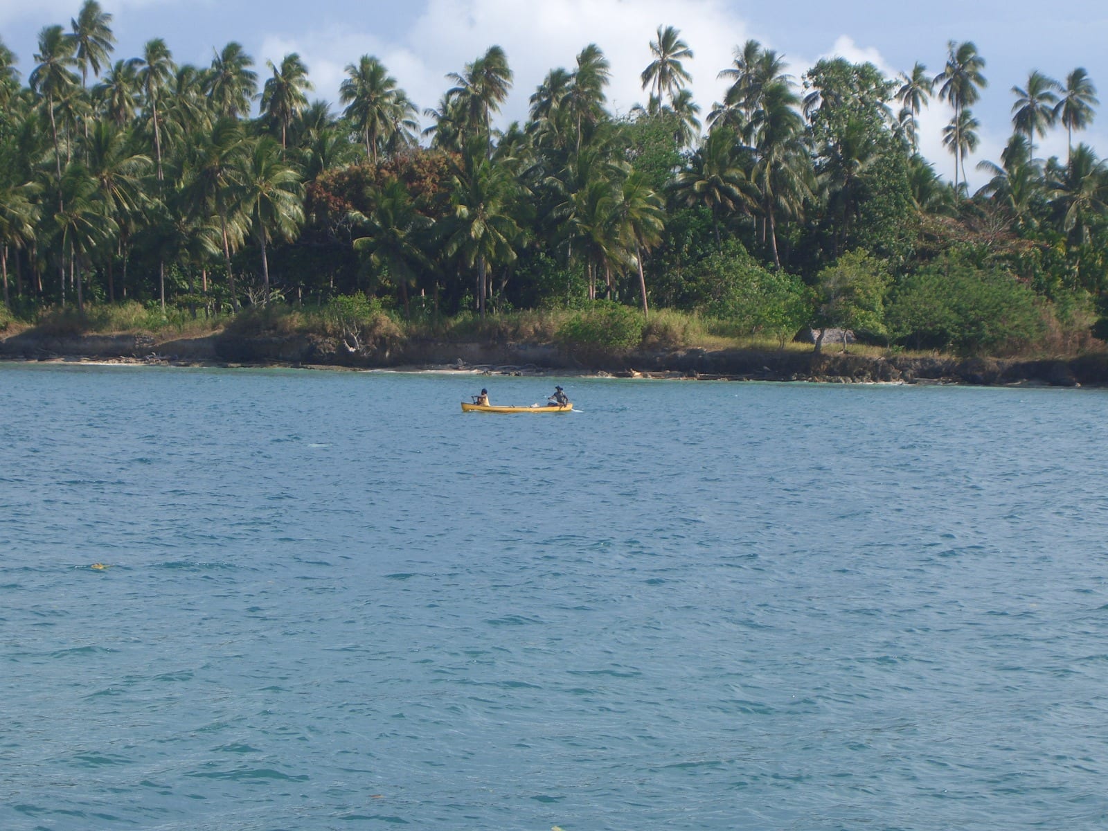
A small yellow canoe with two paddlers on blue water in front of a shore dense with coconut palms

Madang, the Sepik & the North Coast, Papua New Guinea

Madang

A canoe on the water off a palm-covered shore at Madang, on the north coast of Papua New Guinea. (eGuide Travel / Wikimedia Commons · CC BY 2.0)

The capital of Madang Province, on a low peninsula of coral and coconut palms between Astrolabe Bay and a sheltered harbour on Papua New Guinea's north coast. Founded by Germans as Friedrich-Wilhelmshafen, flattened in the Second World War and rebuilt, it is a small port town known for reef and wreck diving, offshore island villages and a waterfront market.

Neighbourhoods

  • Town centre and the harbour front
    • First-time visitors
    • Markets
    • Close to the water

    The compact grid of shops, banks, offices and hotels on the peninsula, with the market, the wharf and the shipping agents a short walk apart. Almost everything a visitor needs is here, and the water is rarely out of sight.

    Open in Maps
  • Kalibobo Point
    • Quiet and residential
    • Views over the harbour

    The tip of the peninsula, where lawns run down to the sea and the water is in view on both sides. Hotel grounds, government houses and mooring for small boats occupy the point, a few minutes from the town centre.

    Open in Maps
  • Newtown and Modilon Road
    • Local life
    • Everyday shopping

    The residential spread inland along the main road, with the provincial hospital, schools, churches, trade stores and small kai bars. This is where most of the town's population lives, and where buses and open-backed trucks pick up passengers.

    Open in Maps
  • The offshore islands
    • Snorkelling
    • Village stays
    • Beaches

    Low coral islands lie within sight of the town, reached in minutes by motor canoe or dinghy. Their villages have sand beaches, lagoons and reef edges, and a few take paying guests in simple guesthouses.

    Open in Maps
  • The north coast road
    • Diving
    • Quiet and residential

    North of the town the road passes Nagada Harbour, coconut plantations and the settlement of Alexishafen. Dive operators and a scatter of lodgings use this stretch of coast, which is also the way to the airport road junction.

    Open in Maps

Things to do

The harbour and the water

  • Astrolabe Bayattraction

    The wide bay the town looks out on, named after a French survey ship and the base for diving on coral walls, sunken wartime ships and aircraft.

    Open in Maps
  • Kranket Islandattraction

    A palm-covered coral island with a lagoon, opposite the town and reached by motor canoe, with villages, walking tracks and snorkelling off its reef.

    Open in Maps
  • Madang Marketmarket

    The town's produce market near the waterfront, where island and village sellers bring fish, taro, greens, bananas, coconuts and betel nut.

    Open in Maps

Town sights

  • Divine Word Universityattraction

    A national Catholic university on the edge of the town, established by an Act of Parliament in 1996 and a reason many young people from across the north coast live in Madang.

    Open in Maps
  • Madang Airporttransit hub

    The town's airport, close enough to the centre that arriving passengers are in town within minutes, with domestic flights to the rest of the country.

    Open in Maps

Short trips from the town

  • Bilbilattraction

    A coastal village south of the town whose potters have made and traded clay pots along the coast for generations, and still make them in the old way.

    Open in Maps
  • Alexishafenattraction

    A settlement on the coast north of the town, taken by Australian troops in April 1944 and used afterwards as a United States naval base, with wartime remains along the shore.

    Open in Maps
  • Karkar Islandattraction

    A large, densely settled volcanic island north of the town, with two nested calderas at its summit and coconut and cocoa plantations on its slopes.

    Open in Maps

Eat and drink

Long-standing places and food districts in Madang. Hours, ratings and directions come from your maps app, always current.

Markets and town kitchens

  • Madang Marketmarket

    The main place to see and buy what the district eats — reef fish, crayfish in season, taro, yams, aibika greens, bananas, pawpaw, coconuts, galip nuts and betel nut, brought in by canoe and truck.

    Open in Maps
  • Kai bars in the town centreneighborhood

    Small counter-service shops selling the standard town meal of rice, fried chicken or fish, lamb flaps, greasy scones and sweet tea, eaten quickly or taken away.

    Open in Maps
  • Harbour-front hotel restaurantsneighborhood

    The hotels on and near the peninsula run the town's sit-down dining rooms, where fresh tuna and reef fish appear beside imported meat, curries and cold beer.

    Open in Maps

Experience Madang

History

The shores of Astrolabe Bay were settled long before Europeans arrived, and the villages around the modern town spoke Austronesian languages and traded pots, food and valuables by canoe along the coast and out to the islands. The Russian naturalist Nikolai Miklouho-Maclay lived on the bay in the 1870s, and his accounts of the people he stayed among became some of the earliest detailed descriptions of the region published in Europe.

Germany annexed north-eastern New Guinea in 1884, and the German New Guinea Company laid out a harbour town here, naming it Friedrich-Wilhelmshafen. The company moved its headquarters to the new settlement in the 1890s and planted coffee, coconut and other export crops on the coastal flats, but malaria and dysentery killed staff and labourers in numbers, and the administration eventually shifted east to the islands in 1899. The name Madang, used by the Papuan workers who had come with the German administrators, became official towards the end of German rule; Australian forces took the colony in 1914, and the town settled into a quiet career as a copra port with Catholic and Lutheran missions along the coast.

Japanese troops occupied Madang in 1942 and used it as a supply base for the fighting inland and along the coast; Allied bombing and shelling destroyed most of what stood, and Australian soldiers entered the ruins in April 1944. The present town is essentially a post-war creation, rebuilt on the same peninsula around a wharf and a market, and it became the capital of Madang Province after independence in 1975. Nickel processing, a tuna cannery and a small but steady flow of divers have shaped it since.

Culture & Customs

Madang Province is one of the most linguistically diverse places on earth, with well over a hundred languages spoken across its islands, coast and mountain valleys, and the town is where those worlds meet. Tok Pisin does the work of a common language in the market and the street, English in offices and classrooms. The coastal communities nearest the town, including the potters of Bilbil, belong to Austronesian-speaking groups whose seaborne trade once carried clay pots north and south in exchange for sago, food and shell valuables.

Church life is central. Catholic and Lutheran missions have worked this coast since the nineteenth century, and Sunday fills the churches and empties the streets; choirs, church women's groups and mission schools organise much of the town's social calendar. Kundu drums, shell and feather dress and village dance groups appear at sing-sings for provincial occasions, school events and Independence Day in September.

Manners are gentle and indirect. Greetings, handshakes and a little small talk come before business, voices stay low, and open irritation is considered poor form. Almost all land, reef and beach is customary property, so visitors ask before crossing or swimming, usually through a host or guide. Betel nut, bought in small bundles at the market, is chewed almost everywhere, and rugby league is followed with real passion. Divine Word University gives the town an unusually large student population for its size.

Daily Life

About 30,000 people live in Madang, which makes it one of the country's larger provincial towns while remaining small enough to cross on foot. Work is concentrated in the provincial government, the wharf and shipping trades, the hospital and schools, the university, retail and the tuna cannery, and a good deal of the cash economy runs through the market, where island and village families sell what they grow, catch or gather. Coconut, cocoa and betel nut from the surrounding districts pass through the port.

The day begins early. Canoes cross from the islands at first light, market sellers set out produce, and public motor vehicles fill up along Modilon Road; by mid-afternoon the heat has slowed everything, and most business closes well before dark. Residential areas run inland from the peninsula, with settlements of migrants from the Sepik and the Highlands on the edges of town, where pressure on housing, water and power is greatest. Electricity and water supplies are unreliable, and generators and tanks are common.

Current concerns are familiar across urban Papua New Guinea: unemployment among young people, petty crime, the cost of imported food and fuel, and the state of the road to Lae. The Ramu nickel and cobalt operation in the province has brought jobs and royalties along with a long dispute over waste discharged into the sea, after an independent investigation in 2019 found that toxic slurry had been improperly released.

Food

Madang eats from the reef and the garden. Tuna, reef fish, crayfish and shellfish are grilled, fried or stewed in coconut cream with aibika, the soft green leaf used across the lowlands, and served with taro, yam, sweet potato, cooking banana or rice. Sago, washed from the pith of the palm and cooked into pancakes or a stiff jelly, is more a Sepik and swamp staple than a town food, but it appears in the market and on village tables inland.

Feasts and family occasions mean a mumu, the earth oven: pork or chicken, root vegetables and greens wrapped in leaves and cooked on hot stones, often with coconut cream poured in. Galip, the local canarium nut, is roasted and sold in bundles, and the market fills seasonally with mangoes, pawpaw, pineapple, breadfruit and cooking bananas of many kinds. Island sellers bring smoked fish and green coconuts for drinking.

Everyday town food is simpler and cheaper: rice with tinned mackerel, fried chicken, lamb flaps, instant noodles and flour scones from the kai bars, washed down with sweet tea or soft drinks. Hotel kitchens on the waterfront cook the day's tuna alongside curries and imported meat. Coffee from the Highlands and cocoa from the coastal plantations are both local products, and SP, the national lager, is the usual drink with a meal.

Planning tools

Budget

Madang has the widest choice of places to stay on the north coast, from simple guesthouses and mission lodgings to waterfront hotels and dive resorts, and prices sit between the two. Flights into the town are usually the largest single cost. Boats are the other expense: island trips and dive days are priced per boat, including fuel, so they are far cheaper shared among a group.

Daily Budget Midrange
USD 220–400 (harbour-front hotel or dive resort, restaurant meals, boat trips and airport transfers)
Daily Budget Shoestring
USD 70–130 (guesthouse or island village stay, market and kai-bar food, shared motor canoe or a local truck)

Agree the price of a boat, its fuel and the boatman before setting out, and book rooms ahead when a provincial event or a ship is in port.

Best Time to Visit

The drier, calmer months from about May to October are the easiest for boats, island trips and diving, and the middle of the year is the usual season for provincial events and travel inland. Rain falls in every month. The northwest monsoon, roughly December to March, brings heavier downpours, rougher water and poorer visibility on the reefs.

Suggested Number of Days

Two or three days suit the town, its market and the nearest islands. Four to six allow boat trips further out, diving over several days, or a run along the coast road. Weather and boat availability change the number more than anything else.

First Visit
2–3 days
With Surroundings
4–6 days

Transportation

The town centre is small enough to cross on foot. Beyond it, transport means public motor vehicles — minibuses and open-backed trucks that run set routes along Modilon Road and the coast road for a flat fare — along with taxis arranged through a hotel and hire vehicles with drivers. Boats matter as much as roads: motor canoes and dinghies cross to the islands and along the coast, and coastal ships call at the wharf.

Ask a hotel or host to arrange vehicles and boats rather than hailing them, and travel between towns in daylight.

Airport & Station Connections

Most visitors fly in to Madang Airport, which sits beside the town, on domestic services; schedules change and connections are sometimes cancelled in bad weather. A road links Madang to Lae, south-east along the coast, and on to the Highlands Highway, a long day's drive covered by buses and trucks. Coastal ships and small boats also serve the town.

Leave a spare day before an onward international flight in case a domestic leg is delayed.

Walkability

The peninsula is flat and easy to walk, and the market, the wharf, the shops and the point are all within a short distance of one another. Walks are hot and humid, shade is patchy and heavy rain arrives quickly. Distances out to Newtown and along the coast road are better covered by vehicle, and walking after dark is not advised anywhere in the town.

Safety

Madang is generally calmer than the larger north-coast towns, but opportunistic theft and robbery occur, especially after dark and away from the centre, and drunkenness can cause trouble around paydays. The greater risks are practical: small boats in open water, strong currents and reef injuries, malaria and dengue, and long distances to medical care beyond the provincial hospital.

Use hotel or operator transport at night, keep valuables out of sight, choose boats with life jackets and a second engine, take malaria precautions, and carry insurance with medical evacuation cover. Check current official travel advice before travelling.

Climate

Hot, humid and wet all year, with sea breezes on the peninsula. Rain falls in every month, heaviest around April, while September is the driest month and the middle of the year the calmest at sea. Being south of the equator, the warmest months fall around December to February.

Summer
December–February, the monsoon season: around 24–31°C, humid, with heavy downpours and rougher water
Winter
June–August: around 23–30°C, slightly drier and calmer, the usual season for boat trips and diving

Local Customs

Greetings matter, and a handshake and a few words of Tok Pisin go a long way. Land, reefs and beaches almost all belong to clans, so access is asked for rather than assumed, and a guide or host smooths the way. Dress is modest: shorts and shoulders covered away from a resort beach, and Sunday is quiet, with churches full. Betel nut chewing is widespread, and asking before photographing people is expected.

Ask permission before entering a village, walking on a beach or photographing anyone, expect to pay a small agreed fee for guides and village visits, and be aware that alcohol restrictions and dry days can apply locally.

Common Payment Methods

The currency is the Papua New Guinean kina. Banks and ATMs are in the town centre, and hotels, larger stores and some operators take cards, though card networks can go down. Markets, canoes, trucks and village guesthouses are cash only, and small notes are useful because change is scarce. There is nowhere to draw money on the islands.