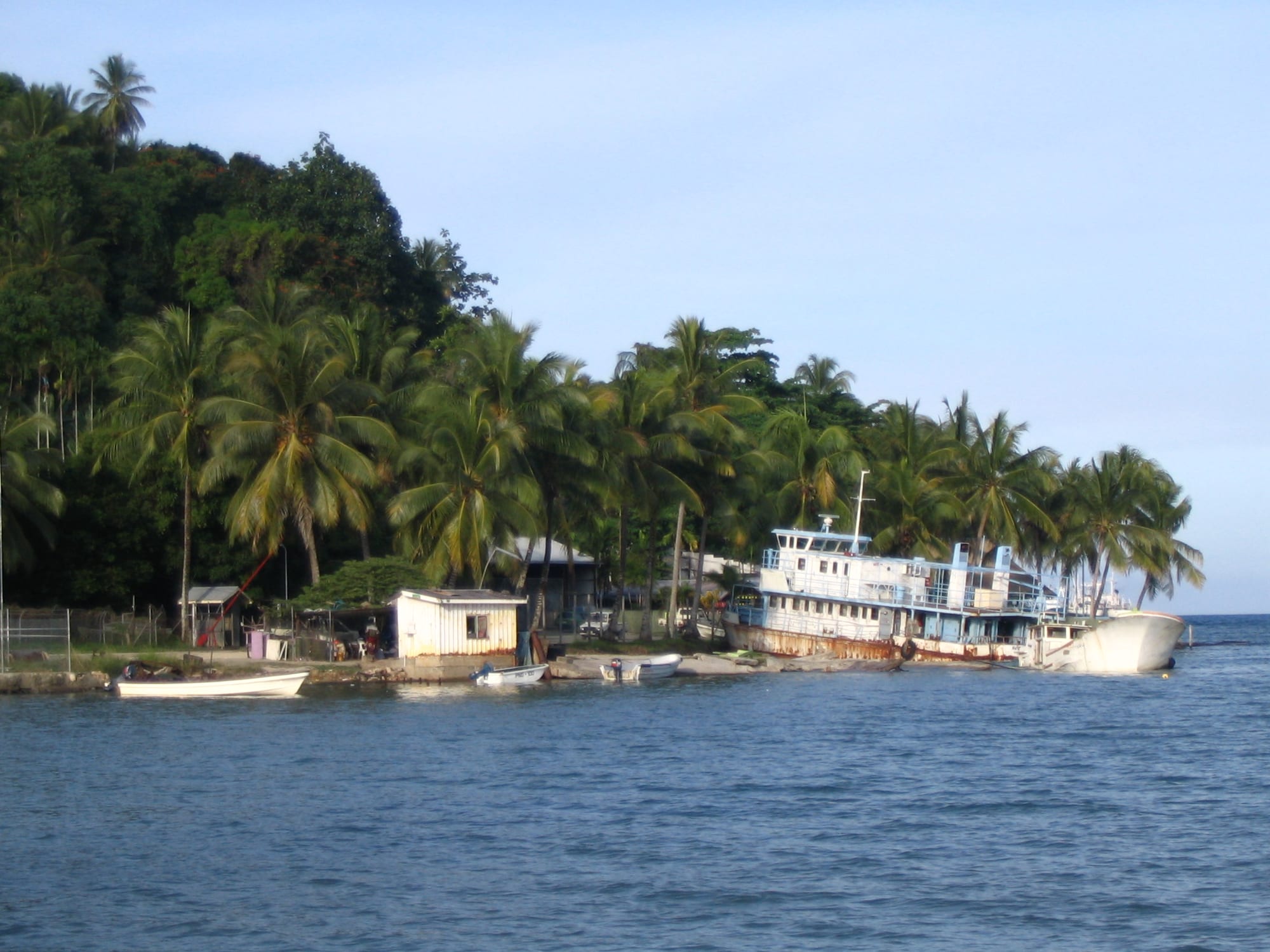
A rusting coastal ship and small boats drawn up on a shore below coconut palms and a forested headland

Madang, the Sepik & the North Coast, Papua New Guinea

Wewak

Boats and a beached coastal vessel on the shore at Wewak, East Sepik Province. (David Bacon / Wikimedia Commons · CC BY 2.0)

The capital of East Sepik Province, built on a headland on Papua New Guinea's north coast with beaches on either side and forested islands offshore. A Japanese base and then a battleground in the Second World War, it is now a small administrative and market town, and the usual place to arrange travel inland to the Sepik river.

Neighbourhoods

  • Town centre and the point
    • First-time visitors
    • Markets
    • Close to the water

    The few streets on the headland hold the shops, banks, provincial offices, the main market and the wharf, with the sea on both sides. Most of what a visitor needs, including places to stay and the offices of boat and vehicle operators, is within a short walk.

    Open in Maps
  • Wewak Hill and Wirui
    • Views
    • Historic sites
    • Quiet and residential

    The ridge above the town, with wartime remains and long views along the coast. Wewak is the seat of a Catholic diocese, and mission buildings, schools and staff housing stand on the slopes at Wirui.

    Open in Maps
  • Kreer and Kaindi
    • Local life
    • Everyday shopping

    The residential areas spreading inland and east from the headland, where much of the town's population lives. A busy secondary market, trade stores, schools and churches serve them, and public motor vehicles run in to the centre through the day.

    Open in Maps
  • Boram and the eastern coast road
    • Beaches
    • Close to the airport

    East of the town the road passes the hospital, the airport and a long shore of dark sand and coconut palms before reaching the cape at the end of the road. Guesthouses and a few lodgings sit along this stretch.

    Open in Maps

Things to do

The headland and the beaches

  • Wewak Hillviewpoint

    The ridge behind the town, reached by road, with views over the harbour, the islands offshore and the coast running west.

    Open in Maps
  • Wewak Marketmarket

    The town's main market beside the centre, where village and island sellers bring fish, sago, greens, bananas, coconuts and betel nut.

    Open in Maps
  • Wewak Beachbeach

    The dark-sand shore below the town, used by fishing canoes and swimmers, with palms along the back and coastal boats loading at the nearby wharf.

    Open in Maps
  • Kreer Beachbeach

    A stretch of sand and shallow water east of the headland, close to the residential areas, popular for weekend swimming and picnics.

    Open in Maps

Wartime sites

  • Cape Wom Memorial Parkpark

    A memorial park on the cape directly west of the town, on the ground where the commander of the Japanese 18th Army surrendered on 13 September 1945.

    Open in Maps
  • Wewak Airporttransit hub

    The town's airport at Boram, a few kilometres east of the centre, built on one of the wartime airfields that made Wewak a target.

    Open in Maps

The islands and the road inland

  • Kairiru Islandattraction

    A mountainous island north of the town, reached by boat, with coastal villages whose people speak Kairiru, one of the languages of this stretch of coast.

    Open in Maps
  • Muschu Islandattraction

    A low, reef-fringed island between Wewak and Kairiru, with beaches, villages and wartime relics, and the scene of an Australian commando raid in 1945.

    Open in Maps
  • Pagwi and the middle Sepikattraction

    The river landing reached by road south of Wewak, where motor canoes set off for the Iatmul villages, spirit houses and carving workshops of the middle Sepik.

    Open in Maps
  • Maprikattraction

    An inland town south-west of Wewak in Abelam country, where giant yams are grown for festivals at which villages measure their status against one another.

    Open in Maps

Seasonal events

  • Independence Day celebrationsmid-September

    Marches, school displays and sing-sings mark the anniversary of independence, with provincial events in the town and village celebrations along the coast.

Eat and drink

Long-standing places and food districts in Wewak. Hours, ratings and directions come from your maps app, always current.

Markets and town kitchens

  • Wewak Marketmarket

    The place to see what the province eats — reef and river fish, sago, taro, yams, aibika greens, bananas, coconuts, galip nuts and betel nut, much of it carried in by canoe.

    Open in Maps
  • Kai bars in the town centreneighborhood

    Counter-service shops selling the standard town plate of rice with fried fish or chicken, lamb flaps, noodles and flour scones, with sweet tea or soft drinks.

    Open in Maps
  • Guesthouse and hotel dining roomsneighborhood

    The lodgings on the headland and along the coast road cook the town's sit-down meals, usually the day's tuna or reef fish with rice, curries and imported meat.

    Open in Maps

Experience Wewak

History

The coast and islands around Wewak were long settled by fishing and trading communities, while the hills behind held the gardens and hamlets of inland groups. Germany claimed the north-east of New Guinea in 1884 and set up posts along this coast, and Catholic missionaries of the Divine Word order arrived from the 1890s and built stations along this coast, Wewak later becoming the seat of a Catholic diocese. Australia took over the colony in 1914 and Wewak grew slowly as an administrative and mission centre among coconut plantations.

The Second World War made the town's name. Japanese forces occupied Wewak in 1942 and turned it into their principal base in New Guinea, with a ring of airfields along the coast; between 1943 and 1945 it held the largest Japanese airbase on mainland New Guinea. Repeated Australian and American bombing, most heavily on 17 August 1943, destroyed much of the aircraft and shipping based here, and the town itself was largely reduced to rubble. Australian troops landed near Wewak in 1945, and on 13 September that year the commander of the Japanese 18th Army surrendered at Cape Wom, west of the town, where a memorial park now marks the ground.

Post-war Wewak was rebuilt from very little as the administrative centre of the Sepik district, and became the capital of East Sepik Province after independence in 1975. Michael Somare, the country's first prime minister and later governor of East Sepik, grew up in the village of Karau in the Murik Lakes of this province. The town has since lived on government, the church, schooling, coastal shipping and the produce trade, with a small flow of visitors heading for the river.

Culture & Customs

Wewak is a meeting point for peoples with very different ways of life: coastal and island villages whose livelihoods come from the sea, and the river and grassland communities of the Sepik basin inland, among them the Iatmul, Abelam and their neighbours. East Sepik takes in many language groups — the Iatmul are the largest along the river — in a country of many hundreds of languages, and Tok Pisin carries most everyday conversation between them.

The province's reputation abroad rests on its art. Sepik carving — masks, figures, hooks, story boards and the posts and gables of the haus tambaran, the men's spirit house — is among the best known in the Pacific, and carvings from inland villages are sold in the town. River villages also make clay pottery and garamut drums, hollowed from tree trunks and carved into the shapes of totem animals for use in ritual. Among the Abelam around Maprik, the growing of giant yams is the centre of ceremonial life: a man's standing, and his village's, rests on the size of the yams he can bring to a festival, and strong feelings are kept in check during the growing season for fear of stunting them.

Christianity is woven through all of this: Catholic and other churches run schools, health posts and choirs, Sunday empties the streets, and church groups organise much of the town's social life. Sing-sings with kundu drums, shell ornament and feather headdresses mark provincial occasions and Independence Day. Manners are quiet and indirect, greetings matter, and visitors are expected to ask permission before entering a village or photographing people, carvings or ceremonial houses.

Daily Life

Wewak is the largest town on the coast between Madang and Jayapura, though still a small one, spread from the headland through the residential areas inland and along the coast road east. The provincial administration, the hospital, schools, the churches and their missions, the wharf and a handful of stores and workshops provide most of the formal jobs, while a great deal of the town's money moves through the markets, where sellers from the islands and the villages trade fish, garden produce and betel nut.

Mornings start early, with canoes coming in to the shore, market stalls set up before the heat and trucks filling with passengers. Business winds down in the afternoon, and the town is quiet after dark. Many households depend on remittances, on a garden plot, or on selling produce and cooked food, and electricity and water supplies are intermittent, so water tanks and generators are common. East Sepik remains one of the country's poorer provinces, and Wewak shows it in crowded housing and worn infrastructure.

Beyond the town, most of the province lives in villages, growing taro, yams, bananas and sago, fishing the sea or the river, and selling cocoa, vanilla, copra and betel nut for cash. Poor roads, the cost of fuel, unemployment among young people and the state of health and education services dominate local debate, as does the rise and fall of the Sepik itself, which can change level by several metres in the course of a year.

Food

Wewak sits where sea food and river food meet. Tuna, reef fish, crayfish and shellfish come in from the coast and the islands and are grilled or cooked in coconut cream with aibika, the soft lowland green, and served with taro, yam, sweet potato, cooking banana or rice. From inland come river fish, prawns and smoked meat, along with sago, the starch washed from the pith of the sago palm — saksak in Tok Pisin — and cooked as flat pancakes or a stiff, glue-like jelly, the staple of the Sepik floodplain.

Feasts are cooked in a mumu, the earth oven of hot stones, with meat, root vegetables and greens wrapped in leaves and often soaked in coconut cream. Galip, the roasted canarium nut, is sold in bundles at the market, and the seasons bring mangoes, pawpaw, pineapple, breadfruit and many kinds of banana. Coconuts are drunk young and grated into almost everything when mature.

Town food is cheaper and plainer: rice with tinned mackerel, fried chicken or fish, lamb flaps, instant noodles and scones from the kai bars, with sweet tea or soft drinks. Guesthouse kitchens serve the day's catch with rice or chips, and SP, the national lager, is the usual beer. Buai, betel nut chewed with lime and mustard stick, is a constant of daily life and is sold at every market and roadside table.

Planning tools

Budget

Wewak has guesthouses, mission lodgings and a small number of hotels, and little else to spend money on beyond food, transport and guides. Flights are the main expense in reaching it. The costs that add up here are boats out to the islands and vehicles and canoes for the Sepik, all priced per trip with fuel included, so sharing them among a group makes a large difference.

Daily Budget Midrange
USD 180–350 (hotel room, restaurant meals, a hired vehicle with driver or a day's boat hire)
Daily Budget Shoestring
USD 70–130 (guesthouse or mission lodging, market and kai-bar food, public motor vehicles and shared boats)

Fuel drives the price of every boat and vehicle trip, so agree the total, including the driver, before setting out, and carry enough cash for the whole journey.

Best Time to Visit

About May to October is the easier stretch, with calmer seas for the island crossings, more reliable roads inland and the river low enough for canoe travel to be straightforward. Rain is possible in any month, and the northwest monsoon from about December to March brings heavier downpours, rough water and flooded roads.

Suggested Number of Days

The town itself needs a day or two. Most visitors stay longer because Wewak is where journeys are arranged: island crossings, the coast road, or a trip inland to the river, which takes several days on its own. Weather, boats and road conditions decide the total.

First Visit
1–2 days
With Surroundings
5–8 days

Transportation

The headland is walkable, and beyond it public motor vehicles — minibuses and open-backed trucks — run along the coast road and inland for a flat fare. Hire vehicles with drivers can be arranged through lodgings, and taxis are few. Boats matter as much: dinghies and motor canoes cross to the islands and along the coast, and roads run west towards the border and south to the river landings.

Arrange vehicles and boats through a guesthouse or a known operator, travel between towns in daylight, and expect journeys inland to take much longer than the distance suggests.

Airport & Station Connections

Wewak Airport, at Boram a few kilometres east of the centre, takes domestic flights; services are limited and weather can disrupt them. A coastal road runs west towards Aitape, and roads run south to the Sepik river landings at Angoram, Timbunke and Pagwi, though their condition varies. Coastal ships and small boats also call.

Allow spare days around domestic flights, which are often rescheduled, especially in the wet season.

Walkability

The centre on the headland is small and flat and easily covered on foot, with the market, the shops and the shore all close together. It is hot and humid, shade is limited, and rain comes suddenly. The hill, the residential areas and the beaches east of town are spread along the coast road and are better reached by vehicle, and walking after dark is not advised.

Safety

Wewak is generally quieter than the country's larger towns, but theft and robbery happen, particularly after dark, away from the centre and around paydays, and drunkenness can lead to trouble. The practical risks weigh heavier: small boats in open sea, river travel far from help, malaria and other mosquito-borne illness, and limited medical care, with serious cases needing evacuation.

Use lodging or operator transport at night, keep valuables out of sight, choose boats with life jackets and a spare engine, take malaria precautions, and carry insurance with medical evacuation cover. Check current official travel advice before travelling.

Climate

Hot and humid all year, with rain in every month and a wetter northwest monsoon season. The coast is a little drier and calmer in the middle of the year, while inland the Sepik floodplain rises and falls with the rains. Being south of the equator, the wettest and stickiest months fall around December to February.

Summer
December–February, the monsoon season: around 24–31°C, humid, with heavy rain and rough seas
Winter
June–August: around 23–31°C, drier and calmer, the usual season for boat and river travel

Local Customs

A handshake, a greeting and some small talk come before business, and Tok Pisin is the common language in the market and the street. Land, beaches and reefs belong to clans, so access is asked for through a host or guide rather than assumed. Dress is modest away from a resort beach, Sunday is quiet and church-centred, and betel nut is chewed widely.

Ask before entering a village or photographing anyone, agree a fee for guides, village visits and permission to photograph carvings or spirit houses, and respect restrictions on who may enter a haus tambaran.

Common Payment Methods

The currency is the Papua New Guinean kina. Banks and ATMs are in the town centre, and hotels and larger stores take cards, although card systems sometimes fail. Everything else — markets, canoes, trucks, guides and village stays — is cash, and there is no way to withdraw money on the islands or along the river, so cash is drawn before leaving town.