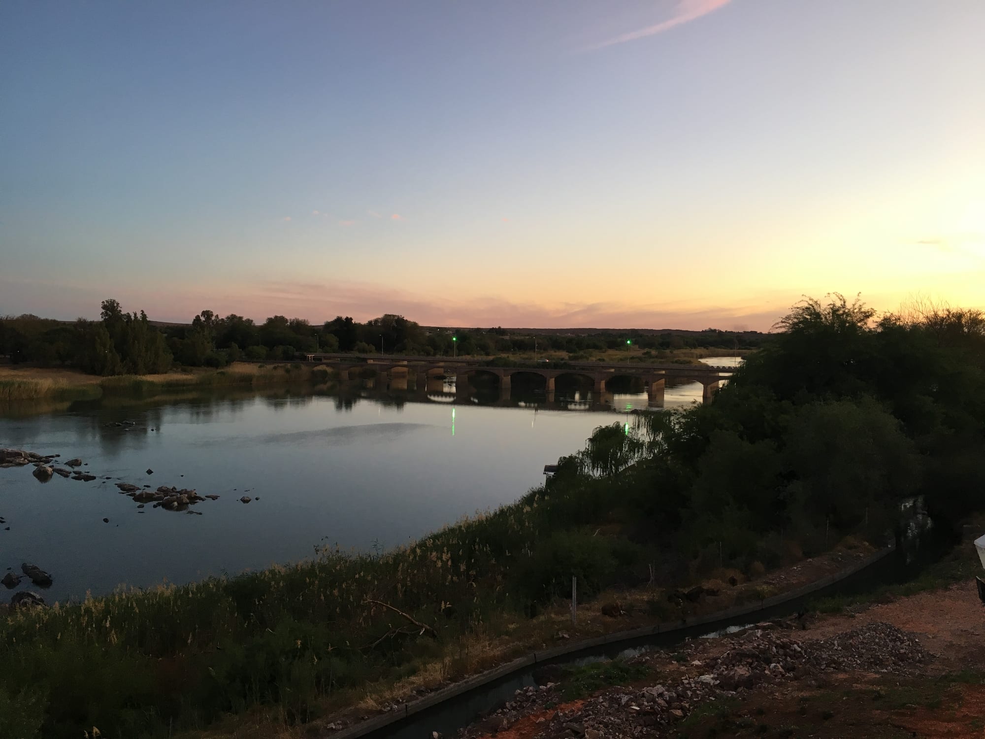
A broad calm river with reed banks and trees, crossed by a low arched road bridge under a pale evening sky

The Northern Cape & the Kalahari, South Africa

Upington

The Orange River at Upington in the evening. (Svwmal / Wikimedia Commons · CC BY-SA 4.0)

A green town strung along the Orange River in the dry heart of the Northern Cape, grown from a mission station of the 1870s into the service centre of an irrigated valley of vineyards, raisin sheds and date palms. It is the usual base for reaching the Augrabies Falls and the red dunes of the Kgalagadi to the north.

Neighbourhoods

  • The town centre
    • First-time visitors
    • Shopping
    • Close to the river

    A compact grid of wide streets holding the shops, banks, supply stores and fuel stations that serve a huge area of farmland and desert. The museum in the old mission station and the riverbank are close by.

    Open in Maps
  • The riverfront and the island suburbs
    • Quiet and residential
    • River walks

    Green streets along the Orange, where date palms, willows and lawns run down to the water and guesthouses and lodges face the current. Islands in the river are farmed, among them Kanoneiland.

    Open in Maps
  • Paballelo and Rosedale
    • Local life

    The residential areas on the edges of the town where much of Upington's population lives, with churches, schools, shops and taverns. Paballelo has its own political history, centred on the unrest of 1985 and the trial that followed.

    Open in Maps
  • The irrigation belt
    • Farm stays
    • Wine and raisins

    The narrow strip of vineyards, lucerne fields and date plantations that follows the river upstream and downstream from the town, sharply green against the surrounding red sand, with cellars, packing sheds and farm guesthouses along the roads.

    Open in Maps

Things to do

In the town

  • Kalahari Orange Museummuseum

    The town museum, housed in the mission station that Reverend Christiaan Schröder established in 1871 and from which Upington grew, with a donkey statue recognising the animal's part in developing the region in the 19th century.

    Open in Maps
  • The riverfront gardenspark

    Lawns and picnic spots along the Orange, the coolest place in town on a hot afternoon and a good spot for birdwatching.

    Open in Maps
  • The date palm avenuelandmark

    An avenue about a kilometre long at the entrance to Die Eiland, lined with more than 200 date palms, a reminder of the dates that grow along this stretch of the river.

    Open in Maps

Short trips from the town

  • Spitskop Nature Reservepark

    A reserve about 13 km north of the town on the R360, with some 40 km of gravel roads, three hiking trails and a telescope on a hill for spotting its many mammals, none of them predators.

    Open in Maps
  • Augrabies Falls National Parkpark

    The Orange River falling about 56 m into a granite gorge some 240 m deep and 18 km long, in a park of quiver trees and exfoliation domes such as Moon Rock, with hiking trails and night drives in peak season.

    Open in Maps
  • Keimoesattraction

    A river town known for its sultanas and irrigation canals, with a restored water wheel still turning on a canal along the main road and the Tierberg Nature Reserve, 4 km outside town, looking over the Orange River valley.

    Open in Maps
  • Kakamasattraction

    A farming town founded in 1898 as a Dutch Reformed Church irrigation settlement, with hand-dug canals still in use and the water wheels that were once widely used to lift water onto the fields.

    Open in Maps
  • Kanoneilandattraction

    A farming settlement on an island in the Orange River, among vineyards, where Orange River Cellars has one of its depots.

    Open in Maps
  • Riemvasmaakattraction

    A remote area bordering the Augrabies Falls National Park, whose Xhosa, Damara, Herero, Nama and Coloured community was removed in the early 1970s for a military testing range and returned after a successful land claim in the late 1990s, with land set aside for community-based eco-tourism.

    Open in Maps

Eat and drink

Long-standing places and food districts in Upington. Hours, ratings and directions come from your maps app, always current.

Where to eat

  • The town centreneighborhood

    Steakhouses, grills, bakeries and takeaways in the centre, where farmers, road travellers and office workers eat; grilled meat, pap and burgers are the standards.

    Open in Maps
  • Riverside restaurantsneighborhood

    Places with tables looking over the Orange, serving braaied meat, fish and cold drinks under the trees, at their best in the evening when the heat drops.

    Open in Maps

Local produce

  • Orange River wine cellarsmarket

    Orange River Cellars, the valley's wine organisation, has depots on the riverbank at Upington, Kanoneiland, Keimoes, Kakamas and beyond, and its wines are exported to Europe and the USA.

    Open in Maps
  • Raisins, dates and farm stallsmarket

    The valley is known for its export raisins and sultanas, and stalls and packing sheds sell sultanas, dates, dried fruit, nuts, biltong and preserves.

    Open in Maps

Experience Upington

History

The stretch of the Orange River where Upington now stands was long used by Korana and Nama herders, and the river islands and reed beds gave shelter to groups moving along the valley. In 1871 the missionary Christiaan Schröder established a station here, first called Olyvenhoutsdrift, and the settlement that grew around it was named after Thomas Upington, an attorney-general and later prime minister of the Cape Colony. The mission station now houses the town's museum.

Everything that followed came from water. Furrows and canals were dug by hand to lead water from the river onto the terraces, with water wheels to lift it, and the valley turned from thorn scrub into an irrigated strip of vineyards, lucerne, wheat and fruit. Keimoes downstream had its first irrigation furrow in 1882, and Kakamas was founded in 1898 as a church settlement for white farmers ruined by drought and rinderpest. Raisin production became the district's signature crop, alongside table grapes and, later, wine.

In the 20th century Upington grew into the administrative and commercial capital of a huge, thinly populated district, with a railway, an airport whose long runway was built for heavily loaded aircraft in desert heat, and a role as the last town before the Kalahari. Under apartheid its population was divided into separate residential areas, and Paballelo became known nationally during the 1980s for protest and for a mass trial arising from unrest there. Since 1994 the town has remained the gateway to the Kgalagadi and Augrabies parks, while solar power plants such as Khi Solar One have been built nearby.

Culture & Customs

This is an Afrikaans-speaking river town in a desert, and the culture reflects both. Afrikaans is spoken by almost everyone, in the distinctive rural form of the Northern Cape that carries words and rhythms from Nama and Khoekhoe speech, and English is heard too. Coloured and white communities both have deep roots in the valley, and family networks stretch along the river from Upington to Kakamas and beyond.

Farming shapes the year: pruning, the grape harvest in late summer, the drying and packing of raisins, and the constant management of water rights and canals. The agricultural show, farmers' co-operatives and church calendars organise social life, and the Dutch Reformed and mission churches remain central. Choir singing and the rieldans, an old celebratory dance of the San, Nama and Khoi, are strong traditions in the wider district.

The town is also a crossroads. Travellers heading for the Kalahari, the falls or Namibia stop here, and the hospitality industry has grown around that traffic, alongside guides, outfitters and 4x4 workshops. Sport means rugby and, in the townships, football, and canoeing and fishing draw people to the river. Manners are country manners: greetings before business, an unhurried pace, and a tolerance for heat that visitors take days to acquire.

Daily Life

About 125,000 people lived in the Dawid Kruiper municipality centred on Upington at the 2022 census, and the town is the only substantial centre for hundreds of kilometres. Agriculture drives the economy — table grapes, raisins, dates, wine and lucerne from the irrigated valley — supported by packing plants, cold stores, transport firms and the agricultural suppliers whose yards line the approach roads. Tourism, government offices, schools and a hospital add the rest.

Most residents live in Paballelo, Rosedale and the newer developments away from the river, while the older streets near the water hold guesthouses, offices and larger houses under trees. Commuting is short, and much of the workforce travels out to farms and packing sheds during harvest, when the population swells with seasonal labour.

The heat organises the day. Work starts early, the middle of the afternoon is slow, and the town comes outside again in the evening, when families walk along the river and the braai fires are lit. Water is the constant subject: allocation, canal maintenance, drought upstream and the level of the Orange. Unemployment, seasonal work and the cost of the long journeys to bigger centres are the standing local concerns, and power cuts have shaped routines for years.

Food

Meat from the dry veld is the foundation. Kalahari lamb, grazed on herb-rich scrub, is grilled as chops over coals or slow-cooked in a potjie, the three-legged iron pot; game such as springbok and gemsbok appears as steaks, stews and biltong; and skilpadjies, lamb's liver wrapped in caul fat and grilled, are a braai favourite. Pap, the stiff maize porridge, and roosterkoek, dough cooked directly on the braai grid and split with butter and jam, go alongside.

The valley's produce sets Upington apart from the rest of the region. Raisins and sultanas are dried on the farms in enormous quantities, dates ripen on the valley's palms, and table grapes, peaches and oranges come off the river terraces in season. The cellars around the town make wine from vineyards irrigated by the Orange.

Everyday eating runs to braais, steakhouse grills, pies and takeaways, with vetkoek, fried dough filled with curried mince, and pap with stew common at roadside stalls. Nama and Khoekhoe influence shows in the use of mutton, goat and veld herbs, and after good rains Kalahari truffles are dug from the sand of the Kalahari to the north. Rooibos tea, grown further south-west, is drunk everywhere, and biltong and droëwors are the staple snack for the long drives.

Planning tools

Budget

Upington is cheap for food and accommodation, with guesthouses, riverside lodges and camping all modestly priced. The costs that matter are fuel and car hire, because everything worth seeing is a long drive away, and park entry and chalets if a trip to the Kgalagadi is part of the plan.

Daily Budget Midrange
USD 120–250 (riverside guesthouse, restaurant meals, car hire and fuel, park entry)
Daily Budget Shoestring
USD 40–70 (campsite or budget guesthouse, self-catering, shared car)

Stock up on food, water and fuel here before heading north or west — supplies beyond the valley are limited and expensive.

Best Time to Visit

April, May, August and September are the most comfortable months, with warm days and cold nights. Winter is sunny and dry, and good for the Kgalagadi, though nights are cold. Midsummer is punishing, with January highs averaging 36°C, and Augrabies is at its most powerful after the summer rains upstream fill the river.

Suggested Number of Days

A night or two covers the town, the river and the valley. Four to six days make sense for anyone using it as a base for the falls, the Kalahari parks and the gravel roads north, since the distances are long and the driving slow.

First Visit
1–2 days
With Surroundings
4–6 days

Transportation

A car is essential. The town itself is small and its centre easily driven or walked, but the sights lie 40 to 250 km away on long, straight, empty roads. Minibus taxis link the town with the valley settlements and with Kimberley and Springbok, and car hire is available in town and at the airport.

Distances are deceptive and fuel stations far apart; refuel whenever possible, carry water, and avoid driving after dark when livestock and game are on the road.

Airport & Station Connections

Upington Airport has scheduled flights with Airlink and is known for its 4,900 m runway, one of the longest in the world, built so that a fully loaded Boeing 747 could take off in the heat and altitude. By road, Kimberley is about four and a half hours east, Springbok some four and a half hours south-west, and Windhoek in Namibia is reached through the border posts north-west of the town.

Walkability

The centre and the riverfront are flat and easy to walk in the cooler hours, with the museum, the shops and the palm avenue close together. Summer heat makes midday walking unpleasant, pavements thin out beyond the centre, and anything outside town needs a vehicle.

Safety

Upington is a quiet town by South African standards, with lower crime than the big cities, though the usual precautions apply in the centre and around the shops. The real risks are environmental: extreme summer heat, dehydration, breakdowns on empty roads with little mobile signal, and strong currents in the Orange River, which is not a safe place to swim.

Tell someone the route on remote drives, carry extra water, stay in the vehicle in the Kgalagadi except at designated sites, and drive only in daylight. Keep valuables out of sight in a parked car and treat the river with caution. Check current official travel advice before travelling.

Climate

One of the hottest and driest places in South Africa, with very little rain at any season and a large gap between day and night temperatures. In the southern hemisphere summer runs from December to February and winter from June to August.

Summer
very hot and dry, often 35–40°C by day, with rare thunderstorms
Winter
sunny days around 21°C, with cold nights averaging about 4°C in July

Local Customs

Afrikaans is the everyday language of almost everyone here, with English also spoken and the local speech carrying Nama and Khoekhoe words. Life is rural and religious, and Sunday mornings are quiet. Dress is casual but modest, hats and water are practical necessities, and farm hospitality is generous. Ask before photographing people or homes.

Tipping is around 10 per cent in restaurants, with a few rand for car guards and petrol attendants, who fill the tank as a matter of course.

Common Payment Methods

The currency is the South African rand. Cards work in the town's shops, restaurants, supermarkets and fuel stations, and ATMs are available in the centre, but cash matters once outside the valley, where small shops, farm stalls and park facilities may not take cards or have signal.