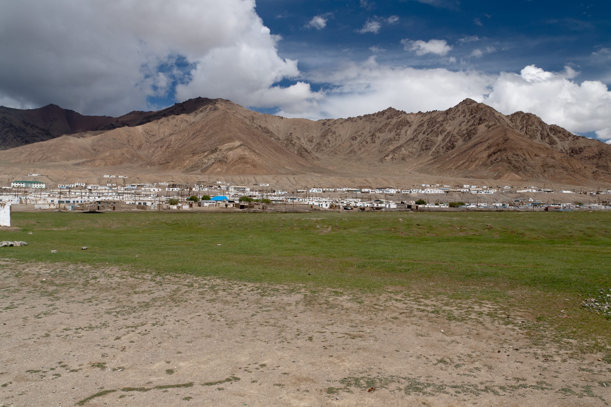
A line of low white houses on a bare plain below brown rocky mountains, with a strip of green pasture in the foreground under a cloudy sky

The Pamirs, Tajikistan

Murghab

Murghab spread along the plateau below the bare eastern Pamir ranges. (Hylgeriak / Wikimedia Commons · CC BY-SA 3.0)

The highest town in Tajikistan, at about 3,650 metres on the eastern Pamir plateau, built along the Murghab river where the Pamir Highway crosses a treeless high desert. Founded as a Russian military post in 1893, it is now a small, largely Kyrgyz town of flat-roofed houses and a container bazaar, and the base for the lakes and passes of the eastern Pamirs.

Neighbourhoods

  • The centre and the bazaar
    • First-time visitors
    • Markets
    • Local life

    The heart of the town, where the market of shipping containers stands near the administrative buildings, the school and the few shops. Drivers, traders and travellers all pass through it, and almost everything a visitor needs is within a few hundred metres.

    Open in Maps
  • Along the river
    • Quiet and residential
    • Walking
    • Views

    The lines of low, flat-roofed houses with walled yards that follow the Murghab river on both banks. Fuel, animals and water are stored in the yards, poplars planted with difficulty give the only shade, and the bare ridges beyond are always in sight.

    Open in Maps
  • The highway edge
    • Close to transport
    • Views

    The outskirts where the Pamir Highway enters and leaves town, with fuel, vehicle repairs and the stands used by drivers heading for Khorugh, Kyrgyzstan and the lakes. Beyond the last houses the plateau opens out immediately.

    Open in Maps

Things to do

In the town

  • Murghab container bazaarmarket

    The town market, built from shipping containers set in rows, selling food trucked over the passes, clothing, fuel and goods brought from Kyrgyzstan and China.

    Open in Maps
  • Murghab riverattraction

    The river the town is named for and built along, running clear and shallow across the plateau before entering the gorges that lead to Sarez Lake.

    Open in Maps

Short trips onto the plateau

  • Ak-Baital Passviewpoint

    The highest point of the Pamir Highway, at 4,655 metres, on the road north towards Karakul and the Kyrgyz border.

    Open in Maps
  • Karakulattraction

    A large, intensely blue salt lake some 25 kilometres across, lying in an ancient impact crater at about 3,960 metres, with a small village of the same name on its shore.

    Open in Maps
  • Rangkulattraction

    A lake and small settlement east of the town, on the plateau near the Chinese frontier, surrounded by pasture used by Kyrgyz herders.

    Open in Maps
  • Yashilkulattraction

    A long, deep freshwater lake in the upper Gunt valley west of the town, reached on rough tracks from the Pamir Highway near Bulunkul.

    Open in Maps
  • Bulunkulattraction

    A tiny village by a shallow lake west of Murghab, known as one of the coldest inhabited places in Central Asia, with a record low near -63°C and wide views over the plateau.

    Open in Maps

Seasonal events

  • NowruzMarch

    The Persian new year, marked across the Pamirs with special dishes, music and family visits, though on the plateau it arrives while the ground is still frozen.

  • Summer pasturesJune to September

    The months when herding families move with yaks and sheep to high pastures and set up yurt camps around the valleys near the town.

  • Independence DaySeptember

    Tajikistan's national day on 9 September, marked with sport, music and official gatherings in the town centre.

Eat and drink

Long-standing places and food districts in Murghab. Hours, ratings and directions come from your maps app, always current.

Plateau classics

  • Yak and mutton dishesrestaurant

    Meat from the herds of the plateau appears in soups, in fried noodle dishes and grilled, often served with potatoes and bread in homestays and the town's few canteens.

    Open in Maps
  • Shirchoy and milk teacafe

    Tea boiled with milk, salt and sometimes butter, drunk all day and served with bread, cream and dried fruit against the cold.

    Open in Maps

The market

  • Murghab container bazaarmarket

    Flour, rice, tinned goods, sweets, tea and occasional fresh vegetables, all trucked up from Osh or Khorugh, alongside local dairy and meat.

    Open in Maps
  • Homestay tablesrestaurant

    Most meals in Murghab are eaten in family homes, where dinner and breakfast come with the room — soup, bread, dairy and tea, in generous quantities.

    Open in Maps

Experience Murghab

History

The plateau was crossed by traders and herders long before anyone settled here permanently: branches of the Silk Road used its passes between the Tarim basin and the valleys of the Oxus, and Kyrgyz families grazed yaks and sheep on its summer pastures. Permanent building came with empire. In 1893 Russian forces established the Pamirsky Post on the Murghab river, their most advanced outpost in Central Asia and part of the manoeuvring with Britain over the Pamirs that ended with the boundary agreement of 1895. Accounts differ over exactly where the post stood, and the modern town was laid out under Soviet rule as a stop on the Pamir Highway.

Under Soviet rule the town became the centre of a vast, almost empty district, and the only town of any size in the eastern half of Gorno-Badakhshan. The Pamir Highway was pushed through in the 1930s, tying the plateau to Osh in the north and Khorugh in the west, and Murghab gained a school, a hospital and a military presence, supplied by truck from Kyrgyzstan. Kyrgyz herders were organised into collective farms, and the town's population grew with soldiers, officials and teachers.

Independence in 1991 removed most of that support. Subsidies, supply convoys and jobs disappeared, the civil war of the 1990s cut the region off, the old Soviet outpost closed in 2002, and many residents left for Kyrgyzstan or the lowlands. The town has since lived on herding, cross-border trade with China and Kyrgyzstan, and, in the summer months, travellers on the Pamir Highway. The Aga Khan network and other agencies have funded schools, energy and tourism projects, and homestays have become a significant source of income.

Culture & Customs

Murghab is a Kyrgyz town in a Tajik country. Most of its people speak Kyrgyz at home and Tajik or Russian in offices and schools, and their customs — yurts on the summer pastures, felt-making, horse riding, hunting with birds of prey in living memory — belong to the Central Asian steppe rather than to the Pamiri valleys to the west. They are Sunni Muslims, unlike the Ismaili Pamiris, and the difference in faith and language is one of the things that sets the eastern plateau apart within Gorno-Badakhshan.

Everything is organised around livestock. Families keep yaks, sheep and goats, move them to high pastures in summer, and cut and store fuel and fodder for a winter that lasts half the year. Wealth is measured in animals, and skills in handling them are prized. Felt shyrdaks and woollen goods are made for use as much as for sale, and a small craft economy has grown around visitors.

Hospitality is taken very seriously: a traveller who arrives at a house will be fed, and refusing tea is difficult. Meals are eaten seated on the floor around a low table, with bread treated respectfully and never placed upside down. The town is remote enough that news travels by word of mouth, and life is organised around the arrival of trucks over the passes. Visitors are common in summer and almost absent in winter, and the seasonal rhythm shapes the whole community.

Daily Life

Murghab has just under 7,500 residents, in a district that covers a vast area of the eastern Pamirs but holds very few settlements. Houses are single-storey, flat-roofed and thick-walled against the cold, built in walled compounds with yards for animals and stores of dung and fuel. The centre holds the district administration, a school, a clinic, a mosque and the bazaar of shipping containers where most trade happens.

Work is herding, trade, government employment, driving and, increasingly, tourism through homestays and guiding. Much of the food comes up by truck from Osh or Khorugh, and prices reflect the distance. Electricity is limited and has long been unreliable, with households relying on solar panels, small generators and stoves burning dung and teresken shrub, whose over-harvesting for fuel has been a real environmental problem on the plateau.

The day is shaped by altitude, cold and light. Water freezes overnight for much of the year, the wind blows steadily across the plain, and outdoor work is done in the middle of the day. Young people leave for Osh, Dushanbe or Russia, and some return in summer. The long winter empties the town of visitors and turns life inward, around stoves, tea and the slow business of keeping animals alive until the pastures green again.

Food

The food of the eastern Pamirs is the food of herders: meat, dairy, bread and tea, with very little that grows locally. Almost nothing can be cultivated at this altitude, so vegetables, rice, flour and fruit arrive by truck, and meals are built around what the herds provide. Yak meat and milk are staples alongside mutton and goat, and yak yoghurt, butter and cream are richer than their lowland equivalents.

Shirchoy, tea boiled with milk and salt and often enriched with butter or cream, is drunk through the day and eaten with bread broken into the bowl. Qurut — dried salted yoghurt balls — is both a snack and the base of sauces, and kaymak, thick clotted cream, appears at breakfast. Soups of meat, potato and noodles are the usual hot meal, and lagman, hand-pulled noodles with meat and whatever vegetables are available, is common, as are steamed dumplings and, for guests, plov.

Bread is baked at home and treated with respect. Meals in homestays are generous, repetitive and served on the floor around a shared table, and a guest is expected to eat well. Dried fruit, nuts and sweets accompany tea, and travellers often carry fresh fruit and vegetables up from Khorugh or Osh, where they are far easier to find than on the plateau.

Planning tools

Budget

Beds and meals are cheap and there is little to spend money on, so the cost of a stay is driven almost entirely by transport — a seat in a shared car, or a share of a hired 4x4 and driver for the lakes and passes. Fuel and food are more expensive than in the lowlands because everything arrives by truck over high passes.

Daily Budget Midrange
USD 95–190 (a share of a hired 4x4 and driver, homestays or a simple guesthouse, a guide)
Daily Budget Shoestring
USD 30–55 (homestay with dinner and breakfast, bazaar food, shared cars)

Carry all the cash needed in somoni and some US dollars; there is no reliable cash machine on the plateau and cards are not accepted.

Best Time to Visit

July to September, when the passes are open, the pastures are in use and homestays are running. June and early October are possible but cold, with snow a real risk on the high roads. From November to May the plateau is bitterly cold, the highway can close for days and most travellers stay away.

Suggested Number of Days

A day is enough for the town itself, and many travellers stop only for a night to break the drive and to let their bodies adjust to the altitude. Three or four days allow trips out onto the plateau, and longer if trekking or waiting on the weather.

First Visit
1 day
With Surroundings
3–4 days

Transportation

Shared cars and 4x4s leave from near the bazaar for Khorugh, for Osh in Kyrgyzstan and, less often, for the lakes and the Wakhan, usually in the early morning and only when full. There is no bus service and no taxi rank in the usual sense; the town is small enough to walk, and trips out to the lakes and passes mean hiring a vehicle with a driver.

Arrange a car through a homestay or the tourism office the day before, and allow spare time for breakdowns, snow and closed side roads.

Airport & Station Connections

The town sits on the Pamir Highway, the M41. Khorugh is a long day's drive to the west by shared 4x4, and Osh in Kyrgyzstan a long day to the north over the Ak-Baital and Kyzylart passes. There are no scheduled flights and no railway. A GBAO permit is required for the region, and passports are checked at posts along the way.

Walkability

Everything in Murghab is within walking distance, and the whole town can be crossed on foot in twenty minutes or so. There are no pavements, the streets are gravel and dust, and the plateau begins where the houses end. At about 3,650 metres even gentle slopes leave newcomers short of breath, so walking is slower than the distances suggest.

Safety

Murghab is quiet and crime against travellers is very rare, but the environment is unforgiving: altitude sickness is common for anyone arriving quickly from the lowlands, nights freeze in every month, and medical facilities are minimal, with serious cases needing evacuation. The Chinese and Afghan frontiers are closely controlled, and the region as a whole has seen tension between Pamiri communities and the central government in recent years.

Acclimatise before arriving high, carry warm clothing, water and insurance with evacuation cover, keep the GBAO permit and copies to hand, and stay away from border zones and checkpoints. Check current official travel advice before travelling.

Climate

A cold high desert on a plateau above 3,500 metres, with light precipitation that falls mostly in spring, strong sun, thin dry air and a large gap between day and night temperatures in every season. Wind across the open plain is a constant.

Summer
mild by day and cold at night — July days are often 15–20°C, with nights around or below freezing
Winter
severe — January averages around -19°C, with nights that can fall past -30°C and frequent closure of the passes

Local Customs

Most people in Murghab are Kyrgyz and Sunni Muslim, unlike the Ismaili Pamiris of the western valleys, and life follows a herding calendar. Hospitality is an obligation: tea and bread are offered to any visitor, and guests are seated in the place of honour. Shoes come off indoors, dress is modest and warm, and homes are heated with dung and scarce fuel, so doors are kept closed.

Ask before photographing people, herds or yurts, never photograph border posts or soldiers, and bring a small gift or pay promptly for a homestay rather than tipping.

Common Payment Methods

The currency is the Tajikistani somoni, and Murghab runs on cash. Small notes are needed for the bazaar, homestays and shared cars. There is no dependable cash machine and cards are not taken, so travellers draw money in Khorugh, Dushanbe or Osh before arriving; clean US dollar notes can sometimes be changed in the market.