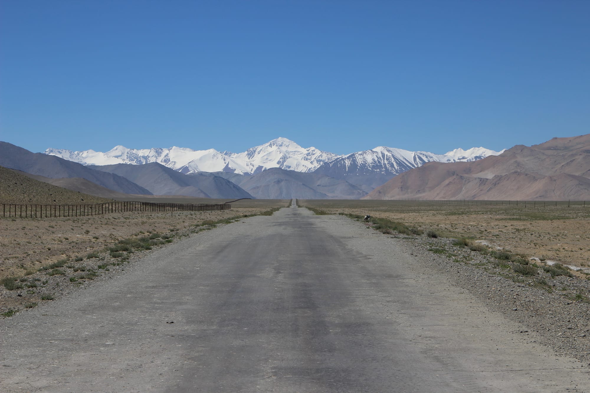
A straight grey road crossing a dry high plain towards snow-covered peaks, with a long fence on the left

Tajikistan

The Pamirs

The Pamir Highway crossing the high plateau near Lake Karakul in the eastern Pamirs. (Hylgeriak / Wikimedia Commons · CC BY-SA 3.0)

The Gorno-Badakhshan Autonomous Region, which covers the eastern half of Tajikistan but holds only a few per cent of its people — deep western valleys of Ismaili Pamiri villages along the Panj opposite Afghanistan, and a high, cold eastern plateau of Kyrgyz herders, crossed by the Pamir Highway.

Explore The Pamirs

History

The Pamir valleys have been lived in and crossed since ancient times: a stupa of uncertain origin survives at Vrang in the Wakhan, and branches of the Silk Road used its passes between China and the Oxus lands. For centuries the western valleys were small principalities — Shughnan, Roshan, Wakhan — ruled by local mirs and loosely tied to Badakhshan across the Panj. Ismaili Islam arrived in the 11th century, and tradition credits its spread to the poet and missionary Nasir Khusraw.

In the late 19th century the Pamirs became a prize of the Great Game between Russia and Britain. Russia set up the Pamirsky Post at Murghab in 1893, and the Pamir boundary agreement of 1895 fixed the Panj as the border with Afghanistan, leaving the Wakhan Corridor as an Afghan buffer between the two empires. Khorog grew around a Russian garrison, and the Pamir Highway was pushed through by the Soviets in the 1930s to tie the region to the rest of the country.

Gorno-Badakhshan became an autonomous region in 1925. In the 1992–97 civil war Pamiris largely sided with the opposition, and the region was cut off and close to famine until the Aga Khan's humanitarian aid arrived. The Aga Khan Development Network has remained central to its economy. Relations with Dushanbe have stayed tense, erupting in armed clashes in Khorog in 2012 and in a harsh crackdown in 2022 after protests over the torture and killing of a local youth leader.

Culture & Customs

The Pamiris of the western valleys are distinct within Tajikistan in faith and language. They are Ismaili Shia Muslims who follow the Aga Khan, and their prayer houses and practices differ from the Sunni mainstream. At home they speak Eastern Iranian languages — Shughni, Rushani, Bartangi, Wakhi, Ishkashimi, Yazghulami — which belong to a different branch of Iranian languages from Tajik.

Pamiri Ismailis call their faith the religion of the five holy persons: the Prophet Muhammad, Ali, Fatima, Hasan and Husayn. Maddoh, an ancient devotional genre of Pamiri music, is a cycle of sung praise whose name comes from the Arabic word for eulogy.

On the eastern plateau many of the people are Kyrgyz herders around Murghab and Karakul, a different culture again from the valley Pamiris. Hospitality in both is a serious obligation, and a traveller will be offered tea and bread in any house.

Daily Life

Gorno-Badakhshan has around 230,000 people in about 45 per cent of Tajikistan's territory. Khorog, with about 30,000, is the capital and only real town: a strip of houses, shops and poplar-lined streets along the Gunt river, home to the University of Central Asia campus. Murghab, a small town at about 3,600 metres, is the centre of the east.

Livelihoods are small-scale farming of wheat, barley, potatoes and fruit on irrigated terraces in the valleys, yak and sheep herding on the plateau, and increasingly homestays and guiding. Remittances matter as elsewhere, and the Aga Khan network funds schools, clinics, hydroelectric plants and microfinance. Education levels are high by national standards, and many young Pamiris study or work in Dushanbe, Russia or abroad.

Life is shaped by altitude and isolation. Winters are long, the Pamir Highway can close for days, and food prices rise with transport. The security presence since 2022 weighs on daily life in Khorog.

Food

The Pamiri table is simple mountain food. Tea is drunk at every hour, bread is baked at home in flat rounds, and qurutob and oshi palov appear for guests and celebrations, though rice is a luxury brought up from the lowlands.

The valleys grow fruit and grain on irrigated terraces, and much of the fruit is dried for the long winter. Soups, yoghurt, fresh cheese and kaymak, a rich clotted cream, fill the rest of the diet. On the eastern plateau the Kyrgyz herders live largely on meat and dairy from their animals.

Homestays serve what the family has, usually generous and repetitive, and hospitality demands that guests eat well. Vegetables and fresh fruit are scarce on the plateau, and travellers often carry some from Khorog.

Attractions & Natural Wonders

Khorog is the base: the Pamir Botanical Garden, among the highest botanical gardens in the world, looks down on the town, and the city park and the bazaar fill the rest of a visit.

The Wakhan Corridor route runs south and east along the Panj, facing Afghanistan's Wakhan and the white peaks of the Hindu Kush. Along it are the Garm-Chashma hot spring, about 40 kilometres from Khorog, where water at up to 75°C bubbles from small geysers, and the stupa of uncertain origin at Vrang, which may once have been a Zoroastrian fire temple. Upstream, the Panj is formed where the Pamir and Wakhan rivers meet. A rough track climbs from the upper valley onto the plateau, and a permit side trip leads to Zorkul, a lake on the Afghan border.

The Pamir Highway leaves Khorog up the Gunt valley, past the turn-offs to the lakes of Yashilkul and Bulunkul, onto the high plateau. The Bartang valley to the north leads towards Sarez Lake. Murghab, the highest town in Tajikistan at about 3,650 metres, is the plateau's only real town, and further north the road crosses the Ak-Baital pass, at 4,655 metres, before descending to Lake Karakul and the Kyrgyz border at the Kyzylart pass.

Cities in The Pamirs

Planning basics

Budget

The Pamirs are the most expensive part of Tajikistan to travel, not because of prices on the ground but because of transport: a chartered 4x4 with driver for the Pamir Highway is the main cost, best shared between several travellers. Homestays charge a simple nightly rate with dinner and breakfast, and Khorog has a few hotels. Everything beyond Khorog runs on cash.

Daily Budget Midrange
USD 95–190 (a share of a hired 4x4 and driver, homestays or Khorog hotels, a guide)
Daily Budget Shoestring
USD 30–60 (homestays with meals, shared taxis and hitched rides)

Bring enough cash in somoni and US dollars for the whole trip; Khorog's cash machines are unreliable and there are none on the plateau.

Safety

The Pamirs are hospitable, but the region has a history of tension with the central government: armed clashes in Khorog in 2012 and a security operation after protests in 2022 left many dead, and extra checkpoints have followed. The Afghan border along the Panj is closely guarded. Altitude sickness, cold, remote roads and the absence of medical care are the everyday risks.

Check the current situation in GBAO before setting out, acclimatise gradually before the plateau, and carry warm clothing and insurance with evacuation cover. Check current official travel advice before travelling.

Climate

The western valleys around Khorog and along the Wakhan are dry, sunny and warm in summer, with orchards and fields irrigated from glacier streams. The eastern plateau around Murghab lies at over 3,500 metres and is a cold high desert: summer days are mild but nights freeze, and winters are among the coldest in Central Asia.

Summer
warm in Khorog and the Wakhan, 25–30°C by day; cool days and frosty nights on the eastern plateau
Winter
cold and snowy in the valleys; severe on the plateau, with nights far below -20°C and passes that can close

Transportation

The Pamir Highway is the spine. From Dushanbe to Khorog is a long journey by shared 4x4, usually split over two days; from Khorog to Murghab is a long day, and from Murghab the road crosses into Kyrgyzstan towards Osh. The Wakhan route rejoins the highway on the plateau. Side trips to Sarez, Bulunkul or Zorkul need a hired vehicle and sometimes extra permits.

Get the GBAO permit with the e-visa, carry several copies, and build spare days into any Pamir itinerary for landslides and breakdowns.

Best Time to Visit

July to September is the main season: the passes are clear, homestays are open and the Wakhan is green. June and early October are possible but colder, with snow risk on the Ak-Baital pass and on the side roads to the lakes.