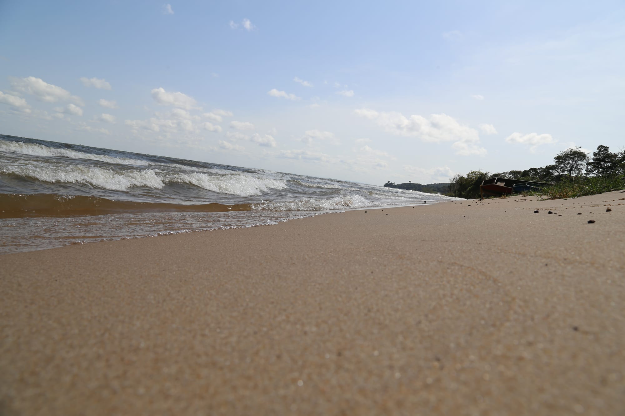
A wide empty beach of pale sand with small waves breaking, trees and a boat on the shoreline in the distance

Kampala & Central Uganda, Uganda

Ssese Islands

A sand beach on the Ssese Islands, with waves running in off Lake Victoria. (Jiame Josh / Wikimedia Commons · CC BY-SA 4.0)

An archipelago in the north-western corner of Lake Victoria, forming Kalangala district and reached by ferry from Entebbe and from Bukakata near Masaka. Bugala, the largest island, holds the district town of Kalangala, sandy bays, patches of forest, fishing villages and large oil-palm plantations; the smaller islands are quieter still.

Neighbourhoods

  • Kalangala town
    • First-time visitors
    • Local life
    • Transport connections

    The small district headquarters on Bugala, above Lutoboka Bay, with offices, a market, a few shops, guesthouses and the island's main services. Almost everything on the island is arranged around it.

    Open in Maps
  • Lutoboka Bay
    • Beaches
    • Relaxed evenings

    The bay below Kalangala where the Entebbe ferry ties up, lined with sand, trees and most of the islands' lodges and beach camps. Evenings are quiet apart from music from a bar or two and the noise of the fishing boats.

    Open in Maps
  • Western Bugala and Luku
    • Quiet and residential
    • Countryside

    The long western arm of the island, crossed by the murram main road that runs down to the Luku ferry landing, where oil-palm plantations, smallholdings and fishing villages have replaced much of the old forest. This is working island country rather than a visitor strip.

    Open in Maps
  • The outer islands
    • Quiet and residential
    • Fishing life

    Dozens of smaller islands scattered around Bugala, among them Bukasa and Banda, reached by public motor boat or by hiring one. Facilities are basic, electricity is limited and visitors are few.

    Open in Maps

Things to do

The islands

  • Bugala Islandattraction

    The largest of the Ssese Islands and the only one with a long road across it, a murram track running from Luku through Kalangala to Mulabana, and the island holding the district town, the ferry landings, beaches and plantations.

    Open in Maps
  • Bukasa Islandattraction

    One of the larger islands of the Bugala group, with forest, fishing villages and footpaths and old shrines of the Ganda spirits Musisi and Wanema, reached by public boat from Bugala or from the mainland.

    Open in Maps
  • Boat trips on the lakeattraction

    Hired motor boats from the landings pass fishing villages, birdlife and uninhabited islets, and are the only way to reach most of the archipelago.

    Open in Maps

Beaches and forest

  • Lutoboka beachesbeach

    Sandy bays on Bugala's north-eastern shore, backed by trees and lodges, where the lake is calm in the morning; the water carries bilharzia.

    Open in Maps
  • Bugala forest walkstrail

    Patches of surviving forest behind the beaches, walked for birds, butterflies and monkeys; vervets are the mammal most often seen around Lutoboka and Kalangala, while black-and-white colobus and bushbuck are present but seldom observed.

    Open in Maps
  • Fishing villagesattraction

    Landing sites around the islands where boats come in with tilapia and Nile perch, nets are mended on the sand and the day's catch is sold and smoked.

    Open in Maps

Getting to and from the islands

  • Kalangala ferry landingtransit hub

    The pier at Lutoboka where the passenger ferry from Nakiwogo in Entebbe arrives, taking about three and a half hours across the lake.

    Open in Maps
  • Bukakata ferry crossingtransit hub

    The short vehicle ferry between Bukakata on the mainland near Masaka and Luku on western Bugala, the route used by cars and lorries.

    Open in Maps

Seasonal events

  • Drier months on the lakeJune to August and December to February

    Calmer water and firmer island roads make this the busiest season, when Kampala and Entebbe visitors fill the beach lodges at weekends.

  • Nsenene seasonaround April–May and November

    Grasshoppers swarm with the rains and are caught at night, fried and sold around the landings and markets.

Eat and drink

Long-standing places and food districts in Ssese Islands. Hours, ratings and directions come from your maps app, always current.

Island eating

  • Fried tilapia at the landingsrestaurant

    Whole tilapia and Nile perch, fried or grilled with chips, cassava or matooke, is the standard meal on the islands, cooked at the landings and the beach bars.

    Open in Maps
  • Kalangala marketmarket

    A small market for produce brought over from the mainland, along with island bananas, pineapples, cassava and dried mukene fish.

    Open in Maps
  • Beach bars at Lutobokarestaurant

    Simple kitchens attached to the lodges along the bay, serving fish, chicken, rice and matooke, and pouring bottled lager and waragi in the evening.

    Open in Maps

Experience Ssese Islands

History

The Ssese Islands were settled long before the Buganda kingdom reached the lake shore opposite. Their people, the Bassese, were known as canoe builders and sailors, and the islands supplied much of the fleet that made Buganda a power on Lake Victoria in the nineteenth century. They were also a religious centre: the islands are strongly associated with the balubaale spirits of Ganda tradition, above all Mukasa, the spirit of the lake, whose shrines drew petitioners from the mainland and whose mediums held real influence at court.

Buganda absorbed the archipelago and used its boats and its timber, and the islands lived on fishing, canoe building, bark cloth and crops grown in a fertile, well-watered soil. Disaster came in the first years of the twentieth century, when sleeping sickness spread through the lake shore communities; the epidemic that broke out in Uganda in 1901 killed more than 250,000 people, about two-thirds of the population in the affected lake shore areas, and the islands were left largely empty for years before resettlement began.

Through the later twentieth century the islands remained remote, living on fishing for tilapia and Nile perch, with slow boats to the mainland. Kalangala district, which is coterminous with the archipelago and holds no mainland territory, administers them from Kalangala town. A government-backed scheme planted oil palm across large areas of Bugala for Bidco, a processor based at Jinja on the mainland, clearing forest and smallholdings and changing the island's economy and appearance; the project brought roads, jobs and steadier incomes, and also disputes over land and the loss of forest that continue to be argued over. A vehicle ferry from Bukakata and a better passenger service from Entebbe made the islands reachable for weekend visitors, and lodges appeared along the beaches.

Culture & Customs

Island life is Ganda in language and manners — Luganda is spoken everywhere, greetings are long, and the clans and their totems matter — but the Bassese have their own reputation, built on boats, water and the old shrines. The lake spirit Mukasa is the best-known figure in that tradition, and the islands' place in Ganda religious life is still remembered even where churches and mosques have taken over daily worship. Christianity, Catholic and Anglican, is dominant, with Pentecostal congregations and a smaller Muslim community.

The other half of the islands' character comes from the fishery. Landing sites draw migrants from all over Uganda, from Kenya and Tanzania and further, and they have their own rhythm: boats out at night, the catch sold at dawn, money spent quickly, and a mobile population that moves as the fish move. This mixing makes the landings livelier and rougher than the villages behind them, and has brought serious public-health work on HIV to the islands.

Music and drink belong to the evening — bottled lager and waragi, radios and generators at the bars, and drumming at ceremonies. Visitors are a recent and accepted part of the scene, and the islands are used to weekend arrivals from Kampala. Manners are relaxed but dress in villages is modest, and time is treated loosely: boats and vehicles leave when they are ready.

Daily Life

Kalangala district, which covers the archipelago, had about 66,000 residents at a 2012 estimate, most of them on Bugala, and the population moves with the fishery. Kalangala town, above Lutoboka Bay, holds the district offices, a market, a health centre, schools and a handful of guesthouses; everywhere else is villages and landing sites.

Fishing is still the base of the economy, though catches have fallen and rules on net sizes and licences are enforced, sometimes harshly, by the authorities. Oil-palm growing is now the other pillar on Bugala, with plantations, smallholder blocks and a mill, and it has brought wage work, roads and a steadier cash income along with arguments about land and forest. Tourism supports lodges, boats and transport around Lutoboka, and smallholders grow matooke, cassava, sweet potato and pineapple.

The day begins before dawn with boats coming in and the fish trade, and slows in the heat of the afternoon; the ferry's arrival is the event that organises the middle of the day at Lutoboka. Electricity supply, water, transport costs, the state of the roads, falling fish stocks and the balance between palm and forest are the recurring local concerns, along with the cost of reaching a hospital on the mainland.

Food

Fish is the everyday meal. Tilapia is fried whole until the skin crisps, or grilled over charcoal, or stewed with tomato and onion, and Nile perch is sold in thick steaks; both come with chips, cassava, posho or matooke and a tomato and onion kachumbari. Mukene, the small silver fish of the lake, is dried on racks in the sun and cooked with groundnut paste into a savoury sauce, and smoked fish keeps for the journey to the mainland market.

Beyond the fish the cooking is Ganda: matooke steamed in banana leaves and mashed, served with groundnut sauce, beans or meat stew; katogo for breakfast, matooke or cassava cooked together with beans or offal; and luwombo, steamed in a banana-leaf parcel, for celebrations. The islands grow their own pineapples, jackfruit, bananas and sweet potato, while rice, sugar, bread and most packaged goods arrive by boat.

Street eating is limited to what the landings support — chapati, the egg-filled rolex, muchomo skewers of goat or beef, roasted maize and gonja plantain. Nsenene grasshoppers appear with the rains. To drink there is milky tea with ginger, passion-fruit juice, bottled lager, waragi gin and, in the villages, home-brewed tonto made from bananas.

Planning tools

Budget

The islands are among the cheapest places in central Uganda to stay: beach camps and guesthouses cost little, meals are simple and the ferry from Entebbe is inexpensive. Costs rise at the handful of larger lakeside lodges, and anything brought from the mainland — fuel, bottled drinks, building materials — is dearer than in Kampala.

Daily Budget Midrange
USD 70–140 (lakeside lodge, restaurant meals, a hired boat or private transfer)
Daily Budget Shoestring
USD 20–45 (beach camp or guesthouse, fish and matooke, ferry and shared transport)

Bring enough cash in small shilling notes: banking and card acceptance on the islands are very limited, and boats and lodges often want cash.

Best Time to Visit

June to August and December to February are drier, the lake is calmer and the island tracks are passable. The rains of March to May and September to November make the roads muddy and can delay boats, though the islands stay warm and green throughout and the beaches are emptiest then.

Suggested Number of Days

Two days allows for the crossing and a full day on the main island. Three or four suits a slower stay that includes the smaller islands. Ferry timings, rather than distance, shape how long a visit takes.

First Visit
2 days
With Surroundings
3–4 days

Transportation

Bugala has one main road running the length of the island between the two ferry landings, served by shared minibuses and boda-boda motorbikes; the side tracks are rough. Getting between islands means the public motor boats that link the landings or hiring a boat locally. There is no public transport on the smaller islands.

Check the day's ferry times before planning a crossing, and avoid open boats when the lake is rough or a storm is building.

Airport & Station Connections

A passenger ferry runs from Nakiwogo pier in Entebbe to Lutoboka on Bugala, taking about three and a half hours. A shorter vehicle ferry crosses in about fifty minutes from Bukakata, some 36 km east of Masaka, to Luku on western Bugala, which is the route used by cars; Masaka is roughly 130 km from Kampala by road. Small boats also run from lakeside landings, but weather can stop them.

Walkability

The beaches and the stretch between Kalangala town and Lutoboka Bay are walked easily, and forest paths behind the shore make good short walks. The island as a whole is long and hilly, the road is dusty or muddy depending on the season, and distances between villages are more than most people want to cover on foot, so boda-bodas fill the gap.

Safety

The islands are quiet and the risks are mostly practical rather than criminal: sudden squalls on Lake Victoria, which is dangerous for small overloaded boats, limited medical facilities, and malaria, which is common on the lake shore. The lake carries bilharzia, and hippos and crocodiles live along parts of the shoreline.

Use boats with life jackets and do not travel in rough weather, avoid swimming in the lake, take malaria precautions, and carry any medicines needed, as clinics are basic. Under the Anti-Homosexuality Act, 2023, same-sex acts carry life imprisonment and 'aggravated homosexuality' the death penalty; most of the law was upheld by the Constitutional Court in April 2024. Check current official travel advice before travelling.

Climate

Warm, humid and rainier than the mainland shore, with the lake keeping temperatures steady through the year. Days reach the high 20s °C and nights stay in the high teens. Storms build quickly over the water, most often in the two wetter seasons of March to May and September to November.

Summer
June to August is slightly cooler and drier, about 17–26°C
Winter
December to February is warm and drier, about 18–28°C

Local Customs

The islands are part of Buganda, and Luganda is the everyday language alongside English, though fishing communities draw people from across Uganda and beyond. Greetings come before any request. Dress is modest away from the beaches, and swimwear is not worn in villages or on the ferry.

Ask before photographing people or their boats at the landings, carry small notes as change is scarce, and expect power and mobile signal to be limited on the smaller islands.

Common Payment Methods

The currency is the Ugandan shilling (UGX). Cash is essential: card payment is rare outside a couple of the larger lodges, ATMs are few and can be out of service, and boats, guesthouses and markets all expect shillings. Mobile money is widely used by residents where there is signal.