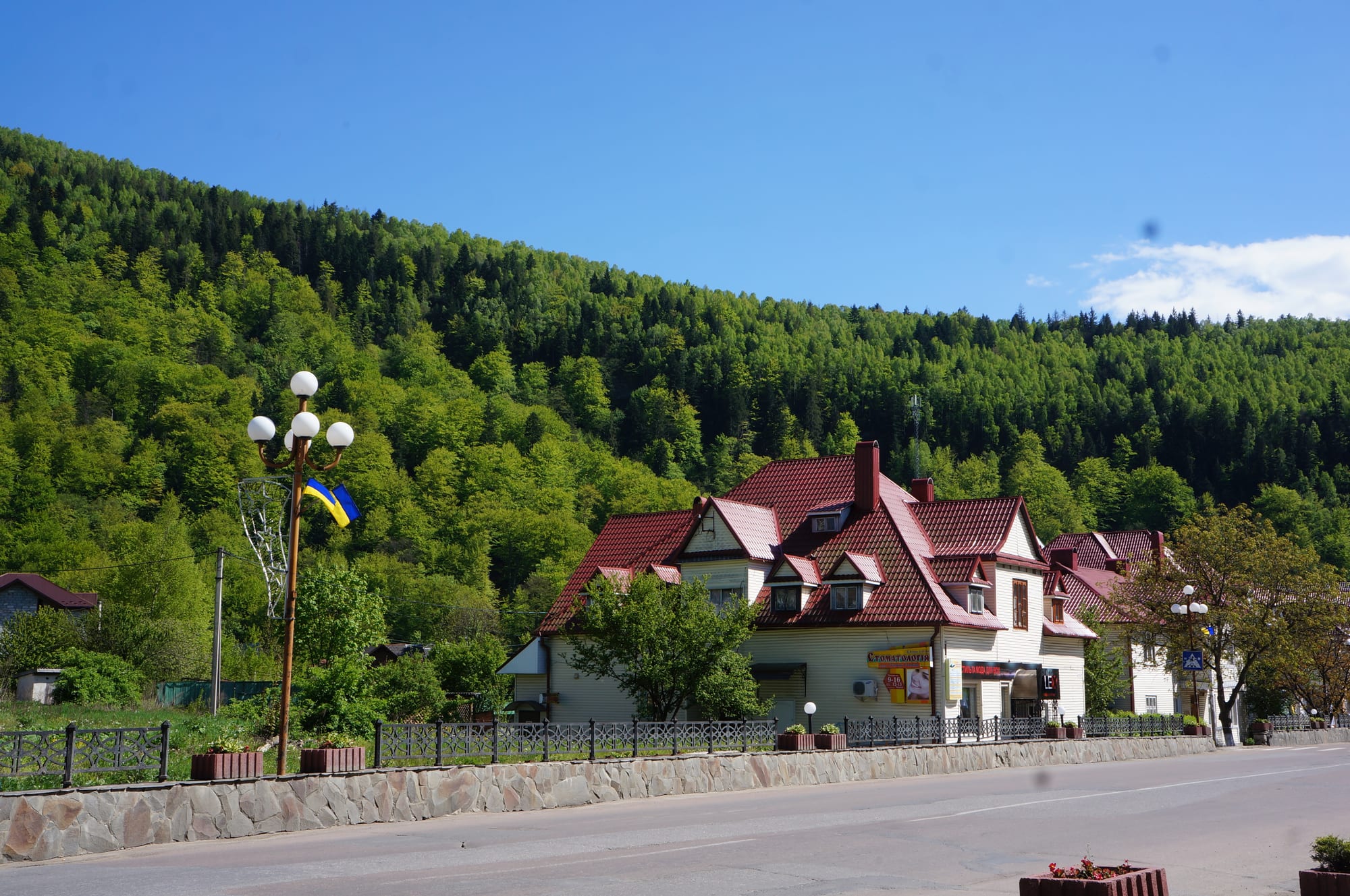
A red-roofed house and street lamps on a quiet road below a steep, forested green hillside under blue sky

Western Ukraine & the Carpathians, Ukraine

Yaremche

A street in Yaremche beneath the forested slopes of the Carpathians. (Skoropadsky / Wikimedia Commons · CC BY-SA 4.0)

A small Carpathian resort town on the Prut in Ivano-Frankivsk Oblast, about 580 metres above sea level, that grew from a Hutsul village into a mountain spa after the railway arrived in the 1890s. It is known for the Probiy waterfall, its souvenir markets and a rail viaduct, and is the base of the Carpathian National Nature Park. This page is written to explain the town, not to encourage travel.

Neighbourhoods

  • Town centre and the Prut
    • First-time visitors
    • Close to public transport

    The town strings out along the main road through the Prut valley, with the railway station, the wooden Orthodox church, the museum and many guesthouses near the river.

    Open in Maps
  • Probiy and the bridges
    • Sightseeing
    • Views

    The busiest corner of the town, around the Probiy waterfall on the Prut, the rail viaduct and a swinging footbridge.

    Open in Maps
  • Mykulychyn and the valley villages
    • Quiet and residential
    • Countryside

    Mykulychyn and other villages of the Yaremche hromada lie along the valleys around the town, with scattered houses, meadows and forest.

    Open in Maps

Things to do

In the town

  • Probiy waterfallattraction

    An 8-metre waterfall on the Prut in the town, one of the most powerful in the Ukrainian Carpathians, reached by steps built in the early days of the resort.

    Open in Maps
  • Prut rail viaductlandmark

    An arched railway bridge of 1894 over the Prut valley, about 30 metres high, with a 65-metre span that made it one of the largest arched rail bridges in Europe; the town also has a swinging footbridge.

    Open in Maps
  • Wooden Orthodox churchlandmark

    A wooden Orthodox church in the town.

    Open in Maps
  • Museum of Ethnography and Ecology of the Carpathian Regionmuseum

    A museum covering the folk life and natural history of the Carpathians.

    Open in Maps
  • Souvenir marketsmarket

    Stalls of Hutsul folk art — carving, weaving, embroidery and more — where buyers haggle with local Hutsuls.

    Open in Maps

Mountains and parks

  • Carpathian National Nature Parkpark

    A national park set up in 1980 to protect Carpathian landscapes, with its headquarters in Yaremche; its most common trees are silver fir, European beech and spruce.

    Open in Maps

Short trips from the town

  • Vorokhtaattraction

    An old spa town higher up the Prut, later a winter sports centre with ski lifts and the ski-jumping ramps of the Avanhard resort.

    Open in Maps
  • Bukovelattraction

    The largest ski resort in Eastern Europe, about 35 km by road, on the Carpathian ridges near Polianytsia; its ski season usually runs from early December to mid-April.

    Open in Maps
  • Hoverlaviewpoint

    At 2,061 metres the highest mountain in Ukraine, in the Chornohora range, with forest slopes below sub-alpine meadows.

    Open in Maps

Eat and drink

Long-standing places and food districts in Yaremche. Hours, ratings and directions come from your maps app, always current.

Yaremche classics

  • Banoshrestaurant

    The Hutsul cornmeal dish cooked with sour cream and topped with pork rind, mushrooms and bryndza sheep's cheese, especially popular in the Carpathians.

    Open in Maps
  • Guesthouse and roadside restaurantsneighborhood

    Restaurants and cafés along the main road serve Hutsul and Ukrainian dishes to visitors.

    Open in Maps

Cafés

  • Main-road cafésneighborhood

    Cafés along the main road through the town serve coffee, cakes and simple meals.

    Open in Maps

Experience Yaremche

History

Yaremche was founded in 1787, when the region belonged to Galicia in the Habsburg Monarchy, in Hutsul country where people lived mainly from herding, especially sheep. Its name may come from a Turkic word for 'half'. The outlaw leader Oleksa Dovbush, whose bands of opryshky robbed the rich in the 18th century, often passed through the area, and local places still carry his name.

The railway from Deliatyn up the Prut changed everything. In 1894 engineers built one of the largest arched railway bridges in Europe across the valley, and the resort grew from that year: paths into the mountains were marked, steps were cut down to the Probiy waterfall and villas went up. Yaremche became a separate village in 1895. In the interwar years, under Poland, it was the most popular tourist centre in the eastern Carpathians, with more than 6,000 guests a year by the late 1920s, and some thought it could rival Zakopane and Krynica.

In September 1939 the town passed to the Soviet Union. During the German occupation that followed, most of its Jewish population was murdered. Soviet forces returned in 1944, and in 1963 a museum of partisan glory opened in the town. Yaremche received town status in 1977 and was officially renamed from Yaremcha in 2006 after a local referendum. Since a 2020 reform it has been part of Nadvirna Raion.

Culture & Customs

Yaremche is a Hutsul town. The Hutsuls are the highlanders of this part of the Carpathians, and their crafts fill the town's souvenir markets, where visitors haggle with local Hutsuls over carving, weaving and embroidery. The town's nickname, the Pearl of the Carpathians, comes from its setting.

Much of the local identity is bound up with the mountains and their stories. Oleksa Dovbush and his opryshky are remembered across the valley, and a large rock above the road is known as the Kratter Stone, after Franz Kratter, who had the road through the valley built. The wooden Orthodox church recalls an older mountain settlement.

The town is the headquarters of the Carpathian National Nature Park, set up in 1980, where about 1,260 plant species grow and silver fir, European beech and spruce are the most common trees. Resort life has always shaped the calendar: walkers and spa guests in summer, skiers passing through on the way to the slopes higher up the valley in winter.

Daily Life

About 7,900 people lived in Yaremche in 2022, a small population for a place that receives so many visitors. Until 2020 it was the centre of a municipality that also took in the ski settlement of Vorokhta and villages including Mykulychyn, Polianytsia, Tatariv, Voronenko and Yablunytsia; since then it has headed an urban hromada within Nadvirna Raion.

Tourism is the main business. Guesthouses, small hotels, restaurants and souvenir stalls line the river and the main road, and the town is also a climatic resort and a centre of 'green' tourism for the Hutsul region. The national park has its headquarters in the town, and the railway and the H09 road connect it with the rest of the region.

The rhythm follows the seasons and the trains: busy summer weekends around the waterfall, quieter weekdays, and winter traffic heading up the valley. Since 2022, as across western Ukraine, daily life has also included air-raid alerts, martial law and people displaced from the east.

Food

The Hutsul kitchen is built on maize, dairy and pork. Banosh, the best-known dish, is cornmeal cooked with sour cream and topped with pork rind, mushrooms and bryndza, a crumbly, tangy sheep's milk cheese; it is especially popular in the Carpathian region. Maize porridges such as banosh and kulesha are characteristic of south-western Ukraine as a whole.

Ukrainian staples are eaten here as everywhere: red borscht, varenyky dumplings with potato or other fillings, holubtsi cabbage rolls and deruny, potato pancakes with sour cream. Salo, cured pork fat, and kovbasa sausage are widely eaten, and brook trout live in the mountain streams. Borscht is often eaten with pampushky, small buns seasoned with garlic sauce, and kapusniak, a soup of cabbage, pork, salo and beans served with sour cream, is another hearty standby for cold mountain days. Kholodets, a meat aspic, appears on holiday tables.

To drink there is kvass, horilka and the dried-fruit compotes of village tradition. Restaurants along the main road cater to visitors.

Planning tools

Budget

The town has long been one of the cheaper Carpathian bases, with many small guesthouses, though prices rise in the ski season and on summer weekends. Price is not the obstacle to travel; the war is.

Daily Budget Midrange
USD 60–120 (mid-range guesthouse or hotel, restaurant dinners, taxis and day trips)
Daily Budget Shoestring
USD 25–45 (guesthouse room, simple Hutsul meals, trains and minibuses)

Do not plan leisure travel while the war continues; carry some cash in the mountains.

Best Time to Visit

In peacetime, summer and early autumn suited walking in the national park, and December to April brought skiers on their way to the slopes higher up the valley. Air-raid alerts and strikes can affect any part of Ukraine at any time of year, so current advice matters more than the season.

Suggested Number of Days

The town itself needs a day or two. Allow four or five to walk in the national park and reach the resorts and peaks higher up the Prut, and more for a ski holiday; mountain weather can add a day.

First Visit
1–2 days
With Surroundings
4–5 days

Transportation

The town centre is walked. The railway up the Prut valley and minibuses on the H09 road link the town with the villages and resorts around it, and taxis fill the gaps. Mountain roads are slow and winding.

Allow extra time on mountain roads in winter and keep a power bank charged.

Airport & Station Connections

Yaremche has a railway station with direct trains to Ivano-Frankivsk, Kolomyia, Lviv, Ternopil and other cities, and buses run daily from Ivano-Frankivsk. The H09 road passes through the town. Civilian flights in Ukraine are suspended, so arrivals are overland.

Walkability

The centre, the waterfall, the bridges and the market are within easy walking distance, but the town is long and thin along the river, and outlying guesthouses can be a long walk uphill. Paths in the national park are steep and can be muddy after rain.

Safety

Most governments advise against all travel to most or all of Ukraine. The town lies in the west, far from the front line, but the whole country is subject to missile and drone strikes and nationwide air-raid alerts, and martial law is in force. In the mountains, sudden weather changes and winter avalanches are the natural hazards.

Follow air-raid alerts and go to shelter when sirens sound, carry identification at all times, and check the weather before walking in the mountains. Check current official travel advice before travelling.

Climate

A very humid mountain climate with relatively low annual temperatures.

Summer
mild — in Ivano-Frankivsk, the oblast capital, July averages about 19°C, and the mountains are cooler
Winter
cold and snowy — in Ivano-Frankivsk January averages about −4°C

Local Customs

Yaremche lies in the Hutsul highlands, and folk crafts and the memory of the 18th-century outlaw leader Oleksa Dovbush, who often passed through the area, are part of the town's identity. The wooden churches are places of worship as well as sights. Haggling is part of buying at the souvenir stalls.

Dress modestly in churches, ask before photographing people, and stay on marked paths in the national park.

Common Payment Methods

The currency is the hryvnia. Cards and contactless payment are common in the town, but market stalls and small guesthouses often prefer cash, and power cuts can take card terminals offline.