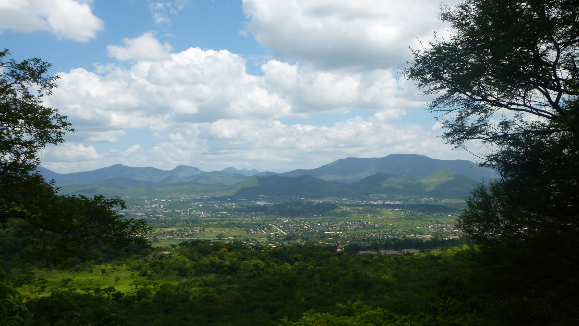
A green valley city spread between wooded ridges and a long line of blue mountains under white cumulus cloud

The Eastern Highlands, Zimbabwe

Mutare

Mutare seen from Christmas Pass, in its bowl of hills near the Mozambican border. (Seabifar / Wikimedia Commons · CC BY-SA 3.0)

Zimbabwe's eastern border city, set in a bowl of hills in Manicaland a few kilometres from Mozambique. Called Umtali until 1982, it was moved to its present valley in the 1890s to meet the railway to the port of Beira, and it lives by that corridor of road, rail and pipeline, by timber and by its cool, green hinterland.

Neighbourhoods

  • City centre
    • First-time visitors
    • Shops and transport

    A compact grid of wide streets below the hills, with jacaranda and flamboyant trees, the museum, colonial-era shopfronts, banks, the main bus terminus and the railway station. Most of the city's hotels and offices are here and it is easily crossed on foot.

    Open in Maps
  • Sakubva
    • Local life
    • Markets
    • Best for food

    The first high-density suburb, south of the railway line, built for African workers in the colonial city and now holding a large share of its population. Its market is the biggest in Mutare, selling vegetables, secondhand clothes and cooked food, and the area has the city's busiest transport rank and its football stadium.

    Open in Maps
  • Dangamvura
    • Local life
    • Quiet and residential

    A large hillside suburb spreading up the slopes south of the centre, one of the city's main townships and still growing. It is residential rather than a sight, with shopping centres, churches and schools, and views over the valley from the higher streets.

    Open in Maps
  • Murambi and the northern suburbs
    • Quiet and residential
    • Gardens

    Low-density streets of large gardens, hedges and old trees on the slopes towards Christmas Pass and Cecil Kop, where the colonial town's houses were built. Quiet, green and a short drive from the centre, with guesthouses among the houses.

    Open in Maps
  • The Bvumba road
    • Views
    • Walks

    The road climbing south-east from the city into the mist forest of the Bvumba mountains, past small farms and plant nurseries to hotels, gardens and viewpoints over Mozambique. It is where people from the city go for a cool day out.

    Open in Maps

Things to do

In the city

  • Mutare Museummuseum

    One of Zimbabwe's four national museums, begun as a society in 1954 and made a national museum in 1959, covering the region's history and natural history.

    Open in Maps
  • Cecil Kop Nature Reservepark

    A reserve of msasa woodland and hills on the northern edge of the city, with a game enclosure and walking trails within sight of the streets.

    Open in Maps
  • Christmas Passviewpoint

    The gap in the hills where the Harare road drops into the city, with the classic view over the valley and its surrounding ridges.

    Open in Maps
  • Murahwa Hilltrail

    A wooded granite hill at the edge of the city with walking paths, rock art and the remains of an old settlement on its slopes.

    Open in Maps

Into the Bvumba

  • Bvumba Mountainsviewpoint

    A range of misty, forested hills on the Mozambican border above the city, with viewpoints looking far out over the Mozambican lowlands.

    Open in Maps
  • Bvumba Botanical Gardenspark

    Terraced gardens of exotic trees, streams and lawns in the mist forest above the city, beside the Bunga Forest reserve, with paths into indigenous forest.

    Open in Maps

Short trips from the city

  • Africa Universityattraction

    A pan-African, United Methodist-related university that opened in 1992, on a rural campus outside the city, with students from across the continent.

    Open in Maps
  • Honde Valleyattraction

    A hot, green valley of tea estates and banana plots beneath the escarpment, with waterfalls dropping from the highlands above it.

    Open in Maps
  • Penhalongaattraction

    A village in a green valley north of the city, the site of gold workings since the 1890s and of a well-known mission church and school.

    Open in Maps
  • Machipandatransit hub

    The Mozambican border settlement on the Beira corridor, just beyond the border post east of the city.

    Open in Maps
  • Nyanga National Parkpark

    High grassland, pine forest, waterfalls and trout dams around Mount Nyangani, Zimbabwe's highest mountain.

    Open in Maps

Eat and drink

Long-standing places and food districts in Mutare. Hours, ratings and directions come from your maps app, always current.

Markets and food districts

  • Sakubva Musikamarket

    Mutare's biggest market, also known as Musika Wehuku, where vegetables, fruit, dried fish and secondhand goods are sold in bulk and stalls cook sadza, stew and roasted maize for traders.

    Open in Maps
  • City centre eating housesneighborhood

    Counters and small dining rooms around the main streets serving sadza with beef, chicken or offal and greens, plus rice, chips and morning tea with buns.

    Open in Maps
  • Roadside fruit stalls on the highlands roadsmarket

    Bananas, avocados, mangoes, macadamia nuts and buckets of tomatoes sold beside the roads climbing out of the valley, cheap and in season.

    Open in Maps

Experience Mutare

History

Mutare has stood in three places. Fort Umtali was established in 1890 between the Tsambe and Mutare rivers, near the Penhalonga valley to the north; the site was moved in 1891 to what is now Old Mutare, about 14 kilometres from the present centre, and moved a third time in 1896 so that the town would sit on the railway being built to the Mozambican port of Beira, the British South Africa Company compensating the townspeople for the cost of the move. The town on its present site dates from 1897, and the corridor to the coast fixed the purpose it has kept ever since as the country's gateway to the sea.

The town grew as a customs post, railhead and service centre for the farms, plantations and mines of the eastern districts, with gold worked at Penhalonga and timber cut on the slopes. Its position made it a frontier town in every sense: Portuguese territory a few kilometres away, a constant traffic in goods and people, and a mixed population of settlers, migrant workers from Mozambique and Manyika villagers drawn into wage work.

During the liberation war of the 1970s the border district saw fighting, and the town's position beside Mozambique put it close to the front; the Catholic bishop of Umtali, an outspoken critic of the Rhodesian government, was tried and expelled from the country in 1977. The town was renamed Mutare in 1982, after the river whose name comes from utare, meaning iron, and from the gold found in the Penhalonga valley. Since then it has lived through the growth and decline of its industries, the reopening of the Beira corridor after Mozambique's civil war, the diamond rush at Marange from 2006 in the district to the west, and the long economic crisis that has emptied many of its factories.

Culture & Customs

Mutare is a Manyika city. The Manyika dialect of Shona is what is spoken in the street, distinct enough in vocabulary and intonation to be recognised anywhere in the country, and the city's humour and music trade on it. Proximity to Mozambique gives an added layer: families with relatives on both sides of the border, Portuguese words in circulation, and a taste for Mozambican music and prawns brought up the corridor.

Religion is prominent. The city has churches and mission foundations of long standing and is the seat of a Roman Catholic bishop, and Africa University, a United Methodist-related institution, stands outside the city and brings students from across the continent. White-robed apostolic congregations gather in the open on hillsides and open ground at weekends, and their singing carries a long way.

The mountains shape leisure as much as anything else. Sunday drives into the Bvumba, walks on Cecil Kop and Murahwa, church picnics and school trips to the highlands are part of city life, and the border is a fact of daily existence rather than a novelty — traders crossing for goods, lorries queueing for the port, and a constant awareness of what is cheaper on which side. Football is followed keenly, with the city's clubs playing at the Sakubva stadium.

Daily Life

About 225,000 people lived in Mutare at the 2012 census, making it one of Zimbabwe's larger cities and the capital of Manicaland province. Most live in the high-density suburbs south and west of the centre — Sakubva, Dangamvura, Chikanga and the areas around them — while the older low-density streets on the northern slopes hold the bigger houses and gardens.

The corridor to Beira is the economic backbone: road haulage, the railway, the fuel pipeline and customs work, with cross-border trade both formal and informal supporting thousands of households. Timber and paper, food processing, a border-area industrial estate, provincial government offices, schools and hospitals provide the rest of the formal jobs, and the diamond fields at Marange to the west pull workers and money through the city. Much of the population, as everywhere in the country, lives by informal trade.

The day starts early with kombis filling at the ranks and traders setting up at Sakubva. Water rationing and power cuts are routine, and prices are calculated in US dollars. The city is quieter than Harare and small enough that people meet the same faces, and many families have someone working in South Africa, Mozambique or overseas whose remittances keep the household going.

Food

Sadza remains the centre of the plate: stiff maize-meal porridge eaten by hand with muriwo, the greens of covo, rape or pumpkin leaves cooked with tomato and onion and often finished with peanut butter, a habit especially strong in the eastern districts. Beans, matemba and kapenta dried fish, beef stew, and road-runner chicken for a proper occasion complete the everyday repertoire, and derere, the slippery okra relish, is popular here.

The highlands supply what the rest of the country cannot. Potatoes, cabbages and temperate fruit come down from the uplands, bananas, avocados and macadamia from the warm valleys, and trout from the Nyanga dams appears on hotel menus. Tea from the Honde valley and coffee grown around Chipinge are local products and a point of pride, drunk strong and very sweet. Roadside stalls sell fruit by the bucket, and maize is roasted on braziers at every rank.

Mozambique is close enough to be tasted. Prawns and fish come up the corridor from Beira, peri-peri chilli and coconut turn up in kitchens near the border, and Mozambican beers and soft drinks are sold in the city. Local drinks follow the national pattern — maheu, sorghum beer, Chibuku from cartons in the beer halls, and Mazoe orange cordial at home.

Planning tools

Budget

Mutare is one of the better-value cities in Zimbabwe. Guesthouses, kombis and market food cost little, and the sights nearby are mostly walking, gardens and small entry fees. The cost rises for anyone hiring a car to reach the Bvumba, Nyanga or Chimanimani, or staying in the country hotels in the hills.

Daily Budget Midrange
USD 90–200 (a hotel or country lodge, car hire, guided walks, restaurant meals)
Daily Budget Shoestring
USD 35–60 (a guesthouse, market and takeaway food, kombis)

Bring US dollars in small notes, as card payment and cash machines are unreliable outside the city centre, and share a vehicle for trips into the hills.

Best Time to Visit

April to October brings dry, clear days and comfortable temperatures, the best conditions for walking in the surrounding hills. May to August is cooler, with cold nights up in the Bvumba. The rains from November to March make the valley humid and green, with mist and heavy storms on the heights and flowering trees in the city streets.

Suggested Number of Days

The city itself is usually seen in a day or two. Four to six days suit anyone using it as a base for the wider highlands. The number depends on whether a vehicle is available, since most of the surrounding country needs one.

First Visit
1–2 days
With Surroundings
4–6 days

Transportation

Kombis and shared taxis run constantly between the centre, Sakubva, Dangamvura and the outer suburbs, with the main ranks in and beside the city centre. Long-distance coaches and buses leave for Harare, Bulawayo and the border, and buses and pick-ups serve Nyanga, Chimanimani and the Honde valley. Metered taxis exist but are usually arranged by telephone or through a hotel.

Agree a fare before setting off in a taxi, allow extra time on the narrow mountain roads out of the city, and keep documents and small change ready for police roadblocks.

Airport & Station Connections

A good paved highway links Mutare with Harare, roughly four hours away, and buses and kombis run the route through the day; Bulawayo is a much longer haul across the country. The border post east of the city leads into Mozambique on the corridor to Beira, with the port about 290 kilometres away. The city's airport handles mainly light aircraft and charter flights, so most visitors arrive by road.

Walkability

The centre is flat, compact and pleasant to walk, laid out on a grid of wide, tree-lined streets that can be crossed in twenty minutes. Beyond it the ground rises steeply and the suburbs are spread out, so kombis or a car are needed. Pavements are uneven in places and the centre empties after dark.

Safety

Mutare is calm by day and generally friendly, with the petty crime of any border city — pickpocketing in the market and around the bus ranks, and bag snatching after dark in quiet streets. Traffic, unlit vehicles and potholes are a hazard, as are informal gold workings in the hills nearby. Power cuts are frequent.

Take malaria precautions in the low-lying areas, avoid political gatherings, don't drive at night, keep documents and small change ready for roadblocks, and don't swim in still fresh water outside managed sites. Check current official travel advice before travelling.

Climate

Mild for Zimbabwe, sheltered in its valley at around 1,100 metres, and noticeably warmer than the mountains above it. Summer falls in December to February and winter in June to August, as elsewhere in the southern hemisphere.

Summer
warm and wet, generally 25–30°C with afternoon storms from November to March
Winter
dry and sunny, days around 20–24°C with cool nights and mist in the hills

Local Customs

Shona in its Manyika dialect is the everyday language, with English used in business and Portuguese heard near the border. Greetings come before any request, and the Shona custom of clapping cupped hands in thanks or greeting is common. Churches are central to social life, from the cathedrals in the centre to the white-robed apostolic groups who gather in the open on Saturdays. Dress is conservative in town.

Ask before photographing people or church gatherings, do not photograph the border post, police or government buildings, and tip small amounts in restaurants and for guides.

Common Payment Methods

The US dollar handles most transactions, alongside the ZiG, and rand and Mozambican metical circulate informally near the border. Larger shops, hotels and fuel stations may take cards, but connections fail often and cash machines are unreliable, so small dollar notes are the practical currency.