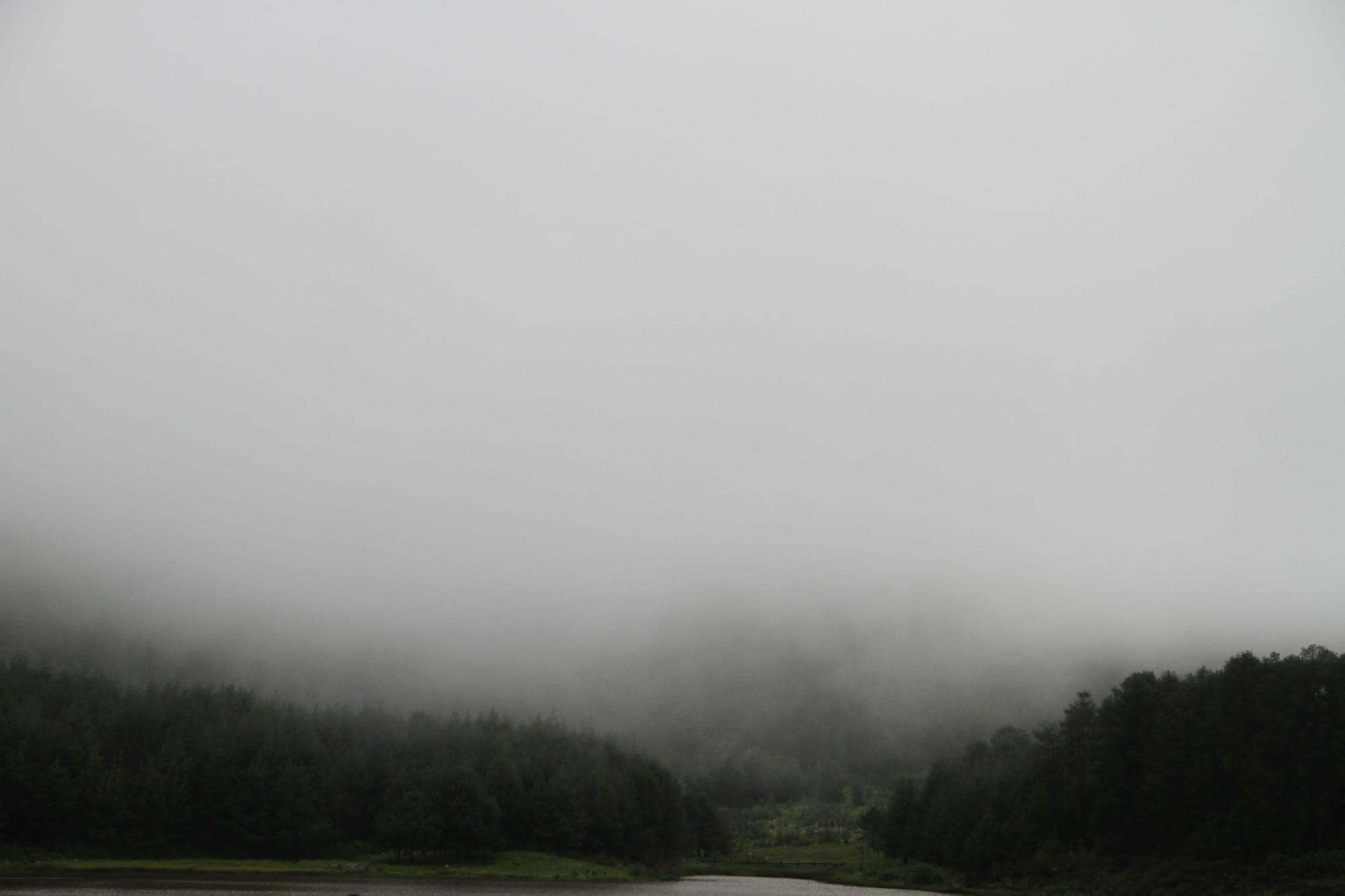
Dark pine forest along a stretch of still water, its upper slopes disappearing into low grey mist

The Eastern Highlands, Zimbabwe

Nyanga

Pine plantations and mist above a dam on the Nyanga plateau. (Tru Katsande iamtru / Wikimedia Commons · CC0)

A small highland village in north-eastern Zimbabwe, at about 1,680 metres among pine plantations, trout dams and waterfalls in the country's coolest corner. Originally spelt Inyanga, it serves the farms and forestry of the Nyanga plateau and is the usual base for Nyanga National Park and Mount Nyangani, Zimbabwe's highest mountain.

Neighbourhoods

  • Nyanga village centre
    • First-time visitors
    • Shops and transport

    A single main street of shops, banks, a post office, a market and the bus stop, with the district offices and a hospital nearby. It supplies the whole plateau and is where buses from Mutare and Harare terminate.

    Open in Maps
  • Nyamhuka
    • Local life
    • Markets

    The high-density township beside the village, where most people who work in the shops, schools, plantations and hotels live. Vendors, tuckshops, bars and churches give it the everyday life the village centre lacks.

    Open in Maps
  • The park and the dams
    • Walks
    • Quiet and residential

    South and west of the village the road runs into Nyanga National Park, past trout dams, pine and eucalyptus plantations and scattered lodges and campsites. This is where most visitors stay and where the walking begins.

    Open in Maps
  • Juliasdale and the Mutare road
    • Views
    • Country hotels

    A scattered settlement of hotels, farms and holiday houses south along the road to Mutare, spread over open granite country and msasa woodland with long views over the escarpment.

    Open in Maps

Things to do

The national park

  • Nyanga National Parkpark

    A high plateau park of grassland, pine and streams south of the village, with dams, walking routes and the ruins of old stone terraces and pit structures.

    Open in Maps
  • Mount Nyanganitrail

    Zimbabwe's highest mountain at about 2,590 metres, a long walk up open moorland from the car park, with sudden mist that has caused walkers to go missing.

    Open in Maps
  • Nyangombe Fallsattraction

    A wide, stepped waterfall where the Nyangombe river drops over granite slabs in the north of the park, a short walk from the road.

    Open in Maps
  • Pungwe Falls and Gorgeviewpoint

    A waterfall where the Pungwe river drops into a deep, densely wooded gorge, seen from the Pungwe View on the park's Scenic Road.

    Open in Maps

Waterfalls and the escarpment

  • Mutarazi Fallsattraction

    Zimbabwe's highest waterfall, dropping 762 metres in two stages from the lip of the escarpment into the Honde valley, in its own national park adjoining the southern edge of the Nyanga park.

    Open in Maps
  • World's View, Troutbeckviewpoint

    A lookout on the western edge of the Troutbeck plateau, where engraved granite plaques give the direction and distance of towns in Zimbabwe and South Africa across the country below.

    Open in Maps

Short trips from the village

  • Ziwa National Monumentlandmark

    Hillsides covered in stone-walled agricultural terraces, sunken pit structures and forts from a farming society of roughly the fifteenth to eighteenth centuries.

    Open in Maps
  • Honde Valleyattraction

    A hot, green valley of tea estates and banana plots beneath the escarpment, reached by a long descent from the plateau.

    Open in Maps

Eat and drink

Long-standing places and food districts in Nyanga. Hours, ratings and directions come from your maps app, always current.

Everyday eating

  • Nyanga village marketmarket

    Potatoes, peas, cabbages, apples and other highland produce sold by growers from the surrounding farms, with vendors cooking maize and selling maputi alongside.

    Open in Maps
  • Village centre takeawaysneighborhood

    Small counters along the main street serving sadza with stew and greens, rice and chips, and hot sweet tea with buns on cold mornings.

    Open in Maps
  • Country hotel dining roomsneighborhood

    The plateau's long-established hotels cook set menus around trout from the local dams, roasts and puddings, the main alternative to village and self-catering food.

    Open in Maps

Experience Nyanga

History

The Nyanga uplands were farmed long before any village stood here. Across the plateau lie stone-walled terraces stepping up the hillsides, sunken stone-lined pit structures that were probably cattle pens, and hill forts, the remains of a large farming society of roughly the fifteenth to eighteenth centuries, best seen at Ziwa to the north-west. The Manyika, who gave Manicaland its name, formed chiefdoms in these hills, and their descendants farm the same slopes.

European settlement came with the British South Africa Company in the 1890s, when Cecil Rhodes bought a large estate on the plateau in 1896, attracted by the cool climate, and built a homestead at what is now Rhodes Dam; his land later passed to the state and became the core of the national park. Settlers planted exotic pines and eucalyptus, stocked the streams and dams with trout brought from abroad, and built the hotels that made the district the colony's holiday retreat — a role it has never quite lost. The village, originally spelt Inyanga, grew as the service centre for those farms, plantations and hotels.

The liberation war of the 1970s reached the district hard, since the Mozambican border lies a short distance east and guerrilla groups crossed it. After independence the estates changed hands in stages, most sharply during the land reform of the 2000s, and the district's economy has since leaned on timber, smallholder farming, potatoes and a tourism trade that rises and falls with the country's fortunes.

Culture & Customs

This is Manyika country, and the dialect, the food and the church life are shared with Mutare and the districts between. The mountains carry a spiritual weight that outsiders notice quickly: Mount Nyangani is spoken of as a place with its own rules, stories of walkers vanishing in its mists are widely told and widely believed, and families with a connection to the mountain's shrines are treated with respect. Objects are not casually removed from the mountain, and guides will mention what should and should not be done up there.

Alongside this is a long tradition of the plateau as a holiday place. Generations of Zimbabwean families have come up for the cold weather, log fires, trout fishing and golf at the old country hotels, and school parties have camped in the park for decades, so the village sees a stream of domestic visitors as well as foreign ones. The two worlds — plantation and hotel on one side, smallholding and church on the other — sit close together on the same hills.

Church life is strong, from mission-founded congregations to the white-robed apostolic groups who meet in the open on Saturdays. Funerals draw relatives back from the cities, gardens and cattle are the common currency of conversation, and the cold of the highland winter shapes daily habits in a way it does nowhere else in Zimbabwe.

Daily Life

Nyanga is a village of a few thousand people serving a much larger rural district of scattered homesteads, and its scale shows: one main street, one market, a hospital and a cluster of schools. Most residents live in Nyamhuka and the villages around, and many work on the plantations, at the hotels and lodges, in the district offices or on their own land.

Farming sets the rhythm. The cool, wet uplands grow potatoes, cabbages, peas, apples and other temperate crops that struggle elsewhere in the country, alongside maize and beans for the household, and smallholders sell into Mutare and Harare. Pine and eucalyptus plantations and the sawmills that go with them are the other long-standing employer, along with trout farming and tourism. Cash is short, and many households depend on relatives working in the cities or abroad.

Mornings begin cold, often in mist, with fires lit for tea and school children walking long distances on the hill roads. Power cuts are routine and mobile signal comes and goes in the valleys, so plans are loose. Weekends bring church, football on rough pitches and funerals, and in the holiday seasons the roads fill with cars from Harare heading for the hotels and campsites.

Food

Everyday cooking follows the national pattern: sadza, the thick maize-meal porridge, eaten by hand with muriwo — covo, rape or pumpkin leaves cooked with tomato, onion and often peanut butter — beans, dried kapenta or matemba fish, and beef or chicken stew when there is money for it. Bota, the thinner breakfast porridge, is taken with peanut butter or sour milk on cold mornings.

What makes Nyanga different is what the altitude grows. Potatoes are the district's signature crop and appear boiled, roasted and in stews; peas, cabbages, carrots and temperate fruit such as apples and plums come from the same farms, and roadside stalls sell them by the bucket in season. Trout from the dams and streams, stocked since the colonial period, is the local speciality on hotel menus, usually grilled or pan-fried with butter, and macadamia nuts and honey are sold along the roads.

Drinks are hot and sweet more often than not: strong tea with plenty of sugar and milk, grown down in the Honde valley below the escarpment, is the drink of the cold mornings, and coffee from Chipinge appears too. Maheu, the thick fermented maize drink, sorghum beer brewed at home for gatherings, Chibuku from cartons and the usual lagers cover the rest.

Planning tools

Budget

Nyanga is one of the cheaper places in Zimbabwe to spend time outdoors: park campsites and simple lodges cost little, the walking is free beyond the park entry fee, and village food is inexpensive. The old country hotels and golf resorts on the plateau are a different level of spending altogether.

Daily Budget Midrange
USD 90–200 (a country hotel or lodge, car hire, guided hikes and park fees)
Daily Budget Shoestring
USD 35–60 (a park campsite or village guesthouse, local food, buses)

Bring US dollar cash in small notes and buy food in Mutare or the village market, since shops on the plateau are few and self-catering is common.

Best Time to Visit

April to October gives the clearest skies and driest paths, the best conditions for hill walking, and May to August brings crisp days, cold nights and log fires in the hotels, with frost on the high ground. The rains from November to March turn the plateau brilliantly green and fill the waterfalls, but mist and cloud often close in on the peaks.

Suggested Number of Days

Two or three days suit the village and the park around it. Four or five allow for longer walks and the wider plateau. How long depends mainly on the weather and on whether a vehicle is available, as the sights are spread out.

First Visit
2–3 days
With Surroundings
4–5 days

Transportation

The village is small enough to walk, and pick-ups and kombis run to the surrounding villages, Juliasdale and Mutare, thinning out in the afternoon. There is no public transport inside the national park: a hire car, a lodge vehicle or a long walk is needed. Roads on the plateau are narrow, some are dirt, and mist can reduce visibility to a few metres.

Use a high-clearance vehicle for the park's rougher tracks, allow extra time in mist, and keep documents and small change ready for police roadblocks.

Airport & Station Connections

Nyanga lies about 115 kilometres north of Mutare by a good mountain road, and roughly 265 kilometres east of Harare, a drive of some four hours. Buses and kombis run from both cities and from Rusape, and many visitors arrive by hire car. There is no scheduled air service; the nearest airports are at Harare and Mutare.

Walkability

The village centre is small and easily covered on foot, and Nyamhuka is a short walk from it. Everything else is a distance away over hilly ground, and the park's trails are proper hill walking rather than strolls, with steep sections, cold wind and fast-changing weather at altitude.

Safety

The plateau is peaceful and crime against visitors is rare. The risks are natural: sudden mist on Mount Nyangani, where walkers have gone missing, steep and slippery paths beside the waterfalls, cold nights, and flash floods in heavy rain. Mobile coverage is patchy in the valleys.

Take malaria precautions in the low-lying areas, avoid political gatherings, don't drive at night, keep documents and small change ready for roadblocks, and don't swim in still fresh water outside managed sites. Walk with a guide or register with park staff, carry warm and waterproof clothing, and turn back if cloud comes in. Check current official travel advice before travelling.

Climate

Cool and wet by Zimbabwean standards, the result of altitude at about 1,680 metres in the village and higher on the peaks, with mist common all year. Summer falls in December to February and winter in June to August, as elsewhere in the southern hemisphere.

Summer
warm and wet, generally 20–26°C by day with frequent mist and afternoon storms
Winter
dry sunny days of 15–22°C with cold nights and frost on the high ground

Local Customs

Shona in its Manyika dialect is the everyday language, with English used in business. Greetings, often with cupped hands clapped in thanks, come before any request, and elders are addressed first. Churches are central to community life. The mountain is treated as a place of spiritual weight, and local people speak of it with care rather than bravado.

Ask before photographing people or homesteads, respect park rules and any local requests about behaviour on Mount Nyangani, dress warmly and modestly, and tip guides and lodge staff a small amount.

Common Payment Methods

The US dollar is used for most payments, alongside the ZiG, and park fees and lodges are quoted in dollars. Card machines and cash machines are unreliable on the plateau, so notes in small denominations should be drawn in Mutare or Harare before arriving.