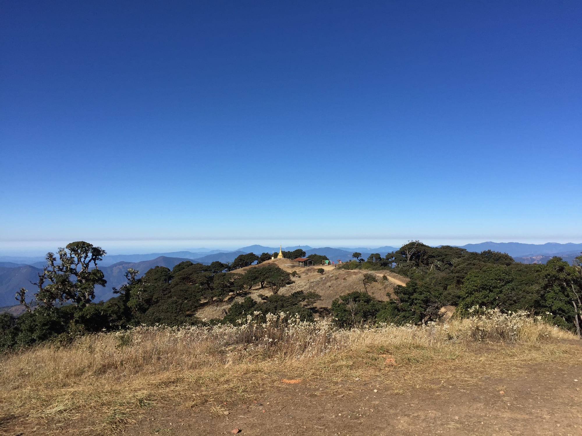
Dry grass and dark trees on a hilltop with a small golden stupa, above layers of blue forested ridges under a clear sky

Myanmar

Kachin, Sagaing & the North

The summit of Nat Ma Taung, or Mount Victoria, in the southern Chin hills. (Lionslayer / Wikimedia Commons · CC BY-SA 4.0)

Myanmar's mountainous north and north-west — Kachin State under the eastern Himalaya, the Chindwin valley of Sagaing and the Chin hills on the Indian border — a region of mostly Christian hill peoples, jade and amber mines, and some of the heaviest fighting since the 2021 coup. This page is written to explain the region, not to encourage travel.

Explore Kachin, Sagaing & the North

History

The north was long a frontier. The Pyu city of Halin, in Sagaing Region, is among the earliest walled towns in the country and part of the Pyu Ancient Cities World Heritage Site. Later the Burmese kingdoms held the Mu and Chindwin valleys, and Shwebo, north of Sagaing, was the home town of Alaungpaya, who founded the Konbaung dynasty there in 1752. Sagaing and Inwa across the river served as royal capitals at different times. The hills beyond were the domain of Kachin, Chin, Naga and Shan peoples who paid tribute when the kingdoms were strong and ignored them when they were not.

Britain annexed Upper Burma in 1885 and campaigned into the Chin and Kachin hills over the following years, governing them separately from Burma proper as Frontier Areas. American Baptist missionaries converted much of both peoples to Christianity. In the Second World War Myitkyina, on the supply route to China, was taken by Allied and Chinese forces in 1944 after a long siege.

Kachin and Chin leaders signed the Panglong Agreement with Aung San in 1947, but the Kachin Independence Army took up arms in 1961 and fought, with a long ceasefire from 1994, until war resumed in 2011. Sagaing, heartland of the Bamar, became a stronghold of armed resistance after the 2021 coup, while Chin resistance forces came to control most of Chin State and the Kachin Independence Army captured many army bases in Kachin State. In March 2025 an earthquake centred near Sagaing caused heavy damage.

Culture & Customs

The region's peoples differ sharply. Sagaing's lowlands are Bamar and Buddhist, and the Sagaing hills, crowded with monasteries and nunneries, are one of the country's great centres of monastic life. The Kachin — a group of related peoples including the Jinghpaw, Lisu, Rawang, Lhaovo, Lachik and Zaiwa — are mostly Christian, and their great festival is the Manau, a mass dance around painted poles in Myitkyina, held in January around Kachin State Day.

The Chin are overwhelmingly Christian too, with many churches in every hill town, and speak dozens of related languages that often differ from valley to valley. Older women in the southern Chin hills still carry the facial tattoos of a vanishing custom. In the far north-west of Sagaing, the Naga hold their New Year festival each January.

Identity here is bound up with the long struggle against the central state, and local languages, churches and armed organisations are part of daily loyalty. Among Buddhist Bamar, the region's traditions include the thanaka paste harvested around Shwebo and the pagoda festivals of Sagaing's hills.

Daily Life

Myitkyina, the Kachin capital, is the largest town in the far north, with about 150,000 people; Monywa is Sagaing's commercial centre on the Chindwin, and Sagaing, Shwebo, Kalay and the Chin capital Hakha are the other main towns. Chin State is the country's poorest, and many Chin work abroad, especially in Malaysia, India and the United States.

Kachin State's economy is extraction: jade from Hpakant, famous for gem-quality jadeite, where landslides in waste heaps have killed hundreds of miners; amber from the Hukawng Valley; gold and rare-earth mining; and logging. Much of this trade runs through armed groups and across the Chinese border. Sagaing grows rice, pulses and wheat, and the Letpadaung copper mine near Monywa has been a long source of protest.

Daily life since 2021 is shaped by war. Hundreds of thousands of people have been displaced across Sagaing, Chin and Kachin, schools and clinics are run by resistance administrations in some areas, and electricity, mobile signal and internet are cut for long periods. Churches, monasteries and camps shelter families who have fled air strikes and burned villages.

Food

Kachin cooking is one of the most distinctive in the country, built on cold-climate ingredients such as potatoes, wild game like venison and wild boar, and foraged herbs and greens. Japhtu, a spicy relish of pounded chillies and garlic, is a typical side dish, and so are salted or preserved bamboo shoots. Shat jam, a dish of boiled rice with beans, carrots, mushrooms and fried onions, is another Kachin staple.

Chin food is plain mountain fare built on maize, millet and rice. A well-known dish is sabuti, a hominy corn soup served at holidays alongside rice cakes. The Chin also brew zu, a home-made alcohol of fermented grain that plays a ritual role in Chin culture.

In Sagaing's lowlands the food is Bamar: river fish from the Chindwin and Ayeyarwady in curries, pulses, laphet thoke tea-leaf salad, palm jaggery and teashop milk tea, much as in Mandalay across the river.

Attractions & Natural Wonders

In Kachin State, Myitkyina sits on the Irrawaddy, and about 40 kilometres to the north the Mali and N'Mai rivers meet at Myitsone, the river's traditional source and a sacred place for the Kachin. The Chinese-backed dam planned there was suspended in 2011 after nationwide protest. South-west of Myitkyina, Indawgyi Lake, the country's largest, is a wildlife sanctuary for waterbirds with the Shwe Myitzu Pagoda standing offshore. Putao, in the far north, is the base for treks towards Hkakabo Razi, at about 5,880 metres usually counted the highest mountain in Southeast Asia, whose national park is a stronghold of the country's biodiversity.

Sagaing Region's sights cluster by its rivers. Monywa, on the Chindwin, has the Thanboddhay Pagoda and the Bodhi Tataung complex, where a standing Buddha more than 100 metres tall rises over a reclining one. Across the river the Hpo Win Daung caves hold hundreds of Buddha images and murals carved into sandstone. Nearer Mandalay are the Sagaing hills and, on the far bank, Mingun, with its unfinished giant pagoda and huge bronze bell.

The Chin hills rise to Mount Victoria, or Nat Ma Taung, reached from Kanpetlet and Mindat and protected as a national park known for rhododendrons and rare birds. In the north of the state, Rih Lake near the Indian border and the hill towns of Hakha and Falam complete the region.

Cities in Kachin, Sagaing & the North

Planning basics

Budget

Before 2021 the north was costly to reach rather than costly to stay in: Putao and much of Chin State needed permits, guides and flights, while Monywa and Myitkyina had cheap guesthouses. Today most of the region is a conflict zone where normal tourist spending is not possible, and fuel, food and transport prices have risen sharply.

Daily Budget Midrange
USD 80–200 (flights to Myitkyina or Putao, permits, guide and driver)
Daily Budget Shoestring
USD 25–45 where travel is possible (basic guesthouse, local food, buses)

Remote areas once required permits and licensed guides; under current conditions most of the region should be treated as closed to visitors.

Safety

This is one of the most dangerous parts of Myanmar. Sagaing's countryside, Chin State and much of Kachin State have seen sustained fighting between the army and resistance or ethnic armed groups since 2021, with air strikes on villages, burned settlements, landmines and very large numbers of displaced people. Control of towns and roads has changed hands, the jade mines of Hpakant are lawless and deadly, and consular help is effectively unavailable.

Do not travel to this region; if already in Myanmar, stay out of conflict areas and keep in contact with the relevant embassy. Check current official travel advice before travelling.

Climate

The north is cooler and wetter than central Myanmar. Kachin State takes the full monsoon from about May to October, and its northern mountains carry snow; the Chin hills are mild by day and cold at night, with frost on Mount Victoria in winter. Sagaing's southern lowlands around Monywa belong to the hot, dry central zone.

Summer
hot and humid in the valleys, 30–38°C around Monywa before the rains; heavy monsoon rain in Kachin and Chin from May to October
Winter
dry and clear; cool in Myitkyina, cold nights in the Chin hills and Putao, snow on the Himalayan peaks

Transportation

Distances are long and roads poor. Myitkyina and Putao have airports, and the railway from Mandalay to Myitkyina takes the best part of a day or more. Monywa is a few hours by road from Mandalay, and boats once ran up the Chindwin towards Hkamti. Chin State is reached on steep mountain roads that landslides cut in the monsoon. Much of the road network now runs through contested territory, with checkpoints, closures and landmines.

Treat all overland movement in the north as unsafe; land borders with India and China are not reliable exits.

Best Time to Visit

In climate terms, November to March, when the roads are dry and the mountains clear; the Kachin Manau festival falls in January. The weather is secondary: fighting across Sagaing, Chin and Kachin since 2021 has put most of the region beyond safe reach.