History · Caribbean Netherlands
The Caribbean Netherlands: Three Islands, One Country
Bonaire's salt pans, Statia's smugglers' harbour, and Saba's cloud-wrapped village — three scraps of the Dutch Caribbean that became part of the Netherlands itself
By Globeway Editorial · 30 September 2026
Three islands that are not a country
The "Caribbean Netherlands" is an odd unit: three small islands that are legally part of the Netherlands itself, as "special municipalities", rather than a separate country. They have almost nothing in common with each other. Bonaire is a flat, dry, Papiamentu-speaking island off the coast of Venezuela, ringed by coral reef and edged with salt. Sint Eustatius and Saba are tiny English-speaking volcanic rocks in the northern Lesser Antilles, hundreds of kilometres away. What links them is a shared Dutch colonial past and a shared outcome, in 2010, that bound them directly to the Netherlands rather than leaving them to strike out alone.
A short history
- pre-1500
The Caquetío
Arawak people from Venezuela settle Bonaire; the northern islands are used by Kalinago.
- 1636
The Dutch West India Company
The Company takes Bonaire, two years after Curaçao, and claims Statia; Dutch settlers reach Saba in the 1640s.
- 17th–19th c.
Salt and sailors
Bonaire is a company salt plantation worked by enslaved people; Saba raises seamen.
- 1770s–1780s
The Golden Rock
Sint Eustatius becomes one of the busiest free ports in the Caribbean.
- 16 November 1776
The First Salute
Statia's fort salutes an American ship — often called the first foreign recognition of the United States.
- 1781
Rodney's sack
A British fleet plunders Statia; its trade never recovers.
- 1863
Emancipation
Slavery is abolished in the Dutch colonies.
- 10 October 2010
Integration
The Netherlands Antilles is dissolved; the three islands become Dutch special municipalities.
Bonaire: salt and the ABC islands
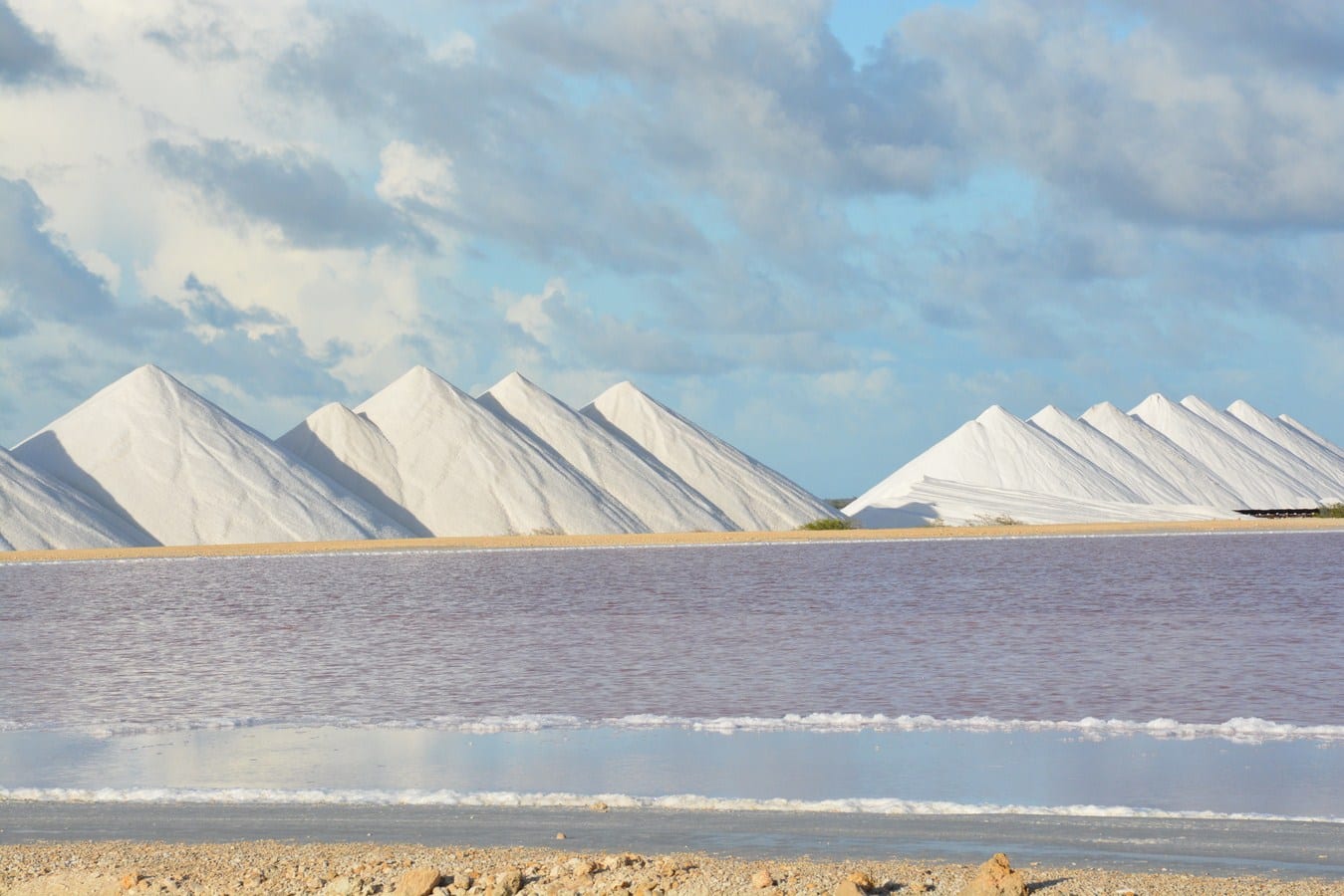
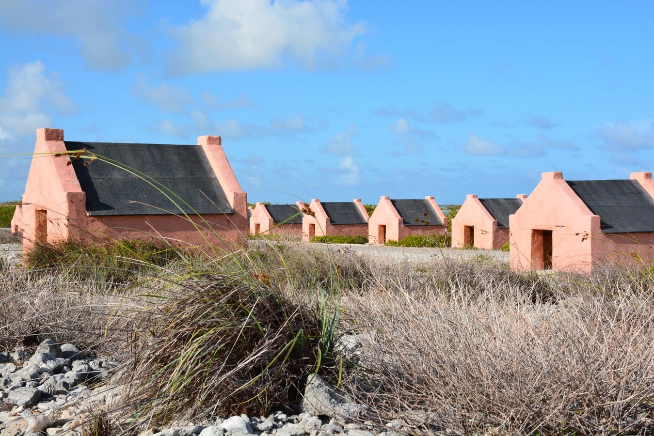
Bonaire was settled around a thousand years ago by the Caquetío, an Arawak people from the Venezuelan mainland, who left rock paintings in its caves. Spain claimed the island in 1499, shipped most of the Caquetío away as forced labour, and later used it to graze cattle. The Dutch West India Company seized it in 1636, two years after taking Curaçao, and ran it as a company property — livestock, and above all salt, raked from the great lagoon in the south by enslaved Africans in brutal heat. The little stone huts still standing by the salt pans housed those workers.
After slavery ended in 1863, Bonaire lived on salt — now an industrial operation — on aloe, and on the wages its men sent back from the oil refineries of Aruba and Curaçao. In recent decades it has run on diving tourism and, since 2010, ever closer ties with the European Netherlands. Low and coral-dependent, it is now one of the Caribbean's front lines for climate change.
Sint Eustatius: the Golden Rock
Sint Eustatius — Statia — is barely 21 square kilometres, but in the 18th century it was one of the most important places in the Caribbean. The Dutch made it a free port with no customs duties, and in the 1770s and 1780s it became "the Golden Rock": a harbour crowded with shipping, a waterfront lined with warehouses, a major transshipment point for enslaved people, and a merchant community that included a Jewish congregation whose synagogue, Honen Dalim, dates from 1737.
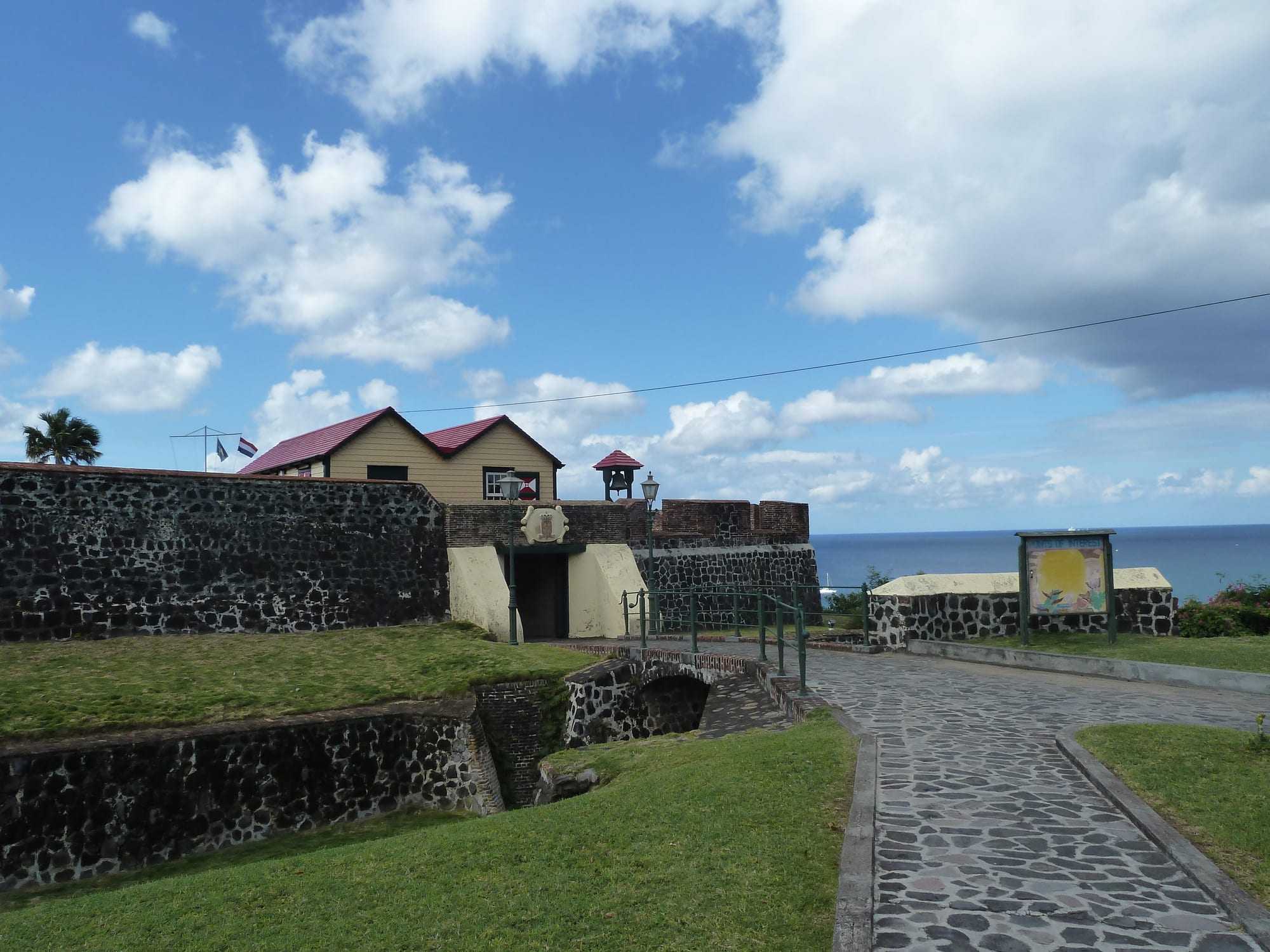
Statia sold arms and supplies to the American rebels, and in 1776 its fort fired a salute to a ship flying the new Continental colours. Britain took its revenge in 1781, when a fleet under Admiral Rodney seized the island and stripped it — warehouses, ships, and the property of merchants of every nationality, including the Jewish community. Control of Statia changed twenty-one times among the Dutch, British and French before the early 19th century, and its trade never came back. It sank into a poor, half-empty backwater, and in 2018 the Netherlands dissolved its island council and put it under a government commissioner after an inquiry found gross neglect of duties, including financial mismanagement; local self-government has been restored in stages since 2020.
Saba: the island of sailors
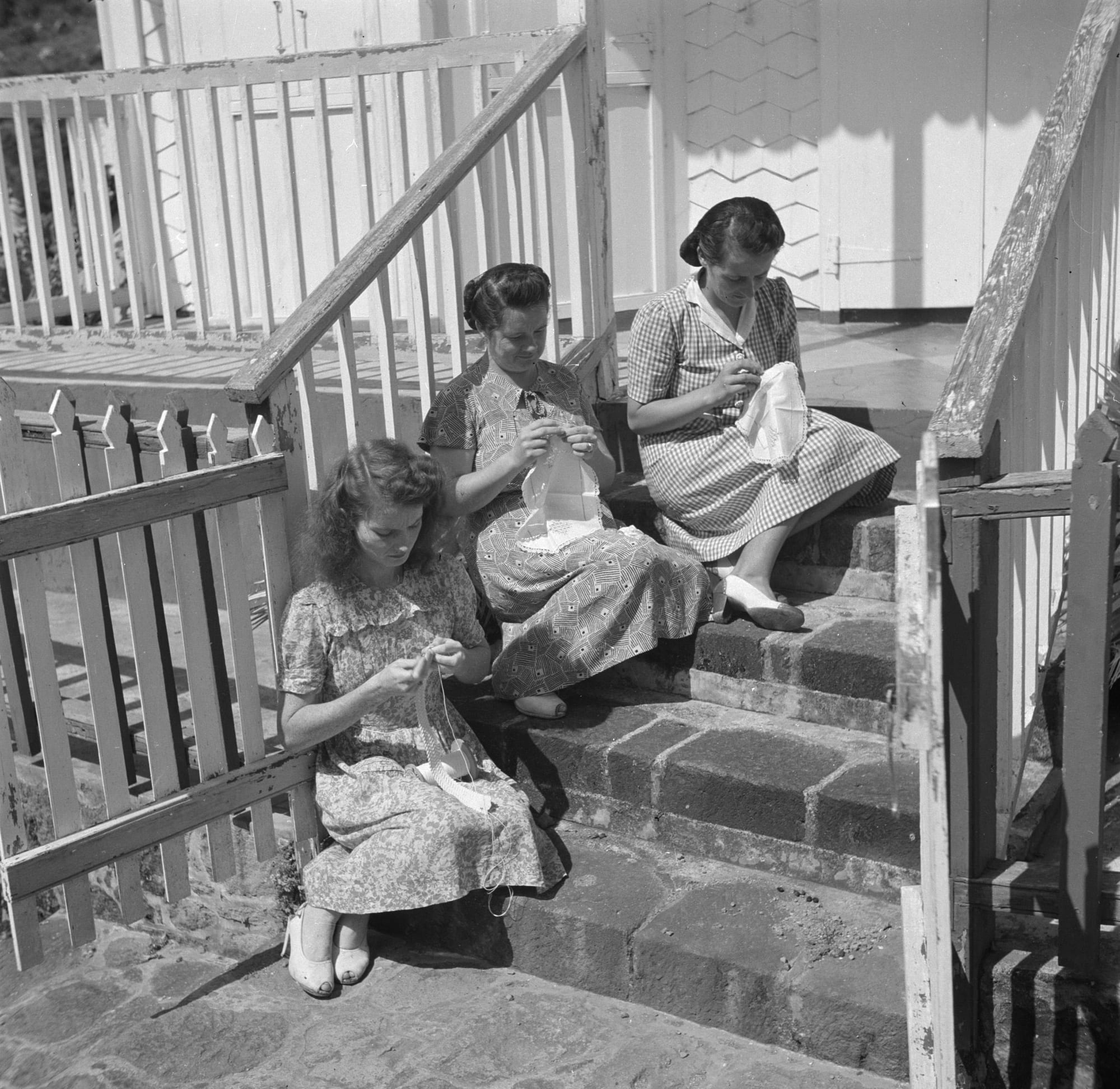
Saba is smaller still — a single steep green cone rising to Mount Scenery, at 870 metres the highest point in the entire Kingdom of the Netherlands. It has almost no sandy beaches and almost no flat ground; its four villages cling to the slopes. The Dutch settled it in the 1640s, and it became a community of English-speaking small farmers and, above all, sailors: so many of its men spent long years at sea that it became known as "the Island of Women", and from the late 19th century the women made "Saba lace", which they sold by mail order abroad.
Saba's airport, opened in 1963, has the shortest commercial runway in the world, 400 metres long, and same-sex marriage has been legal there, as on Bonaire and Statia, since 2012.
Becoming part of the Netherlands
From 1954 all six Dutch Caribbean islands were governed together as the Netherlands Antilles, a self-governing country within the Kingdom, run from Curaçao. Aruba broke away in 1986, and by the 2000s the rest wanted out too. When the Antilles was formally dissolved on 10 October 2010, Curaçao and Sint Maarten became separate countries within the Kingdom — but Bonaire, Sint Eustatius and Saba, too small to stand alone, became instead special municipalities of the Netherlands itself — Bonaire and Saba had voted for closer ties with the Netherlands, while Statia had voted to keep the Antilles. Their people are Dutch citizens, they use the US dollar, and they are governed by Dutch law adapted to island conditions — though they remain outside the European Union.
What the islands keep
The three islands of the Caribbean Netherlands are a reminder that Dutch expansion in the Caribbean was never about large plantation colonies but about specific, practical uses: a salt lake, a duty-free harbour, a supply of sailors. Each island kept its own language, its own character and its own economy through the centuries, and in 2010 all three stopped being colonies in the old sense and simply became part of the metropole — Bonaire and Saba by choice, Statia once the old federation it had voted to keep was gone.