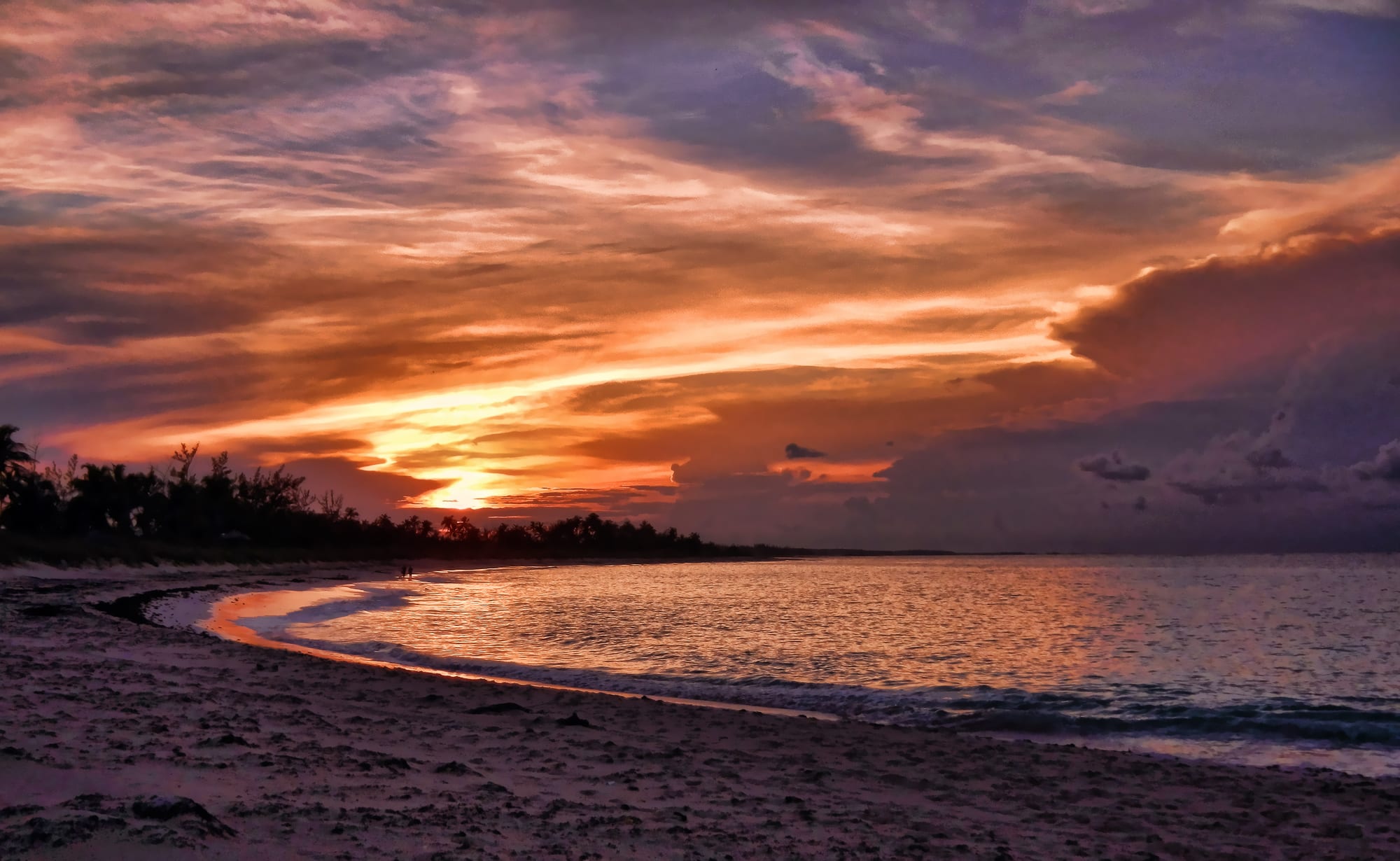
Orange and purple sunset clouds over a curving sandy beach and calm sea, with a line of palms and trees on the left

The Bahamas

Eleuthera

Sunset over a beach on the Atlantic coast of Eleuthera near Governor's Harbour. (Trish Hartmann from Tampa, Florida, USA / Wikimedia Commons · CC BY 2.0)

A long, thin island about 50 miles east of Nassau, stretching some 110 miles between the Atlantic and the shallow Great Bahama Bank. Settled in 1648 by Puritans from Bermuda who named it after the Greek word for free, it later grew pineapples for export; today small settlements, pink-sand beaches, caves and the narrow Glass Window draw quiet tourism.

Neighbourhoods

  • Governor's Harbour
    • First-time visitors
    • Close to services
    • Historic district

    The administrative centre in the middle of the island, which claims to be where the Eleutheran Adventurers began the post-Lucayan Bahamas in 1648. It has a ferry dock, a Friday-night fish fry, and an airport a short drive north, with Atlantic beaches close by.

    Open in Maps
  • North Eleuthera and Gregory Town
    • Beaches
    • Caves
    • Surfing

    The northern part of the island, with sandy beaches between limestone cliffs, Preacher's Cave, the Glass Window and the Hatchet Bay caves. Gregory Town, known for its pineapple festival, sits near Surfer's Beach, and the North Eleuthera airport is the gateway to Harbour Island and Spanish Wells.

    Open in Maps
  • Tarpum Bay
    • Local life
    • Quiet and residential

    One of the larger settlements, south of Governor's Harbour, with brightly painted buildings, a large waterside Anglican church and two fishing docks where fishermen sell their catch.

    Open in Maps
  • Rock Sound and South Eleuthera
    • Local life
    • Caves
    • Beaches

    The main town of the south, with about a thousand people, its own airport, the Ocean Hole and nearby caves, and the road on to Lighthouse Beach near the island's southern tip.

    Open in Maps

Things to do

Caves, beaches and the water

  • Hatchet Bay Cavesattraction

    A cave system south of Gregory Town, explored with a torch, with a small colony of bats.

    Open in Maps
  • Surfer's Beachbeach

    A beach south of Gregory Town known for its surfing.

    Open in Maps
  • Ocean Holeattraction

    A natural pool in Rock Sound where visitors swim with and feed the fish.

    Open in Maps
  • Leon Levy Native Plant Preservepark

    A 25-acre preserve opened in 2010 as Eleuthera's first national park, with more than 170 species of native plants.

    Open in Maps

Short trips

  • Glass Window Bridgeviewpoint

    The island's narrowest point, where a strip of rock about 30 feet wide separates the deep blue Atlantic from the Bight of Eleuthera.

    Open in Maps
  • Queen's Bathattraction

    A natural bathing spot a mile or so south of the Glass Window.

    Open in Maps
  • Preacher's Caveattraction

    The cave in the far north where the shipwrecked Eleutheran Adventurers sheltered and held services in the mid-17th century; Arawak remains have been found there, and a plaque marks the entrance.

    Open in Maps
  • Lighthouse Beachbeach

    A beach at the southern end of the island, near the Bannerman lighthouse.

    Open in Maps
  • Spanish Wellsneighborhood

    A fishing town on St George's Cay, just off the northern tip of Eleuthera, with about 1,600 people at the 2022 census.

    Open in Maps

Seasonal events

  • Junkanoo in Tarpum BayChristmas season

    Tarpum Bay's Junkanoo parade, with costumed groups dancing to drums, cowbells and whistles.

Eat and drink

Long-standing places and food districts in Eleuthera. Hours, ratings and directions come from your maps app, always current.

Eleuthera classics

  • Governor's Harbour fish frymarket

    The Friday-night fish fry on the waterfront, where locals and visitors meet for food, drinks and loud music.

    Open in Maps
  • Tarpum Bay fishing docksmarket

    Local fishermen sell their catch daily at the settlement's two docks.

    Open in Maps
  • Sammy's Placerestaurant

    A local restaurant and bar in Rock Sound serving Bahamian food.

    Open in Maps

Experience Eleuthera

History

The island's first known people were Taíno, or Lucayans, who called it Cigatoo; in the 16th century the Spanish enslaved them and shipped them to Hispaniola. In 1648 Puritan colonists from Bermuda, the Eleutheran Adventurers led by Captain William Sayle, arrived in search of religious freedom. Shipwrecked off the north end, they sheltered in what is now Preacher's Cave and gave the island its name, from the Greek eleutheros, "free". Governor's Harbour claims to be where their settlement, and the post-Lucayan Bahamas, began.

Farming shaped the island for centuries, and between 1950 and 1980 Eleuthera was agriculturally prosperous, with a large crop of pineapples for export. The United States also ran a naval facility near Governor's Harbour Airport, a shore station of its Sound Surveillance System. Independence in 1973 brought new ownership laws that changed the island economy, and tourism became its principal business.

Recent years have brought new developments. In 2019 a cruise line bought the Lighthouse Point property on the island and agreed a development plan with the government; it opened to the line's passengers in June 2024. In 2021 the government announced a $30 million upgrade for the Glass Window Bridge, at the island's narrowest point.

Culture & Customs

Eleuthera's identity rests on its claim to be the birthplace of the Bahamas, and Preacher's Cave, with its plaque to the Eleutheran Adventurers, marks the site of that first settlement. Locals call the island Lutra, and its settlements — Gregory Town, Governor's Harbour, Tarpum Bay, Rock Sound and many smaller ones strung along the Queen's Highway — are small, close-knit and centred on their churches; Tarpum Bay's large Anglican church stands right on the water.

The calendar follows island traditions. Gregory Town holds an annual Pineapple Festival in honour of the crop that once made the island prosperous, and Tarpum Bay holds a Junkanoo parade at Christmas. The Friday-night fish fry at Governor's Harbour is the weekly social gathering.

Nature and the sea are close to daily life: fishermen sell their catch at the docks, surfers ride the Atlantic swell south of Gregory Town, and caves and beaches are explored by locals and visitors alike. The Leon Levy Native Plant Preserve, Eleuthera's first national park, has become a popular destination for local teachers and schoolchildren.

Daily Life

About 9,100 people lived on Eleuthera island at the 2022 census, with more on Harbour Island and in Spanish Wells. The population is spread thinly along the island in settlements such as the Bluff and Upper and Lower Bogue in the north and Wemyss Bight in the south; Governor's Harbour is the administrative capital, and Rock Sound and Tarpum Bay are among the larger towns.

Tourism is the main economic activity, with small hotels, cottages, guesthouses and restaurants, while a small share of the population works in fishing and farming. Three public high schools serve the island, in Lower Bogue, North Palmetto Point and Rock Sound.

Life depends on the Queen's Highway, the principal road that joins the settlements, and on the planes and ferries to Nassau. Hurricane season is watched closely, and the Glass Window Bridge, which carries the road across the island's narrowest point, is the vital link between north and south.

Food

Eleuthera's cooking is Family Island cooking: conch salad, made with raw conch; cracked conch and conch fritters; fried and grilled fish bought fresh at docks such as Tarpum Bay's; and spiny lobster. Plates come with peas 'n' rice, baked macaroni "pie" and coleslaw. Tarpum Bay, renamed after the tarpon fish once found there, still has fishermen selling their catch at its two docks every day.

The pineapple is the island's emblem, celebrated at Gregory Town's Pineapple Festival. Souse, a lime-and-pepper broth, and johnnycake are often eaten for breakfast, and guava duff, a boiled pudding with guava folded into the dough and served with a sauce, is the classic dessert.

The Friday-night fish fry in Governor's Harbour is the best-known place to eat like a local, and small restaurants in Rock Sound, Governor's Harbour and the other settlements serve home-style Bahamian food. Kalik and Sands beer and Bahamian rum are the usual drinks.

Planning tools

Budget

Eleuthera is expensive in the way of all the Family Islands: food and fuel are imported and there are few large hotels. A hire car is close to essential and is one of the main daily costs, while self-catering in rented cottages keeps food spending down.

Daily Budget Midrange
USD 300–600 (small resort or cottage, restaurants, car hire, a boat trip)
Daily Budget Shoestring
USD 130–200 (guesthouse or cottage, self-catering, a shared hire car)

Cars are hired from local owners rather than chains; many will meet arrivals at the airport.

Best Time to Visit

Mid-December to mid-April brings the most reliable weather along with the highest prices. May and early June are a good-value shoulder. Late summer and autumn are hotter and wetter, with a real risk of hurricanes. Junkanoo comes at Christmas.

Suggested Number of Days

The island is long, and driving from one end to the other takes time, so three or four days suit one part of it. A week allows the whole length of the island and a crossing to the neighbouring cays.

First Visit
3–4 days
With Surroundings
6–7 days

Transportation

The Queen's Highway runs the length of the island, and a hire car is the best way to explore, and there are also taxis. Cars are rented from local owners, sometimes combined with a petrol station or taxi firm. Cycling is possible but hilly around Gregory Town. Traffic drives on the left.

Watch for overtaking cars on the Queen's Highway, especially when cycling.

Airport & Station Connections

Three airports serve the island: North Eleuthera, in the north and the gateway to Harbour Island; Governor's Harbour Airport, in the middle of the island about 8 miles north of the town, with services to Nassau; and Rock Sound International Airport in the south. Flights from Nassau take less than half an hour. Ferries from Nassau dock at Governor's Harbour, Spanish Wells and Harbour Island.

Walkability

The settlements are small and walkable, but they are spread along more than 100 miles of road, and beaches, caves and the Glass Window are far apart. Everything beyond a single village needs a car.

Safety

The Family Islands are very safe and quiet. Nassau needs more care: there is significant gun and gang violence, but it is concentrated in specific residential districts away from the tourist areas, and armed robberies and thefts targeting visitors do occur. Eleuthera is one of the Family Islands; the main risks are on the roads and in the sea.

Take care on the rocks at the Glass Window and Queen's Bath, carry a torch in the caves, and watch for overtaking cars. Check current official travel advice before travelling.

Climate

Tropical and warm all year, steadied by the trade winds. The drier, slightly cooler season runs from December to April; May to October is hotter, more humid and wetter, and overlaps the hurricane season, which runs from June to November.

Summer
hot and humid on Eleuthera, warmer than the winter highs of 77–82°F typical of the Bahamas, with frequent afternoon showers
Winter
highs around 77–82°F across the Bahamas, with low rainfall and some cool northerly spells

Local Customs

English is spoken everywhere, and locals call the island Lutra. The settlements are small and close-knit, and church is central to their life. Many hotels and restaurants add a service charge, so check the bill before tipping.

Ask before photographing people and their homes, and drive slowly through the settlements.

Common Payment Methods

The Bahamian dollar is pegged one-to-one to the US dollar, and US dollars circulate freely. Cards are accepted at resorts and some businesses, but ATMs are scarce on the Family Islands, so carry cash for car hire, fish fries, small shops and taxis.