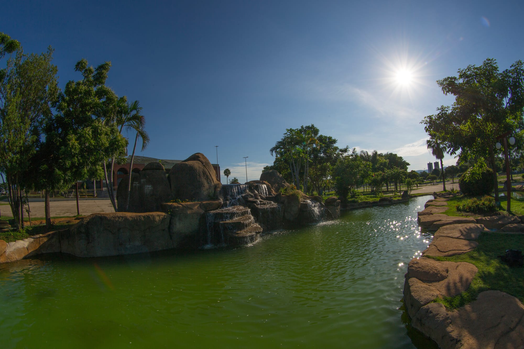
An artificial waterfall over rocks into a green pool, framed by trees and palms under a bright blue sky

Belém & the Eastern Amazon, Brazil

Palmas

The Cascata in the Sunflower Square, Palmas, representing the rivers and waterfalls of Tocantins. (Flávio André - MTUR / Wikimedia Commons · Public domain)

The capital of Tocantins, Brazil's newest state, built from scratch on former farmland from 1989 on a plan inspired by Brasília. Wide avenues, preserved cerrado trees and one of the world's largest squares mark its centre, and since 2002 a hydroelectric reservoir on the Tocantins River has given it lakeside beaches. It is the usual starting point for the Jalapão.

Neighbourhoods

  • Plano Diretor
    • First-time visitors
    • Government buildings
    • Close to the square

    The planned core of the city, laid out around the Sunflower Square and the Araguaia Palace, from which its streets and avenues were designed. Wide avenues, large blocks and green strips of original trees give it a spacious, car-oriented feel.

    Open in Maps
  • Taquaralto and the Aurenys
    • Local life
    • Markets and shops

    The southern districts of the city, linked to the planned centre by Avenida Teotônio Segurado, and busier and more everyday than it.

    Open in Maps
  • Taquaruçu
    • Waterfalls
    • Crafts
    • Nature

    A village district in the hills about 30 km from the city, known for the many waterfalls around it, for swimming and rappelling, and for handicrafts made from golden grass, babaçu and local seeds.

    Open in Maps

Things to do

The Sunflower Square

  • Sunflower Squarelandmark

    The main square of the city, inaugurated in 1991 and one of the largest squares in the world, where the foundation stone of Palmas was laid in 1989.

    Open in Maps
  • Araguaia Palacelandmark

    The seat of the Tocantins government, inaugurated in 1991 at the centre of the master plan, the point from which the city's streets and avenues were designed.

    Open in Maps
  • Prestes Column memoriallandmark

    A memorial in the square by Oscar Niemeyer recalling the passage of the Prestes Column, the rebel march of the 1920s, through Tocantins.

    Open in Maps
  • Monument to the Biblelandmark

    A sculpture of a man holding the Bible towards the sky, at the centre of a compass rose laid in Portuguese stone at the north end of the square.

    Open in Maps
  • Krahô Squarepark

    A section of the Sunflower Square paying tribute to the Indigenous peoples of Tocantins.

    Open in Maps

The lake

  • The reservoir beachesbeach

    Freshwater beaches a few kilometres from the centre on the reservoir created in 2002 by the Lajeado dam on the Tocantins River.

    Open in Maps
  • Fernando Henrique Cardoso Bridgelandmark

    An 8 km bridge across the reservoir, built with the dam, linking Palmas with the BR-153 highway and Luzimangues.

    Open in Maps

Short trips from the city

  • Taquaruçu waterfallstrail

    The waterfalls in the hills around the village of Taquaruçu, about 30 km away, where people swim and practise rappelling.

    Open in Maps
  • Lajeado State Parkpark

    A state park mostly within the municipality, protecting a fragile, dry, hilly area of cerrado near the capital.

    Open in Maps

Eat and drink

Long-standing places and food districts in Palmas. Hours, ratings and directions come from your maps app, always current.

Palmas classics

  • Lakeside kiosks and restaurantsneighborhood

    Kiosks and restaurants by the reservoir beaches, where grilled river fish and cold drinks are the usual order.

    Open in Maps
  • Restaurants in the Plano Diretorneighborhood

    Most of the city's restaurants, bars and per-kilo lunch places are spread along the avenues of the planned centre.

    Open in Maps

Experience Palmas

History

Palmas is Brazil's youngest state capital. The state of Tocantins was created under the 1988 constitution from the northern part of Goiás, and a commission to build its new capital, named Novacap, was set up in March 1989. On 20 May 1989 the foundation stone was laid in a ceremony attended by some 10,000 people on the site of today's Sunflower Square, on former farmland near the Tocantins River. In 1990 Palmas replaced the temporary capital, Miracema do Tocantins, and the Araguaia Palace, seat of the state government, was inaugurated in March 1991.

The city was laid out with its own master plan, its zoning inspired by Brasília, with a symmetrical park at its centre and a long central avenue running north to south. Builders preserved many of the original cerrado trees in green strips along the avenues, so many of the street trees are older than the city itself.

Growth was rapid. Palmas had about 24,000 people in 1991 and over 130,000 by 2000, and the population more than doubled again in the following years as migrants arrived from across Brazil. In 2002 the Lajeado hydroelectric dam was completed on the Tocantins River, creating a large reservoir beside the city that gave it beaches, and an 8 km bridge across it linked Palmas with the BR-153 highway.

Culture & Customs

As a new city, Palmas has drawn its culture from the migrants who came from across Brazil to build it and from the land around it. The Indigenous peoples of Tocantins are honoured in the Sunflower Square, where the Krahô Square pays tribute to them, and the city even has a name in the Akwẽ-Xerente language.

The square is the city's stage and its history book. The Cruzeiro, the first monument erected in Palmas, the Súplica dos Pioneiros monument to the pioneers, a memorial by Oscar Niemeyer to the Prestes Column, which marched through the region in the 1920s, and a monument to the Bible all stand within it, alongside the Cascata, a waterfall representing the rivers of the state.

Religion is an important part of life: about half the population is Catholic and over a third evangelical. Crafts made from capim dourado, the golden grass of the Jalapão, are a main source of income for communities there, sold in the city and made in villages such as Taquaruçu, whose artisans also work with babaçu and local seeds.

Daily Life

Palmas had an estimated 306,000 inhabitants in 2020, according to IBGE, and its metropolitan area about 470,000. The planned centre, the Plano Diretor, holds the government buildings and most offices, while the southern region of Taquaralto and the Aurenys forms the rest of the urban area; the municipality also includes the rural districts of Taquaruçu and Buritirana.

The state government, public services and commerce dominate the economy, and the Federal University of Tocantins draws students from across the state. The surrounding region lives on soya, cattle and the Tocantins and Araguaia rivers. Despite its growth, the city's economy remains small: in 2013 its GDP was the lowest of any Brazilian state capital.

The rhythm of life follows the heat. Avenues are wide and distances long, so most people drive, and the lake beaches fill at weekends, especially in the dry season. Built for far more people than it yet has, the city still has a spacious feel, and its uncrowded airport was planned for a population of a million.

Food

The cooking of Palmas mixes the traditions of the people who settled it with the produce of the cerrado and the rivers. Rice and beans with grilled meat are the everyday base, and per-kilo restaurants, where diners pay by the weight of their plate, are the usual lunch.

River fish is the regional speciality. Along the Tocantins and the Araguaia, fish is grilled on the dry-season beaches, and the kiosks and restaurants by the lake serve it fried or grilled with rice, beans and manioc flour. Beef is also common, as cattle are one of the mainstays of the state's economy.

The cerrado provides distinctive fruits, such as buriti, the fruit of a tall palm, which is made into juice, jam, ice cream and other sweets. The migrants who built the city brought the dishes of their home states with them, so menus mix the cooking of many parts of Brazil.

Planning tools

Budget

Palmas itself is moderately priced, with simple hotels and inexpensive lunches. The big cost for most visitors is the Jalapão, which is visited over long dirt roads, usually on 4x4 tours that cost well above the city's daily range.

Daily Budget Midrange
USD 80–170 (mid-range hotel, restaurant meals, app taxis or a hire car); Jalapão 4x4 tours cost more
Daily Budget Shoestring
USD 30–60 (simple hotel, per-kilo lunches, city buses)

Compare several Jalapão tour operators for what is included; the square, the lake beaches and the city's parks cost nothing.

Best Time to Visit

The dry season, from about May to September, is the time for the Jalapão, when the dirt roads are passable, and for the lake beaches. August and September are the hottest months. The rains run from about October to April.

Suggested Number of Days

The city itself needs only a day or two. Most visitors come to continue to the Jalapão, which adds several days on a 4x4 tour, and a day or two more allows time in the hills and the lake around the city.

First Visit
1–2 days
With Surroundings
5–7 days

Transportation

Palmas was built for the car, with long, wide avenues such as Teotônio Segurado running north to south and Juscelino Kubitschek running east to west. City buses run along the main avenues, and app taxis are widely used. A car makes it easier to reach the lake beaches and Taquaruçu.

Visit the Jalapão with a 4x4 tour or an experienced driver; it is relatively inaccessible, reached over long dirt roads.

Airport & Station Connections

Palmas–Brigadeiro Lysias Rodrigues International Airport lies about 20 km south of the city centre, with flights mostly to and from Brasília and other Brazilian cities, and city buses into town. Long-distance buses connect with the rest of the country, best southwards via Brasília, and the TO-050 highway leads towards the federal capital.

Walkability

The planned centre is spacious rather than compact: blocks are large, avenues wide and distances long, and the heat makes walking tiring for much of the year. The Sunflower Square and its monuments are pleasant to explore on foot, especially early or late in the day, but most journeys need a bus, taxi or car.

Safety

Brazil has high rates of crime, including violent crime, and it is the main practical concern for visitors — though very unevenly distributed. Palmas has had one of the lowest homicide rates among Brazil's state capitals. The main risks for visitors are heat and dehydration, especially in the dry season and on trips to the Jalapão.

Carry water, protect against the sun, use app taxis at night, and travel to remote areas with established operators. Check current official travel advice before travelling.

Climate

A savanna climate, hot all year, with a rainy season from about October to April and a long, hot, dry winter. As in the rest of the southern hemisphere, summer is December to February, which here is the wet season.

Summer
hot, humid and rainy — the rainiest time of year, when rain and cloud keep it cooler than the dry months and their highs in the upper 30s°C
Winter
dry and sunny, with highs in the upper 30s°C, and hottest in August and September, when some days reach 40°C or more

Local Customs

A service charge is usually added to restaurant bills. Palmas is a city of newcomers from all over Brazil, informal and friendly. About half the population is Catholic and over a third evangelical. Portuguese is spoken everywhere and English is rare.

Dress for the heat but cover up in churches and government buildings, and respect Indigenous communities and their crafts — buy capim dourado pieces from local artisans rather than picking the grass.

Common Payment Methods

The currency is the Brazilian real (R$). Cards, phone payment and the instant Pix transfer system are accepted almost everywhere in the city. Carry cash for the Jalapão, where small villages, campsites and attractions may not take cards, and withdraw it in Palmas by day.