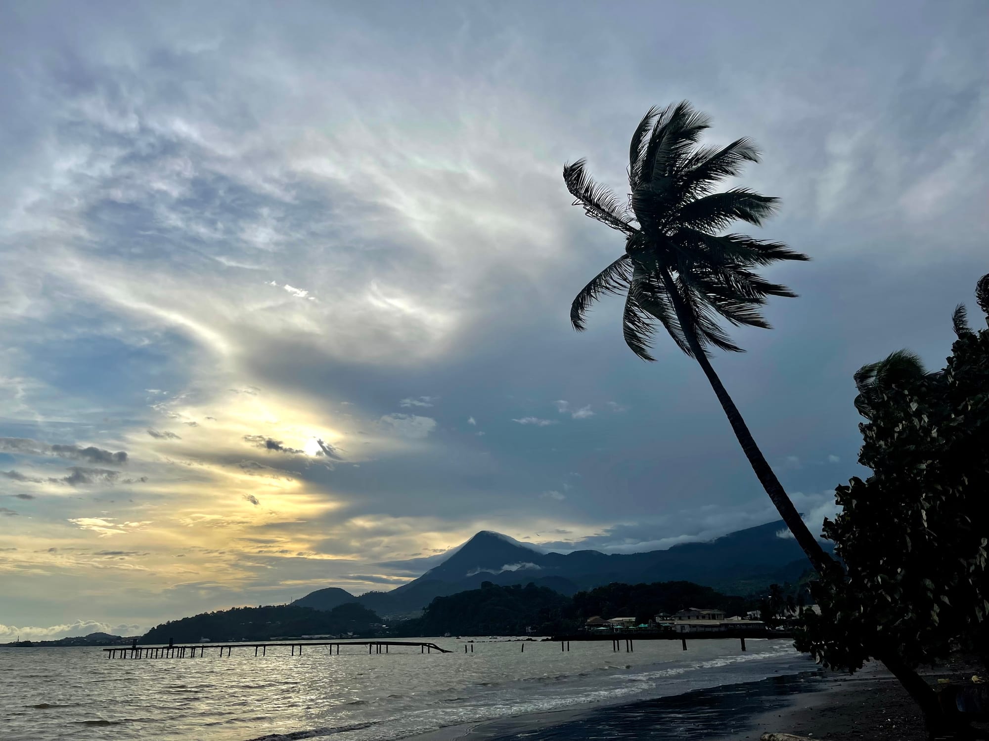
A leaning coconut palm above dark sand at Limbe, with a wooden jetty, the bay and the wooded flank of Mount Cameroon under evening cloud

Bamenda, Bafoussam & the Western Highlands, Cameroon

Limbe

Evening on Down Beach at Limbe, with the slopes of Mount Cameroon across the bay. (Blaizo 237 / Wikimedia Commons · CC BY-SA 4.0)

A seaside town in Cameroon's English-speaking Southwest region, set on Ambas Bay between the Atlantic and the slopes of Mount Cameroon. Founded as Victoria by the Baptist missionary Alfred Saker in 1858 and renamed in 1982, it is known for black volcanic sand, a botanic garden laid out under German rule, a wildlife rescue centre and the national oil refinery. This page is written to explain the town, not to encourage travel.

Neighbourhoods

  • The town centre and Down Beach
    • First-time visitors
    • Best for food
    • Beaches

    The compact centre above the bay, with the market, churches, small hotels and the botanic garden, running down to the fishing beach where the pirogues land and the fish grills are set out in the evening.

    Open in Maps
  • Bota
    • Local life
    • Harbour

    The western end of town towards the port and the plantation offices, with quays, workshops and housing built for plantation and refinery workers.

    Open in Maps
  • Mile 4 and the coast road north
    • Beaches
    • Quiet stays

    The road running north-west out of town past black-sand bays, small hotels and the refinery, with views back to Ambas Bay and the mountain rising behind the coast.

    Open in Maps
  • The mountain side
    • Quiet and residential
    • Views

    The residential slopes climbing away from the sea towards Mount Cameroon, cooler and greener than the shore, with family compounds, small farms and the road up towards Buea.

    Open in Maps

Things to do

Gardens and wildlife

  • Limbe Botanic Gardenpark

    A garden of about 48 hectares between the sea and the mountain, founded under German rule in 1892 to study tropical crops and now a centre for plant conservation.

    Open in Maps
  • Limbe Wildlife Centreattraction

    A rescue and rehabilitation centre for gorillas, chimpanzees, drills and other primates taken from the illegal wildlife trade, run with Cameroonian government involvement.

    Open in Maps

Beaches and the shore

  • Down Beachbeach

    The dark volcanic sand in the middle of town where fishing pirogues land the catch and open-air grills sell it a few metres away.

    Open in Maps
  • The black-sand bays on the coast roadbeach

    The dark volcanic sand that makes Limbe one of Cameroon's two main coastal resorts, in bays along the road running north-west out of town, backed by palms and lava rock.

    Open in Maps
  • Ambas Bayviewpoint

    The bay the town stands on, with wooded islets offshore and the flank of Mount Cameroon behind — the view that made Victoria a natural harbour.

    Open in Maps

Short trips from the town

  • Mount Cameroontrail

    The active volcano that rises straight from the coast, the highest point in sub-Saharan western and central Africa, with its trailhead up at Buea.

    Open in Maps
  • Bueaattraction

    The former German colonial capital about 25 kilometres inland and uphill, with colonial-era buildings including the governor's residence.

    Open in Maps
  • Bimbialandmark

    A site about 8 kilometres from town along the coast, once a slave-trading port, where remains of the trading settlement stand in the forest by the water.

    Open in Maps

Seasonal events

  • Mount Cameroon Race of HopeJanuary or February

    A mountain race up and down Mount Cameroon from Buea, held in the years when conditions in the region allow it.

  • The dry-season holidaysDecember to February

    Christmas and New Year bring families back from Douala and the cities, filling the beaches, the grills and the churches for several weeks.

Eat and drink

Long-standing places and food districts in Limbe. Hours, ratings and directions come from your maps app, always current.

Limbe classics

  • Erurestaurant

    The signature dish of the Southwest — finely shredded Gnetum leaves cooked with waterleaf, palm oil, meat and dried fish, eaten with water fufu, a soft pounded cassava.

    Open in Maps
  • Grilled fish at Down Beachrestaurant

    Whole fish landed by the pirogues, grilled over charcoal with pepper sauce and served with plantain or cassava at tables set out on the sand.

    Open in Maps
  • Achu and njama njamarestaurant

    Highland dishes that travel down to the coast — pounded cocoyam with yellow palm-oil soup, and stewed huckleberry greens with corn fufu.

    Open in Maps

Markets and street food

  • Limbe marketmarket

    Fish, prawns, plantain, cocoyam, forest leaves and palm oil from the plantations and farms on the mountain's lower slopes.

    Open in Maps
  • The beach and roadside grillsneighborhood

    Roast fish, soya skewers, puff-puff and roasted plantain sold from braziers along the seafront and the main roads in the evening.

    Open in Maps

Experience Limbe

History

The bay was home to Isubu and other coastal communities, and the settlement of Bimbia nearby was a trading port whose chiefs dealt with European ships; in the era of the Atlantic slave trade people were shipped from this shore, and the remains of the trading post still stand in the forest. The Baptist missionary Alfred Saker founded Victoria on Ambas Bay in 1858, resettling a congregation expelled from the Spanish island of Fernando Po, and the town grew around the mission, its school and its printing press.

Germany annexed Kamerun in 1884 and took over Victoria itself in 1887, when Britain exchanged it for German rights elsewhere in Africa. German rule turned the mountain's lower slopes into plantations of cocoa, bananas, oil palm and rubber, worked by labourers brought from across the territory, and the botanic garden was laid out in 1892 to study tropical crops for the colony. The administration was seated for a time at Buea, higher up the mountain, while Victoria served as its harbour.

After the First World War the Southwest was governed by Britain as part of Nigeria, and the plantations passed to a public corporation that remains one of the region's largest employers. In 1961 British Southern Cameroons voted to join independent Cameroon. The country's only oil refinery was built at the edge of the town, and in 1982 a presidential decree renamed Victoria as Limbe. The volcano has erupted several times in living memory: a flank eruption in 1922 sent lava all the way to the coast, and the eruption of 1999 stopped about 200 metres short of the sea. Since 2017 the region has been affected by the conflict between separatist groups and government forces.

Culture & Customs

Limbe is an English-speaking town in a mainly French-speaking country, and the distinction runs through its schools, its courts and its sense of itself. Standard English is the language of official life and Cameroonian Pidgin English the language of the market, the beach and the bar, while Isubu, Bakweri and the languages of families drawn here by the plantations are spoken at home.

The plantation economy gave the town an unusually mixed population, with families from the Grassfields, the Northwest and the francophone regions settled for generations alongside coastal communities. Churches are the centre of social life, Baptist and Presbyterian congregations tracing their origins to the mission that founded the town, and choirs, harvest services and church-run schools remain important. Bakweri communities on the mountain's slopes hold the mountain itself in regard, with ceremonies tied to its spirits and to the annual farming cycle.

The best-known sporting event of the region is the race up and down Mount Cameroon from Buea, run over about 38 kilometres and held in January or February in the years when conditions allow. Football is played on any open ground, makossa and Cameroonian gospel play from the beach bars, and the evening ritual of the town is eating grilled fish at Down Beach as the boats come in.

Daily Life

The 2005 census counted about 84,000 people in Limbe, a figure that has shifted since as the conflict has pushed some residents away and brought others in from the surrounding villages. The town lives on four things: the plantations of the state development corporation, the oil refinery and port on its western edge, fishing, and the trade and services that serve both.

The day starts at the beach, where pirogues return in the early morning and women buy fish to smoke or sell on, and in the plantation fields on the slopes above. The market is busiest in the morning; offices and shops keep long hours broken by a midday lull; and the seafront grills and bars fill in the evening. Shared taxis move people along the single main road, which carries almost all the town's traffic.

Since 2017 the crisis in the English-speaking regions has shaped daily life here as elsewhere in the Southwest. Schools have closed for long periods, businesses have suffered from lockdowns and curfews, and many families have moved to Douala or further afield. Power and water supply are unreliable, the heavy rain damages roads each year, and the volcano's presence is a constant, watched by scientists on the mountain.

Food

Eru is the dish of the Southwest and of Limbe: the fine shredded leaves of the Gnetum vine cooked with waterleaf, palm oil, dried fish and meat, and eaten with water fufu, the soft pounded cassava of the region. It is the meal people come home for, sold in chop houses all over town at a price anyone can afford.

The sea supplies the rest. Fish landed at Down Beach — barracuda, snapper, mackerel — is grilled whole over charcoal with a pepper sauce and served with fried plantain, boiled cassava or miondo, while prawns, crayfish and crab from the mangroves go into soups. Bush meat's place has diminished with conservation enforcement, and smoked fish is the usual protein of the market.

Highland food travels down the mountain: achu, pounded cocoyam with a yellow palm-oil soup, njama njama greens with corn fufu, and koki, the steamed pudding of ground black-eyed peas. Roadside stalls sell puff-puff, roast plantain, maize and safou. Palm wine is tapped on the slopes above town, and bottled beer, brewed in the country, is what the beach bars serve at night.

Planning tools

Budget

Limbe was long one of the cheaper places on the Cameroonian coast, with simple hotels along the shore and inexpensive food. The conflict in the English-speaking regions has closed or emptied much of the tourist trade, and any travel here now carries security costs and uncertainty well above an ordinary budget.

Daily Budget Midrange
USD 70–140 (mid-range hotel, restaurant meals, a hired car with driver)
Daily Budget Shoestring
USD 25–50 (basic hotel, beach grills and market food, shared taxis and motorbike taxis)

Cash in CFA francs is needed for nearly everything; ATMs are limited and cards are accepted at very few places.

Best Time to Visit

The dry season from about November to February brings the clearest views of Mount Cameroon and the calmest sea. This coast is among the wettest places on Earth, and from June to September rain falls almost daily, with the mountain hidden in cloud for weeks at a time.

Suggested Number of Days

The town, its garden and its beaches take a day or two at an easy pace. Adding the coast road and the slopes above the town stretches a stay to about three. Weather and the security situation influence any plan here more than distance does.

First Visit
1–2 days
With Surroundings
3 days

Transportation

Shared taxis run along the main road through town and out along the coast, and motorbike taxis cover the side streets and the hills. Buses and shared taxis link Limbe with Douala and, uphill, with Buea. Roads in the Southwest are subject to checkpoints, lockdowns and closures, and journeys can be cancelled at short notice.

Travel only by day, use established transport rather than roadside lifts, and allow for delays at checkpoints.

Airport & Station Connections

Limbe lies about 70 kilometres west of Douala by road, roughly one to two hours in normal conditions, and about 25 kilometres downhill from Buea. The nearest international airport is Douala. The town has a small port, used by the oil industry and by boats working along the coast towards Douala and across to Nigeria.

Walkability

The centre is small and flat enough to walk, from the market down to the beach and along to the botanic garden. Away from the shore the town climbs steeply, pavements are patchy and the heat and humidity are heavy, so shared or motorbike taxis are used for anything longer.

Safety

Limbe is in the Southwest region, where armed separatist groups have fought Cameroonian security forces since 2017. The conflict has killed thousands of people and displaced hundreds of thousands; kidnappings, attacks on checkpoints, curfews and separatist-imposed lockdowns affect towns as well as rural areas, and journeys and businesses can be shut down at short notice.

Most governments advise against all travel to the Far North and to the Northwest and Southwest regions. That includes Limbe, Buea and Mount Cameroon. Check current official travel advice before travelling.

Climate

Equatorial and extremely wet, since the slopes above the town catch the full force of the Atlantic monsoon. Temperatures stay between about 23 and 31°C all year, and the seasons differ in rainfall rather than heat.

Summer
the heart of the rains, roughly June to September, with near-daily downpours, thick cloud and temperatures around 24–28°C
Winter
the dry season, November to February, warmer and brighter at around 25–32°C, with the clearest views of the mountain

Local Customs

This is an English-speaking town, and Cameroonian Pidgin English is the everyday language of the market and the street alongside standard English. Greetings come first and are unhurried, elders are addressed with respect, and dress is modest away from the beach. Churches are central to social life, and funerals and family celebrations fill weekends.

Ask before photographing people, and never photograph soldiers, police, checkpoints, the port or the refinery.

Common Payment Methods

The currency is the Central African CFA franc (XAF), pegged to the euro. Cash is used for almost everything, including hotels; ATMs are few and can be out of service, and cards are rarely accepted. Mobile money is widely used by residents. Euros are the easiest currency to change, and changing money is easier in Douala.