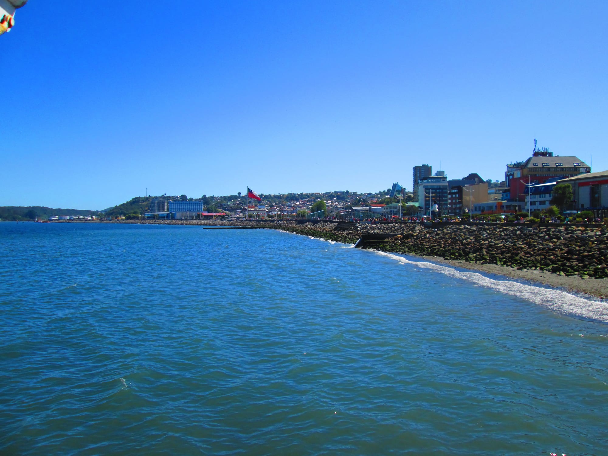
Blue water of the sound beside a rocky seawall and waterfront promenade, with city buildings and a large Chilean flag on low hills

The Lake District & Araucanía, Chile

Puerto Montt

The waterfront promenade of Puerto Montt on the Reloncaví Sound, seen from the pier. (Manxuc / Wikimedia Commons · CC BY-SA 4.0)

The capital of Chile's Los Lagos Region, a port city at the northern end of the Reloncaví Sound, 1,055 km south of Santiago. Founded in 1853 during German settlement, rebuilt after the 1960 earthquake and enlarged by the salmon-farming boom, it is the commercial hub of northern Patagonia and the gateway to Chiloé, the fjords and the far south.

Neighbourhoods

  • Centre and the waterfront
    • First-time visitors
    • Close to public transport
    • Shopping

    The grid between the hills and the sea around the Plaza de Armas and its wooden cathedral, with cafés, restaurants, bars, shopping centres and the regional library. The waterfront promenade runs along the sound, and the main bus terminal is by the harbour, a 10- to 15-minute walk away.

    Open in Maps
  • Angelmó
    • Best for food
    • Markets
    • Local life

    The fishing cove about a kilometre beyond the bus terminal, with a seafood market, restaurants and stalls of crafts and local products. Painters made it famous in the 20th century, and passenger boats cross from here to Tenglo Island.

    Open in Maps
  • Pelluco
    • Beaches
    • Quiet and residential

    A seaside district about 5 km south-east of the centre along the shore, with a beach, restaurants and a campus of the Austral University, opened in 1989.

    Open in Maps

Things to do

In the city

  • Puerto Montt Cathedrallandmark

    The cathedral on the Plaza de Armas, built on a plot set aside when the city was laid out, with a front of four Doric columns and a timber structure resting on twelve larch columns; repaired after the 1960 earthquake.

    Open in Maps
  • Waterfront promenadetrail

    The seafront walk along the Reloncaví Sound between the centre and the bus terminal, the city's main place for a stroll.

    Open in Maps
  • Casa del Arte Diego Riveraattraction

    The city's arts centre, opposite the regional library in the centre.

    Open in Maps

Markets and the coast

  • Angelmómarket

    The fishing cove and seafood market south-west of the bus terminal, with restaurants, fresh fish and shellfish, and stalls selling crafts, chocolates, jams and liqueurs.

    Open in Maps
  • Tenglo Islandattraction

    The island across the narrow Tenglo Channel from the city, reached by passenger boats that run every day from Angelmó and nearby landings.

    Open in Maps
  • Pelluco beachbeach

    The beach in the seaside district of Pelluco, about 5 km south-east of the centre along the waterfront.

    Open in Maps
  • Reloncaví Soundviewpoint

    The sound south of the city where the Central Valley meets the Pacific, dotted with the islands of the Calbuco Archipelago, with the Chamiza Wetland on its northern shore east of the city.

    Open in Maps

Short trips from the city

  • Alerce Andino National Parkpark

    A park of about 393 square kilometres of mountains, some 50 lakes and ponds and ancient alerce trees between the Reloncaví Sound and Estuary.

    Open in Maps
  • Puerto Varasattraction

    The German-settled lake town about 17 km north on Lake Llanquihue, with wooden houses and views of the Osorno and Calbuco volcanoes.

    Open in Maps
  • Lake Llanquihuepark

    Chile's second-largest lake, whose shore towns, Puerto Varas and Frutillar among them, are the region's best-known resorts.

    Open in Maps
  • Frutillarattraction

    A German-settled lakeside town known as the City of Music, home to the Teatro del Lago and part of UNESCO's Creative Cities network.

    Open in Maps
  • Carretera Austral and Caleta La Arenaattraction

    The southern highway that runs about 1,240 km from Puerto Montt to Villa O'Higgins; about 45 km south of its start, a car ferry crosses between Caleta La Arena and Puelche.

    Open in Maps

Eat and drink

Long-standing places and food districts in Puerto Montt. Hours, ratings and directions come from your maps app, always current.

Food districts and markets

  • Angelmó seafood marketmarket

    The city's best-known place for seafood: market stalls of fresh fish and shellfish and the restaurants beside them in the fishing cove.

    Open in Maps
  • Local products at Angelmó and the waterfrontmarket

    Small producers' stalls selling chocolates, fruit jams, liqueurs and biscuits along with crafts.

    Open in Maps
  • Cafés and restaurants of the centreneighborhood

    Many cafés, restaurants and bars around the Plaza de Armas and the waterfront.

    Open in Maps

Experience Puerto Montt

History

The site, covered in thick forest, was called Melipulli, "four hills" in Mapudungun. The colonial government chose it as an entrance to Lake Llanquihue once its closeness to the open sea was known. The naturalist Bernardo Philippi was put in charge of the settlement but died in 1851, and Vicente Pérez Rosales took over, bringing woodsmen from the islands of the sound to clear and burn the forest. The city was founded on 12 February 1853, after German immigration that began in 1848, and named after President Manuel Montt, who had set that immigration in motion.

Larch timber was the first business, alongside distilleries, breweries and the trade in goods from Germany and Valparaíso. The railway from Santiago arrived in 1912, making the city a point of entry to Chilean Patagonia, and the port opened in 1934. By 1950 the city had 27,500 people. The 1960 Valdivia earthquake then destroyed much of it, bringing down the port, the railway station and many buildings and houses. In March 1969 a police operation ordered by the Interior Ministry against landless families occupying unused farmland left ten people dead, an event remembered in Víctor Jara's song Preguntas por Puerto Montt.

In the 1970s Puerto Montt became capital of the Los Lagos Region. From the late 1980s the salmon farming industry brought accelerated growth in population and business, until a crisis in salmon aquaculture in the late 2000s caused severe unemployment. Passenger trains returned in 2025 on a local line.

Culture & Customs

Puerto Montt's culture mixes Chilean Spanish traditions with the German heritage of its founders, still visible in its German school, its old family names and the honorary consulates of Germany and other European countries. It has also long been a Mapuche city — its original name is Mapudungun — and in recent decades it has drawn many newcomers from across Chile looking for work.

Angelmó has a special place in the city's imagination. The painter Arturo Pacheco Altamirano, who arrived in 1926, made the fishing cove famous across Chile through his work, and in 1956 the Grupo Plástico Angelmó brought together a circle of local painters. The folk group Bordemar and the film-maker Raúl Ruiz are among the city's best-known natives.

As a regional capital and a university city, with campuses of the University of Los Lagos, the Austral University and private universities, Puerto Montt has a regional library, an arts centre and a cultural calendar that serves the whole of northern Patagonia. Its port makes it a city of arrivals and departures, the gateway to Chiloé, the fjords and Western Patagonia.

Daily Life

The commune had about 246,000 inhabitants at the 2017 census, the great majority of them in the city, after rapid growth since the 1980s; it has grown well beyond its historic centre over the surrounding hills. As capital of Los Lagos and of Llanquihue Province, it is the principal commercial, service and financial hub of northern Patagonia.

The economy rests on the port and on the salmon industry, with hatcheries, fisheries and packing plants mostly to the south of the city; fresh salmon is flown out daily to world markets. Agriculture, cattle and forestry on the surrounding land and islands, and tourism, add to it. The salmon crisis of the late 2000s showed how much the city depends on a single industry.

Daily life follows the rhythm of a busy regional centre: shopping centres along the waterfront, colectivos climbing the hills, boats crossing to Tenglo and the islands, and the constant traffic of buses and ferries heading for Chiloé and the south. Rain falls through much of the year, and summer brings the travellers passing through on their way to Patagonia.

Food

Seafood is the city's food. Angelmó, the fishing cove beyond the bus terminal, is where most visitors eat it: market stalls sell fresh fish and shellfish, and the restaurants beside them serve seafood dishes. Salmon, the city's great industry, is the region's best-known export.

The cooking of the south is here too. Curanto, the Chiloé feast of shellfish, meat, sausage and potato dumplings cooked over hot stones, and milcao, a potato pancake, come from the island across the channel, while the Chilean staples — empanadas, cazuela and pastel de choclo — are everywhere. The German settlers of the surrounding lake country brought kuchen, a cake filled with seasonal fruit.

Small producers sell chocolates, fruit jams, liqueurs and biscuits at stalls in Angelmó and on the waterfront, and the city's cafés, restaurants and bars cluster in the centre. Breweries and distilleries were among Puerto Montt's first businesses in the 19th century, and chicha de manzana, a fermented apple cider, is one of the drinks of southern Chile.

Planning tools

Budget

Puerto Montt is a working city and generally cheaper than the lake resorts nearby, with plenty of rooms around the bus terminal. The main extra costs are ferries to Chiloé and Patagonia, excursions to the lakes and national parks, and car hire, which is easy to arrange here.

Daily Budget Midrange
USD 95–190 (city hotel, restaurant dinners, a day excursion, a hire car)
Daily Budget Shoestring
USD 40–65 (hostel or guesthouse, seafood lunches at Angelmó, buses and colectivos)

Book long ferry trips south well ahead in summer, and expect far fewer sailings in winter.

Best Time to Visit

December to March is the main season, with the driest weather and the most ferry departures to Chiloé, Chaitén and the far south. Rain falls heavily through the year, with a drier spell in summer; winter is wet and grey but rarely frosty.

Suggested Number of Days

One or two days are enough for the city itself, which most travellers use as a base or a stop between the lakes, Chiloé and Patagonia. Four to six days allow time for the lakes and national parks around it. Ferry and flight timings often decide the number.

First Visit
1–2 days
With Surroundings
4–6 days

Transportation

Colectivos, shared taxis on fixed routes, run on 36 lines across the city, alongside urban buses. Since 2025 a local train has linked the city's La Paloma station with Alerce, Puerto Varas and Llanquihue. Frequent buses go to Puerto Varas and the lake towns, passenger boats cross to Tenglo Island, and a hire car is the most flexible way to reach the parks and the Carretera Austral.

The ferry to Chiloé leaves from about 50 km south-west of the city; long-distance buses to the island include the crossing.

Airport & Station Connections

El Tepual International Airport, outside the city, has regular flights from Santiago, about two hours away, and from Punta Arenas, Balmaceda and Antofagasta. Long-distance buses arrive at the central terminal by the harbour from Santiago, 1,055 km to the north, and from Bariloche in Argentina in about seven hours. Ferries sail south to Chaitén, Puerto Chacabuco and Puerto Natales, with many fewer sailings in winter.

Walkability

The centre is compact and walkable, and the waterfront promenade links it with the bus terminal in 10 to 15 minutes and with Angelmó about a kilometre beyond. The city climbs steeply up its hills, and Pelluco and the outer districts need a colectivo, bus or taxi.

Safety

Chile is one of the safer countries in South America, but petty and opportunistic crime has risen, especially in Santiago and Valparaíso — pickpocketing, bag-snatching, phone theft, and distraction scams in tourist areas, markets, and on transport. In Puerto Montt the busy bus terminal and markets call for the usual care. The city lies in a seismic zone: the 1960 earthquake destroyed much of it, including the port and the railway station.

Keep bags close in the bus terminal and at Angelmó, use registered taxis or colectivos at night, and learn the tsunami evacuation routes near the waterfront. Check current official travel advice before travelling.

Climate

A wet oceanic climate, with heavy rain throughout the year and a drier tendency in summer. Temperatures are moderate all year, with no real heat and little frost.

Summer
December–February is mild and comparatively dry, with temperatures staying below 25°C
Winter
June–August is cool, grey and very wet; frosts below 0°C are rare, a couple of times a month

Local Customs

The city mixes Chilean Spanish culture with a German heritage seen in its founding families, its German school and its old breweries, and it has a large Mapuche population and many newcomers from across Chile. Angelmó is a working fishing community as well as a market.

Ask before photographing traders and fishermen at Angelmó, and dress for rain and wind.

Common Payment Methods

The currency is the Chilean peso (CLP). Cards are widely accepted in hotels, restaurants, shopping centres and the bus terminal, and ATMs are plentiful in the centre, though they charge fees and cap withdrawals. Cash is useful at the Angelmó stalls, in colectivos and on boats.