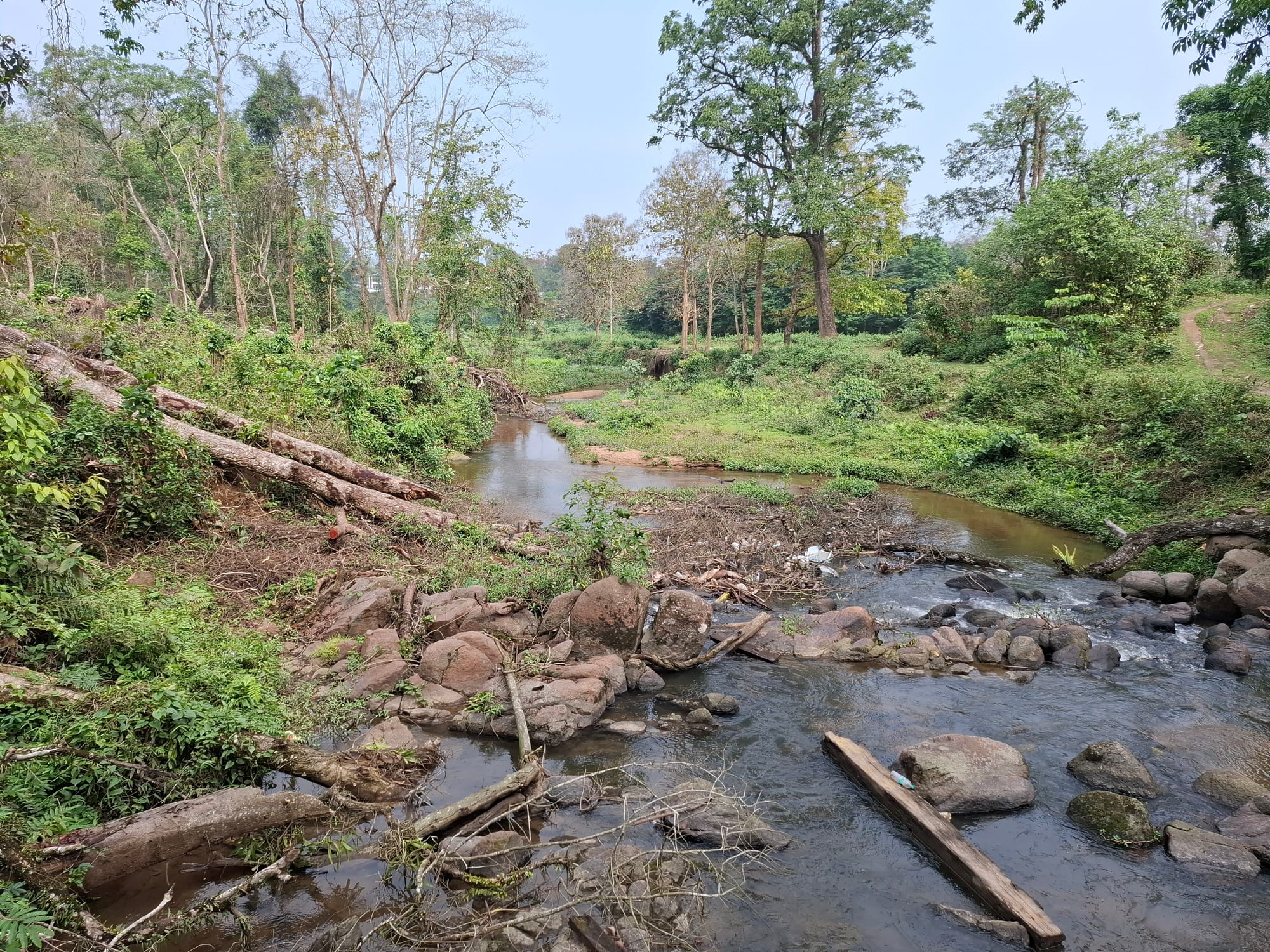
A shallow rocky river running between wooded banks and fallen logs in green forest near Kohora

The Northeast, India

Kohora

The Kohora river running out of the Karbi hills beside the village of Kohora, Assam. (Pinakpani / Wikimedia Commons · CC BY 4.0)

A roadside village in Assam's Golaghat district where National Highway 715 runs along the southern edge of Kaziranga National Park. Kohora gives its name to the park's central range and is the usual base for visitors to the Brahmaputra floodplain grasslands, with lodges, guides and safari offices strung along a short stretch of highway below the Karbi hills.

Neighbourhoods

  • The highway strip
    • First-time visitors
    • Lodges and guesthouses
    • Close to transport

    Kohora is essentially a kilometre or so of National Highway 715, with the park's tourist office, resorts and guesthouses, tea and snack stalls, craft shops and a small bazaar. Buses between Guwahati and Jorhat stop here, and safari jeeps gather outside the lodges before dawn.

    Open in Maps
  • Kohora range (Mihimukh)
    • Wildlife
    • Early mornings

    The park's central range begins a short drive north of the highway, where the jeep and elephant safaris set off across the grassland towards the Brahmaputra. It is the busiest and most visited of Kaziranga's ranges.

    Open in Maps
  • Bagori and the western range
    • Wildlife
    • Quieter safaris

    About twenty kilometres west along the highway, reached through the small settlement of Bagori. The grassland here is open and rhinos are often seen close to the tracks, with a handful of lodges near the gate.

    Open in Maps
  • Agoratoli and the eastern range
    • Birdwatching
    • Quiet and residential

    The eastern part of the park, roughly forty kilometres from Kohora near Agoratoli, has more woodland and wetland and is favoured for waterbirds. Visitors stay in Kohora or Bokakhat and drive out for the morning.

    Open in Maps
  • The Karbi hills edge
    • Views
    • Tea gardens

    South of the highway the ground rises into the wooded slopes of Karbi Anglong, where animals move to escape the monsoon floods. Tea gardens and small villages line the lanes that climb away from the main road.

    Open in Maps

Things to do

The national park

  • Kaziranga National Parkpark

    A UNESCO World Heritage Site of tall elephant grass, marsh and woodland on the south bank of the Brahmaputra, holding the largest population of greater one-horned rhinos in the world, along with wild water buffalo, elephants, swamp deer and tigers.

    Open in Maps

Nearby towns and hills

  • Bokakhatattraction

    The nearest town east of the park, with markets, banks and bus connections, and the administrative centre for much of the Kaziranga area.

    Open in Maps
  • Karbi Anglongattraction

    The hill district rising immediately south of the highway, home to the Karbi people and the higher ground to which Kaziranga's animals move when the floods come.

    Open in Maps
  • Numaligarhattraction

    A small town east of the park known for its oil refinery and for the ancient stone ruins of the Deopahar archaeological site nearby.

    Open in Maps

Short trips from the village

  • Golaghatattraction

    The district headquarters south-east of the park, an old trading town on the Dhansiri river surrounded by tea gardens.

    Open in Maps
  • Jorhatattraction

    A tea town east of Kaziranga with the nearest airport and the ferry ghat for Majuli, long a centre of the Assamese tea industry.

    Open in Maps
  • Majuliattraction

    A large river island in the Brahmaputra, reached by ferry from near Jorhat, known for its Vaishnavite sattras and their dance, drama and mask-making.

    Open in Maps
  • Hoollongapar Gibbon Sanctuarypark

    A patch of tall evergreen forest near Jorhat that protects the western hoolock gibbon, India's only ape, along with several other primates.

    Open in Maps

Seasonal events

  • Rongali Bihumid-April

    The Assamese new year, marked in villages around Kaziranga with husori singing, drums, pepa pipes and dancing over several days.

  • Magh BihuJanuary

    The harvest festival, when temporary bamboo and thatch huts are built, feasts are cooked outdoors and bonfires are lit at dawn.

  • Park season openingNovember

    The park reopens to visitors after the monsoon floods recede, and Kohora's lodges, guides and jeep operators start the season together.

Eat and drink

Long-standing places and food districts in Kohora. Hours, ratings and directions come from your maps app, always current.

Assamese classics

  • Assamese thali at the Kohora lodgesrestaurant

    Most lodges and small dining rooms along the highway serve a rice thali with dal, a green, a potato or pumpkin dish and river fish or chicken, often with khar to begin and a sour tenga curry alongside.

    Open in Maps
  • Highway dhabas on NH 715restaurant

    Simple roadside kitchens along the Guwahati–Jorhat highway cook rice and curry through the day for drivers and bus passengers, with strong sweet tea and fried snacks.

    Open in Maps

Markets and tea

  • Kohora bazaarmarket

    A small village market for vegetables, fish, betel nut and everyday goods, busiest in the morning.

    Open in Maps
  • Assam tea estates around Kaziranganeighborhood

    The gardens that surround the park grow the strong malty black tea named after the state; several estates near the highway sell leaf and offer tastings.

    Open in Maps

Experience Kohora

History

Kohora existed long before the park did, as a farming settlement on the strip of firm ground between the Brahmaputra's floodplain and the wooded slopes of Karbi Anglong, in a district that grew rice, mustard and, from the 19th century, tea. The Ahom kingdom ruled this stretch of the valley for some six hundred years until Burmese invasions and then the British East India Company took Assam in 1826; tea planting spread across Golaghat district in the decades that followed, and the road that became National Highway 715 carried the crop westward.

The village owes its present shape to conservation. Kaziranga was declared a reserve forest in 1905 after concern over the collapse of the rhino population, became a game sanctuary, was renamed a wildlife sanctuary in 1950 and was later made a national park; UNESCO inscribed it as a World Heritage Site. The park's central administration and its busiest entrance sit at Kohora, and the range that begins here carries the village's name.

From the late 20th century tourism reshaped the place. Lodges, resorts and souvenir stalls filled the highway frontage, jeep owners and guides organised into associations, and families who had farmed or worked in the tea gardens took jobs in hospitality. The other constant in Kohora's history is water: the Brahmaputra floods the park most years, drowning animals and washing out roads, and the highway itself becomes the escape route for wildlife heading uphill.

Culture & Customs

Kohora is an Assamese village with a mixed population drawn from the valley's communities and from the Karbi hills above, along with families whose ancestors were brought from central India to work the tea gardens in the 19th century and are known collectively as the tea tribes. Assamese is the common language, with Karbi, Hindi and Bengali heard along the highway.

The religious life of the valley revolves around the Vaishnavite tradition of the 15th- and 16th-century saint Srimanta Sankardev, whose namghars — village prayer houses without images, where singing and recitation take place — stand in most settlements. Bihu shapes the year: Rongali Bihu in April brings drums, buffalo-horn pepa pipes and dancing in the fields, Magh Bihu in January brings feasting and bonfires, and Kongali Bihu in autumn is a quieter observance in a lean month. Muga and eri silk, woven in the valley, are worn for festivals, and the gamosa, a white cotton cloth with red borders, is given as a mark of respect.

Conservation itself has become part of local identity. The rhino appears on shop signs and school walls, families count forest guards and guides among their members, and the annual poaching figures are followed closely. Relations between the park and the villages around it are not always easy, because elephants raid crops and land near the boundary has been contested, but the park is also the district's largest source of work.

Daily Life

Kohora itself holds only a few thousand people; the wider Bokakhat area and Golaghat district around it are rural, with Golaghat district counting a little over a million residents at the 2011 census. Life runs to two clocks. Tourist Kohora wakes before dawn between November and April, when jeeps line up for the morning safari, and quietens by mid-morning; village Kohora follows the agricultural day, with rice fields, kitchen gardens, cattle and the tea gardens that surround the highway.

Work comes from three sources: the park and the lodges, tea estates and smallholdings, and the road, which brings dhabas, workshops and transport jobs. Many households combine them, and the monsoon closure of the park means a long off-season in which guides and drivers return to farming or travel for work. Mobile phones and UPI payments have reached even small shops, although coverage thins away from the highway.

The recurring problems are floods, which submerge fields, roads and much of the park most years and drive animals across the highway; human-wildlife conflict, with elephants in the crops and the risk of collisions on the road; and the seasonal nature of tourist income. Education and health services cluster in Bokakhat and Golaghat rather than the village, and younger people often leave for Guwahati or further afield.

Food

Eating in Kohora is Assamese home cooking, light on oil and spice and built around rice. A meal usually begins with khar, a mildly alkaline preparation of vegetables or papaya cooked with water filtered through the ash of banana peel, and ends with a sour dish — masor tenga, a light fish curry soured with tomato, elephant apple or lemon, is the classic. In between come dal, a green such as lai xaak, a potato or pumpkin dish, and often duck or pigeon cooked with ash gourd on a festive day. Pork with bamboo shoot appears in Karbi and tribal kitchens up the hill.

Fish from the Brahmaputra and its channels is central, smoked, fried or dried, and bamboo shoot, fermented as khorisa, gives many dishes their sour edge. Pitha, rice cakes filled with sesame or coconut and jaggery, and laru, sweet balls of coconut or rice, are made for Bihu, along with rice beer in communities that brew it. Betel leaf with areca nut, tamul-paan, follows a meal almost everywhere.

The everyday drink is Assam tea, grown in the gardens on all sides and drunk strong with milk and sugar from glasses at the roadside stalls; the estates also sell whole-leaf grades that never reach a village cup. Lodges catering to visitors add north Indian and Chinese-style dishes to their menus, and the highway dhabas serve rice and curry, parathas and eggs all day to drivers.

Planning tools

Budget

Kohora is cheap to eat and sleep in but the park itself is not: jeep hire, entry and camera fees, and the guide who must travel with each vehicle add up quickly, and elephant rides are limited and priced separately. Rooms in the larger lodges rise sharply between December and February, and a car with driver is the usual way to reach the place at all.

Daily Budget Midrange
USD 60–140 (lodge or resort room, two jeep safaris with fees, a car with driver, restaurant meals)
Daily Budget Shoestring
USD 20–40 (guesthouse room, thalis and dhaba meals, shared jeep seat, buses along the highway)

Share a jeep with other visitors to cut the largest single cost, and carry cash: ATMs are few and card payment is unreliable outside the bigger lodges.

Best Time to Visit

November to April. The park is closed through the monsoon and generally reopens once the floodwater has drained, usually by November. Grass is high early in the season and is burned back later, so February, March and April give the clearest sightings, though they are also the hottest and dustiest months.

Suggested Number of Days

Two days is enough for the village and more than one safari in different ranges. Four or five suit those adding the tea country and the river islands further east. Weather, floods and the time of year change how much of the park can be reached.

First Visit
2 days
With Surroundings
4–5 days

Transportation

Everything in Kohora is on or just off the highway and walkable; everything beyond it needs a vehicle. Lodges arrange jeeps for the park ranges, and shared jeeps, state buses and private coaches run along National Highway 715 towards Guwahati in one direction and Bokakhat, Golaghat and Jorhat in the other. Autorickshaws cover short hops between the lodges and the bazaar.

Safaris are booked through a lodge or the park office and leave before dawn and in mid-afternoon; road journeys in Assam are slower than the distances suggest.

Airport & Station Connections

Most visitors arrive by road from Guwahati, a drive of about five hours west on the highway; buses and shared jeeps make the same trip. The nearest airports are at Jorhat to the east and Guwahati to the west, and the nearest railway junction is Furkating, near Golaghat. Many travellers come as part of a longer Assam trip with a hired car and driver.

Walkability

The village is a short walk from end to end, with lodges, shops and tea stalls along the road, but the highway carries heavy lorry traffic and has no proper footpath in places. Walking inside the park is not allowed, and animals including elephants move across the highway corridor at night, so evening walks are best kept short and close to the lodges.

Safety

Kohora is a quiet village and crime is rarely a problem for visitors. The real risks are the road, where lorries, animals and poor light make night travel dangerous; wild animals, since elephants, rhinos and occasionally tigers cross the highway strip; and the monsoon, when the Brahmaputra floods the park and cuts roads. Assam's summer heat and humidity are heavy.

Follow the guide's instructions on safari, never approach animals on foot, avoid driving the highway after dark, and check whether roads and ranges are open in the wet season. Check current official travel advice before travelling.

Climate

Subtropical and very wet. The monsoon runs from about June to September and floods much of the park most years; the dry season from November to March is mild and pleasant, with cool mornings and mist over the grassland.

Summer
hot and very humid, typically 28–35°C, with heavy rain and flooding from June to September
Winter
mild days of about 22–26°C and cool mornings near 10°C, with fog on the grassland and the driest weather of the year

Local Customs

This is a conservative rural area. Modest dress is expected, shoes come off when entering a home or a namghar prayer house, and visitors are usually offered tea and betel nut, which it is polite to accept. Assamese greetings use the word nomoskar with joined palms. Photographing people, especially in Karbi and other tribal villages, should be asked about first.

Tipping the safari guide and driver is customary in small amounts; keep quiet in the park; do not use flash or drones; and dress in dull colours for early safaris, when mornings are cold.

Common Payment Methods

The currency is the Indian rupee. Larger lodges take cards and most small businesses accept the UPI phone-based payment apps, but cash remains the practical choice in the bazaar, at dhabas and for jeep shares. ATMs exist at Kohora and in Bokakhat but can run empty in the high season, so draw money in Guwahati or Jorhat before arriving.