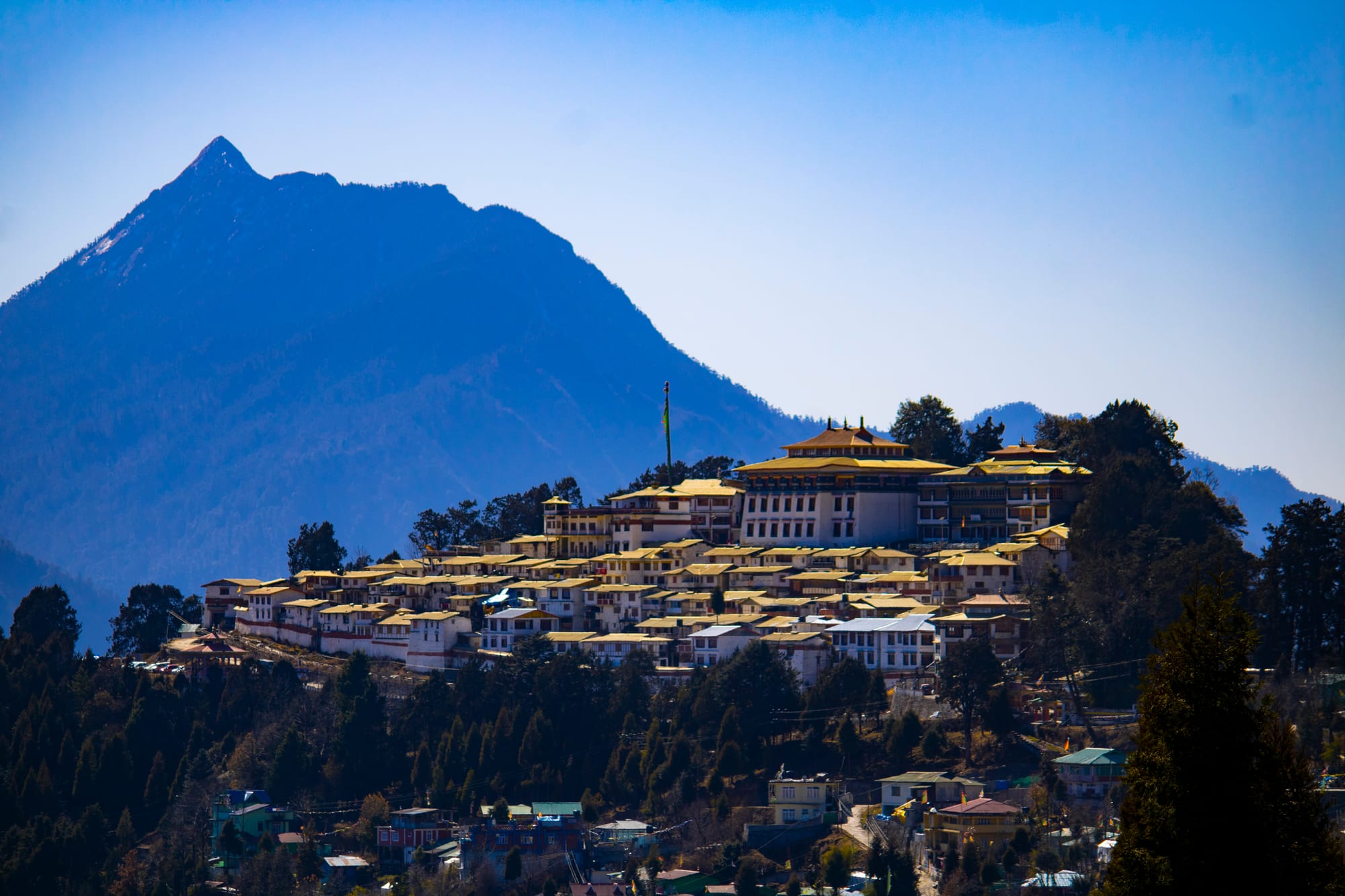
A white and gold monastery complex on a wooded ridge above small houses, with a sharp mountain peak behind

The Northeast, India

Tawang

Tawang Monastery on its ridge above the town, with the mountains of western Arunachal Pradesh beyond. (Chandrasen31 / Wikimedia Commons · CC BY-SA 4.0)

A small town on a Himalayan shelf in western Arunachal Pradesh, at about 3,000 metres between Bhutan and the Tibetan plateau. Tawang grew around the 17th-century monastery that still stands above it, the largest in India, and is home to the Monpa people. Roads reach it from Assam past the Sela Pass, now bypassed by a tunnel, and the surrounding valleys hold lakes, waterfalls and high pastures.

Neighbourhoods

  • The town centre and market
    • First-time visitors
    • Hotels
    • Best for food

    A compact grid of concrete buildings along the main road, with the bazaar, taxi stand, small hotels, momo shops and shops selling shawls, prayer flags and carpets. Almost everything a visitor needs is within a few minutes' walk, and the ground slopes steeply away on both sides.

    Open in Maps
  • The monastery ridge
    • Historic district
    • Views
    • Quiet

    The walled monastery sits above the town on a spur, a short climb or drive from the market, with monks' quarters, a library and a prayer hall around a courtyard. The lanes below it are quieter than the centre and give the widest views over the valley.

    Open in Maps
  • Old Tawang and Urgelling
    • Quiet and residential
    • History

    The villages spread below the town on the slopes towards the river, including Urgelling, the birthplace of the sixth Dalai Lama. Farmhouses, terraces and small gompas line the lanes, and the pace is entirely rural.

    Open in Maps
  • The Jang road and Nuranang valley
    • Waterfalls
    • Day drives

    The approach from the east, through Jang and past the Nuranang falls, is where much of the district's farming and hydro-power sits. Travellers usually pass through it on the way in and stop for the falls and the war memorials.

    Open in Maps
  • Zemithang and the far valleys
    • Mountain scenery
    • Villages

    North-west of the town, the Nyamjang Chu valley runs down towards the Bhutan border past Monpa villages and pastures, with a large stupa at Zemithang. The roads are long and rough and the area feels very remote.

    Open in Maps

Things to do

Monasteries and temples

  • Tawang Monasterylandmark

    Founded in 1680–81 by Merak Lama Lodre Gyatso, the largest Buddhist monastery in India and one of the largest of the Gelug school anywhere, with a three-storey assembly hall, a tall gilded Buddha and a library of manuscripts.

    Open in Maps
  • Urgelling Monasterylandmark

    A small gompa below the town, revered as the birthplace in 1683 of Tsangyang Gyatso, the sixth Dalai Lama.

    Open in Maps

Mountains, lakes and waterfalls

  • Sela Passviewpoint

    The pass of 4,170 metres on the road in from Dirang and Bomdila, with a lake on its northern side, usually snow-covered in part all year; the Sela Tunnel now carries the main road below it.

    Open in Maps
  • Nuranang Fallsattraction

    A powerful waterfall near Jang on the road from Sela, dropping about a hundred metres into a wooded gorge.

    Open in Maps
  • Bum La Passviewpoint

    A high border pass some 37 kilometres north of the town, a trading point and meeting point for the two armies, reached only with a special permit issued in Tawang and stamped at the army cantonment.

    Open in Maps

Short trips from the town

  • Zemithangattraction

    A valley village near the Bhutan border, with the Gorsam Chorten stupa, about 28 metres high, a short way outside it; this was the first point in India the fourteenth Dalai Lama reached when he crossed from Tibet in 1959.

    Open in Maps
  • Dirangattraction

    A valley town in West Kameng district on the road out towards Bomdila, home to the National Institute of Mountaineering and Adventure Sports and to a large geothermal power project.

    Open in Maps

Seasonal events

  • LosarFebruary or early March

    The Tibetan and Monpa new year, marked with prayers at the monastery, house cleaning, new clothes and visits between families.

  • TorgyaJanuary

    A three-day festival held only at Tawang Monastery, around 10 to 12 January, with masked dances in the courtyard to drive out evil spirits for the year ahead.

  • Buddha PurnimaMay

    The celebration of the Buddha's birth, enlightenment and death, kept with processions and prayer at the gompas.

Eat and drink

Long-standing places and food districts in Tawang. Hours, ratings and directions come from your maps app, always current.

Monpa and Tibetan classics

  • Momo and thukpa shops in the marketrestaurant

    Small kitchens around the bazaar steam and fry momo dumplings filled with pork, chicken or vegetables and serve thukpa, a hot noodle soup that is the everyday meal in the cold months.

    Open in Maps
  • Butter tea and local brewscafe

    Salty butter tea, called suja, is offered in homes and monasteries across the Monpa country, alongside millet and maize beers brewed in the villages.

    Open in Maps

Markets

  • Tawang town bazaarmarket

    The main street market sells vegetables, dried chillies, yak cheese, churpi and woollens, and is the place to find local produce brought down from the valleys.

    Open in Maps

Experience Tawang

History

Tawang belongs to the Monpa people and to the Tibetan Buddhist world. Its history as a town begins with Gaden Namgyal Lhatse, the monastery founded in 1680–81 by Merak Lama Lodre Gyatso in accordance with the wishes of the fifth Dalai Lama; the settlement grew on the slope below it, supplying and serving the monks. Just downhill at Urgelling, Tsangyang Gyatso, the sixth Dalai Lama, was born in 1683, and the district has been tied to Lhasa's religious life ever since.

For centuries the monastery collected taxes and administered the surrounding valleys, which traded salt, wool and grain across the passes. The McMahon Line, drawn at the Simla Convention of 1914, placed Tawang on the Indian side of the boundary between Tibet and British India, but Tibetan administration continued in practice until Indian forces took over the area in 1951. In 1959 the fourteenth Dalai Lama crossed into India through the Tawang district on his flight from Tibet, entering near Zemithang.

The 1962 war with China was fought partly here: Chinese troops advanced over the border and through the town before withdrawing, and the fighting at Nuranang and around the Sela Pass is remembered at memorials along the road and in the town. Arunachal Pradesh is administered by India; China does not recognise the state and claims the territory as South Tibet, and has pressed its claim to Tawang in particular, so the district remains sensitive and heavily garrisoned. Tawang district was split from West Kameng in 1989, and the town has grown since with roads, schools, army establishments and, in the last two decades, tourism.

Culture & Customs

The Monpa, who form most of the population, speak Tibeto-Burman languages and follow the Gelug school of Tibetan Buddhism. Prayer flags run from ridge to ridge, water-driven prayer wheels turn beside streams, and chortens and mani walls mark the entrances to villages. Monastic life sets the rhythm of the year: the Torgya festival in January fills the monastery courtyard with masked cham dancing, Losar brings the new year in late winter, and Buddha Purnima is kept in May.

Monpa craft is well known across the Northeast. Households weave woollen shawls and carpets, make wooden bowls and masks, and produce handmade paper from the pulp of the local sukso tree; the cane and bamboo work of the valleys is traded down to Assam. Dress for festivals is based on the Tibetan chuba and the distinctive yak-hair hat with its hanging fringes, worn by both men and women.

Households keep yaks and the yak-cattle crosses used at these altitudes, grow maize, millet, barley and buckwheat on terraces, and pass the winter indoors around a stove. Hospitality is strong and formal: guests are offered butter tea and local brew, and visitors are expected to be quiet and respectful at religious sites. The army is a large presence in daily life, and the border is a constant background to conversation, though the town itself is calm and used to travellers.

Daily Life

Tawang town has only around ten thousand residents, and Tawang district as a whole counted about 50,000 people at the 2011 census, in the smallest district of Arunachal Pradesh by area. Life is concentrated in a few streets: the market, the taxi stand, government offices, schools and a hospital, with villages of stone and timber houses scattered on the slopes around.

The economy rests on four things: government employment, which is the largest single source of salaried work; the army and its supply chain; farming and herding, with maize, millet, potatoes and yak products; and tourism, which has grown quickly since the road improved and now supports hotels, homestays, drivers and guides. Hydro-power projects on the rivers are a significant and sometimes contested source of investment.

Days start early, as they do across the Northeast, because India keeps a single time zone and the sun rises well before six in summer; shops shut soon after dark. Winter closes the town in on itself, with snow, power cuts and slow roads. The recurring issues are road access, the cost of bringing everything up from Assam, the pull of Guwahati and Itanagar on young people seeking work and education, and the debate over how much hydro-power and how much tourism the valleys should take.

Food

Tawang eats as the Tibetan plateau does. The staples are momo, steamed or fried dumplings filled with pork, beef, chicken or vegetables, and thukpa, a noodle soup with meat and greens that is the usual dinner in cold weather. Zan, a thick porridge of millet or maize flour stirred with vegetables or meat stock, is the old Monpa staple, and puta, buckwheat noodles, and khura, buckwheat pancakes, belong to the same tradition.

Dairy comes from yaks and their crosses. Churpi, hard dried cheese chewed for hours or softened into stews, is made in every village, and butter goes into suja, the salty butter tea that is offered to guests everywhere and takes some getting used to. Homes brew their own alcohol from millet, maize or rice, often served warm.

Vegetables are limited by altitude: potatoes, radish, beans, greens and fermented preparations carry the winter, along with dried and smoked meat hung above the kitchen stove. Chillies are used freely, as in the rest of the Northeast, and dried red chillies are strung outside houses. The market restaurants add north Indian and Chinese-style dishes for visitors and for the army and government staff posted here, and simple bakeries sell bread and biscuits that travel well on the mountain roads.

Planning tools

Budget

Tawang is inexpensive for rooms and meals, but reaching it is not: the two-day drive from Guwahati usually means a hired car or a seat in a shared jeep, and side trips to the passes and lakes are priced per vehicle and need permits. Heating, in season, is often an extra. Prices rise in October and November and around Losar.

Daily Budget Midrange
USD 50–120 (hotel room with heating, restaurant meals, a car with driver for the valleys, permit costs)
Daily Budget Shoestring
USD 15–30 (guesthouse or homestay, momos and thukpa, shared jeeps)

Share a car and driver with other travellers for the road in and for the day trips, and carry enough cash for the whole stay.

Best Time to Visit

October and November are the clearest months, with settled weather and sharp mountain views, and March to May is the other good window, when the rhododendrons flower. The monsoon from June to September brings rain, landslides and closed roads; deep winter is very cold and snow can close the higher roads for a time, although Losar falls in that season.

Suggested Number of Days

Two or three days suit the town and the monastery, with a day for the valleys nearby. Five to seven make sense once the long drive in and out and the higher side valleys are counted. Altitude, permits and weather all change how much can be fitted in.

First Visit
2–3 days
With Surroundings
5–7 days

Transportation

The town itself is walked. Everything beyond it is done by shared Sumo jeeps, which leave early in the morning for Bomdila, Dirang and Guwahati, or by hired car with a driver, which is how most visitors reach the passes and outlying valleys. There is no railway and no regular public bus network in the mountains; helicopter services from Guwahati operate but are weather dependent.

Book a jeep seat or car the day before, set off early because mountain journeys take far longer than the distances suggest, and avoid driving after dark.

Airport & Station Connections

The usual approach is the road from Guwahati, normally two long days with a night in Dirang or Bomdila, climbing to the Sela Pass and its tunnel on the final stretch. Tezpur, with the nearest airport of any size, is about 320 kilometres away. A permit is required before travelling: foreign visitors need a special permit for Arunachal Pradesh, and Indian visitors an inner line permit, so check the rules for the state before setting out.

Walkability

The centre is small enough to cross on foot in fifteen minutes, but it is built on a steep slope at around 3,000 metres, so even short climbs are tiring until the body adjusts. The walk up to the monastery is the main one; pavements are patchy, and ice and snow make the slopes slippery in winter.

Safety

Tawang is a quiet town with very little crime, and visitors are generally met with courtesy. The real risks are altitude, since the town sits at about 3,000 metres and the passes are far higher; mountain roads, with landslides, fog and long drops; and winter snow, although the Sela Tunnel has made the road up an all-weather route. This is a sensitive border district, and some areas need additional permits or are closed to visitors.

Gain altitude in stages and rest on arrival, carry warm clothing in every season, allow spare days for road closures, and respect photography restrictions near military installations. Check current official travel advice before travelling.

Climate

A high mountain climate. Nights are cold all year and the air is thin. The monsoon between June and September brings cloud, rain and landslides, while autumn and spring are the driest and clearest seasons.

Summer
mild days of roughly 15–22°C with cold nights, and heavy rain with fog from June to September
Winter
cold and dry, with daytime temperatures around 0–8°C, nights well below freezing and snow on the town and the passes

Local Customs

This is a Tibetan Buddhist town. Shoes come off at temple thresholds, hats come off inside prayer halls, and monasteries, stupas and mani walls are walked around clockwise. Photography inside prayer halls is often restricted and should be asked about, as should photographs of monks and villagers. Modest dress is expected, and the offer of butter tea is best accepted, even if only a sip.

Pointing the soles of the feet at an altar or a person causes offence, military posts and border areas should not be photographed, and permits must be carried at all times.

Common Payment Methods

The currency is the Indian rupee. Cash is essential here: ATMs exist in the town but run out during holidays and when the roads are blocked, and card machines depend on a connection that often fails. Phone payment apps work when the network does. Draw money in Guwahati, Tezpur or Bomdila before the drive up.