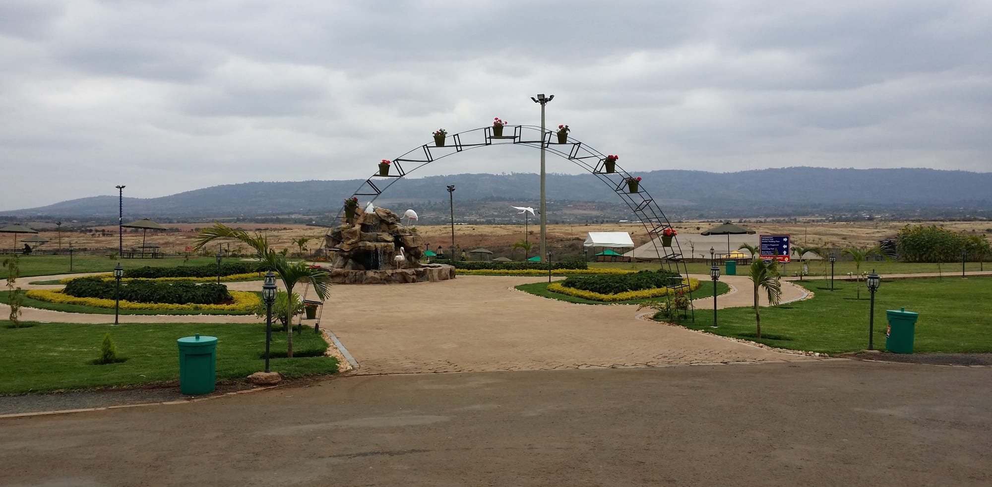
A landscaped park with lawns, flower beds, palms and a metal arch, with dry hills on the horizon under grey cloud

Mount Kenya, Meru & the East, Kenya

Machakos

Lawns and planting in Machakos People's Park, with the hills around the town behind. (Nairobi123 / Wikimedia Commons · CC BY-SA 4.0)

A hill town about 65 km south-east of Nairobi, set in a bowl of dry hills in the heart of Kamba country. Founded as the first British administrative centre in the interior in the late nineteenth century, it lost that role when the railway went to Nairobi instead, and is now a county capital and university town with a large public park.

Neighbourhoods

  • Town centre
    • First-time visitors
    • Markets
    • Close to public transport

    The compact grid below the hills, with the market, county offices, banks, hotels and the matatu stages for Nairobi and the Kamba country beyond. Most of what a visitor needs is within a few blocks.

    Open in Maps
  • Around the People's Park
    • Families
    • Parks
    • Events

    The open, newer edge of town laid out around the county's large public park, with space for concerts, sports and weekend crowds from Machakos and Nairobi. Hotels and restaurants have grown up along the approach roads.

    Open in Maps
  • Iveti hills
    • Quiet and residential
    • Views
    • Walks

    The steep, terraced ridges rising directly above the town, greener and cooler than the centre, covered in smallholdings, schools and churches, with wide views back down over Machakos.

    Open in Maps
  • Mua hills
    • Quiet and residential
    • Views

    A forested ridge on the higher ground towards the Nairobi road, with cool air, plantations and scattered farms — the area where many Nairobi commuters and weekend visitors have built.

    Open in Maps

Things to do

In the town

  • Machakos People's Parkpark

    A large landscaped public park beside the Maruba dam, with lawns, gardens, playgrounds and open ground used for concerts and county events.

    Open in Maps
  • Machakos Universityattraction

    A public university on the edge of town, which began in 1957 as a technical training school, became a university college in 2011 and was chartered as a full university in 2016.

    Open in Maps
  • Machakos marketmarket

    The town's produce and livestock trading ground, where maize, beans, pigeon peas, mangoes and goats from the surrounding dry country change hands.

    Open in Maps

Hills and viewpoints

  • Iveti Hillsviewpoint

    Terraced ridges rising immediately above Machakos, laid out in smallholdings and rows of stone-lined terraces, with tracks climbing to views over the town and the plains.

    Open in Maps
  • Mua Hillsviewpoint

    Higher, cooler wooded country in the hills outside the town, with plantations, farms and long views towards the Athi plains.

    Open in Maps

Short trips from the town

  • Ol Donyo Sabuk National Parkpark

    A small park north of Machakos built around a single forested mountain, with buffalo and birdlife and a track to a summit that looks towards Mount Kenya and Kilimanjaro in clear weather.

    Open in Maps
  • Konza Technopolislandmark

    A planned technology city being built on the plains south-west of Machakos, a flagship project of Kenya's Vision 2030 development plan.

    Open in Maps

Eat and drink

Long-standing places and food districts in Machakos. Hours, ratings and directions come from your maps app, always current.

Machakos classics

  • Nyama choma and local kitchens in the town centreneighborhood

    Goat roasted over charcoal and cut up with kachumbari, served with ugali, alongside plates of githeri and boiled pigeon peas in the small hotelis around the market.

    Open in Maps
  • Machakos marketmarket

    Maize, beans, pigeon peas, cassava, sweet potatoes and, in season, the mangoes the county is known for, piled in the open trading ground at the centre of town.

    Open in Maps

Cafés and street food

  • Tea houses and street stalls around the matatu stagesneighborhood

    Sweet milky chai with mandazi, chapati and roast maize sold to travellers and drivers where the Nairobi matatus load.

    Open in Maps

Experience Machakos

History

The town takes its name from Masaku wa Munyati, a Kamba chief who settled among these hills in the early nineteenth century. The Kamba were then among East Africa's most important long-distance traders, carrying ivory, hides and other goods between the interior and the coastal ports, and the country around Machakos sat on those caravan routes.

In the late 1880s the Imperial British East Africa Company placed a station here, and Machakos became the first British administrative centre in the interior of what became the East Africa Protectorate, a base for officials, soldiers and traders pushing inland. Its pre-eminence was brief. When the Uganda Railway was built through the plains in the late 1890s it bypassed the hills, and the depot founded on the swampy ground to the north-west grew into Nairobi, which took the administration, the trade and eventually the capital. Machakos was left as a district headquarters in a farming region.

Colonial land policy pressed hard on the Kamba: grazing land was alienated, and and a 1938 attempt to seize Kamba livestock met organised protest, led by figures such as Muindi Mbingu, which the community succeeded in resisting. Severe soil erosion in the following decades was tackled with an enormous programme of hand-dug terracing, which reshaped the hills. After independence Machakos remained a district town, its people heavily represented in the army and police and in labour migration to Nairobi. Devolution under the 2010 constitution made it the capital of Machakos County, bringing county offices, a public university and conspicuous investment in public works, of which the People's Park is the best known.

Culture & Customs

Machakos is the principal town of the Kamba, and Kamba identity runs through its cultural life. The community is known across Kenya for wood carving — figures, animals, bowls and masks sold in markets and curio shops far beyond the county — and it is practised in the villages around the town as well as in Machakos itself. Basketry and pottery are equally part of the tradition.

Kamba music and dance are the other great local export. Dances are noted for acrobatic display, with somersaults and lifts performed to drums, and Kamba guitar-and-drum bands have had a long place in Kenyan popular music. Church choirs are everywhere, and gospel, benga and Kamba-language recordings dominate the matatus and the market stalls.

The county has a strong tradition of migration and of military and police service, and families in the hills are often supported from Nairobi or abroad. Christianity is the dominant faith, with Catholic and Protestant churches, many of mission foundation, prominent in every neighbourhood. Kikamba is the everyday language, with Swahili and English in offices, schools and business. Respect for elders, mutual help at funerals and weddings, and the Harambee tradition of community fundraising are visible parts of daily life, and the county's public events — sports days, concerts in the park, agricultural shows — draw large crowds.

Daily Life

About 64,000 people live in the town itself, counted at the 2019 census, in a county of about 1.4 million, and the town's population swells on market days and at weekends. Mornings begin with matatus loading for Nairobi and produce coming down from the hills; the centre is busy through the day with traders, students and county workers, and quietens early in the evening.

The economy rests on farming, trade, government and education. Smallholdings on the terraced hills grow maize, beans, pigeon peas, cassava, sweet potatoes and fruit — mangoes above all — and keep goats and cattle, while water and the reliability of the rains are the constant anxiety of every farming household. County government, schools and the university are major employers, and a great many households depend on wages earned in Nairobi, close enough for daily or weekly commuting.

Nairobi's growth is the biggest force acting on the county. Its edge has reached Athi River and Syokimau in the north-west, where industry, cement works and housing estates have spread across land that was farmed a generation ago, and land prices around Machakos have risen with it. Water supply, the cost of living, youth unemployment and the subdivision of family land are the recurring local issues.

Food

Kamba cooking is built on drought-tolerant crops. Muthokoi, maize that has been pounded to remove the husk and then boiled with beans, is the dish most associated with the community and is served at celebrations as well as at home. Githeri, whole maize and beans boiled together, is the everyday equivalent, and pigeon peas, cowpeas, green grams, cassava and sweet potatoes fill out the rest of the table. Ugali with sukuma wiki — maize porridge with braised greens — is standard, as it is across Kenya.

Nyama choma, goat grilled over charcoal and eaten by the kilo with kachumbari, is the social meal here as elsewhere, and roadside butcheries around the town do a steady trade at weekends. Chapati, mandazi and roast maize are the street foods, and chai, tea boiled with milk and sugar, punctuates the day. Boiled cowpea leaves and pumpkin leaves are common vegetables.

The county is known for its fruit, especially mangoes, which are sold in great quantities by the roadside in season and processed locally, along with oranges, pawpaw and tamarind. A fermented sugar-cane wine is the traditional drink, long made by the Kamba and prepared for ceremonies and for elders.

Planning tools

Budget

Machakos is one of the cheaper county towns in Kenya. Guesthouses, matatus and local food cost little, and the main attraction, the county park, is inexpensive to enter. Prices rise at weekends and during events, when Nairobi visitors fill the hotels, and the better conference hotels in the hills cost several times a town guesthouse.

Daily Budget Midrange
USD 75–150 (a comfortable hotel, restaurant meals, taxis or a hired car)
Daily Budget Shoestring
USD 25–45 (guesthouse, local food, matatus)

There are no park fees to budget for here; the main costs are the room and getting out to the hills, which needs a taxi or a hired car.

Best Time to Visit

This is semi-arid country that depends on the short rains of October to December, when the hills turn green and mangoes and fruit come into season. June to September is dry, cool and dusty but comfortable for walking; January to March is hot and bright. The long rains from March to May are less reliable here than in the mountains.

Suggested Number of Days

The town, its market and the park are easily covered in a day, and many people visit from Nairobi without staying. Two or three days allow the surrounding hills, the carving villages and the country towards the Athi plains. Weekends are the liveliest and the busiest.

First Visit
1 day
With Surroundings
2–3 days

Transportation

Matatus and buses run constantly between Machakos and Nairobi and out to the market centres of the county, using the stages in the town centre. Boda-boda motorcycle taxis handle short trips and the steep lanes up into the hills, and taxis can be hired by the hour or the day. The hills and the outlying villages have no useful scheduled transport.

The tarmac road from the Nairobi–Mombasa highway is good, but the roads up into the Iveti and Mua hills are steep and become slippery after rain.

Airport & Station Connections

Machakos lies about 65 km south-east of Nairobi, reached by a branch road off the Nairobi–Mombasa highway; the drive takes roughly an hour and a half depending on traffic leaving the capital, and matatus and buses run the route all day. Jomo Kenyatta International Airport is the nearest airport, on the Nairobi side of the plains. Mombasa-bound traffic passes the turn-off on the main highway.

Walkability

The centre is small and walkable, with the market, offices and hotels within fifteen minutes of each other, though it is busy with matatus and the pavements are crowded with traders. The town sits in a bowl, so any walk out of the centre climbs steeply, and reaching the park or the hills generally means taking a boda-boda or a taxi.

Safety

Machakos is a calm town by Kenyan standards, and the region's parent page counts the Kamba counties among the settled parts of the east. The ordinary risks are pickpocketing and bag snatching in market crowds and at the matatu stages, road accidents on the Nairobi highway, and opportunistic theft after dark on unlit streets.

Avoid the north-eastern counties and the immediate Somali border, travel in the Marsabit area only with local advice, and take altitude sickness seriously on Mount Kenya. Check current official travel advice before travelling.

Climate

Semi-arid highland country, milder than the plains below because of the altitude. Rain comes in two seasons, with the short rains of October to December generally the more dependable, and dry spells can be long and hard on farming.

Summer
January to March is the hottest and brightest stretch, with days around 26–30°C
Winter
June to August is cool, dry and often overcast, with days around 21–24°C and chilly nights in the hills

Local Customs

This is Kamba country and predominantly Christian, with churches central to community life. Greetings are unhurried and elders are greeted first; dress is conservative outside hotels and the park. Kamba carving, basketry and dance are sources of local pride, and music and dance feature at weddings, funerals and county celebrations.

Ask before photographing people, market traders or carvers at work, dress modestly away from hotels and parks, and treat prices for crafts as the start of a polite negotiation; tipping is appreciated but not expected in small restaurants.

Common Payment Methods

The currency is the Kenyan shilling. Mobile money is used for nearly everything, including matatu fares and market purchases, and is often preferred to cash. Banks and ATMs are in the town centre, cards work at the larger hotels, and the market and small kiosks need cash or mobile money.