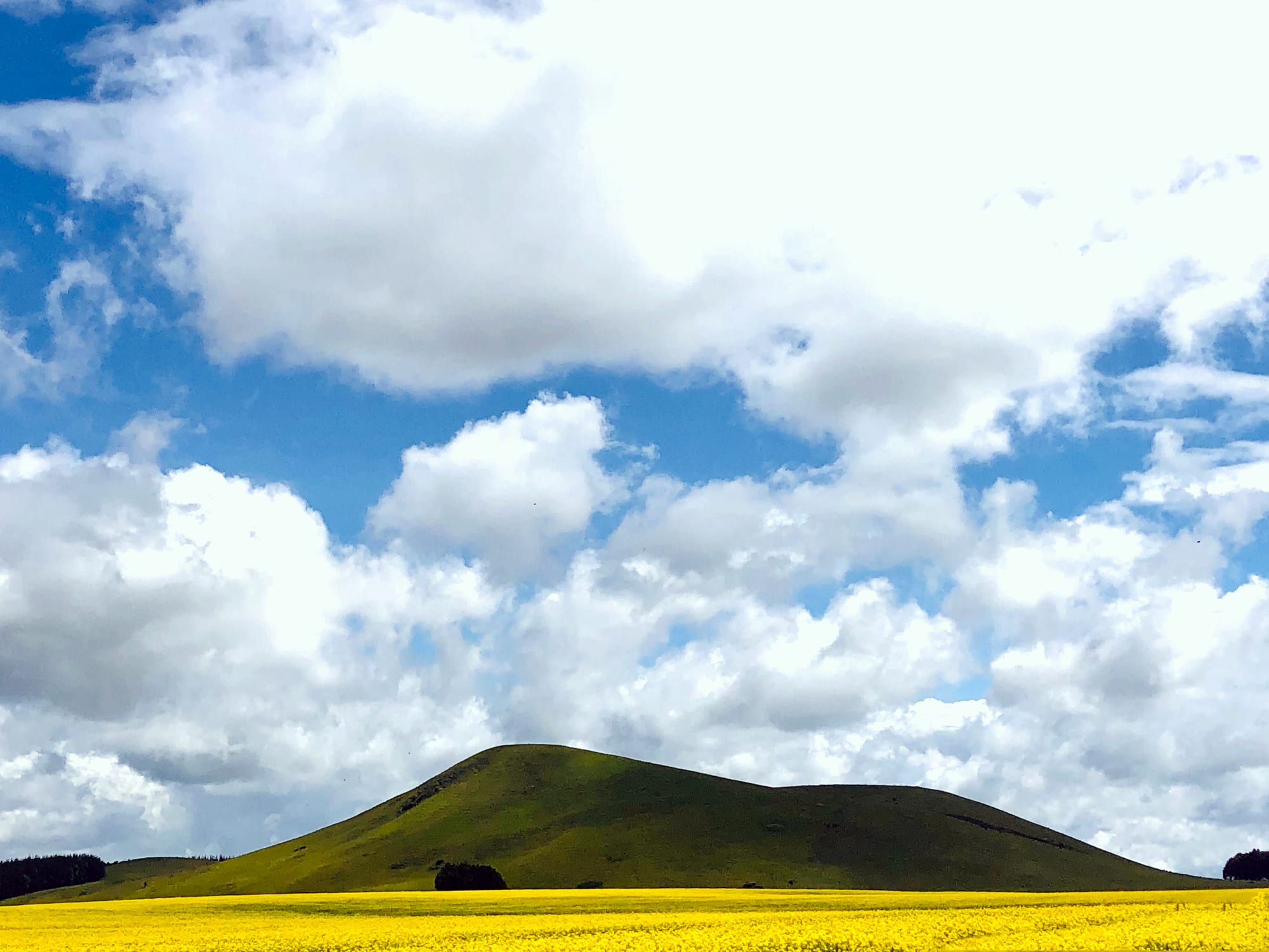
A field of yellow flowering crop below a rounded green hill under a sky of heavy white cloud

Mount Kenya, Meru & the East, Kenya

Meru

Farmland and a hill in the Meru highlands, on the eastern side of Mount Kenya. (Antony Trivet / Wikimedia Commons · CC BY-SA 4.0)

A highland town on the eastern slopes of Mount Kenya, about 8 km north of the equator at some 1,600 metres, and the headquarters of Meru County. It grew as a colonial administrative post among coffee, tea and banana farms, and is now a busy trading centre for the Ameru highlands, the Nyambene hills and the miraa trade, and the usual approach to Meru National Park.

Neighbourhoods

  • Town centre
    • First-time visitors
    • Markets
    • Close to public transport

    The compact grid of shops, banks, county offices and hotels along the main road, with matatu stages at either end. Most of the town's business is done within a few streets, and the ground falls away towards the lowlands on the eastern side.

    Open in Maps
  • Makutano
    • Local life
    • Transport
    • Everyday shopping

    The junction quarter on the northern side of town where the roads towards Isiolo and the Nyambene hills meet. It is the busiest edge of Meru for through traffic, long-distance buses and the lorries that move produce.

    Open in Maps
  • Gakoromone
    • Markets
    • Best for food

    The market end of town, where produce from the surrounding farms is traded in bulk — bananas, potatoes, maize, beans and greens — and miraa is handled in its own part of the trade. Loud and crowded on the main market days.

    Open in Maps
  • Kaaga
    • Quiet and residential
    • Students

    A leafy area on the upper, cooler side of Meru with a long missionary history, a cluster of well-known schools and, a few kilometres out, the campus of Kenya Methodist University. Quieter than the centre, with student housing, churches and schools among smallholdings.

    Open in Maps

Things to do

In the town

  • Meru Museummuseum

    A national museum in the town centre housed in the 1916 District Commissioner's office, the oldest stone building in Meru, with galleries on Meru culture, human evolution and the natural history of the district.

    Open in Maps
  • Kenya Methodist Universityattraction

    A chartered private university founded by the Methodist Church in Kenya, set in woodland on the north-eastern slopes of Mount Kenya about 5 km from the town.

    Open in Maps

Short trips from the town

  • Meru National Parkpark

    Well-watered bush and rivers on the lowlands east of town, where George and Joy Adamson raised Elsa the lioness and where she is buried, and which now holds both black and white rhino.

    Open in Maps
  • Mount Kenya National Parkpark

    The forest, moorland and peaks of Africa's second-highest mountain, a UNESCO World Heritage Site, rising west of Meru; the Chogoria route, cut in from the east, climbs this side of the mountain.

    Open in Maps
  • Lewa Wildlife Conservancypark

    A conservancy on the plains west of Meru, holding more than a tenth of Kenya's eastern black rhino and the world's largest single population of Grevy's zebra.

    Open in Maps
  • Isioloneighborhood

    The crossroads town north of Meru where the highlands end and the northern roads begin, with a mixed Borana, Somali, Turkana, Meru and Samburu population.

    Open in Maps

Eat and drink

Long-standing places and food districts in Meru. Hours, ratings and directions come from your maps app, always current.

Meru classics

  • Nyama choma and local kitchens in the town centreneighborhood

    Grilled goat by the kilo, served with kachumbari and ugali, alongside plates of githeri, beans and greens in the small hotelis around the main street.

    Open in Maps
  • Gakoromone marketmarket

    The town's produce market, piled with bananas, arrowroot, potatoes, avocados and greens brought down from the surrounding ridges, and the place to see the scale of Meru's farming.

    Open in Maps

Cafés and street food

  • Tea houses and chapati stalls around Makutanoneighborhood

    Sweet milky chai, mandazi, chapati and smoky roast maize sold to drivers and traders at the junction end of town.

    Open in Maps

Experience Meru

History

The Ameru settled the well-watered eastern slopes of Mount Kenya over several centuries, farming the ridges between the rivers and grazing stock on the drier ground below. Authority rested not with chiefs but with age-sets and with the Njuri Ncheke, a council of senior elders that judged disputes, set the farming calendar and sanctioned ceremonies, and which still has standing in the county today.

British administration reached the district at the beginning of the twentieth century, and Meru grew up around the government station, its early stone offices, a prison and the mission compounds that followed. Methodist and Catholic missions opened schools and clinics on the upper slopes, and the colonial administration pushed coffee, tea and later pyrethrum onto smallholdings, tying the district into the cash economy and the road network. The town became the market where that produce was collected and where officials, traders and missionaries met.

Meru County was drawn into the Mau Mau years of the 1950s through its forest edge and its links with Kikuyu neighbours on the far side of the mountain, and the detention and villagisation of the period were felt here as elsewhere in the central highlands. After independence the town went on growing as a farming and trading centre; miraa from the Nyambene hills became one of Kenya's more valuable cash crops, moved out by fast lorry and by air. Devolution under the 2010 constitution made Meru the seat of a county government, adding offices, a university presence and a fresh round of building along the main road.

Culture & Customs

Meru is the centre of Ameru life, and identity here is bound up with the mountain, with farming and with the authority of elders. The Njuri Ncheke remains the best-known institution of the community: its elders arbitrate land and family disputes, bless ceremonies and are consulted by politicians who want standing in the county. Age-sets and initiation ceremonies still order social life in the rural locations, alongside a strongly church-going Christianity — Methodist, Catholic and Presbyterian congregations all have deep roots, and Pentecostal churches have grown quickly.

Miraa, the stimulant leaf also called khat, is more than a crop in this part of Kenya. The Nyambene hills grow the best-known grades, the harvest is cut in the early morning and rushed out the same day, and the trade supports growers, graders, drivers and traders across the county. Chewing it is an everyday social activity here in a way that it is not in most of the country, and the trade's fortunes — including foreign import bans — are followed closely in the town.

Kimeru is the language of the streets and markets, with Swahili and English used in offices and schools. The town is proud of its schools and of Kenya Methodist University, and it follows athletics and football as closely as anywhere in the highlands. Traditional Ameru songs and dances appear at weddings, funerals and county celebrations, where elders' red-trimmed robes and staffs mark out the Njuri Ncheke.

Daily Life

The urban centre had about 291,000 residents at the 2019 census, making Meru the sixth largest urban area in Kenya, while Meru County as a whole holds more than a million. Life in the centre begins before dawn, when produce lorries and miraa vehicles move, and the market is at its busiest by mid-morning; county offices, banks and shops keep ordinary working hours, and the town empties back into the surrounding ridges in the evening.

Farming underpins everything. Smallholdings on the upper slopes grow coffee, tea, bananas, potatoes, maize and beans, with dairy cattle kept in stalls; the drier lower zones grow millet, sorghum and cotton-belt crops and keep goats. Miraa money circulates visibly through the town in vehicles, buildings and shops. Government, the county administration, schools, hospitals and the university are the main formal employers, and the informal trade of the market and the boda-boda stages absorbs much of the rest.

Land fragmentation as farms are divided between children, the cost of farm inputs, the volatility of coffee and miraa prices and unreliable rains are the recurring worries. Younger people leave for Nairobi and for work abroad, and remittances show in new houses on the ridges. Water, roads into the hills and the pressure of building on farmland dominate county politics.

Food

Meru eats much as the rest of the Mount Kenya highlands does. Ugali, the stiff maize porridge, is the everyday staple, eaten with sukuma wiki — braised collard greens — beans or a stew of goat or beef. Githeri, maize and beans boiled together, is the ordinary lunch of farms and schools, and mukimo, a mash of potato, maize, beans and greens, appears at celebrations. Bananas are used as a vegetable as much as a fruit here, stewed with meat or beans, and arrowroot, yams and sweet potatoes are common breakfast foods.

Nyama choma, goat roasted over charcoal and cut up on a wooden board with kachumbari — a salad of tomato, onion and chilli — is the social meal, ordered by the kilo at butcheries on the edges of town. Chapati, mandazi fried dough and smoky roast maize are the street foods, and chai, strong black tea boiled with milk and sugar, is drunk through the day. Coffee is grown all around the town but, as elsewhere in Kenya, is more often exported than drunk locally.

The market end of town shows what the county produces: bananas by the stem, avocados, potatoes, tomatoes, beans, greens and miraa in its own tied bundles, wrapped in banana leaves to keep it fresh for the road.

Planning tools

Budget

Meru itself is inexpensive: guesthouses, matatus and local food cost little, and the town has none of the safari mark-up. The cost of a visit is decided by what is done outside it — park entry fees for Meru National Park and Mount Kenya are charged in US dollars, a conservancy stay is several times the price of a town hotel, and a hired vehicle with a driver is the usual way to reach the parks.

Daily Budget Midrange
USD 75–170 (a good town hotel, restaurant meals, a hired car with driver for part of the day)
Daily Budget Shoestring
USD 25–45 (guesthouse, local food, matatus)

Park fees and lodges are the real expense here; the town, its markets and the road up into the hills cost almost nothing.

Best Time to Visit

The drier stretches of January to February and late June to early October are the easiest for the roads up into the hills and for the parks below the town. The long rains from March to May and the short rains of October to December turn the country green and the murram side roads soft. Altitude keeps the town mild all year.

Suggested Number of Days

A day or two covers the town, its market and the museum. Three to five allow the national park on the lowlands, the hills to the north-east or a trek on the mountain's eastern side. The number depends mostly on whether a vehicle is hired for the parks.

First Visit
1–2 days
With Surroundings
3–5 days

Transportation

Matatus and shared taxis run constantly between the centre and Makutano and out to the surrounding market centres, and boda-boda motorcycle taxis cover the short hops and the steep lanes. Long-distance buses link Meru with Nairobi, Nanyuki, Embu and Isiolo. Reaching Meru National Park or the upper slopes of Mount Kenya effectively requires a hired vehicle.

Roads off the tarmac are steep, red-earth and slippery after rain, so allow far more time than the distance suggests.

Airport & Station Connections

Meru is about 230 km north-east of Nairobi by good tarmac road around the eastern side of Mount Kenya through Embu and Chuka, a drive of roughly five hours, with frequent buses and matatus. Isiolo lies about 35 km north by a tarmac road through Ruiri, on the highway towards Marsabit and Ethiopia, and has the nearest airport.

Walkability

The centre is small enough to cross on foot in fifteen or twenty minutes, and the market, the county offices and most hotels are within that area. The town is built on a slope, so walking means climbing; pavements are uneven and often taken up by traders, and boda-bodas are used for anything beyond the centre.

Safety

Meru is a calm county town. The ordinary risks are pickpocketing and bag snatching in the market crowds, road accidents on the mountain roads and opportunistic theft after dark. The mountain itself brings altitude sickness, and the far northern roads beyond Isiolo are a different matter from the highlands around Meru.

Avoid the north-eastern counties and the immediate Somali border, travel in the Marsabit area only with local advice, and take altitude sickness seriously on Mount Kenya. Check current official travel advice before travelling.

Climate

An equatorial highland climate softened by altitude, with two rainy seasons rather than hot and cold halves of the year. Days are mild to warm and nights cool; cloud often sits on the slopes above the town in the afternoons.

Summer
January to March is the warmest and driest spell, with days around 25–28°C
Winter
June to August is cooler and greyer, with days nearer 20–23°C and chilly nights

Local Customs

This is Ameru country, Christian in the main and conservative in dress and manner. Greetings matter and are unhurried, elders are addressed first, and the Njuri Ncheke council of elders still settles disputes and presides over ceremonies. Miraa is a normal part of the local economy and social life here in a way it is not elsewhere in Kenya.

Dress modestly away from hotels, ask before photographing people, market traders or miraa handling, and expect a tip rather than a set service charge in small restaurants; tipping is appreciated but not obligatory.

Common Payment Methods

The currency is the Kenyan shilling. Mobile money is used for almost everything, from matatu fares to market purchases, and small businesses often prefer it to cash. Banks and ATMs are in the town centre, cards work in the larger hotels, and market stalls need cash or mobile money.