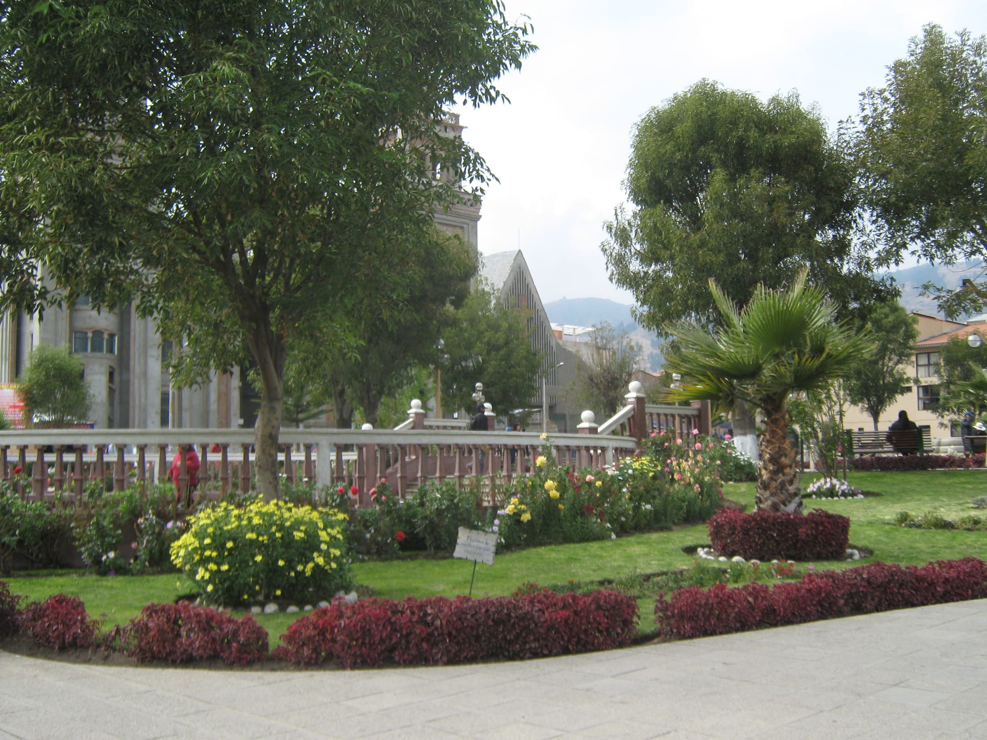
Flower beds, lawns and trees in a town square, with a pale stone church tower and a steep roof behind the trees

Lima & the Central Coast, Peru

Huaraz

Gardens on the Plaza de Armas of Huaraz. (FMG / Wikimedia Commons · CC BY-SA 4.0)

The capital of the Ancash Region, at about 3,050 metres in the Callejón de Huaylas valley between the snow peaks of the Cordillera Blanca and the bare Cordillera Negra. Almost entirely destroyed by the 1970 earthquake and rebuilt with wide modern streets, it is now a market town of about 120,000 people and the base for trekking and climbing in the Cordillera Blanca.

Neighbourhoods

  • Plaza de Armas and the centre
    • First-time visitors
    • Close to public transport
    • Markets

    The main square with the cathedral and city hall, rebuilt after 1970 on a grid of wide streets. Avenida Raimondi, the Central Market, the craft market on the plaza and most tour agencies and bus offices are a short walk apart.

    Open in Maps
  • La Soledad
    • Quiet and residential
    • Close to the trails

    One of the four traditional neighbourhoods the town was founded with, around La Soledad church and the small plaza in front of it. Several guesthouses and hostels are here.

    Open in Maps
  • Jirón José Olaya
    • Historic district

    The one street of traditional houses that survived the 1970 earthquake, which destroyed 95 per cent of the city. It gives an idea of how the old Huaraz looked before the disaster.

    Open in Maps
  • Independencia
    • Local life

    The district north of the Quillcay river, which with the district of Huaraz holds the city's population. The city has spread northwards here, with newer neighbourhoods such as Centenario, the largest in the city.

    Open in Maps

Things to do

In and around town

  • Museo Regional de Ancashmuseum

    The regional museum, which holds a very large collection of ancient stone sculptures, including fine examples of Chavín work.

    Open in Maps
  • Wilcahuaínlandmark

    An archaeological site near the village of Paria, about 6 km north-east of the city at 3,400 metres, regarded as one of the most important sites of the Wari culture, possibly built around AD 1100.

    Open in Maps
  • Central Marketmarket

    The city's food market off Avenida Raimondi, where trekkers stock up for expeditions and small stalls serve regional dishes.

    Open in Maps

Short trips into the Cordillera Blanca

  • Huascarán National Parkpark

    The national park that protects most of the Cordillera Blanca, the world's highest tropical mountain range, about 150 km long, with Huascarán, Peru's highest mountain at 6,768 metres.

    Open in Maps
  • Lake 69trail

    A small glacial lake fed by a waterfall in the thaw season, one of the region's more important tourist destinations, reached on foot from the Cebolla Pampa campground; it was given its number when the park was created in 1975.

    Open in Maps
  • Llanganuco Lakesviewpoint

    Two lakes, Chinancocha and Orconcocha, in a valley of the Cordillera Blanca about 25 km north-east of Yungay, inside the national park.

    Open in Maps
  • Pastoruri Glacierviewpoint

    A cirque glacier in the southern part of the Cordillera Blanca, one of the few glaciers left in the tropical areas of South America.

    Open in Maps

Short trips beyond the valley

  • Chavín de Huántarlandmark

    A UNESCO World Heritage Site over the range to the east, with ruins built from as early as 1200 BC by the Chavín, one of the major pre-Inca cultures.

    Open in Maps
  • Yungayattraction

    The rebuilt town near the site of old Yungay, buried by the avalanche from Huascarán in the 1970 earthquake; the area of the buried town is a national cemetery where excavation is forbidden.

    Open in Maps

Eat and drink

Long-standing places and food districts in Huaraz. Hours, ratings and directions come from your maps app, always current.

Huaraz classics

  • Picante de cuyrestaurant

    Guinea pig, the regional dish, often served as picante de cuy in a spicy sauce at small local restaurants.

    Open in Maps
  • Andean restaurants in the centreneighborhood

    Places around the Plaza de Armas serving highland food — pachamanca cooked in an earth oven and fried trout.

    Open in Maps

Markets

  • Central Marketmarket

    The main food market, with produce stalls and small eateries, a starting point for buying supplies before a trek.

    Open in Maps
  • Sunday street marketmarket

    On Sundays local people sell regional foods at a street market in the city.

    Open in Maps

Experience Huaraz

History

People settled the valley of the Santa River and its tributaries long before the Inca, and the Wari culture left the site of Wilcahuaín on the hills above the city. Huaraz takes its name from the Quechua Waraq, meaning dawn. On 20 January 1574 Alonso de Santoyo founded a Spanish-Indigenous reduction here, Pampa Huarás de San Sebastián, with 14 quarters; by the 1570s hundreds of Quechua speakers were labouring in the region's mines, and whole villages were forcibly marched away and resettled. During the wars of independence the city supported the liberating army with food and arms.

The mountains above the city have repeatedly brought disaster. In 1941 the dam of Lake Palcacocha, the city's water supply, burst after an avalanche of glacier ice, and floodwater and debris destroyed much of the north side and a large part of the centre. On 31 May 1970 the Ancash earthquake, the most catastrophic natural disaster in Peru's history, destroyed 95 per cent of Huaraz; the same reservoir burst again, and an avalanche off Huascarán buried the town of Yungay further down the valley.

The city was rebuilt on a new plan with wider streets, since the narrow colonial lanes had been deathtraps during the earthquake. Only Jirón José Olaya kept its traditional houses. Huaraz grew again as the capital of the Ancash Region and the commercial centre of the Callejón de Huaylas, and from the late 20th century as the base for visitors to Huascarán National Park, created in 1975.

Culture & Customs

Huaraz is the main tourist destination of the Ancash Region. Visitors from around the world come for climbing, hiking, mountain biking and snowboarding in the Cordillera Blanca, whose peaks — Huascarán, the highest mountain in the tropics, and its neighbour Huandoy — are clearly visible from the city in fair weather. Guides, porters and outfitters are part of the local economy and culture, and the town fills with trekkers in the dry season.

The city is also a centre of Andean heritage. Quechua is spoken by a minority, mostly in the rural districts. The city's patron is the Señor de la Soledad, whose image dates from the Spanish founding, and its main religious festivals fall in Holy Week and in May. The regional museum's collection of carved stone, with fine examples of Chavín sculpture, links Huaraz to the temple of Chavín de Huántar over the range.

The memory of 1970 shapes local identity. The loss of almost all the old city left Huaraz with a modern, plain appearance, and the national cemetery on the site of buried Yungay is visited as a place of mourning rather than a sight.

Daily Life

About 119,000 people lived in the Huaraz urban area at the 2017 census, spread across the districts of Huaraz and Independencia. It is the largest town of the Callejón de Huaylas, an important farming valley, and one of the biggest towns in the Peruvian Andes. About half the working population is in commerce and services, and smaller food companies making soft drinks, beer and cheese employ around 13 per cent; tourism adds a strong seasonal income.

The day centres on the markets around Avenida Raimondi, the plaza and the agencies selling treks, and minibuses link the city with the villages of the valley and the Cordillera Negra. On Sundays a street market fills with local people selling regional foods.

Water and ice are pressing concerns. The area of permanent ice in the Cordillera Blanca shrank by about a third between the 1970s and 2006, and the glaciers supply part of northern Peru's water year-round. Lake Palcacocha, whose floods struck the city in 1941 and 1970, has grown as the glacier beside it has receded.

Food

The food of Huaraz is Andean. Cuy, guinea pig, is the regional dish, often served as picante de cuy in a spicy sauce at small local restaurants and market stalls. Pachamanca, meat and potatoes cooked over hot stones in an earth oven, is another highland dish, and trout, raised in fish farms in the region, is on many menus. Other local dishes include tamales, humitas and caldo de patasca.

The Central Market is the place to see the produce of the valley and a starting point for buying supplies for expeditions. Small eateries in and around the market serve set lunches, and on Sundays the street market sells regional foods.

Dairy and drinks are local industries too: cheeses and milk products, soft drinks and beer are made in the city. Coca tea is drunk across the Andes for the altitude.

Planning tools

Budget

Huaraz is much cheaper than Lima for rooms and food. The costs that add up are guided treks, tours by minibus to the lakes and Chavín, gear hire and national park entry. Multi-day treks with a guide, cook and pack animals are the biggest expense.

Daily Budget Midrange
USD 80–160 (guesthouse or mid-range hotel, restaurant dinners, a day tour or guided trek)
Daily Budget Shoestring
USD 30–50 (hostel bed, menú lunches, market food, shared minibuses)

Book treks through established operators, and allow acclimatisation days, which cost little, before the expensive guided trips.

Best Time to Visit

May to September is the dry season, when the trails are dry and the peaks are clear; this is the main trekking and climbing season. The rains fall from about December to March. The town itself can be visited all year.

Suggested Number of Days

Allow three or four days for a first visit, because a day or two is needed to acclimatise after arriving from the coast. A multi-day trek in the Cordillera Blanca, or bad weather in the rainy season, adds several days more.

First Visit
3–4 days
With Surroundings
6–10 days

Transportation

The centre is small enough to cover on foot. Shared minibuses, the combis and colectivos, run to nearby villages and up the valley, and tour companies take visitors to the trailheads and lakes by minibus. Taxis are cheap for short trips around the city.

Colectivos to nearby villages leave from around the Central Market; ask locally for the right route.

Airport & Station Connections

Huaraz is about 420 km north of Lima. Most visitors arrive by coach from the capital, a journey of about eight hours on a road that climbs over the Cordillera Negra. Buses also link Huaraz with the north coast and the other towns of the Callejón de Huaylas.

Walkability

The rebuilt centre is compact and easy to walk, with wide streets laid out after 1970. At over 3,000 metres even gentle hills are tiring for new arrivals, so walking is slower than at sea level for the first days.

Safety

The standard tourist circuit — Lima's Miraflores and Barranco, Cusco, the Sacred Valley, Arequipa, Puno — is generally safe with urban precautions, but crime has risen. In Ancash the risks are altitude, glacier hazards and remote trails, and the region is highly seismic. Huaraz sits at about 3,100 metres, and travellers from Lima may need a day or two to acclimatise; the thin air also increases the strength of the sun.

Acclimatise in Huaraz before trekking, use licensed operators for serious treks, and protect against strong sun at altitude. Check current official travel advice before travelling.

Climate

A highland climate with a dry season, from May to September, and a rainy season, from about December to March, rather than a summer and winter. Mornings are typically sunny and dry and evenings cold, with temperatures generally between 11 and 17°C and highs that can pass 21°C.

Summer
December–March, the rainy season; mornings typically sunny, evenings cold, generally 11–17°C
Winter
May–September, the dry season, with the least rain in June and July; generally 11–17°C, highs can pass 21°C

Local Customs

Quechua is spoken by a minority, mainly in the rural villages around the city. The main religious festivals fall in Holy Week and in May. Ask before photographing people, particularly women in traditional dress.

Tipping is not practised in taxis. Respect the national park's rules and carry rubbish out from the trails.

Common Payment Methods

The currency is the sol (PEN). Cards are accepted by larger hotels and tour agencies, but cash is needed in markets, small restaurants, colectivos and the villages. There are ATMs in the centre, most charging fees.