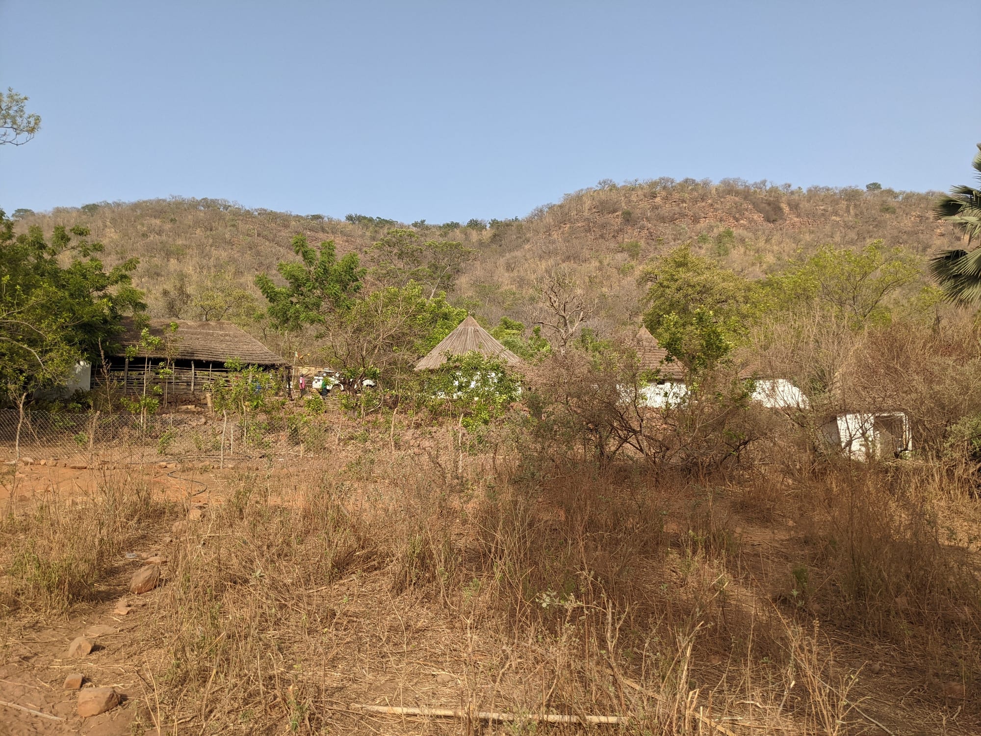
Thatched round houses and trees below a line of dry wooded hills under a clear sky

The Casamance & the East, Senegal

Kédougou

A village below the wooded hills of the Kédougou region in south-eastern Senegal. (Catjacket / Wikimedia Commons · CC BY-SA 4.0)

A small town in the far south-east of Senegal, on the Gambia river close to the borders with Guinea and Mali. Long one of the country's most remote places, it is the capital of a region of wooded hills and waterfalls, the base for visits to Bassari and Bedik villages, and the centre of a gold-mining boom that has reshaped its economy.

Neighbourhoods

  • The town centre
    • First-time visitors
    • Markets
    • Transport

    The administrative and commercial core, with the regional offices, banks, the main market, transport yards and most places to stay. Everything in the town is within walking distance of it.

    Open in Maps
  • The riverside
    • Quiet and residential
    • Walks and viewpoints

    The edge of town along the Gambia river, where gardens, mango trees and washing places line the bank. The water draws people at the end of the day and marks the way out towards the hills.

    Open in Maps
  • The outer quarters
    • Local life
    • Quiet and residential

    Compounds of concrete and mud-brick houses spreading along the approach roads, where much of the town's fast-growing population lives. Small shops, mosques and workshops serve each quarter.

    Open in Maps

Things to do

The hills and villages

  • Bandafassiattraction

    A village south-west of the town at the foot of the hills, the usual starting point for the climb to the Bedik villages on the heights above.

    Open in Maps
  • Dindefeloattraction

    A Fula village below the Guinean escarpment, known for the waterfall, roughly 100 metres high, that drops from the cliff behind it into a pool in a wooded gorge.

    Open in Maps

Short trips from the town

  • Bassari Countryattraction

    The cultural landscape of the Bassari, Fula and Bedik peoples, inscribed by UNESCO in 2012 for its terraced hill villages, farming systems and ceremonies.

    Open in Maps
  • Salémataattraction

    A small town west of Kédougou in the Bassari hills, reached by a rough road and used as a base for walking between hilltop villages.

    Open in Maps
  • Niokolo-Koba National Parkpark

    A very large savanna and gallery-forest park on the Gambia river, a UNESCO World Heritage Site with hippos, antelopes, primates and a small lion population.

    Open in Maps

Eat and drink

Long-standing places and food districts in Kédougou. Hours, ratings and directions come from your maps app, always current.

Markets and food streets

  • Kédougou marketmarket

    The town's market, selling fonio, rice, groundnuts, dried fish, mangoes and oranges in season, and the cheap cooked food that feeds traders and miners.

    Open in Maps
  • Eating houses around the transport yardneighborhood

    Simple kitchens and stalls near where the buses and sept-place taxis load, serving rice and sauce, grilled meat and tea to people waiting for a ride.

    Open in Maps

Eastern Senegal classics

  • Fonio and groundnut saucesrestaurant

    Fonio, the fine highland grain grown in the hills, steamed like couscous, alongside mafé groundnut stew, rice with leaf sauces and grilled goat or mutton.

    Open in Maps

Experience Kédougou

History

Kédougou sits where the Gambia river leaves the hills, in country settled long before Senegal existed as a state. The Bassari and Bedik have farmed the heights and their terraces for centuries, in villages built defensively on rocky spurs; Malinké communities linked to the old Mali empire hold the valleys, and Fula herders and farmers moved in from the Fouta Djallon, just over the hills in Guinea, over several hundred years. The area lay on routes carrying gold, kola and salt long before any colonial officer arrived.

The French reached the upper Gambia late in the nineteenth century and made Kédougou a small administrative post on the edge of their territory. Distance did the rest: for most of the twentieth century this was the end of the road, tied more closely to Guinea and Mali than to Dakar, with a dry-season track north to Tambacounda and little else.

Two changes remade the town. In 2008 Kédougou was made the capital of a new region, bringing offices, staff and services to a place that had been governed from Tambacounda. Then industrial gold mining arrived in the surrounding country, alongside the artisanal digging that had always gone on, drawing workers from across Senegal and neighbouring countries and turning a quiet administrative post into a boom town. In 2012 UNESCO inscribed the Bassari, Fula and Bedik cultural landscape in the hills around it, recognising a way of life that the mining economy now presses against.

Culture & Customs

Kédougou's interest is that several peoples live side by side here without merging. The Bassari, who call themselves Beliyan, keep an age-grade system, a calendar of masked ceremonies and initiations, and a strong attachment to their hill villages. The Bedik, in villages such as those above Bandafassi, build conical thatched houses on steep ground and hold their own initiations and beliefs alongside Christianity and Islam. Fula and Malinké communities, mainly Muslim, farm and herd in the valleys and dominate the town.

Masks, drumming and wrestling belong to the ceremonial calendar rather than to the tourist season. Initiations are held at intervals set by the elders, usually in the dry months and early rains, and they are events for the community first; outsiders attend only by invitation and on the village's terms, and photographing them is not automatically allowed.

Everyday manners follow Senegalese norms — long greetings, respect for age, shared bowls at meals — over several languages: Pulaar, Malinké, Bassari, Bedik and Wolof, with French in offices and schools. The UNESCO listing has brought attention, income and pressure at once, and villages differ in how much contact with visitors they want, which is why local guides from the communities themselves do most of the arranging.

Daily Life

The 2023 census counted about 59,000 people in Kédougou, more than three times the figure recorded in 2007, a rise that followed the creation of the region and the opening of the mines; and the surrounding region remains one of the least densely settled in Senegal. The town is young, mixed and transient, with workers from elsewhere in the country and from Mali, Guinea and Burkina Faso.

Gold dominates the economy — the industrial mines in the surrounding hills and the artisanal camps that employ far more people, in conditions that are dangerous, environmentally damaging and largely outside the law. Beside it, the older economy continues: millet, maize, fonio, groundnuts and cotton, cattle, market gardening along the river, and trade across the Guinean border.

Life is organised around the heat. Business is done early and late, the middle of the day is quiet, and the river and the shade of mango trees are where people gather. Electricity and water supply have improved with the region's new status but remain uneven. The persistent issues are the distance from Dakar and the cost of transport, mercury and deforestation from informal mining, pressure on land and water, and the gap between the wealth leaving the region and what stays in it.

Food

Eastern Senegal eats differently from the coast. Fonio, a tiny grain grown on the poor hillside soils, is the local speciality: steamed like couscous, served with a groundnut or leaf sauce, or eaten with sour milk. Millet and maize appear as couscous and as thick porridges, and rice is common in the town but is largely bought rather than grown.

Sauces do the work. Mafé, a groundnut stew with meat or fish, is the everyday dish; leaf sauces made with baobab or sweet-potato leaves, okra and dried fish turn out thick and dark; and yassa, with lemon and onions, travels here from further west. Meat is more central than on the coast — goat and mutton grilled over charcoal, sold in the evening near the market — while fish is usually dried or smoked and used to flavour a sauce.

The hills supply honey, wild fruit such as the tart baobab pod and the jujube, shea butter, and mangoes and oranges in enormous quantity in season. Palm wine and locally brewed millet or maize beer are part of Bassari and Bedik village life, and sweet ataya tea, hibiscus bissap and ginger juice are drunk everywhere.

Planning tools

Budget

Kédougou is inexpensive for food and rooms, but reaching the villages and the park is not: tracks demand a four-wheel-drive vehicle and a driver, and guides are hired locally. The gold boom has pushed prices for rooms and basic goods above what the town's size would suggest.

Daily Budget Midrange
USD 80–210 (better hotel or lodge, restaurant meals, a vehicle and driver or a guided park visit)
Daily Budget Shoestring
USD 25–50 (basic hotel or campement, market food, shared taxis)

Bring cash: machines in the town are few and can be out of service, and nothing outside it takes cards.

Best Time to Visit

November to February is the most comfortable season, with dry roads, cool nights and water still falling at Dindéfélo. March to May is fiercely hot, often around 40°C. The rains from June to October turn tracks to mud and make the hill villages hard to reach, though the country is green.

Suggested Number of Days

Two or three days cover the town and the nearest hills. Four to six allow for the more distant villages and protected areas, where the roads are slow. Walking in the hills and the timing of local ceremonies are what usually extend a stay.

First Visit
2–3 days
With Surroundings
4–6 days

Transportation

The town is small and is crossed on foot. Motorbike taxis are the everyday transport, and shared sept-place taxis and minibuses run to Tambacounda and on towards Dakar, and across the border into Guinea. Hired four-wheel-drive vehicles with drivers are the practical way to reach the villages, the waterfall and the park.

Agree the price and the route for a hired vehicle in advance, and travel between towns in daylight.

Airport & Station Connections

Most people arrive by road from Tambacounda, about 230 km north on a paved route, which is itself a long day's travel from Dakar by bus or sept-place taxi. There is a small airport, though scheduled air links are slight. Crossings into Guinea and Mali lie close by, and the Guinean border is only a short distance south.

Walkability

The centre is compact and easily walked, with the market, offices and transport yard close together, though there are few pavements and the heat shortens the walking day. Anything beyond the town — the villages, the hills, the falls — needs a vehicle or a long hike with a guide.

Safety

Senegal is one of the safer and more stable countries in West Africa, and Dakar and the tourist areas are generally fine with normal precautions. Kédougou is calm, and visitors are rare enough to attract curiosity rather than trouble. The greater risks are practical ones: road accidents, extreme heat, malaria, and slippery rock and fast water at the waterfall. The region borders Mali, and the artisanal gold-mining camps around it are rough, unregulated places where disputes and accidents are common.

Stick to main roads and established routes, do not walk into bush areas near the borders, and take malaria precautions. Check current official travel advice before travelling.

Climate

Sudanian savanna climate, hotter than most of Senegal, with a single rainy season and a long dry one. The hills make nights cooler than in the plains around Tambacounda, and harmattan dust hazes the air early in the year.

Summer
hot and wet, roughly 24–35°C, with heavy storms from June to October
Winter
dry, with warm days around 33–38°C, cool nights and dusty air; April and May are hotter still

Local Customs

The region is shared by Fula, Malinké, Bassari, Bedik, Jalonké and Dialonké communities, Muslim, Christian and followers of traditional religion, and several languages are used alongside French and Wolof. Initiation rites, masks and sacred sites belong to the villages that hold them, and access is granted, not assumed.

Visit hill villages with a local guide, ask permission before photographing people, ceremonies or shrines, and dress modestly away from the water.

Common Payment Methods

The currency is the West African CFA franc (XOF). Kédougou has banks and cash machines, but they can run out of notes, and mobile money is widely used. Cards are of little use beyond one or two hotels, and villages and guides are paid in cash.