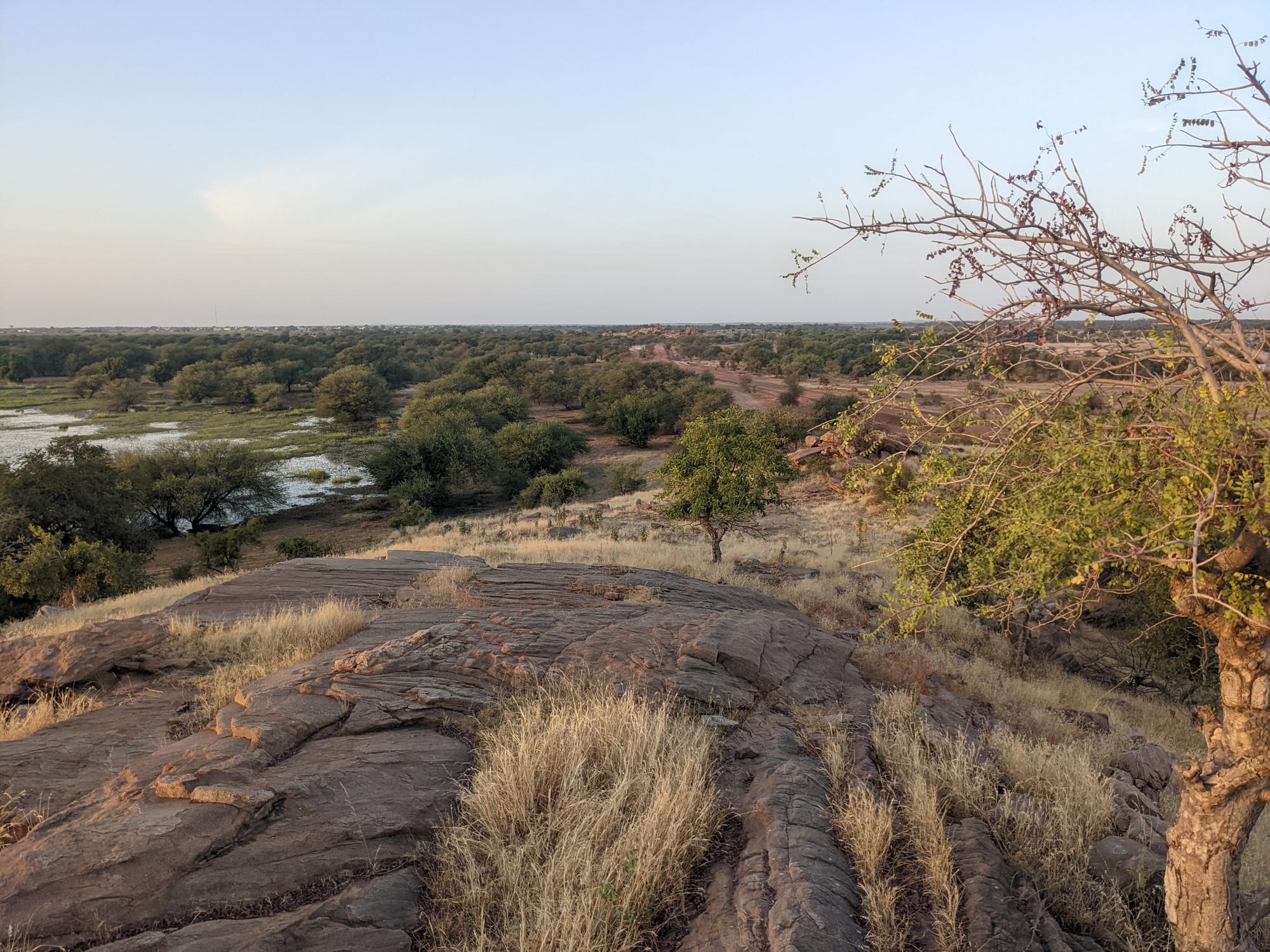
Bare rock and dry grass in the foreground above a plain of scattered green thorn trees and a shallow strip of water

Saint-Louis & the North, Senegal

Matam

Sahelian bush and standing flood water in the Matam region of north-eastern Senegal. (Catjacket / Wikimedia Commons · CC0)

A small administrative town on the left bank of the Senegal River in north-eastern Senegal, looking across the water to Mauritania. It is the capital of Matam Region and a centre of the Fouta Toro, the Pulaar-speaking middle valley, where farming along the flood plain, herding in the dry bush and money sent home by emigrants shape a quiet, very hot river town.

Neighbourhoods

  • The river front and the old town
    • First-time visitors
    • Historic district
    • Riverside walks

    Matam's core sits on a bank above the Senegal River, a short grid of low administrative buildings, mosques, a market and compounds of mud brick and cement. The water is the town's reason for being, with pirogues, washing places and the Mauritanian bank in plain sight.

    Open in Maps
  • Ourossogui
    • Transport connections
    • Markets
    • Local life

    The road town about 10 km south-west of Matam and of much the same size, where the highway along the valley meets the route towards Bakel and the interior. Most through traffic, much of the commerce, the regional hospital and the airport that serves Matam are here rather than on the river.

    Open in Maps

Things to do

The river and the town

  • Senegal Riverattraction

    The 1,086-kilometre river of the western Sahel forms the frontier with Mauritania here, and its yearly flood has shaped farming, fishing and settlement in the valley for centuries.

    Open in Maps

Getting around

  • Ouro Sogui Airporttransit hub

    The airport that serves Matam, 10 km south-west of the town near Ourossogui, and the only one in the middle valley.

    Open in Maps

Short trips along the valley

  • Kanelattraction

    A department capital upstream of Matam, a market town for the farming villages of the flood plain.

    Open in Maps
  • Thilogneattraction

    A Haalpulaar town north-west of Matam on the valley road, with a dozen mosques, schools and a small market, and twinned with Trappes in France.

    Open in Maps
  • Fouta Toroattraction

    The historic Pulaar-speaking region of the middle Senegal valley, whose villages of mud brick and mosques line the river in both directions from Matam.

    Open in Maps

Eat and drink

Long-standing places and food districts in Matam. Hours, ratings and directions come from your maps app, always current.

Markets and food streets

  • Matam marketmarket

    The town's daily market, with river fish, millet and rice, onions and dried tomatoes from the flood plain, tea, sugar and imported goods.

    Open in Maps
  • Ourossogui market and roadside grillsneighborhood

    The busiest trading place in the middle valley, where the transport stands are ringed by stalls selling grilled mutton, bean fritters and bread, and by tea sellers.

    Open in Maps

Matam classics

  • Milk, millet and river fishneighborhood

    Small eating houses near the market and the transport stand serve rice with fish or meat sauce at midday; the valley's own foods are soured cow's milk, millet couscous and porridge, and fish from the river.

    Open in Maps

Experience Matam

History

Matam belongs to the Fouta Toro, the middle valley of the Senegal River, long settled by Pulaar-speaking farmers and herders and ruled from the sixteenth century by the Denianke dynasty. In 1776 a movement of Muslim clerics overthrew that dynasty and founded an Islamic state under elected rulers called almamys, an order that gave the valley an unusual tradition of religious scholarship and of authority held by learned families rather than inherited by a single royal line.

The town's modern shape comes from the river trade and from France. Steamers could work up the Senegal as far as the middle valley when the flood was high, and Matam grew as a landing place and a trading post for gum arabic, grain, hides and cloth, later becoming an administrative centre under colonial rule. The pattern that still defines it — a small official town on the bank, a larger commercial town a few kilometres inland at Ourossogui where the roads meet — took hold as motor transport replaced the river in the twentieth century.

After independence the valley was reorganised by dams and irrigation downstream, and Matam became a regional capital when the Matam region was created. The border conflict between Senegal and Mauritania from 1989 to 1991 fell heavily on this stretch of the river, displacing thousands of people on both banks and leaving a long memory in the valley. Emigration has been the other great force: generations of men from the Fouta have worked in Dakar, France and beyond, and their remittances have rebuilt villages that farming alone could not support.

Culture & Customs

Matam is a Haalpulaar town — the name means "those who speak Pulaar" — and identity here rests on language, Islam and family. The Fouta Toro has produced scholars and clerics for centuries, and religious learning still carries prestige; the Tijaniyya brotherhood is strong throughout the valley, and Quranic schools are part of childhood. Social life is ordered by extended families and by old occupational groupings, including the griot families who keep genealogies and perform at weddings and naming ceremonies.

Hospitality is exact and expected. Greetings run through a long exchange of family names and news; food is shared from a common bowl; tea is brewed in three increasingly sweet rounds and takes an hour that no one hurries. Music in the valley leans on the hoddu, a plucked lute, and on praise-singing, and Pulaar song carries the recurring themes of cattle, migration and separation.

Emigration is the cultural fact that shapes everything else. Many households have relatives in Dakar, France, Italy or the United States, and the association of villagers abroad that funds a school, a mosque or a health post is a familiar institution across the Fouta. Returning migrants and their large houses mark the skyline of small villages, and the seasons of departure and return set the calendar of family events.

Daily Life

Matam is a town of about 27,700 people at the 2023 census, with a similar number in Ourossogui inland. It is a regional capital, so a large share of the local salaried work is administrative: the governor's offices, schools, the courts and the regional hospital at Ourossogui. Almost everything else is trade or farming.

The agricultural year follows the river. Flood-recession crops are sown on the waalo, the land the water covers and leaves behind, while millet and sorghum are grown on the higher jeeri; irrigated plots produce rice, onions, tomatoes and maize. Herders move cattle, sheep and goats between the valley and the dry Ferlo inland, and fishing on the river adds to the diet and to market income. Money sent home from abroad is the other pillar of the economy and is visible in building work, shops and vehicles.

The day starts before sunrise and pauses through the worst of the afternoon heat, which is the central fact of life here; people sit outside in the evening and shops reopen late. The persistent difficulties are the heat itself, the cost and reliability of water and power, thin job prospects for young people, and the steady drain of the young to Dakar and overseas.

Food

Food in the valley is built on millet, rice and milk. Millet is pounded and steamed into thiéré, a couscous eaten with a sauce, or cooked as lakh, a porridge served with soured milk and sometimes baobab fruit. Kossam, the soured cow's milk of the herders, is drunk on its own or poured over grain, and butter and curds appear on the table where the coast would use fish.

The national dishes are here too. Ceebu jën, fish simmered with tomato and vegetables over broken rice, is made with fish from the river as much as from the sea; yassa, marinated in lemon and heaped with onions, uses the valley's own onion crop; and mafé, meat in a thick groundnut sauce, is everyday cooking. Sheep and goat are grilled for festivals, and roadside stands sell dibi, mutton grilled over wood and eaten with bread and raw onion.

Between meals the town runs on tea and juice. Ataya is brewed strong, poured from a height into small glasses and drunk in three rounds. Bissap from hibiscus flowers, bouye from baobab fruit and ditakh or tamarind drinks are sold cold in plastic sachets, and fresh bread from the town's ovens is the standard breakfast with milky coffee or tea.

Planning tools

Budget

Matam is inexpensive, and there is little to spend money on. Accommodation is limited to simple hotels and guesthouses, most of them in Ourossogui rather than in Matam itself, and meals in local eating houses cost very little. The real expenses are transport: a seat in a sept-place taxi from Saint-Louis or Dakar, or a hired vehicle for the villages along the river.

Daily Budget Midrange
USD 60–120 (the best hotel available, restaurant meals, a car and driver for the valley)
Daily Budget Shoestring
USD 20–40 (simple guesthouse, local eating houses, shared taxis)

Carry enough cash, as banks and cash machines are concentrated in Matam and Ourossogui and are scarce in the villages.

Best Time to Visit

November to February, when days are hot but bearable and the nights cool. March to June is punishing, regularly above 40°C, and July to September brings short, heavy rains, greener bush and mosquitoes. The river is at its fullest late in the rains and through the autumn.

Suggested Number of Days

A day is enough for the town, the river bank and the market. Two or three make sense for anyone taking in the river villages along the valley, or breaking the long journey between Saint-Louis and the east. The heat slows everything and shortens what is practical in a day.

First Visit
1 day
With Surroundings
2–3 days

Transportation

Shared sept-place taxis and minibuses run between Matam, Ourossogui and the valley towns, leaving from the transport stands when they fill rather than to a timetable. Within Matam everything is walkable, and horse carts and motorcycle taxis cover short distances. A hired vehicle is the practical way to reach villages off the main road.

Set off early, as departures thin out badly in the afternoon and travelling between towns after dark is best avoided.

Airport & Station Connections

Matam lies on the road that follows the Senegal River east from Saint-Louis through Richard-Toll and Podor, a long day's drive; the inland route from Dakar via Linguère and the Ferlo is the other approach. Sept-place taxis and buses serve both. Ouro Sogui Airport lies 10 km south-west of the town, near Ourossogui, and is the only airport in the middle valley.

Walkability

The town is small, flat and easily crossed on foot, with the market, administrative buildings and the river bank all within a few minutes of one another. Streets are sandy and largely unpaved away from the main road, and the heat, not the distance, is what limits walking: most people move around early in the morning and late in the afternoon.

Safety

Matam is quiet, with little crime beyond occasional opportunistic theft, and visitors are uncommon enough to be conspicuous rather than targeted. The serious hazards are environmental: extreme heat and dehydration, malaria year-round, and the river itself, which has strong currents and bilharzia risk. The Mauritanian bank is a national frontier and crossings are made at official posts.

Don't walk the Corniche or empty beaches after dark or carry valuables, be firm with touts, take malaria precautions, and check current advice for the far east near Mali and rural Casamance. Drink far more water than feels necessary, keep out of the midday sun, and do not swim in the river. Check current official travel advice before travelling.

Climate

Sahelian and among the hottest parts of Senegal, far from the sea and its cooling breeze. The year divides into a long dry season and a short, intense rainy season from roughly July to September, when the river rises and the bush turns green for a few months.

Summer
very hot, often above 40°C before the rains in April to June, then hot and humid with heavy downpours
Winter
warm days around 30–35°C, noticeably cool nights, and harmattan dust from the Sahara

Local Customs

This is a conservative, strongly Muslim Haalpulaar town where Pulaar is the everyday language, French the language of offices and Wolof widely understood. Greetings are long and matter more than the business that follows, and refusing a glass of ataya tea is awkward. Modest dress covering shoulders and knees is expected of men and women alike, and prayer times shape the working day.

Ask before photographing people, dress modestly, use the right hand for eating and greeting, and do not expect alcohol to be served or sold.

Common Payment Methods

The currency is the West African CFA franc (XOF), pegged to the euro. This is a cash economy: cards are of little use outside a bank counter, cash machines exist in Matam and Ourossogui but can be empty or out of service, and mobile money is widely used for transfers. Bring notes from Dakar or Saint-Louis in small denominations.