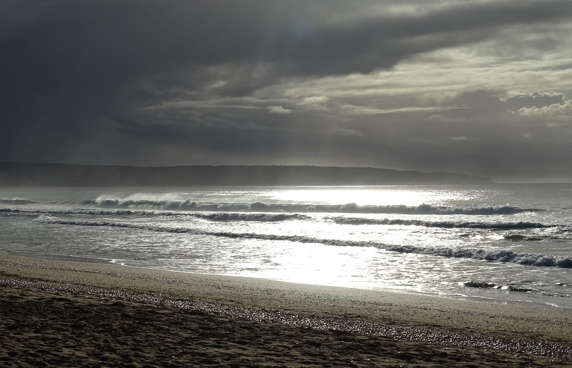
Low waves breaking on a wide empty sand beach under heavy grey cloud, with a dark headland along the horizon

Cape Town & the Western Cape, South Africa

Plettenberg Bay

Surf and wet sand on the beach at Plettenberg Bay, with the coast running away towards the headland. (Ad Meskens / Wikimedia Commons · CC BY-SA 4.0)

A resort town on the eastern Garden Route, where the Western Cape coast turns towards the Tsitsikamma forests. Portuguese sailors called the bay Bahia Formosa before a Dutch governor gave it his name in the 1770s. Long beaches, a lagoon, the rocky Robberg peninsula and whales in the bay from mid-winter into early summer have made it one of the busiest holiday towns on the southern coast.

Neighbourhoods

  • The town centre and Central Beach
    • First-time visitors
    • Beaches
    • Best for food

    The compact grid on the hill above the bay, with Main Street's shops, restaurants and estate agents, and a short walk down to the sheltered sand of Central Beach and the boat launch. Most of the town's accommodation and its everyday services are within a few blocks.

    Open in Maps
  • Robberg Beach and the peninsula road
    • Beaches
    • Walks and viewpoints
    • Quiet and residential

    The long western arm of the bay, backed by holiday houses that run out towards the Robberg peninsula and the town's small airfield. The beach here is broad and open to the swell, and the reserve's trailhead sits at the far end.

    Open in Maps
  • Keurboomstrand and the lagoon
    • Beaches
    • Quiet and residential
    • Families

    Across the Keurbooms River east of town, a strip of houses behind a long beach at the foot of forested slopes. The river's lagoon is used for paddling and small boats, and the shore is quieter than the beaches in front of the town.

    Open in Maps
  • The Crags
    • Wildlife
    • Farm stalls
    • Countryside

    A scattered settlement in the hills along the N2 east of town, among forest, fynbos and small farms. Wildlife sanctuaries, farm stalls and craft studios line the road, and it makes a green base a short drive from the coast.

    Open in Maps

Things to do

Beaches and the bay

  • Central Beachbeach

    The sheltered town beach at the foot of the main street, where boats launch and the bay is calmest for swimming.

    Open in Maps
  • Robberg Beachbeach

    A long open stretch of sand running west from the town towards the Robberg peninsula, with steady surf and space to walk.

    Open in Maps
  • Keurboomstrandbeach

    The beach east of the Keurbooms River mouth, backed by wooded hills and quieter than the sands in front of the town.

    Open in Maps

Nature reserves and walks

  • Robberg Nature Reservepark

    The rocky peninsula south-west of town, a nature reserve and marine protected area with cliff paths, a Cape fur seal colony and circular walks of several hours.

    Open in Maps
  • Nelson Bay Cavelandmark

    A sea cave on the Robberg peninsula whose deep deposits of shell, bone and stone tools have made it an important record of Stone Age coastal life.

    Open in Maps
  • Keurbooms Riverpark

    The river that reaches the sea east of town through a wide lagoon, with a forested gorge upstream that is explored by canoe and small boat.

    Open in Maps

Short trips from the town

  • Knysnaattraction

    The next Garden Route town west, about 30 km away, set on a tidal lagoon between sandstone cliffs known as the Heads and long known for its oysters and forests.

    Open in Maps
  • Nature's Valleybeach

    A single small village behind a beach and lagoon at the western edge of the Tsitsikamma forest, about 30 km east, at the end of the old Bloukrans pass road.

    Open in Maps
  • Bloukrans Bridgelandmark

    The arch bridge that carries the N2 over the deep Bloukrans gorge about 40 km east, the site of the world's highest commercial bridge bungee jump, run since 1997.

    Open in Maps
  • Tsitsikammapark

    The forested coastal section of the Garden Route National Park, about 70 km east, where a suspension bridge crosses the Storms River mouth.

    Open in Maps

Eat and drink

Long-standing places and food districts in Plettenberg Bay. Hours, ratings and directions come from your maps app, always current.

Plettenberg Bay classics

  • The Main Street restaurantsneighborhood

    The town's eating is concentrated on and just off Main Street — seafood grills, steakhouses, pizzerias and coffee shops, most of them with a view down to the bay.

    Open in Maps
  • Central Beach and the harbour sideneighborhood

    A cluster of casual places by the boat launch serving line fish, calamari and prawns, busiest through the December holidays.

    Open in Maps

Farm stalls and markets

  • Farm stalls on the N2 at The Cragsmarket

    Roadside stalls east of town selling cheese, preserves, honey, bread and berries from the smallholdings of the Crags and the Bitou valley.

    Open in Maps
  • Knysna oystersmarket

    The lagoon at Knysna, half an hour west, has farmed and wild oysters that appear on menus all along this stretch of coast.

    Open in Maps

Experience Plettenberg Bay

History

The bay has been used for far longer than the town. Caves on the Robberg peninsula, Nelson Bay Cave among them, hold layers of shell, bone and stone tools left by people living off the shore and the fynbos over tens of thousands of years, and Khoekhoe herders grazed the coastal plain when the first European ships appeared. Portuguese navigators charted the bay in the sixteenth century and called it Bahia Formosa, the beautiful bay.

In 1630 the Portuguese ship São Gonçalo was wrecked here. About a hundred survivors were marooned for nine months and built two small boats from the wreckage, one of which met a passing vessel while the other reached Mozambique — the earliest sustained European presence on this coast. Dutch East India Company parties came for timber from the forests behind the bay in the eighteenth century, and in 1778 the Company's governor, Joachim van Plettenberg, visited and had a stone beacon erected claiming the district; his name replaced the Portuguese one.

A small settlement grew around timber, whaling and fishing in the nineteenth century, with a whaling station on Beacon Island that closed in 1916, and the town remained a remote outpost of the Knysna forest district for decades. The modern town is a creation of the road: once the coastal highway was pushed through, Plettenberg Bay became a holiday destination for inland South Africans, and from the 1970s onward hotels, holiday houses and retirement estates spread along the bay and up the slopes behind it. Growth has been rapid ever since, with the service settlements inland and the coastal suburbs developing along very different lines.

Culture & Customs

Plettenberg Bay's culture is that of a South African seaside resort, which means two towns in one. For much of the year it is a quiet coastal community of retirees, guesthouse owners, builders and farm workers; from mid-December to mid-January the population multiplies as families arrive from Gauteng and the Cape, and the beaches, restaurants and roads fill. The season ends and the town empties again almost overnight.

Afrikaans and English are the languages heard most in the centre, with isiXhosa widespread in the townships above the N2, and many households move between all three. Outdoor life shapes the social calendar: surfing and bodyboarding at the open beaches, fishing from ski-boats launched off Central Beach, paddling on the Keurbooms lagoon, trail running and long walks on the Robberg peninsula. Whale and dolphin watching from about July to December is both a tourist business and a local habit, with people stopping at the clifftop lookouts when the animals are close inshore.

The art and craft studios of the Crags, the farm stalls along the N2 and the small-scale food producers of the Bitou valley give the district a countryside-and-coast character distinct from the wine-farm culture further west. Manners are relaxed and informal, but the gap between the holiday-house suburbs and the working settlements inland is the defining social fact of the town, and local debate returns constantly to housing, water and jobs.

Daily Life

Plettenberg Bay is the main town of the Bitou local municipality, which counted around 50,000 residents at the 2011 census across the town, the Crags, Keurboomstrand, Kranshoek and the settlements of New Horizons, Kwanokuthula and Qolweni. The town itself counted about 32,000 people in the same census, and its permanent population is outnumbered several times over at the peak of the summer holidays.

The economy runs on tourism, construction and property, with farming, forestry and fishing behind them. Work is strongly seasonal: hospitality, building and gardening jobs multiply in the summer and thin out in winter, which keeps unemployment high and drives seasonal migration. Many households in the townships depend on grants and on wages earned in the holiday suburbs, and the contrast between the two is stark within a few kilometres.

Daily rhythms are early. Shops and offices open in the morning and close in the late afternoon; the beach fills before work and again at sunset; and the supermarkets, schools and clinics of the centre serve the whole district. Minibus taxis link the settlements to town along the N2. Persistent local issues are the cost and supply of housing, water security in dry years, the pressure of holiday traffic on a single main road, and the periodic electricity cuts that have affected the whole country.

Food

Seafood leads. Line fish such as kob, yellowtail and red roman come off the ski-boats launched at Central Beach, calamari is caught along this coast and appears grilled or fried on almost every menu, and prawns, mussels and oysters fill out the seafood platters that are a Garden Route staple. Knysna, half an hour west, has farmed oysters in its lagoon, and they are served all along this shore.

Away from the sea the food is standard South African and done well: the braai, with boerewors sausage, lamb chops and sosaties over coals; potjiekos, a stew cooked slowly in a three-legged pot; biltong and droëwors, air-dried spiced meat, sold in butcheries in the centre. Karoo lamb from the dry interior is a fixture on steakhouse menus, and bobotie, the Cape dish of spiced minced meat under an egg custard, appears wherever cooking leans towards the Cape Malay tradition.

The countryside supplies the rest. Farm stalls along the N2 towards the Crags sell cheese, honey, preserves, berries and bread, and small producers in the Bitou valley make craft beer, cheese and chocolate. Wine comes mostly from the Cape, though a handful of vineyards have been planted in the cooler hills around the town. Rooibos, the caffeine-free red bush tea of the Cederberg, is the default hot drink alongside strong coffee.

Planning tools

Budget

Plettenberg Bay is one of the more expensive towns on the Garden Route, and prices climb steeply from mid-December to mid-January, when South African families fill the holiday houses. Outside that window guesthouses are reasonable, and the beaches, the Robberg walks and the lagoon cost little or nothing. A hire car is close to essential.

Daily Budget Midrange
USD 150–300 (guesthouse or small hotel, restaurant dinners, hire car, a boat trip or reserve fee)
Daily Budget Shoestring
USD 55–95 (backpacker lodge or self-catering flat, supermarket food, shared car)

Book months ahead for the December school holidays, or come in March, April or October, when the town is quiet and rooms cost far less.

Best Time to Visit

February to April brings the warmest sea and settled weather after the summer crowds have gone. Southern right whales are in the bay from about July to December and dolphins all year, and the cool, often clear winter and spring months carry the lowest prices. December and January are hot and very busy, and rain can fall in any month on the Garden Route.

Suggested Number of Days

Two or three days suit the beaches, the peninsula and the lagoon. Four or five allow the forests and river mouths to the east and the lagoon town to the west as well. Weather is the main variable, as the coast can be wet or windy for days at a time.

First Visit
2–3 days
With Surroundings
4–5 days

Transportation

Almost everyone arrives and gets around by car. The town centre, Central Beach and the main shops are walkable, but Robberg, Keurboomstrand and the Crags are several kilometres apart and there is no useful public transport for visitors. Minibus taxis serve residents on fixed routes, and metered taxis and ride-hailing operate in a limited way.

Driving is on the left; watch for pedestrians and cyclists on the shoulder of the N2 and keep to the speed limit through the town, where the road doubles as the main street.

Airport & Station Connections

The N2 is the way in: Plettenberg Bay lies about 30 km east of Knysna and about an hour and a half east of George, whose airport has flights from Johannesburg and Cape Town. Cape Town is a long day's drive to the west, and Gqeberha about 210 km east. The town's aerodrome has no scheduled commercial flights, and intercity coaches on the Cape Town–Gqeberha run stop nearby.

Walkability

The centre is small and easily walked, and a path and steps lead down to Central Beach; the beaches themselves invite long walks at low tide. Beyond that the town is spread along the bay and up the hills, with steep gradients and few pavements on the outer roads, so distances between the beach suburbs are usually driven.

Safety

Plettenberg Bay is a holiday town with a heavy seasonal police and security presence, and most visits pass without trouble. The practical risks are break-ins at beach and trailhead car parks, opportunistic theft from unattended belongings on the sand, and the sea itself: strong rip currents, cold water and unguarded stretches of beach outside the lifeguarded season.

Violent crime rates are high, but most of it is concentrated in areas visitors do not go; the main tourist routes — Cape Town centre, the Winelands, the Garden Route, Kruger and the private reserves — are heavily travelled and generally fine with sensible precautions. Leave nothing visible in a parked car, swim between the flags where lifeguards are on duty, and carry water and a windproof layer on the Robberg trails. Check current official travel advice before travelling.

Climate

Mild and maritime, with rain spread through the year rather than falling in one season, and a sea that stays cool even in high summer. In the southern hemisphere summer runs from December to February and winter from June to August. Sea fog and strong easterly or westerly winds are common.

Summer
warm rather than hot, roughly 18–26°C, with humid spells and afternoon wind
Winter
mild and often clear, roughly 8–19°C, with cold fronts bringing rain and big swell

Local Customs

The town is informal and beach-oriented: shorts and sandals are normal everywhere except the smarter restaurants. English and Afrikaans are both widely spoken, with isiXhosa in the townships of New Horizons, Kwanokuthula and Qolweni. Greetings are unhurried, and a handshake and a few words come before business.

Tipping is customary at about 10–15 per cent in restaurants, with a few rand for car guards who watch parked cars and for petrol attendants, who fill the tank for drivers. Ask before photographing people, and remember that swimming and drinking alcohol on the beach are regulated by the municipality.

Common Payment Methods

The currency is the South African rand (ZAR). Cards and contactless payment work in almost every shop, restaurant and fuel station, and ATMs are in the centre and the shopping centres. Cash in small notes is useful for car guards, farm stalls, market stalls and tips.