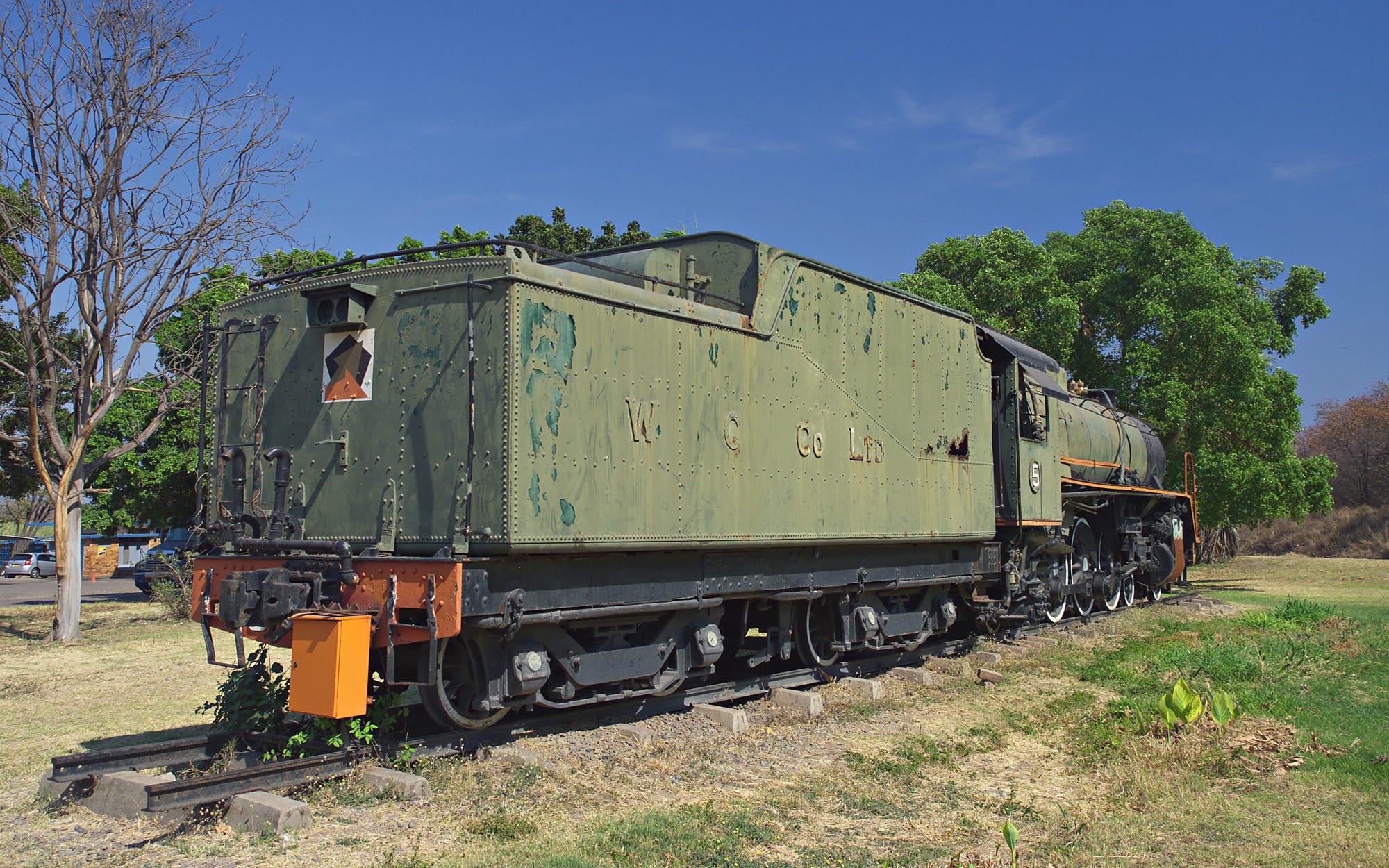
A green preserved steam locomotive with a large tender lettered W C Co Ltd, standing on a short length of track among trees

Victoria Falls, Bulawayo & Matabeleland, Zimbabwe

Hwange

A preserved steam locomotive from the colliery railway, displayed beside the main road at Hwange. (nisudapi / Wikimedia Commons · CC BY 2.0)

A coal town in north-western Zimbabwe, on the road and railway between Bulawayo and Victoria Falls. Known as Wankie until 1982, it grew around the colliery that fuelled the country's railways and power stations, and it shares its name with Zimbabwe's largest national park, whose elephant herds draw most of the visitors who pass through.

Neighbourhoods

  • Town centre
    • First-time visitors
    • Shops and transport

    The small commercial core beside the main Bulawayo–Victoria Falls road, with banks, supermarkets, the bus stop and the railway station. Almost everything a traveller needs is within a few minutes' walk, and the colliery offices and older company housing stand just beyond it.

    Open in Maps
  • Empumalalanga
    • Local life
    • Markets

    The largest of the town's high-density suburbs, built for mine and power-station workers and their families. Rows of small houses, tuckshops, bars, churches and a busy market give the area the everyday rhythm of the town rather than any sight.

    Open in Maps
  • The park road and Dete
    • Wildlife
    • Quiet and residential

    South-east of the town the road and railway run towards Dete, a small railway village at the edge of Hwange National Park. Lodges and camps are scattered along this stretch, and it is where most safari traffic gathers.

    Open in Maps

Things to do

In and around the town

  • Hwange Thermal Power Stationlandmark

    The coal-fired power station on the edge of town, the largest in Zimbabwe, whose cooling towers and chimneys are visible from far off.

    Open in Maps

Short trips from the town

  • Deteneighborhood

    A railway re-crewing depot and small town at the edge of the park, where the line from Bulawayo passes and safari vehicles collect their guests.

    Open in Maps
  • Hwange National Parkpark

    Zimbabwe's largest national park, on the edge of the Kalahari sands, known for its great elephant herds at pumped waterholes as well as lion and wild dog.

    Open in Maps
  • Victoria Fallslandmark

    The waterfall on the Zambezi about 100 kilometres north-west, reached along the same road and railway that serve the town.

    Open in Maps
  • Zambezi National Parkpark

    Riverine woodland and grassland along the Zambezi upstream of Victoria Falls, with elephant, buffalo and antelope beside the river.

    Open in Maps

Eat and drink

Long-standing places and food districts in Hwange. Hours, ratings and directions come from your maps app, always current.

Everyday eating

  • Town centre takeaways and eating housesneighborhood

    Small counters near the shops and the bus stop serving sadza with beef or chicken stew and greens, rice and chips, and tea with fat cooks or buns in the morning.

    Open in Maps
  • Empumalalanga market and barsmarket

    Vegetable stalls, braai stands grilling meat over drums, roasted maize and vendors selling maputi and kapenta, with beer halls alongside.

    Open in Maps
  • Lodge kitchens on the park roadneighborhood

    The camps and lodges towards Dete cook for their guests, usually a set menu of soups, grills and puddings, and are the main alternative to town food.

    Open in Maps

Experience Hwange

History

The coalfield was known to local people and described by European travellers in the 1890s, and the name comes from Hwange, a Nambya chief whose people lived in the area. Mining companies took up concessions at the turn of the century, and the railway pushing north from Bulawayo reached the coalfield in the early 1900s before continuing to Victoria Falls in 1904 — coal and the railway arrived together, each making the other worthwhile. The settlement that grew around the pits was called Wankie, an anglicised form of the chief's name, and it kept that name until it was changed to Hwange in 1982, two years after independence.

For most of the twentieth century the colliery was the country's largest coal producer, supplying the steam locomotives of Rhodesia Railways, the copper mines to the north and later the power stations built beside the mine. Company housing, a hospital, schools and clubs were laid out around the workings in the pattern of a mining town, with the workforce drawn from across the country and from beyond its borders.

The mine also brought the town its worst day. On 6 June 1972 underground explosions at the No. 2 colliery killed 427 men, the deadliest mining disaster in the country's history; the dead came from Rhodesia, Zambia, Mozambique, Malawi, Tanzania and beyond. In later decades the colliery struggled with debt, ageing equipment and irregular wages, while the national park beside it and the power station above it grew into the town's other two reasons for being.

Culture & Customs

Hwange is Nambya country. The Nambya, who trace their origins to Great Zimbabwe and whose stone-walled ruins connect them to the older states of the plateau, are the historic people of the district, and chiefs and their courts still matter in the rural areas around the town. Ndebele is the wider language of Matabeleland North, Shona is heard everywhere through work and schooling, and English does the formal business, so conversations slide between them.

Because the colliery recruited widely, the town has long been more mixed than the countryside around it — families whose grandparents came from Zambia, Malawi and Mozambique as well as from across Zimbabwe, and a culture built around shift work, the mine club, football teams and church. Sunday is for services, often long ones, and funerals draw large crowds and long journeys home.

Wildlife is part of local identity in a way it is not in most towns: people here live with elephants raiding fields and crossing roads, and the park is both a source of jobs — guides, trackers, rangers, lodge staff — and a source of friction where crops and fences are concerned. The killing of a well-known collared lion from the park in 2015 brought a wave of international attention to the district and to the arguments about trophy hunting on its edges, which are still debated locally.

Daily Life

About 21,000 people were recorded in Hwange at the 2022 census, down from more than 40,000 in the early 1990s, most of them in the high-density suburbs built for the mine and the power station. The colliery and the power station remain the largest employers, with tourism to the national park a distant third, and much of the rest of the town lives by informal trade: vegetable stalls, tuckshops, cross-border goods, transport and repairs.

The rhythm of the day is set by shifts and by the heat. Work and market business start early, the middle of the day empties the streets in the hot months, and the evening brings people out to the bars, the braai stands and the football ground. Water and electricity supply are recurring problems, and power cuts are part of the routine even in the shadow of a power station; the coal dust and the smoke are a long-standing complaint.

Money is a daily calculation. Wages have often been paid late or in part at the colliery, many households depend on relatives working in Bulawayo, South Africa or Botswana, and prices are worked out between the US dollar and the ZiG. Schools, clinics and the mine hospital serve a wide rural area as well as the town itself, and the highway traffic between Bulawayo and Victoria Falls keeps a steady trade in food, fuel and repairs.

Food

Everyday food is Zimbabwean staple cooking. Sadza — thick maize-meal porridge, called isitshwala in Ndebele — is eaten by hand with a relish of covo or rape greens cooked with tomato and onion, beans, or beef or chicken stew. Amasi, thick soured milk, is a favourite pairing in this cattle country, and road-runner, the free-range village chicken, is preferred to broiler birds for a proper meal.

Dried fish is a mainstay in the north-west: kapenta, the small lake fish brought down from Kariba, and matemba, cooked with tomato and onion and eaten with sadza. Mopane worms, the caterpillars of the emperor moth harvested from the mopane woodland that surrounds the town, are dried or smoked and then fried with onion, and sell by the cupful in the market. Maputi, puffed maize, is the standard snack, and roasted maize cobs appear at the roadside in season.

Drinks follow the same pattern as elsewhere in the country: sweet tea in the morning, maheu, the thick non-alcoholic fermented maize drink, through the day, Chibuku sorghum beer from cartons in the beer halls, lager for those who prefer it, and Mazoe orange cordial mixed with water at home. Lodge kitchens on the park road cook a different register altogether, with set menus and braais for guests.

Planning tools

Budget

The town itself is inexpensive, with simple guesthouses, local food and shared transport, and it is used by budget travellers as a cheaper base than Victoria Falls. The cost comes from the park: entry fees, a vehicle and a guide, or a lodge with game drives included, all priced in US dollars.

Daily Budget Midrange
USD 150–350 (a lodge on the park road, guided game drives, transfers)
Daily Budget Shoestring
USD 40–80 (a guesthouse in town, sadza and stew, buses along the main road)

Bring small US dollar notes, since change is hard to find and card payment is unreliable outside the larger shops; sharing a vehicle spreads the cost of park entry and fuel.

Best Time to Visit

August to October, the end of the dry season, is when wildlife concentrates around the pumped waterholes and sightings are easiest, though October is very hot. The cooler months from May to July are comfortable for travelling. The rains from November to March green the bush, bring migrant birds and make the sandy tracks harder going.

Suggested Number of Days

A day or two covers the town and a first look at the park. Three or four suit anyone adding more time in the bush or continuing along the highway. The number depends mostly on how much game viewing is wanted and whether a vehicle is available.

First Visit
1–2 days
With Surroundings
3–4 days

Transportation

The town is small enough to cross on foot, and kombis and shared taxis link the centre with the suburbs and the outlying settlements. Buses and coaches running between Bulawayo and Victoria Falls stop on the main road. There is no public transport into the national park: visitors need a hire car, a lodge transfer or a guided drive.

Self-drivers should carry extra fuel, drive by daylight because of animals and potholes, and keep documents and small change ready for police roadblocks.

Airport & Station Connections

Hwange sits on the paved highway between Bulawayo, roughly 330 kilometres south-east, and Victoria Falls, about 100 kilometres north-west, and buses and coaches run the route through the day. The nearest international airport is at Victoria Falls; a small airport serves the national park for light aircraft and lodge flights.

Walkability

The centre is compact and flat and easily walked, and the suburbs are a short ride away. Pavements are patchy, the main road carries heavy lorries, and there is little shade in the middle of the day. Walking is not an option for reaching the park.

Safety

Hwange is a quiet working town and visitors attract little trouble beyond opportunistic theft in the market and at the bus stop. The real hazards are outside it: wild animals on and beside the road, especially elephants at night, heavy traffic on the highway, and the heat before the rains. Power cuts are frequent.

Take malaria precautions in the low-lying areas, avoid political gatherings, don't drive at night, keep documents and small change ready for roadblocks, and don't swim in still fresh water outside managed sites. Check current official travel advice before travelling.

Climate

Hot and dry for most of the year, lower and warmer than the Bulawayo plateau, with a single rainy season. In the southern hemisphere summer falls in December to February and winter in June to August.

Summer
hot and wet from November to March, often 30–35°C with afternoon storms
Winter
dry and sunny, days around 25°C with cold nights in the bush

Local Customs

Nambya and Ndebele are widely spoken alongside Shona and English, and greetings come before any request or transaction. Older people are greeted first and respect for elders is expected. Dress is modest in town, and churches are important to community life. Tipping is not obligatory but is usual for guides, trackers and lodge staff.

Ask before photographing people, and do not photograph the colliery, the power station, police or other official buildings. In the park, follow the guide's instructions at all times.

Common Payment Methods

The US dollar is used for most payments in practice, alongside the ZiG, and prices for lodges, park fees and transfers are quoted in dollars. Bring clean, low-denomination notes: change is a constant problem, card machines are unreliable and cash machines are few, so drawing money in Bulawayo or Victoria Falls is prudent.