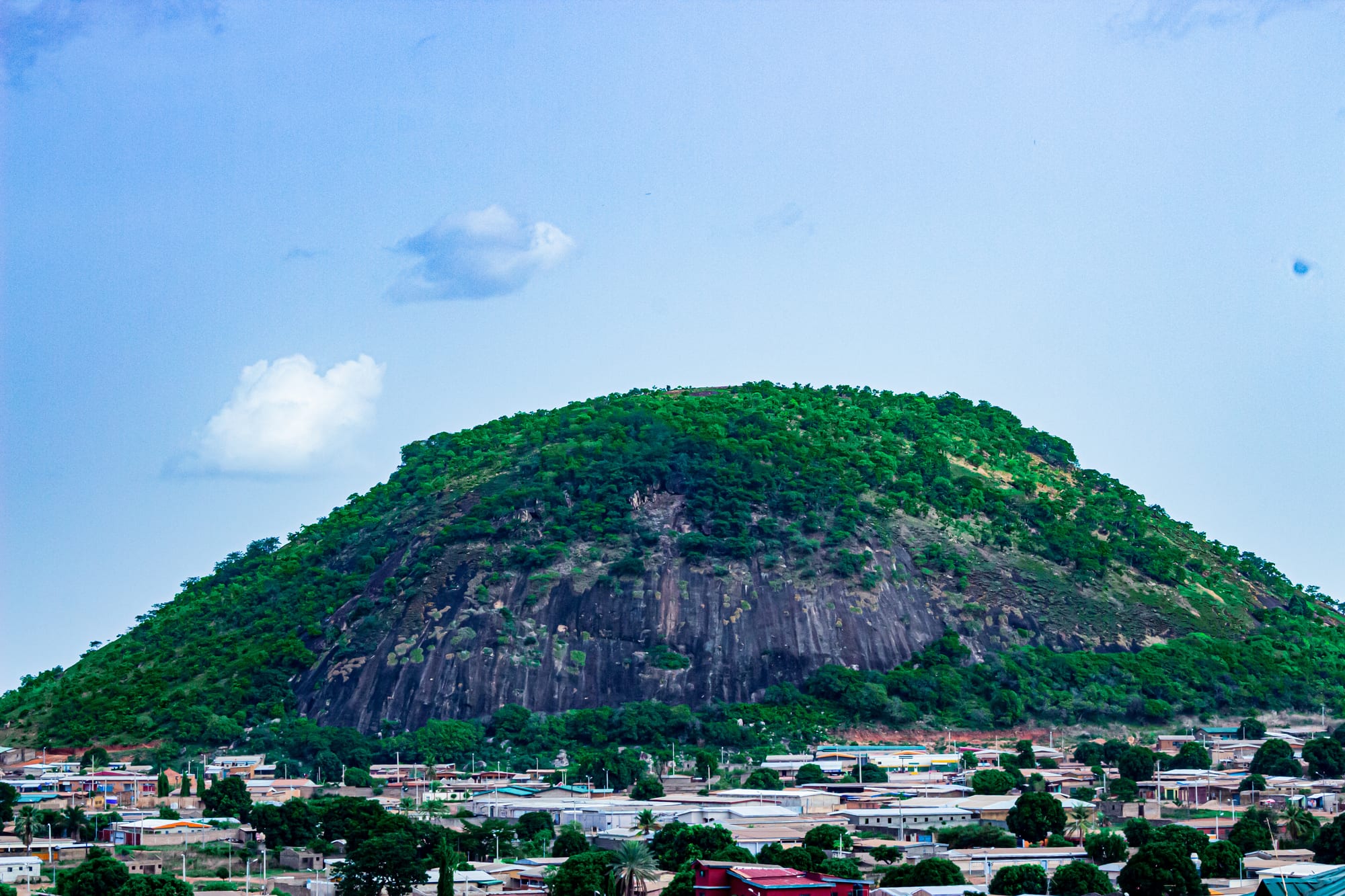
A rounded granite hill covered in green scrub rising above the low rooftops and trees of Korhogo under a blue sky

Côte d'Ivoire

Korhogo & the North

Mont Korhogo, the granite hill that rises above the town of Korhogo in the Senufo country. (Manouka / Wikimedia Commons · CC BY-SA 4.0)

The savanna north of Côte d'Ivoire, stretching from Odienné and Séguéla in the west through the Senufo country around Korhogo to Bondoukou and the Comoé National Park in the east — a mainly Muslim land of mud mosques, craft villages, cotton and cashew farms, bordering Guinea, Mali, Burkina Faso and Ghana.

Explore Korhogo & the North

History

The north lay on the southern edge of the great Sahelian empires, and trade shaped its history. Dioula merchants, Mande-speaking Muslims, carried kola nuts north from the forest and brought salt and cloth south, founding trading towns with mosques and Koranic schools. The Senufo, farmers of the Korhogo plateau, lived in villages organised by the Poro initiation society, while the Kulango and Lobi held the north-east around Bouna, the Abron built the kingdom of Gyaman around Bondoukou, and Malinké states rose in the north-west around Odienné.

In the early 18th century a Dioula dynasty founded the Kong empire, which made Kong a centre of trade and Islamic learning. In the 1890s the Malinké leader Samori Touré swept across the north in his long war against the French, and in 1897 his forces destroyed Kong. The French completed their conquest by the end of the decade and made the north a reservoir of labour for the plantations of the south and a producer of cotton.

After independence the north remained poorer than the south, and a feeling of exclusion grew during the debates over national identity in the 1990s. In the 2002–07 conflict the whole north lay in the zone held by the Forces Nouvelles rebellion until the 2007 Ouagadougou agreement began reunification. Since 2011 new roads, electricity and a university in Korhogo have narrowed the gap, while insecurity from the Sahel has reached the northern border since 2020.

Culture & Customs

The Senufo are the dominant people around Korhogo and Ferkessédougou, and their culture is known far beyond the region. The Poro society still guides the initiation of young men through years of instruction in sacred groves, and its masks, carved figures and funerals are among the most distinctive in West Africa. Senufo balafon music, played on wooden xylophones with gourd resonators, is recognised by UNESCO as intangible heritage. Crafts are organised by caste and village: weavers, cloth painters who decorate cotton with mud dyes, blacksmiths, potters and carvers.

Islam is the majority religion across the north, older among the Dioula and the Malinké and more recent among the Senufo, many of whom keep traditional practice alongside it. Friday prayers, Ramadan and Tabaski, the festival of the sacrifice, shape the year. Dioula is the common language of the markets from Odienné to Bondoukou, alongside Senufo, Malinké, Koulango and Lobi.

In the north-east, the Lobi around Bouna are known for their fortified mud compounds and their independence, and the Abron of Bondoukou belong to the wider Akan world.

Daily Life

Korhogo is the largest city in the north, with a few hundred thousand people, and its capital in all but name. Ferkessédougou, Boundiali, Odienné, Séguéla, Touba, Bondoukou and Bouna are much smaller market towns, and most people live in villages of mud-brick and concrete houses among their fields.

The region is the country's cotton belt and a leading area for cashew nuts, a crop in which Côte d'Ivoire is the world's largest producer. Mangoes from the Korhogo area are a major crop, sugar is grown on the estates around Ferkessédougou, and cattle herding, often by Fulani herders, is widespread. Gold is mined industrially and by small-scale diggers, and diamonds have long been dug around Séguéla.

Life follows the single rainy season: planting in May and June, harvests of cotton, maize and yams from October, and markets full in the dry months. Water supply, youth unemployment, disputes between farmers and herders, and security along the borders are the region's main concerns.

Food

Northern cooking is based on grains. Tô, a stiff porridge of maize, millet or sorghum, is eaten by hand with a sauce of okra, groundnut or leaves, and flavoured with soumbala, a pungent fermented paste made from the seeds of the néré tree. Rice with a tomato-and-meat sauce and fonio, a small grain, are also eaten, and shea butter, made from the nuts of the shea tree, is used for cooking as well as for skincare.

Meat is grilled: choukouya, mutton cut small, grilled and seasoned with spice and onions, and brochettes of beef are sold by the roadside, and whole sheep are roasted for Tabaski. Dèguè, a sweet dish of millet grains mixed with curdled milk or yoghurt, is eaten as a snack or dessert.

Drinks include bissap, made from hibiscus flowers, gnamakoudji, a fiery ginger juice, and in non-Muslim communities tchapalo, a spiced maize beer brewed in villages. Mangoes, cashew fruit and the nuts themselves are sold everywhere in season.

Attractions & Natural Wonders

Korhogo is the base for the Senufo country. The town has Mont Korhogo, a granite hill above its streets, and the quarters of its carvers and blacksmiths. Around it lie the craft villages: Waraniéné for weaving, Fakaha for the painted Korhogo cloth, and others known for pottery and ironwork. The mosques and sacred groves of the villages are often closed to outsiders.

To the east, Kong keeps two Sudanese-style mud mosques, part of a group of northern mosques, including the one at Kouto, listed together as a UNESCO World Heritage Site in 2021. Comoé National Park, one of the largest protected areas in West Africa and a UNESCO World Heritage Site, spreads across savanna, gallery forest and granite outcrops along the Comoé river, with elephants, hippos, buffalo, antelopes and many birds. Access has been limited and parts of the north of the park lie near the Burkinabè border. Bondoukou, near the Ghanaian border, is one of the country's oldest Muslim towns, with its mosques and old houses, and Bouna lies in the Lobi country beside the park.

In the west, the savanna towns of Odienné and Séguéla are set among granite hills and cattle country, and the old mosque of Samatiguila lies near Odienné.

Cities in Korhogo & the North

Planning basics

Budget

The north is the cheapest part of the country. Hotels in Korhogo, Ferkessédougou and Bondoukou are simple and inexpensive, meals in maquis and markets cost little, and coach fares are low. The main extra costs are a car and driver for the craft villages and the long distances between towns. Cash machines exist in Korhogo and the larger towns, but carry enough CFA francs for the smaller ones.

Daily Budget Midrange
USD 70–160 (best hotel in town, restaurants, a car and driver for village visits)
Daily Budget Shoestring
USD 25–50 (basic hotel, market food and maquis meals, coaches and shared taxis)

Buy crafts directly in the villages, where the makers set the price, and carry small notes for village fees.

Safety

Korhogo, Bondoukou, Odienné and Séguéla are generally calm. The area along the border with Burkina Faso has seen jihadist attacks since 2020, including on army and gendarmerie posts, and some governments advise against travel to those zones, which include parts of the north of Comoé National Park. The security presence is heavy, with many checkpoints.

Avoid the northern border strip, travel only by day, and check local conditions before any visit to Comoé or to towns near Burkina Faso and Mali. Check current official travel advice before travelling.

Climate

The north has a savanna climate with a single rainy season, roughly from May or June to September, and a long dry season. From December to February the Harmattan wind brings dust from the Sahara, hazy skies, cool mornings and hot afternoons. March and April are the hottest months, often reaching the high 30s, before the rains return and the grass turns green.

Summer
rainy from about June to September, 22–32°C, with heavy storms and muddy rural roads
Winter
dry and dusty from November to March, 16–36°C, with Harmattan haze and cool nights

Transportation

Korhogo has an airport. The Abidjan–Ouagadougou railway passes through Ferkessédougou on its way to Burkina Faso. Coaches link Korhogo, Odienné, Séguéla and Bondoukou with Bouaké and Abidjan, with Abidjan to Korhogo a long day's journey. Distances between the northern towns are large, and many secondary roads are unpaved and rough.

Travel by day, expect frequent checkpoints, and allow extra time for unpaved roads in the rainy season.

Best Time to Visit

November to February is the most comfortable time, after the rains and before the heat, when roads are dry and village festivals and markets are in full swing, although the Harmattan can dull the light. March to May is very hot, and the rains from June to September make many tracks and the roads into Comoé difficult.