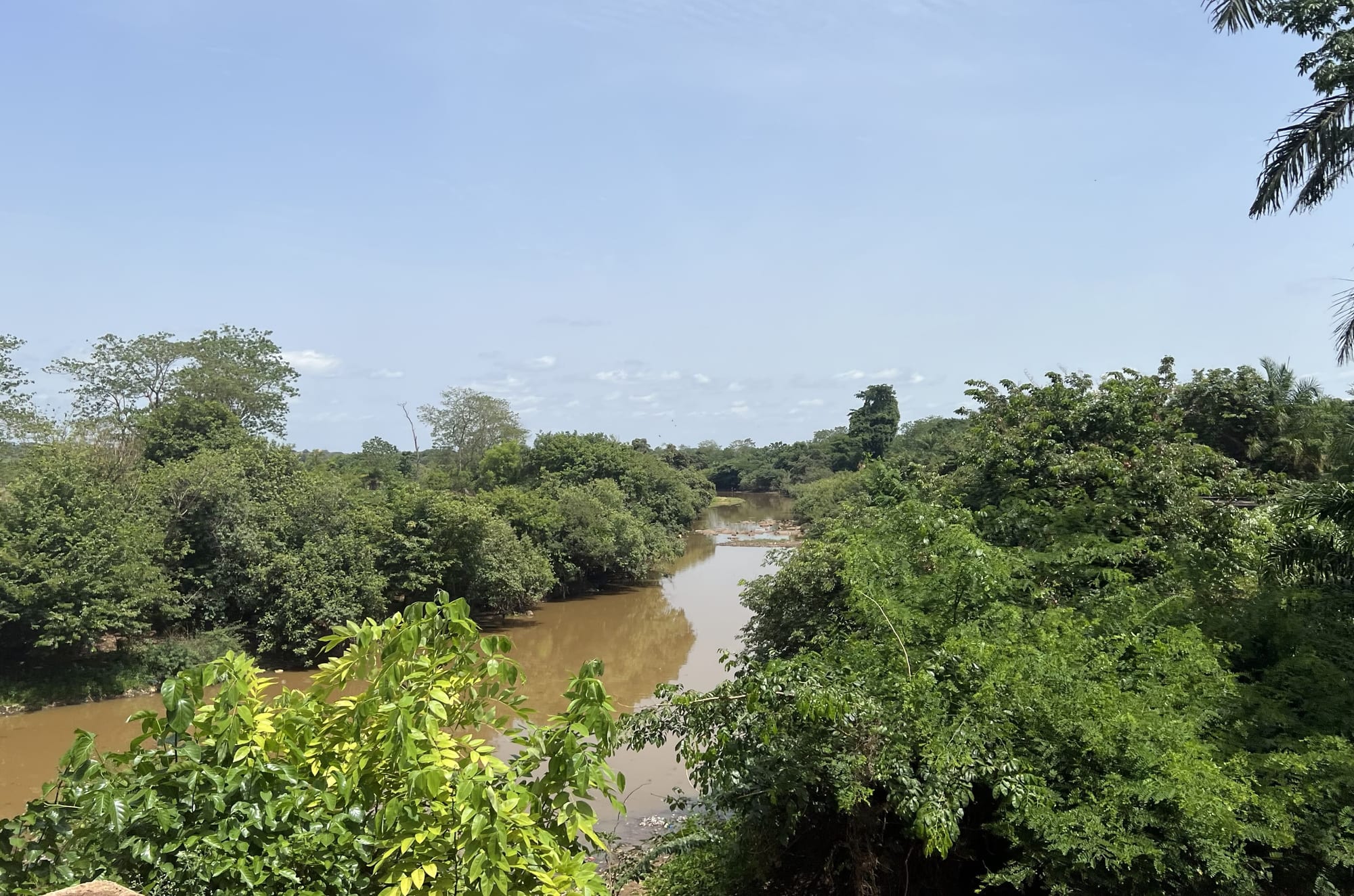
A brown river winding between banks of dense green trees and bushes under a pale blue sky

Guinea

Kankan, Nzérékoré & the East

The Niger river near Faranah, in the upper reaches of its course. (Flucco / Wikimedia Commons · CC BY-SA 4.0)

Guinea's vast interior, from the Maninka savanna of Upper Guinea around Kankan, Faranah and the upper Niger to the forested hills of the south-east around Nzérékoré and Mount Nimba — the old heartland of the Mali Empire and of Samori Touré, and the home of Guinea's gold and iron-ore frontier.

Explore Kankan, Nzérékoré & the East

History

Upper Guinea lies at the heart of the old Manding world. The Mali Empire of the 13th and 14th centuries drew its wealth from the gold of this region, particularly from the fields around Siguiri, and the town of Niani, on the Sankarani river, is one of the places proposed as its early capital, though historians disagree. According to oral tradition, Kankan was founded around 1690 by Daouda Kaba, and it grew into a centre of Islamic learning and trade in kola nuts, gold and cloth.

In the 19th century Samori Touré, a Maninka leader from Upper Guinea, built a large state known as the Wassoulou Empire, with a powerful army and firearms workshops, and resisted French expansion for almost two decades before being captured in 1898; he died in exile in Gabon in 1900. El Hadj Umar Tall had earlier built his base at Dinguiraye, in what is now Faranah region, before his conquests in the Sahel.

The forest region, home to peoples such as the Kpelle, Loma, Kissi and Mano, was conquered by the French in the early 20th century. After independence the region produced leaders including Ahmed Sékou Touré, born in Faranah. Its recent history includes the 2013–16 Ebola epidemic, which began in the village of Meliandou near Guéckédou, and the development of the Simandou iron-ore deposit in the mountains between Beyla and Kérouané.

Culture & Customs

Upper Guinea is Maninka country, and the Maninka language, Islam and the traditions of the Manding world shape daily life. Griots — hereditary musicians and historians — perform the epic of Sundiata Keita, founder of the Mali Empire, with the kora and balafon. Kankan is proud of its Islamic scholarship, and the N'Ko alphabet, created in 1949 by Solomana Kanté, a scholar from the Kankan region, is used to write Manding languages.

The forest region is culturally very different. Its peoples speak languages such as Kpelle, Loma and Kissi, and many are Christian or follow traditional religions alongside Islam. Secret societies of initiation, masked dances and sacred forests remain important in village life. Bembeya Jazz National, one of Guinea's best-known bands, was founded in Beyla in the 1960s.

Across the region, hospitality, respect for elders and extended family networks are central. The writer Camara Laye described his childhood in Kouroussa in L'Enfant noir, one of the classic African novels.

Daily Life

Kankan and Nzérékoré are the largest cities, with universities and markets that draw traders from neighbouring countries. Faranah, Siguiri, Kouroussa, Kissidougou, Guéckédou, Macenta and Beyla are important towns.

Upper Guinea lives on farming — rice, millet, maize, cassava and groundnuts — and on gold, which is mined both industrially and by tens of thousands of artisanal miners around Siguiri. The forest region grows rice, cassava, coffee, palm oil, cola nuts and bananas. Simandou has brought roads, a railway and jobs, as well as concern about the environment and communities.

Life follows the rains and the market days. Current issues include poor roads, lack of electricity, conflicts over land and mining, deforestation, and health risks from diseases such as Ebola and Lassa fever.

Food

Rice with sauce is the staple in both halves of the region. In Upper Guinea, sauces are thickened with groundnuts, okra or leaves, and flavoured with soumbala, fermented seeds of the néré tree. Tô, a stiff paste of cassava semolina served with okra or groundnut sauce, is also eaten, and fonio is common.

The forest region cooks with red palm oil. Sauce feuille, made from cassava or sweet-potato leaves, is eaten with rice, along with cassava, plantains and yams. Fish and meat are smoked, and forest fruits and vegetables fill the markets.

Cola nuts, grown in the forest region and traded north for centuries, are chewed and offered as a sign of respect at ceremonies. Palm wine is drunk in the forest region, while in Muslim areas people prefer ginger juice, bissap and sweet tea poured in rounds.

Attractions & Natural Wonders

In Upper Guinea, Kankan is the main city, with its old quarters, mosques and markets on the Milo river. The upper Niger river flows north-east past Faranah, Kouroussa and Siguiri towards Mali; its source lies in the hills of Faranah region, near the border with Sierra Leone, and the Upper Niger National Park protects savanna and forest along its course. Dinguiraye has the mosque associated with El Hadj Umar Tall, and Niani is linked to the Mali Empire.

In the south-east, Nzérékoré is the main city of the forest region and the base for exploring it. Mount Nimba, rising on the borders with Côte d'Ivoire and Liberia, is protected by the Mount Nimba Strict Nature Reserve, a UNESCO World Heritage Site shared with Côte d'Ivoire, with forest, grassy ridges and many endemic species. Nearby, Bossou is known for its chimpanzees, which use stones to crack nuts.

The rainforest country along the Liberian and Ivorian borders includes the Ziama forest near Macenta, a biosphere reserve with forest elephants, and the Diécké forest near Yomou, as well as villages where masked dances and sacred forests remain part of local life.

Cities in Kankan, Nzérékoré & the East

Planning basics

Budget

Day-to-day costs are low, with cheap local food and basic hotels in Kankan, Faranah, Kissidougou and Nzérékoré. Mining towns such as Siguiri and the areas near Simandou can be more expensive. The biggest costs are transport — a hired four-wheel-drive for the long, rough roads — and guides and permits for Mount Nimba and Bossou.

Daily Budget Midrange
USD 80–170 (best local hotels, a hired car with driver, guides)
Daily Budget Shoestring
USD 25–40 (basic hotel, local food, bush taxis)

Carry cash for the whole trip, as cash machines are scarce and unreliable outside Kankan and Nzérékoré.

Safety

The east is remote, and roads are the biggest daily risk. The forest region has seen episodes of intercommunal violence, sometimes around elections, and political protests can turn violent. Areas near the Mali border are sensitive because of insecurity in the Sahel, and gold-mining towns can be lawless. The region was the origin of the 2013–16 Ebola epidemic, and outbreaks of Ebola and Lassa fever have recurred.

Travel with a reliable driver, avoid demonstrations and border areas near Mali, follow health advice on outbreaks, and take malaria precautions. Check current official travel advice before travelling.

Climate

Upper Guinea around Kankan and Faranah is savanna, with a single rainy season from about May to October and a long, hot dry season when temperatures often pass 35°C before the rains. The forest region around Nzérékoré is wetter, with a longer rainy season and more humid air, while Mount Nimba and the hills are cooler and often misty.

Summer
rainy season, around 22–32°C, with heavy rain and humid air, longest in the forest region
Winter
dry season, warm to hot, around 15–35°C, with harmattan haze in Upper Guinea and hottest weather in March and April

Transportation

Kankan and Nzérékoré are long road journeys from Conakry, usually broken into several days via Mamou and Faranah or Kissidougou. Roads range from paved stretches to deeply rutted tracks, and bush taxis are crowded and slow. A hired four-wheel-drive with driver is the most practical choice. Border crossings link the region to Mali, Côte d'Ivoire, Liberia and Sierra Leone.

Plan for long travel days and delays at checkpoints, and avoid travelling at night.

Best Time to Visit

November to February is the best time, with dry, passable roads and bearable temperatures. March and April are very hot in Upper Guinea. In the rains, from about May to October, many roads in the forest region become very difficult, although the landscape is at its greenest.