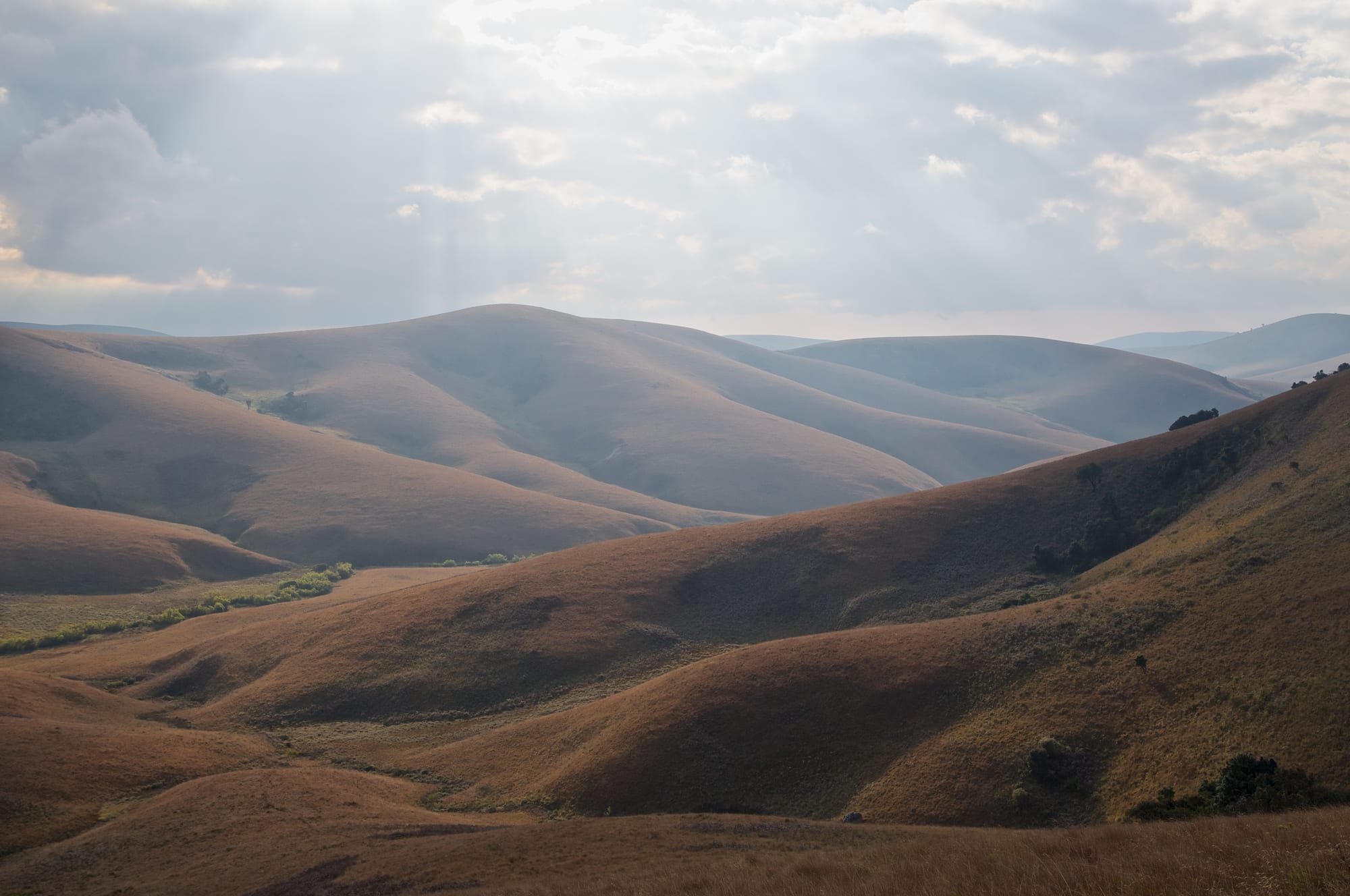
Rolling golden-brown grassy hills under a cloudy sky, with dark patches of forest in the folds

Malawi

Mzuzu & the Northern Region

The rolling grassland of the Nyika Plateau, Malawi's largest national park. (Ludger Heide / Wikimedia Commons · CC BY-SA 2.0)

Malawi's least populated region, running from the Tanzanian border at Karonga down the northern shore of Lake Malawi to the Viphya highlands — a land of Tumbuka, Tonga and Ngoni country, the Livingstonia mission on its escarpment, the grasslands of the Nyika plateau and the lake islands of Likoma and Chizumulu.

Explore Mzuzu & the Northern Region

History

The north holds some of Malawi's deepest past. Near Karonga, fossil hunters found the jaw of an early human relative at Uraha and the bones of a sauropod dinosaur, now called Malawisaurus, and the town's Cultural and Museum Centre displays Malawisaurus. The Tumbuka were the first major group to establish themselves across much of the region, alongside the Ngonde, Tonga and other peoples, well before traders and raiders arrived in the nineteenth century.

In the mid-nineteenth century Ngoni migrants, whose ancestors had moved north from what is now South Africa, settled the Mzimba highlands under the M'Mbelwa line and dominated many of their neighbours. At the lake's northern end, Swahili-Arab slave traders led by Mlozi fought the African Lakes Company in the Karonga War of the late 1880s, shortly before Britain formally declared its protectorate in 1891.

The Free Church of Scotland mission, first set up at Cape Maclear in 1875, moved north and in 1894 settled on the escarpment under Robert Laws, where Livingstonia became a centre of schooling. In 1968, under Hastings Banda's one-nation, one-language policy, Chitumbuka was removed from the school curriculum, the national radio and the print media; Chitumbuka radio programmes returned with multiparty democracy in 1994. In 1992 the northern trade unionist Chakufwa Chihana, who had urged Banda to hold a referendum on multiparty politics, was arrested after returning from exile and sentenced for sedition. Mzuzu grew into the region's city.

Culture & Customs

Chitumbuka is the north's shared language, spoken well beyond the Tumbuka themselves, and the region has long been proud of its schools and educated professionals. Around Karonga live the Ngonde; along the lakeshore at Nkhata Bay live the Tonga, fishermen and cassava farmers; and in Mzimba the Ngoni keep their Nguni heritage alive in dance and ceremony.

Vimbuza, the Tumbuka healing dance in which drumming and song treat people believed to be troubled by spirits, is on UNESCO's intangible heritage list. Presbyterianism, the legacy of Livingstonia, is strong in the north, alongside Catholic, Anglican and Pentecostal churches; Likoma and parts of the lakeshore still reflect the Anglican Universities' Mission. Chiefs' installations and funerals are the great social gatherings, with long speeches, singing and food for whole villages.

Daily Life

About 2.3 million people live in the Northern Region, the smallest of Malawi's three regions by both population and area. Mzuzu, with about 220,000 people, is the region's city, home to Mzuzu University, markets and the coffee trade. Karonga is the northern lakeshore town and border hub; Rumphi, Mzimba, Chitipa and Nkhata Bay are district centres.

Most families farm maize, cassava, beans and groundnuts. Karonga grows rice on the lake plain; the hills of Misuku and around Mzuzu grow coffee; Nkhata Bay has rubber and cassava; and the Viphya Plantation south of Mzuzu, one of Africa's largest man-made forests, supplies timber. Fishing sustains the lakeshore villages, and the uranium mine at Kayelekera, west of Karonga, opened in 2009 and was put on care and maintenance in 2014. Poor roads, dear fuel and the long trip to Lilongwe shape daily life, and many young northerners leave to study or work in the cities or in South Africa.

Food

Northern food shifts with the land. In the highlands the staple is nsima of maize flour eaten with a relish, or ndiwo, of beans, leaves or meat, but in cassava-growing areas such as Nkhata Bay kondowole, a stiff, stretchy nsima made from cassava flour, is eaten with fish. Usipa, the lake's tiny sardine-like fish, is fried fresh or sun-dried on racks along the shore, and chambo tilapia is grilled whole.

Rice grown on the Karonga lake plain is cooked with beans or fish. Bananas, mangoes and cassava are everyday snacks along the lake, and roasted maize and sweet potatoes are sold at the roadside in the highlands. The north is Malawi's coffee country, and Mzuzu Coffee, from smallholders in the surrounding hills, is the best known label. Thobwa, a sweet, lightly fermented maize or millet drink, is served at gatherings, and chibuku sorghum beer and bottled lager are the social drinks.

Attractions & Natural Wonders

The Nyika plateau is the north's great landscape: Malawi's largest national park, a high, rolling upland of grassland, montane forest and seasonal wildflowers, with roan antelope, eland and zebra around the Chelinda camp, and views down into Zambia from its western edges. To the southwest, Vwaza Marsh Wildlife Reserve protects woodland and wetland around Lake Kazuni, where hippos and elephants are regularly seen and the birdlife is rich.

Below Nyika's eastern flank, Livingstonia sits on the escarpment edge high above the lake. The mission's church, its small museum and the Stone House where Robert Laws lived, now a hotel, reward the climb, with long views over the northern shore. Karonga, further north, has its fossil museum.

On the lake, Nkhata Bay is the northern shore's main base, with clear rocky coves for snorkelling among colourful cichlids, kayaking and a busy harbour. Chintheche, to the south, is a quieter lakeshore settlement. Offshore, Likoma Island and its neighbour Chizumulu lie close to the Mozambican coast; Likoma's Cathedral of St Peter, built by the Anglican Universities' Mission in the early twentieth century, is one of the largest churches in Central Africa. In the Viphya highlands, plantation forest and rolling hills lie between Mzuzu and the Central Region.

Cities in Mzuzu & the Northern Region

Planning basics

Budget

The north is as cheap as the rest of Malawi and in places cheaper, with backpacker lodges at Nkhata Bay and Livingstonia and simple guesthouses in Mzuzu and Karonga. The costs come from distance: fuel for the long drives, park fees and full-board rates at the Nyika lodge, and the time the Ilala ferry or a chartered boat takes to reach Likoma.

Daily Budget Midrange
USD 70–180 (lodge or chalet, a hired 4x4 for Nyika and Vwaza, park fees)
Daily Budget Shoestring
USD 20–40 (lakeshore backpacker lodge, local food, minibuses)

Stock up on cash and fuel in Mzuzu, the last reliable place for both before Nyika, Livingstonia or Karonga.

Safety

The Northern Region is calm and low in crime by regional standards. The practical risks are theft from lodges and vehicles on the lakeshore, bag snatching at Mzuzu's bus depot, long remote drives on poor roads, malaria at lake level and sudden storms on the water.

Avoid night driving, use a guide for walks on Nyika and the escarpment, and do not swim where bilharzia or crocodiles are reported. Check current official travel advice before travelling.

Climate

The north has the country's widest range of conditions. The lakeshore at Karonga and Nkhata Bay is hot and humid. The Nyika plateau and the Viphya highlands around Mzuzu are cool all year, with cold nights and morning fogs on Nyika in the middle of the dry season.

Summer
hot and wet, November–April; above 30°C on the lakeshore, mild and misty on the plateaus, with dirt roads turning to mud
Winter
dry and clear, May–August; warm days by the lake, cold nights on Nyika and around Mzuzu

Transportation

The M1 links Lilongwe to Mzuzu, roughly five to six hours by road, and continues north to Karonga and the Tanzanian border; Mzuzu is the hub for minibuses to Nkhata Bay, Rumphi and the lake. Livingstonia is reached by a steep dirt road of many hairpin bends up the escarpment. Nyika and Vwaza need a 4x4 or an organised trip, and Likoma is reached by the Ilala ferry, a charter boat or a light aircraft.

Allow a full day for Nyika from Mzuzu, and check the Ilala's current schedule before planning around Likoma.

Best Time to Visit

May to October for dry roads into Nyika, Vwaza and up the escarpment to Livingstonia, with wildlife gathering at Vwaza's water later in the season. The rains bring Nyika's orchids and wildflowers but make the park tracks difficult. The lakeshore is pleasant for most of the year, though very hot in October and November.