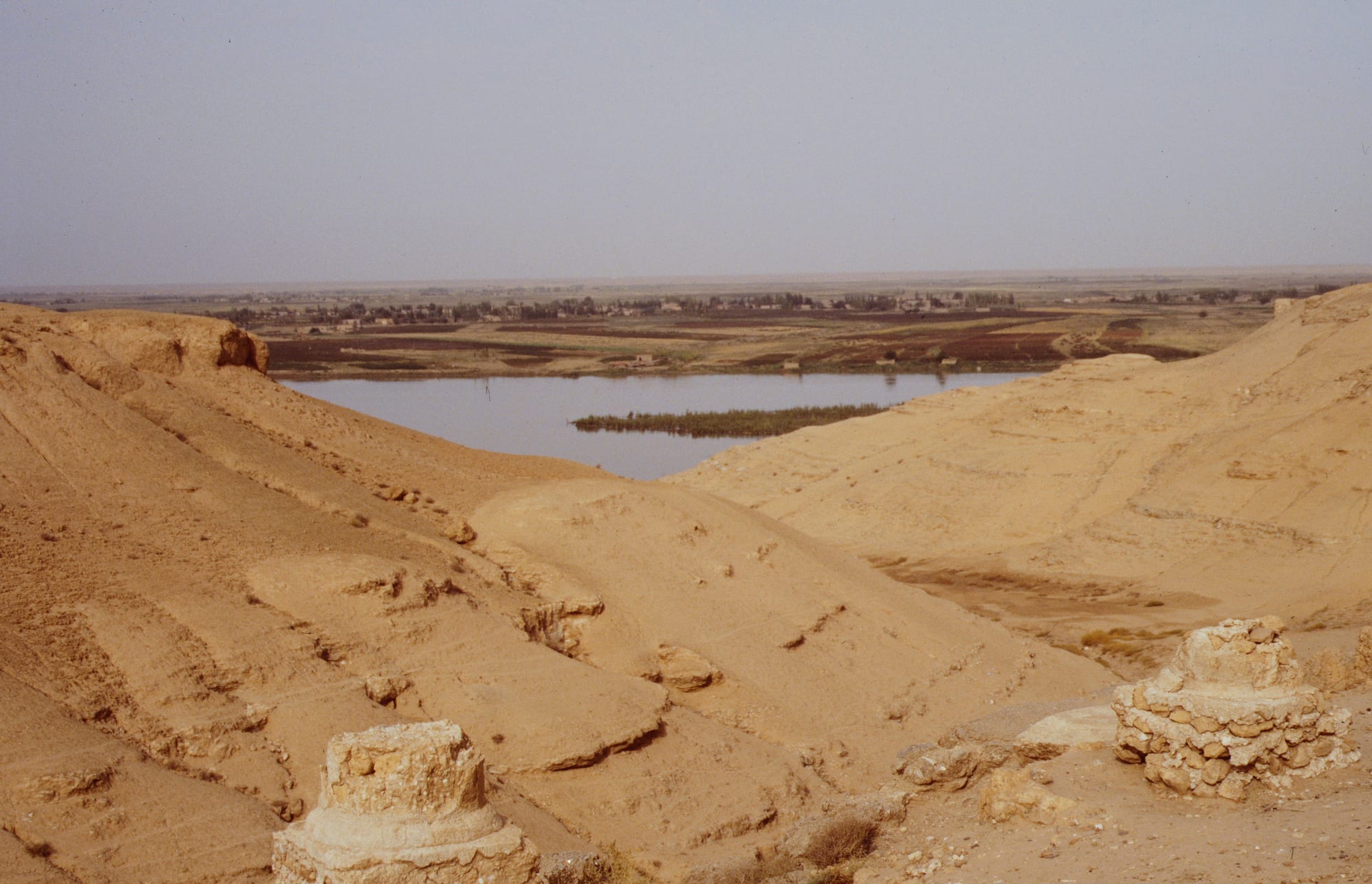
Sandy slopes and stone column bases in the foreground above the Euphrates, with green fields and a village beyond

Syria

The Euphrates & the Northeast

The Euphrates below the ruins of Dura-Europos in Deir ez-Zor province. (Gerhard Haubold (Haubi) / Wikimedia Commons · CC BY-SA 4.0)

Syria's east, where the Euphrates crosses the desert past Raqqa and Deir ez-Zor towards Iraq and the Khabur waters the Jazira plains around Hasakah and Qamishli — a land of Bedouin tribes, Kurdish and Assyrian towns, grain, oil and Bronze Age cities. This page is written to explain the region, not to encourage travel to it.

Explore The Euphrates & the Northeast

History

The Euphrates and its tributary the Khabur made the east a corridor between Mesopotamia and the Mediterranean from the earliest times. Mari, on the river near today's Iraqi border, was a rich city-state in the third and second millennia BC until Hammurabi of Babylon destroyed it in the 18th century BC; its palace archive of tablets is one of the great sources for the period. In the Jazira, tells such as Tell Brak, Tell Halaf and Tell Leilan mark early cities and the Hurrian and Aramaean kingdoms that followed.

Dura-Europos was founded by the Seleucids around 300 BC, became a Roman garrison town facing Parthia and then Persia, and was abandoned after a Sasanian siege in the 250s, preserving its buildings under sand. The Byzantines fortified Resafa, the Umayyads built palaces in the steppe, and the Abbasid caliph al-Mansur founded al-Rafiqa beside Raqqa, where Harun al-Rashid kept his court in the 790s and 800s. Mongol invasions ruined the valley, and for centuries it belonged mostly to Bedouin tribes.

Under late Ottoman rule Deir ez-Zor became the centre of a district, and in 1915–16 its desert became the end point and killing ground of the Armenian deportations. The French mandate brought Assyrian refugees to the Khabur in the 1930s and the Tabqa Dam created Lake Assad in the 1970s. In the civil war ISIS made Raqqa its capital in 2014, and Kurdish-led forces backed by a US-led coalition took the city in 2017, leaving it largely destroyed; ISIS lost its last territory at Baghuz, near the Iraqi border, in 2019.

Culture & Customs

The Euphrates valley is Arab tribal country, where large confederations such as the Uqaidat and the Baggara shape politics, marriages and the settling of disputes. The Jazira around Qamishli and Hasakah is the most mixed part of Syria: Kurds, who are the majority in many northern districts, Arab tribes, Assyrian and Syriac Christians, Armenians, and small Yazidi and Chechen communities.

Kurdish identity was suppressed under the Baʿath state — many Kurds were left without citizenship after a 1962 census — and from 2012 a Kurdish-led autonomous administration governed much of the northeast, teaching in Kurdish and promoting women's participation in public life and in its armed forces. After a government offensive in January 2026 most of its territory passed to Damascus, and the administration was formally integrated into the Syrian state in August 2026. Newroz, the spring new year, is the great Kurdish festival, marked with bonfires and dancing on 21 March.

Tribal hospitality is taken seriously: the guest tent or reception room, bitter coffee poured from a long-spouted pot, and a meal of rice and lamb for honoured visitors. The Assyrian villages of the Khabur keep Syriac church traditions, though many families have emigrated.

Daily Life

Raqqa and Deir ez-Zor were both sizeable cities before the war, and both are still being cleared and rebuilt, much of it by residents themselves. Hasakah and Qamishli, the latter on the Turkish border, are the main towns of the Jazira, and camps such as al-Hol held tens of thousands of people linked to ISIS fighters in the years after its defeat.

This is Syria's breadbasket and oil field. The Jazira grows much of the country's wheat and cotton, the Euphrates valley farms irrigated land, and the oil and gas fields east of the river produced much of Syria's output before the war. Drought, falling river levels and dams upstream in Turkey have hurt farming, and the oil revenues have long been contested.

Days start early to avoid the heat, with markets and field work in the morning and families gathering in courtyards and on roofs after dark. Clearing rubble and mines, restoring water and power, the fate of detainees and camps, and the future of local government are the issues that dominate.

Food

Food in the east is plainer and closer to that of Iraq and the Bedouin than to the cities of the west. Feasts centre on lamb or mutton cooked in large pots and served on rice or on layers of bread soaked in broth, eaten from a shared tray, and guests are fed first. Flatbread is baked on the wall of a clay tannour oven, and dairy from sheep and goats comes as laban (yoghurt), samneh (clarified butter) and dried kishk.

The Euphrates supplies carp and other river fish, grilled over wood by the water. In spring after good rains the desert gives kama, desert truffles, sold by the kilo in the markets and cooked with meat or rice. Kurdish households in the Jazira make bulgur dishes, stuffed vegetables and dumplings, and Assyrian families bake festive breads and pastries for Easter.

Wheat from the Jazira goes into burghul and freekeh, and melons, tomatoes and cucumbers from the river gardens fill summer markets. Tea, strong and very sweet, is drunk all day, and bitter Bedouin coffee with cardamom marks every formal visit.

Attractions & Natural Wonders

The Euphrates is the region's backbone, a green ribbon of fields and poplars through desert. In Raqqa province, the Tabqa Dam holds back Lake Assad, with the castle of Qal'at Ja'bar on its hill above the water; Raqqa itself keeps stretches of its Abbasid walls, the Baghdad Gate and the remains of the Qasr al-Banat palace; and south of the river lies Resafa, a walled city with the ruined basilicas of Saint Sergius.

Downstream, Deir ez-Zor is known for its river corniche and the suspension bridge of the French era, destroyed in the war; the Byzantine fortress of Halabiye guards a narrow stretch of the valley upstream. Towards the Iraqi border lie Dura-Europos, on its cliff above the river, whose synagogue paintings are now in the National Museum of Damascus, and Mari at Tell Hariri, with the remains of the palace of Zimri-Lim. Both sites were heavily looted during the war.

North, the Khabur river crosses the Jazira plains around Hasakah, a flat land of wheat fields dotted with tells, including Tell Brak, Tell Halaf and Tell Leilan, and the Assyrian villages along the river.

Cities in The Euphrates & the Northeast

Planning basics

Budget

The east never had much of a visitor trade — a few simple hotels in Deir ez-Zor, Raqqa and Qamishli served archaeologists and traders — and almost all of it is gone. Journalists, aid workers and researchers rely on local fixers, drivers and guesthouses, and those are the real costs. Figures are indicative only.

Daily Budget Midrange
SYP equivalent of roughly USD 120–250 (better hotel, fixer, car and driver) — indicative only
Daily Budget Shoestring
SYP equivalent of roughly USD 30–50 (basic hotel, local food, shared transport) — indicative only

Carry all money as clean US dollar notes and budget generously for a trusted fixer and driver, the one cost that cannot be cut.

Safety

Most governments advise against all travel to this part of Syria. The region was the heartland of ISIS, whose cells have continued attacks in the desert; Raqqa and Deir ez-Zor were largely destroyed and are heavily contaminated with mines and unexploded ordnance; and control has been divided between different armed forces, with tensions between them. Kidnapping, tribal disputes, air strikes and crime are further risks, and consular help is absent.

Do not travel for leisure; anyone who must go should do so only with an experienced local fixer and security advice, keep off unmarked ground, and never touch debris. Check current official travel advice before travelling.

Climate

The Euphrates valley is desert, with some of Syria's hottest summers — Deir ez-Zor regularly passes 40°C — and short, cool winters with little rain. The Jazira around Hasakah and Qamishli, further north, gets enough winter rain to grow wheat without irrigation and is colder in winter. Dust storms blow in spring and early summer.

Summer
very hot and dry, 40–45°C at times along the Euphrates, slightly less in the Jazira
Winter
cool, 3–14°C, with frosty nights and most of the year's rain in the north

Transportation

Roads follow the Euphrates from Raqqa through Deir ez-Zor to Abu Kamal on the Iraqi border, and north through the Khabur valley to Hasakah and Qamishli, which has an airport. Distances are long, bridges over the Euphrates were destroyed in the war and some remain makeshift, and checkpoints mark the roads. Overland links to Iraq exist but conditions change often.

Move only with a local fixer who knows who controls each stretch of road, and only in daylight.

Best Time to Visit

Historically March to April, when the Jazira is green with wheat and the desert blooms briefly, and October to November after the heat. Security conditions, not the season, now decide whether any visit is possible.