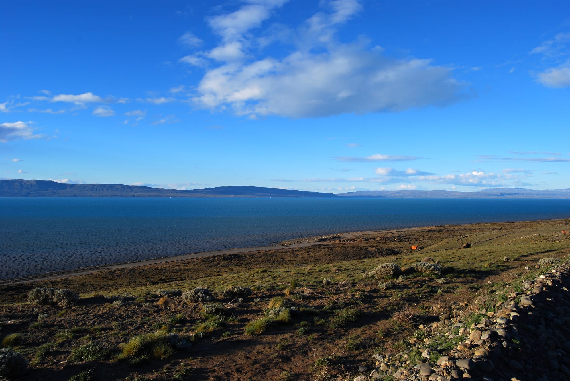
The deep blue water of a vast lake below a bright sky, with dry steppe scrub and a pebbly slope on the shore in front

Patagonia, Argentina

El Calafate

Lago Argentino and the Patagonian steppe at El Calafate, Santa Cruz Province. (Pavel Špindler / Wikimedia Commons · CC BY 3.0)

A town on the southern shore of Lago Argentino in south-west Santa Cruz, founded in 1927 on dry steppe used by wool traders. The creation of Los Glaciares National Park ten years later made it the gateway to the Perito Moreno Glacier, and tourism has turned it into a fast-growing town of hotels, restaurants and tour offices.

Neighbourhoods

  • The centre along Avenida del Libertador
    • First-time visitors
    • Best for food
    • Close to public transport

    The main avenue runs through the town, lined with restaurants, cafés, chocolate and outdoor shops, tour agencies and travel offices. Most of the town's hotels and hostels are on or within a few blocks of it.

    Open in Maps
  • The lakeshore and Bahía Redonda
    • Birdwatching
    • Quiet and residential
    • Lake views

    The shallow bay of Lago Argentino below the centre, with the Laguna Nimez reserve, lakeside walks and newer houses and lodgings. The bay often freezes in winter, when residents skate on it.

    Open in Maps

Things to do

In and around the town

  • Laguna Nimezpark

    A nature reserve on the lakeshore a few blocks from the main street, where Patagonian birds can be watched at close range.

    Open in Maps
  • Glaciariummuseum

    The Patagonian Ice Museum, a few kilometres outside town, explaining how glaciers form and change, with a bar made of glacier ice in its basement.

    Open in Maps
  • Lago Argentinopark

    The largest freshwater lake in Argentina, more than 1,400 km² of milky blue glacial water on whose southern shore the town stands.

    Open in Maps
  • Punta Walichuattraction

    An archaeological site on the shore of Lago Argentino about 15 km east of town, with rock paintings left by the region's Indigenous inhabitants.

    Open in Maps

Short trips into Los Glaciares

  • Perito Moreno Glacierattraction

    A 30-km tongue of ice fed by the Southern Patagonian Ice Field, seen from official paths near its front; its periodic ice-dam ruptures draw crowds, and its northern front has been retreating since 2020.

    Open in Maps
  • Los Glaciares National Parkpark

    Argentina's largest national park, established in 1937 and a UNESCO World Heritage Site since 1981, protecting the eastern edge of the great Andean ice field and its glaciers.

    Open in Maps
  • Upsala Glacierattraction

    One of the park's largest glaciers, at the end of the northern arm of Lago Argentino, retreating fast and calving icebergs into the lake.

    Open in Maps

Eat and drink

Long-standing places and food districts in El Calafate. Hours, ratings and directions come from your maps app, always current.

El Calafate classics

  • Patagonian lamb on Avenida del Libertadorneighborhood

    Restaurants along the main avenue roast cordero patagónico, Patagonian lamb, slowly on iron crosses beside an open fire, often in view of the street.

    Open in Maps
  • Calafate berry treatscafe

    Ice-cream shops, bakeries and chocolate shops sell jams, liqueurs and ice cream made with the purple berry that gave the town its name.

    Open in Maps

Cafés and bars

  • Cafés and bars of the centreneighborhood

    Bars, breweries and cafés along and off the main avenue, busy in the evenings when the glacier tours return.

    Open in Maps

Experience El Calafate

History

The southern shore of Lago Argentino was Tehuelche country, and rock paintings at Punta Walichu, east of the town, record the people who hunted guanaco on the steppe. Francisco Moreno explored the lakes in the 19th century, and his work defending Argentina's case in the 1902 border arbitration with Chile gave the glacier its name. The town's own name comes from the calafate, a thorny bush with yellow flowers and dark-blue berries common in the region.

In the early 20th century the site was little more than a sheltering place for the wagons that carried wool from the sheep estancias. The Argentine government founded the town officially on 7 December 1927 to consolidate settlement in the region. Growth began with the creation of the national park in 1937, which brought better roads, and the first visitors came to see the glacier and its occasional ice-dam ruptures, the earliest recorded in 1917.

Tourism transformed the town in the late 20th century. The population more than doubled between 1991 and 2001 and has kept rising since. In 2000 a new international airport replaced the old Lago Argentino airport. The winds over the Andes have also made the area a centre for high-altitude gliding: in 2018 the Perlan 2 glider set a world altitude record of 22,657 metres from the airport.

Culture & Customs

El Calafate is a town of newcomers. Most residents arrived from other parts of Argentina, and from abroad, to work in hotels, restaurants, tour companies and public services, and the town's culture mixes the country's habits — late dinners, asado, football and mate — with the rhythm of the tourist season.

The older sheep-country culture survives around it. Sheep estancias still work the steppe around the lake, some of them open to visitors, and lamb roasted on the iron cross remains the dish of celebration. The Club Andino Lago Argentino, facing Bahía Redonda, teaches mountain skills and runs a climbing wall, and in winter, when the bay freezes, residents skate on it.

The glaciers shape local identity. The Glaciarium, the Patagonian Ice Museum, presents current research on the ice field, and residents follow each rupture of the Perito Moreno's ice dam as a public event. The town's name and the calafate berry are a point of pride, and the saying that whoever eats the berry will come back to Patagonia is repeated to nearly every visitor.

Daily Life

The 2022 census counted about 23,000 people, up from about 16,700 in 2010 and about 6,400 in 2001, and the town holds nearly nine-tenths of the population of the Lago Argentino Department, of which it is the seat. The growth has been driven almost entirely by tourism.

The year divides into a long, busy season from spring to early autumn and a quiet winter. In summer the town fills with visitors from early morning, when buses leave for the glacier, until late in the evening on the main avenue. Many jobs are seasonal. Most goods travel thousands of kilometres by road, so prices are high.

Daily life is shaped by distance and weather. Río Gallegos, the provincial capital, is about 320 km away, Buenos Aires more than 2,700 km. The wind blows hard for much of the year, and Chilean flamingos gather in the shallows of the lake within sight of the town.

Food

Cordero patagónico, Patagonian lamb, is the town's signature dish. Whole lambs are split and roasted slowly on an iron cross, al asador, beside an open fire, and several restaurants on the main avenue roast the lamb in their front windows. The asado of beef, with chorizo and morcilla, is also everywhere. Like the rest of Patagonia's food, almost everything else arrives by road from far to the north.

The calafate berry, the town's namesake, is turned into jams, liqueurs, sauces and ice cream, and is sold in shops along Avenida del Libertador. Chocolate shops and bakeries line the same street, and apple or chocolate tart appears on dessert menus.

The Glaciarium's basement holds a bar made entirely of glacier ice, down to the glasses and counter. Hot chocolate and mate are the drinks of cold, windy days. Empanadas, pizza and the everyday Argentine milanesa keep the town's large working population fed.

Planning tools

Budget

El Calafate is one of the most expensive towns in Argentina. Rooms, meals and above all glacier excursions, boat trips and ice treks cost well above national prices, and the national park charges an entry fee. January and February are the busiest and dearest months. Prices in pesos change quickly, so any figure is a guide only.

Daily Budget Midrange
USD 140–250 (hotel, lamb dinners, a glacier boat trip or ice trek, transfers)
Daily Budget Shoestring
USD 55–90 (hostel bed, self-catering, park bus and walkway visit)

Book flights and rooms well ahead for January and February, and budget separately for park entry and glacier trips.

Best Time to Visit

November to March is the main season, when boats and treks run fully and days are long; January and February are the busiest. In winter the town is quiet, many services are reduced and the bay may freeze. Spring and summer bring the strongest winds.

Suggested Number of Days

Two or three days suits a first visit to the town and the glaciers near it. Four to six allow for boat trips deeper into the park, the steppe around the lake and the trekking country to the north. Wind can cancel boats and flights, so a spare day helps.

First Visit
2–3 days
With Surroundings
4–6 days

Transportation

The town is small and walkable, but everything beyond it needs transport: regular buses and tours run to the Perito Moreno Glacier, boats to the other glaciers leave from a port on the lake, and long-distance buses run to El Chaltén and Río Gallegos. Many visitors hire a car; the main access roads are paved, while some other routes are gravel.

Drive slowly on gravel, watch for strong crosswinds, and refuel in town before long drives.

Airport & Station Connections

Comandante Armando Tola International Airport, opened in 2000 to a design by Carlos Ott, lies about 21 km east of town, with flights from Buenos Aires and other Argentine cities; buses and taxis run to the centre. Buses run to El Chaltén, about 220 km away on a paved road, and to Río Gallegos, about 315 km away.

Walkability

The centre is compact and easy on foot, with Avenida del Libertador and Laguna Nimez within a short walk. The wind can make walking hard work in spring and summer, and there is little shade on the steppe. The airport, the glacier and the boat port are out of walking range.

Safety

Argentina is relatively safe by regional standards, and violent crime against visitors is uncommon. El Calafate itself is very safe; the hazards are natural — cold, strong winds, gravel roads and long empty distances. At the glacier, falling ice is a danger, and visitors must keep to the official paths.

Keep to the official paths at the glacier, carry layers and a windproof jacket even in summer, and check road conditions before driving the gravel routes. Check current official travel advice before travelling.

Climate

A cold, semi-arid steppe climate moderated by the lake. Summer is December to February: dry, bright and windy, with long days. Winters are cold and slightly wetter, with snow at times and a frozen bay. The record high is 30.7°C and the record low −17.4°C.

Summer
dry and bright, with January averaging about 13°C, warmer afternoons, chilly nights and strong winds
Winter
cold, with July averaging about 1°C, short days, occasional snow and ice on the bay; the record low is −17.4°C

Local Customs

El Calafate is a young town where many residents came from elsewhere in Argentina for tourism work, and service is friendly and used to foreign visitors. Dinner is late, as everywhere in the country. In the national park, rubbish is carried out and fires are restricted. Mate is shared freely, and the calafate berry comes with a local saying that whoever eats it will return to Patagonia.

A tip of around 10 per cent is usual in restaurants. Never feed wildlife or leave the official paths at the glacier.

Common Payment Methods

The currency is the Argentine peso. Cards are widely accepted in hotels, restaurants and tour agencies, and ATMs are on the main avenue. A reserve of cash is useful for small purchases, and inflation means prices change often.