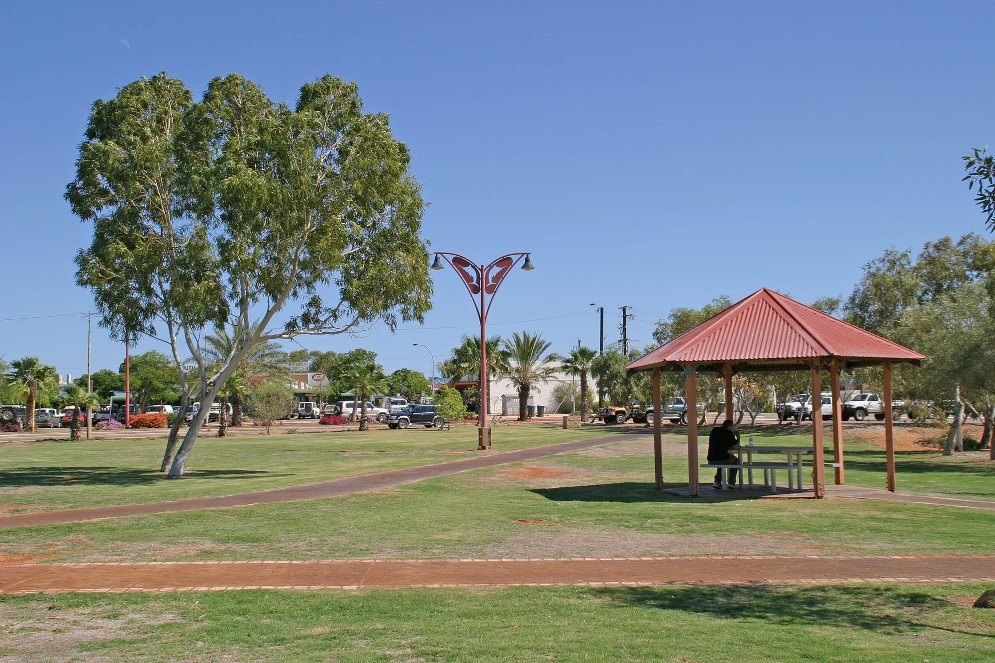
A green lawn with a red-roofed picnic shelter and tall gum trees beside a street of parked vehicles under a deep blue sky

Western Australia, Australia

Exmouth

A shaded picnic shelter and lawn in the centre of Exmouth, near the tip of the North West Cape. (W. Bulach / Wikimedia Commons · CC BY-SA 4.0)

A small town at the tip of the North West Cape in Western Australia, built in the 1960s to serve a naval radio station and now the main base for Ningaloo Reef. Coral grows within swimming distance of the shore here, whale sharks pass in the cooler months, and the dry gorges of Cape Range rise behind the beaches.

Neighbourhoods

  • The townsite
    • First-time visitors
    • Best for food
    • Practical base

    Exmouth sits on the sheltered gulf side of the cape, laid out in wide streets on a grid drawn in the 1960s. A short shopping strip holds the supermarket, bakery, cafés, the pub, dive shops and tour offices, and most of the motels, apartments, caravan parks and backpacker beds are a few minutes' walk from it.

    Open in Maps
  • The boat harbour and marina
    • Boat trips
    • Fishing
    • Quiet and residential

    A protected harbour on the gulf shore at the edge of town, where prawn trawlers, charter boats and dive vessels tie up. Holiday apartments, a few cafés and bars and the main boat ramps surround it, and most reef and fishing trips leave from here or from the ramp on the ocean side.

    Open in Maps
  • Vlamingh Head and the cape tip
    • Viewpoints
    • Whale watching
    • Beaches

    The northern end of the cape, about 15 kilometres from town, where the lighthouse stands on a limestone hill above the Indian Ocean. Wartime radar and gun positions, the rusting remains of a steamer on the reef below, a caravan park and a resort are strung along the shore nearby.

    Open in Maps
  • The west coast and Cape Range National Park
    • Beaches
    • Snorkelling
    • Camping

    Down the ocean side of the cape a single sealed road runs past Tantabiddi and a chain of small campgrounds to Yardie Creek, with the reef a short swim from the sand and dry limestone ridges rising behind. There are no shops, no fuel and little shade once inside the park.

    Open in Maps

Things to do

The reef and the range

  • Ningaloo Coastattraction

    A World Heritage-listed coast whose fringing reef, the largest in Australia, runs for about 260 kilometres and lies close enough to the beach in places to reach by swimming out from the sand.

    Open in Maps
  • Cape Range National Parkpark

    A limestone range of dry gorges and canyons that meets the reef along the western shore of the cape, with rock wallabies, emus and kangaroos, campgrounds behind the beaches and drift snorkelling straight off the sand.

    Open in Maps
  • Yardie Creekattraction

    A gorge in the park where the water is held back by a sandbar and lasts through the year, unlike most creeks in the region; rock wallabies shelter on the cliffs and a walking track follows the rim.

    Open in Maps

Landmarks and the coast

  • Vlamingh Head Lighthouselandmark

    A lighthouse that began operating in November 1912 on a hill at the tip of the cape, built after the loss of the steamer SS Mildura off the North West Cape, and a favoured spot for sunsets and whale watching.

    Open in Maps
  • Naval Communication Station Harold E. Holtlandmark

    The very low frequency radio station built in the 1960s to signal submarines, whose rings of masts a few kilometres north of the town surround Tower Zero, 387 metres tall and for many years the tallest structure in the southern hemisphere.

    Open in Maps
  • Exmouth Gulfattraction

    The wide, shallow gulf on the sheltered side of the cape, a nursery for humpback whales and calves and the ground of a long-standing prawn fishery.

    Open in Maps

Short trips from the town

  • Coral Bayattraction

    A small holiday settlement about 150 kilometres south by road, where the reef curves into a sheltered bay and the snorkelling starts at the water's edge.

    Open in Maps

Seasonal events

  • Whale shark seasonMarch to August

    Whale sharks feed along the Ningaloo reef through the cooler months, and licensed boats take small groups of snorkellers out to swim beside them.

  • Humpback whale migrationThe southern winter, from about June

    Humpback whales follow migratory routes along the reef in the winter months and use the gulf as a nursery, resting there with their calves, watched from the lighthouse hill and from boats.

  • Turtle nestingThe southern summer

    Green, loggerhead and hawksbill turtles breed on the beaches of the reef and come ashore at night to lay, with hatchlings emerging later in the season; volunteers monitor the nesting beaches.

Eat and drink

Long-standing places and food districts in Exmouth. Hours, ratings and directions come from your maps app, always current.

In town and at the harbour

  • The Exmouth shopping stripneighborhood

    Nearly all of the town's eating is in or beside the short central strip — a bakery, cafés, takeaway and pizza shops, the supermarket and the hotel dining room — with food vans appearing through the tourist season.

    Open in Maps
  • Exmouth Boat Harbourneighborhood

    The marina where the prawn and fishing boats land their catch, with a handful of cafés and bars looking over the water and seafood sold close to where it comes ashore.

    Open in Maps

Experience Exmouth

History

Aboriginal people have lived on the North West Cape for tens of thousands of years, and excavations in the gorges of Cape Range have found evidence of coastal life reaching back tens of thousands of years. Dutch ships charted this coast in the seventeenth century, and the British navigator Phillip Parker King named Exmouth Gulf in 1818 after Viscount Exmouth. Pastoral leases spread across the cape from the late nineteenth century, whalers worked the waters beyond the reef, and wrecks on its outer edge led to the building of the Vlamingh Head lighthouse in 1912.

The Second World War brought the first large works. American submarines used a refuelling base on Exmouth Gulf, an operation code-named Potshot, and an airfield was built at Learmonth to the south. The town itself is barely sixty years old. In 1963 Australia and the United States agreed to build a very low frequency radio station at the tip of the cape to signal submarines at sea, and Exmouth was laid out from nothing in 1964 to house the families who ran it. The ring of masts has dominated the horizon ever since.

American numbers fell away in the 1990s and the station passed into Australian hands, while tourism grew around the reef, protected as a marine park in 1987 and listed as World Heritage in 2011. In March 1999 Cyclone Vance crossed the town and wrecked much of it. Exmouth was rebuilt, and in April 2023 a total solar eclipse passed over the cape and more than 20,000 people watched it from a town of a few thousand.

Culture & Customs

Exmouth is a company town that became a tourist town, and both histories show. Street names and the base at the cape's tip recall the American and Australian navies, while the working year now follows the reef. Crews and skippers arrive for the whale shark season, spotter pilots fly the coast looking for shadows in the water, and much of the workforce is seasonal, thinning out when the heat and the cyclone season come.

Fishing is close to a local religion. Boats sit on trailers in front yards, the gulf and the outer reef are fished for mackerel, emperor and billfish, and an annual game-fishing tournament is one of the fixed points of the calendar. Diving clubs, turtle-monitoring volunteers and reef conservation groups take up much of the rest of the social life, and a strong environmental streak runs through local politics, with proposals for industry in Exmouth Gulf regularly opposed.

Manners are informal even by Australian standards, down to bare feet in the supermarket and the habit of lifting a finger from the steering wheel to passing drivers on the empty roads. The cape lies in the country of the Baiyungu and Yinigudura peoples, and Aboriginal heritage in the range and along the coast is protected by law; visitors are asked to leave rock shelters, shell middens and any artefacts exactly as they find them.

Daily Life

About 2,500 people live in Exmouth, which makes it one of the larger settlements on a very empty stretch of coast and still small enough for most residents to know one another. The population swells to around 6,000 at the height of the tourist season with visitors, tour crews and caravanners, and contracts again in the summer heat.

Three things pay the bills. Charter boats, dive shops, caravan parks and motels employ a large share of the town; the communication station and its contractors provide steady work; and prawn trawlers and rock lobster boats fish out of the harbour. Services are those of a remote town — a district high school, a small hospital, a supermarket, a police station and an airport half an hour to the south — and specialist appointments usually mean a flight or a long drive.

Life is shaped by distance and weather. Freight comes up the highway from Perth, so groceries and fuel cost more than in the south; water is drawn from bores beneath the range; and from November households check cyclone plans, clear their yards and keep supplies in the cupboard. Days start early to beat the heat, the pub and the boat ramps are the social centres, and the reef is a short drive rather than a holiday. Housing for seasonal workers is a persistent problem, as is the pressure that growing visitor numbers put on the reef and the park.

Food

Exmouth eats what it catches. Prawns from the gulf, trawled by the local fleet, are the town's signature, along with western rock lobster and reef fish such as red emperor, coral trout and spangled emperor. Spanish mackerel taken off the cape turns up grilled, smoked and in fish and chips, and many visitors cook their own catch at the barbecues in the caravan parks.

The choice of places to eat is small, as it is in any town this far from anywhere. The central strip holds a bakery, cafés, takeaway and pizza shops and the hotel's dining room, a few more cafés and bars sit at the boat harbour, and food vans appear for the season and go when it ends. Coffee is taken as seriously here as it is in Perth.

Almost everything that is not seafood arrives by road from Perth, which is why groceries cost more and why fresh produce depends on the truck. Self-catering is the standard arrangement, since nearly all accommodation has a kitchen, and campers in the national park have to bring food, water and ice with them, because nothing is sold beyond the gate. Wine comes from the state's southern regions, more than a thousand kilometres away, and beer from breweries in Perth and Fremantle.

Planning tools

Budget

Exmouth is expensive for its size. Accommodation is limited and heavily booked in the dry season and the school holidays, groceries and fuel carry the cost of a haul of more than 1,100 kilometres from Perth, and the boat trips most visitors come for are the largest single expense. Camping, self-catering and snorkelling from the beach keep a visit affordable.

Daily Budget Midrange
USD 220–400 (motel room or apartment, restaurant meals, a hire car, one boat tour or day of diving)
Daily Budget Shoestring
USD 80–140 (campsite or backpacker bed, self-catering, a share of fuel, snorkelling from the beach)

Book whale shark tours, hire cars and rooms months ahead for the autumn and winter season, and carry food, water and ice into the national park, where nothing is sold.

Best Time to Visit

April to October, the dry and cooler half of the year. Whale sharks are on the reef from about March to August and humpback whales through the southern winter, and the winter months are warm, clear and settled, which also makes them the busiest and dearest. December to March is very hot and humid with a cyclone risk, though the water is warm and turtles nest on the beaches.

Suggested Number of Days

Three or four days give enough time for the reef and the national park with a day in hand for weather, since boat trips are cancelled in strong wind. A week suits divers, anglers and anyone driving further down the coast.

First Visit
3–4 days
With Surroundings
5–7 days

Transportation

A vehicle is close to essential. The town itself can be crossed on foot, but the national park entrance is about 40 kilometres away and the far end of the park about 90, on a sealed road with no public transport. Hire cars are available in town and at the airport, tour operators collect from accommodation, and bicycles and scooters are used within the townsite. A four-wheel drive is needed only for tracks beyond Yardie Creek.

Kangaroos, emus and cattle come onto the roads around dawn and dusk, the hours local drivers avoid; fuel is sold in the town but not inside the national park.

Airport & Station Connections

Learmonth Airport lies about 35 kilometres south of the town and takes flights from Perth of a little over two hours, met by shuttles and hire cars. By road Exmouth is roughly 1,200 kilometres from Perth up the North West Coastal Highway, a two-day drive for most people, and long-distance coaches run the route. Many visitors arrive as part of a longer drive between Perth and Broome.

Walkability

The townsite is flat and compact, and the shops, cafés, tour offices and most of the accommodation stand within ten or fifteen minutes of each other. Nothing beyond it is walkable. The beaches, the lighthouse and the national park are all a drive away, shade is scarce, and for much of the year the heat makes long walks on the cape uncomfortable.

Safety

Crime is not a concern in a town this small. The risks are heat, sun and water. Summer temperatures are extreme and shade is rare, so dehydration and sunburn are the commonest problems. Beaches are unpatrolled, currents run strongly through gaps in the reef, and stonefish, stingrays and sharks are all present. Cyclones can cross the cape between November and April, and mobile coverage stops outside the town and the main park road.

Carry far more water than seems necessary, snorkel with a companion and check the wind first, keep to marked tracks in the range, and follow local instructions in the cyclone season. Check current official travel advice before travelling.

Climate

Arid and hot, with a long summer and warm, dry winters. Rain is scarce and irregular, most of it from summer storms and the edges of tropical cyclones, and the sea is warm enough to swim in all year. In the southern hemisphere summer falls in December to February and winter in June to August.

Summer
very hot — December to March days usually run between 33 and 38°C and sometimes higher, with humidity and a cyclone season from about November to April
Winter
warm and dry — June to August days are typically around 24–26°C, with cool nights, clear skies and light morning winds

Local Customs

Manners are relaxed and lived outdoors, and tipping is not expected. The town's living depends on the reef, so the rules that protect it are taken seriously — coral is not to be touched or stood on, and licensed operators keep set distances when swimming with whale sharks, manta rays and whales. Nesting beaches have their own etiquette after dark. The communication station is a working defence site and is not open to visitors.

Wear reef-safe sunscreen, touch neither coral nor wildlife, keep torches and camera flashes off nesting beaches at night, and check the state's fishing size and bag limits before keeping a catch.

Common Payment Methods

The currency is the Australian dollar. Cards and contactless payment work in the shops, cafés, fuel stations and tour offices, and cash machines are in the town centre. Some campgrounds and small operators prefer cash, and card terminals rely on a mobile signal that does not reach the national park, so a small amount of cash is worth carrying.