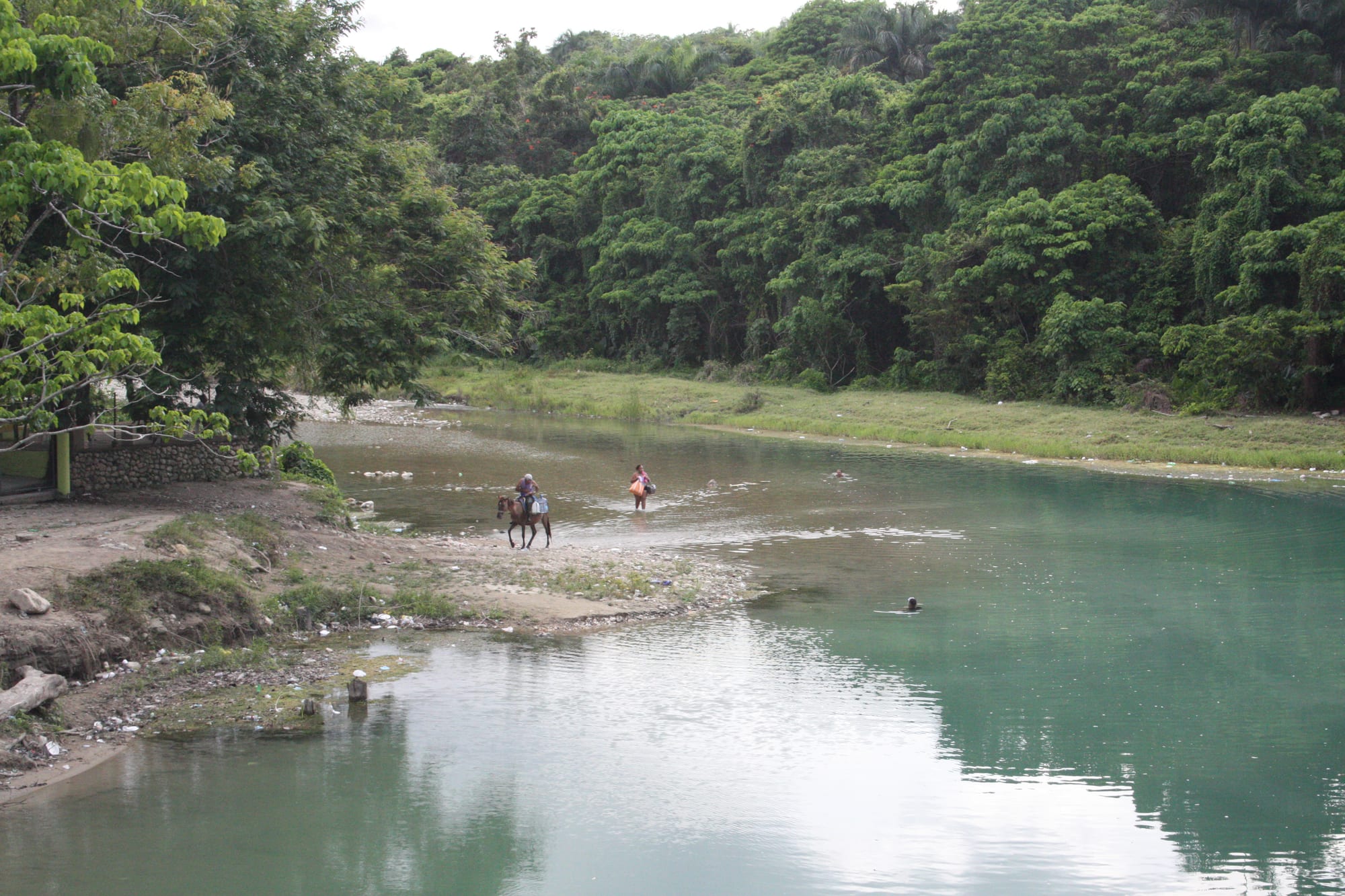
A green river bend below dense forested banks, with a rider on horseback and a person wading across the shallows

Santiago, Puerto Plata & the Cibao, Dominican Republic

Jarabacoa

La Confluencia, where the Jimenoa river joins the Yaque del Norte at Jarabacoa. (Jos1950 / Wikimedia Commons · CC BY-SA 4.0)

A mountain town about 500 metres up in the Cordillera Central of La Vega province, where the Jimenoa and Yaque del Norte rivers meet. Settled by refugees from the lowlands in the early 1800s, it grew on coffee, strawberries and flowers, and its cool climate, waterfalls and rivers have made it a destination for ecotourism and adventure sport and one of the main access points for the climb to Pico Duarte.

Neighbourhoods

  • Town centre
    • First-time visitors
    • Close to transport

    The compact grid of shops, colmados, banks and eateries where the guaguas from La Vega and the coaches from Santo Domingo arrive. Motoconchos gather here to carry people out to the rivers and waterfalls.

    Open in Maps
  • La Confluencia and the riverside
    • Rivers
    • Walks

    The edge of town where the Jimenoa joins the Yaque del Norte, an easy walk from the centre.

    Open in Maps
  • The surrounding hills
    • Quiet and rural
    • Nature

    Pine-covered slopes and farming valleys around the town, dotted with coffee and strawberry farms, plant nurseries, holiday homes and mountain lodges, reached by steep roads.

    Open in Maps

Things to do

Rivers and waterfalls

  • Salto de Jimenoaattraction

    The waterfalls of the Jimenoa river — the municipality has two of them — and a footbridge of rope and wood crossing the river.

    Open in Maps
  • Salto de Baiguateattraction

    A waterfall on the Baiguate river, the third of the town's large rivers.

    Open in Maps
  • La Confluenciapark

    The meeting of the Jimenoa and Yaque del Norte rivers, easily walkable from the centre, where the water continues as the Yaque del Norte, the country's second-largest river.

    Open in Maps
  • Rafting on the Yaque del Norteattraction

    Local operators run rafting, canyoning and tubing trips on the river, offered alongside hiking and paragliding.

    Open in Maps

Short trips into the mountains

  • Pico Duartetrail

    At 3,101 metres the highest peak in the Caribbean, with its easiest access from the trailhead at La Ciénaga, near Jarabacoa, and a mountain shelter for the overnight stay.

    Open in Maps
  • José Armando Bermúdez National Parkpark

    A national park established in 1956 on the northern slopes of the Cordillera Central, cold or cool for most of the year despite the tropical latitude.

    Open in Maps
  • Ebano Verde Scientific Reservepark

    A protected cloud-forest reserve created in 1989, partly in Jarabacoa's municipality, home of the ébano verde, a tree found only in the Dominican Republic.

    Open in Maps
  • Constanzaattraction

    A farming valley in the Cordillera Central known for its strawberries, garlic and potatoes; its town has the coldest average temperature of any settlement in the Caribbean.

    Open in Maps

Seasonal events

  • Festival de las FloresJune

    The town's flower festival, with local growers selling flowers, flowering plants and orchids, alongside handmade crafts.

Eat and drink

Long-standing places and food districts in Jarabacoa. Hours, ratings and directions come from your maps app, always current.

Jarabacoa classics

  • Comedores in the town centreneighborhood

    Simple lunch places serving la bandera and other Dominican set plates to residents and visitors.

    Open in Maps
  • Riverside eateriesneighborhood

    Places to eat along the rivers on the edge of town, popular with families at weekends.

    Open in Maps

Experience Jarabacoa

History

The valley was home to the island's native people before the Spanish arrived, but Jarabacoa as a town is a creation of the 19th century. When Haitian armies invaded the Spanish part of the island in 1801 and 1805, and Dessalines burned La Vega in 1805, many of its people took refuge in the mountains of Jarabacoa and stayed; landowners from other parts of the island and from the south followed, and the valley had a population boom.

In 1854 a military post was set up there, and the town was formally founded, because of its strategic position on the route between the Cibao and the south. It was made a municipality on 27 September 1858, and under Spanish rule a military command was created there in 1862. At its founding in 1854 it had about 2,000 people, and many of its men fought in the wars that secured independence.

Agriculture remained the base of the local economy, and in recent years its rivers and mountains have brought a large growth in ecological and adventure tourism. Growth has brought a large housing shortage, driven by population increase, tourism and migration from the countryside.

Culture & Customs

Jarabacoa's identity rests on its climate and its landscape. Visitors christened it the City of Everlasting Spring, and its mountains, rivers and natural surroundings are its main attractions for visitors.

The town's calendar is marked by the Festival de las Flores every June, when growers sell flowers, flowering plants and orchids alongside handmade crafts — a celebration of the nurseries and flower farms that are part of the local economy. The local carnival in February is one of the best known in the country, and 16 July is the day of Our Lady of Mount Carmel.

Outdoor life is a large part of local culture. Rafting, canyoning and tubing on the Yaque del Norte, hiking in the pine forest and paragliding over the valley have created a community of guides, and Jarabacoa is one of the main access points to Pico Duarte. Like the rest of the Cibao, it is proud of its farming roots, and merengue and baseball are as much a part of life here as in the valley below.

Daily Life

The municipality of Jarabacoa had about 65,000 people at the 2022 census, the second-largest in La Vega province, split almost evenly between the town and the countryside. Daily life in town revolves around the central streets, where motoconchos, guaguas from La Vega and coaches from the capital come and go.

Farming remains the base of the economy. Jarabacoa is known for its strawberries, some of them exported, its coffee, processed in modern factories, and pimento and ají peppers grown in greenhouses; forest, ornamental and fruit nurseries and a wide variety of flowers add to the output. Tourism — lodges, rafting operators, guides and weekend homes — is the other mainstay.

Unemployment is high despite the nurseries and farms, and population growth, tourism and migration from the countryside have left a large housing shortage. The town sits about 500 metres above sea level, and for most of the year its mornings are pleasant, its afternoons hot and its nights mild.

Food

Jarabacoa eats the hearty food of the Cibao. Mangú, mashed green plantain, with fried cheese, salami and eggs is the breakfast favourite, and la bandera — white rice, red beans and stewed meat — is the everyday lunch. Sancocho, the meat stew that is the national soup, suits the cool evenings.

Local farms supply much of what is eaten: strawberries are the best-known crop, and local coffee is sold in town. Ají peppers and pimento are grown in the valley's greenhouses.

At weekends families eat at riverside places on the edge of town, and lodges in the hills cook for visitors and trekkers. As elsewhere, Presidente beer and rum are the drinks of an evening out, and mamajuana — rum and red wine steeped with bark, herbs and honey — is offered as a folk tonic. Chicharrón, crisp fried pork, and longaniza, a spicy sausage, are as popular here as everywhere in the region.

Planning tools

Budget

Jarabacoa runs on local prices, with inexpensive guesthouses and comedores in town and pricier mountain lodges in the hills. Rafting, canyoning, paragliding and guided treks are the main extras, and Pico Duarte treks are arranged with mules to carry supplies.

Daily Budget Midrange
USD 100–200 (mountain lodge, restaurants, a rafting trip or guided hike)
Daily Budget Shoestring
USD 40–70 (guesthouse, comedor meals, guaguas and motoconchos)

Travel agencies can arrange Pico Duarte treks, with mules to carry food, sleeping bags and supplies.

Best Time to Visit

December and January are the busiest months on the Pico Duarte trail, and nights are cold high up. June has the flower festival. Heavy rain can bring flash floods on the rivers, which affects rafting and waterfall visits.

Suggested Number of Days

Two or three days suit the rivers, the waterfalls and a day of adventure sport. A multi-day mountain trek adds several days more, and a visit to the higher valleys adds another.

First Visit
2–3 days
With Surroundings
5–6 days

Transportation

Motoconchos are the most common way around town and out to the waterfalls, and local guaguas to La Vega double as taxis when not on their route. The hill roads are steep and winding, and a hire car or a driver is useful for reaching the lodges and trailheads.

Ride motoconchos with a helmet, and avoid driving the mountain roads after dark.

Airport & Station Connections

Jarabacoa is about two and a half hours by road from Santo Domingo — 130 kilometres on the Autopista Duarte, then 21 kilometres on the Federico Basilis road — and Caribe Tours coaches run from the capital. From the north, travellers change at La Vega. Cibao International Airport is at Santiago.

Walkability

The town centre is small and easy on foot, and La Confluencia is a short walk from it. The waterfalls, farms and lodges lie out along hilly roads, so most people use motoconchos, taxis or a car to reach them.

Safety

The main tourist areas are heavily policed and generally safe, but the Dominican Republic has significant crime, and petty theft, scams, and occasional armed robbery affect visitors, particularly in Santo Domingo and Santiago. In the mountains the bigger risks are natural: river trips and mountain treks need proper guides, and heavy rain brings flash floods.

Raft only with established operators, trek Pico Duarte with a licensed guide and warm clothing, and keep away from rivers after heavy rain. Check current official travel advice before travelling.

Climate

A tropical rainforest climate softened by the altitude of about 500 metres, which has earned Jarabacoa the name City of Everlasting Spring. Rain falls through the year, and nights are noticeably cooler than on the coast.

Summer
hot afternoons and mild nights, with a yearly average of 22°C
Winter
mild days and cool nights — the lowest temperature recorded is 7.1°C, in February 2012

Local Customs

A small, friendly mountain town where people greet each other in the street and Sunday is for family outings to the rivers. Dress is casual, but swimwear belongs at the river, not in town.

Greet people before asking for anything, ask before photographing farmers or residents, and take litter away from rivers and waterfalls.

Common Payment Methods

The currency is the Dominican peso (RD$). Cards work in the larger lodges and some restaurants, and there are banks with ATMs in the centre; cash is needed for motoconchos, guaguas, colmados and entry to some waterfalls.