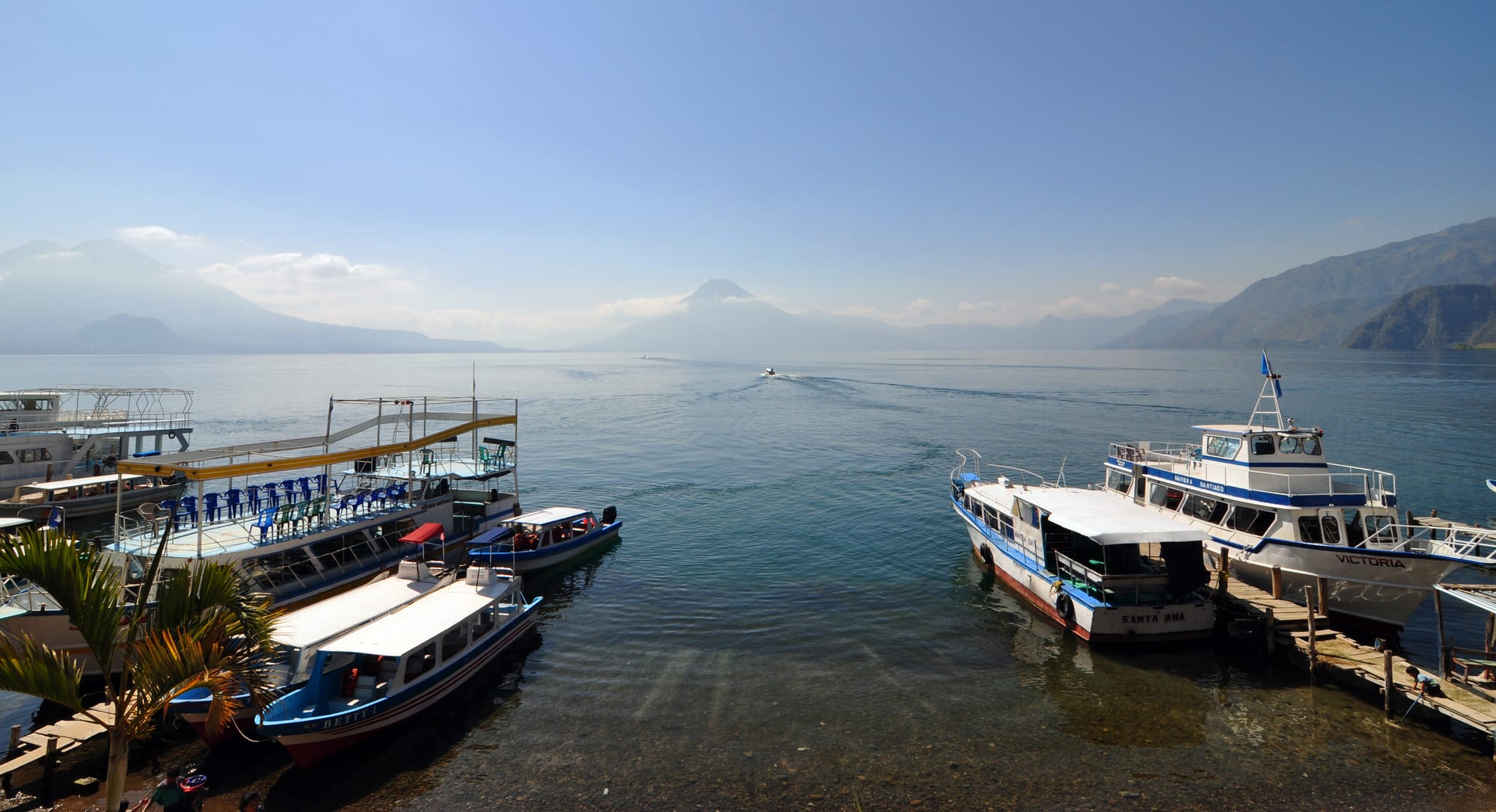
Passenger boats moored at wooden jetties on a calm blue lake, with a volcano and mountain ridges in the haze beyond

Lake Atitlán & the Western Highlands, Guatemala

Panajachel

Boats at the jetties of Panajachel on Lake Atitlán, with the lake's volcanoes on the far shore. (chensiyuan / Wikimedia Commons · CC BY-SA 4.0)

A lakeside town on the north-eastern shore of Lake Atitlán, built on the delta of the Panajachel river beneath the volcanoes Atitlán, Tolimán and San Pedro. A Franciscan mission town in colonial times and a hippie haunt in the 1960s, 'Pana' is now the lake's busiest gateway, with a craft-lined main street and boats to the Maya villages around the shore.

Neighbourhoods

  • Calle Santander and the lakefront
    • First-time visitors
    • Shopping
    • Best for food

    The main tourist street runs down to the lake, lined with textile stalls, travel agencies, cafés, bars and street-food vendors. At its foot are the public beach, the jetties for the lake boats and views across the water to the volcanoes.

    Open in Maps
  • The old town around the church and market
    • Local life
    • Historic district

    Up Calle Principal, away from the lake, the town's older centre gathers around the Franciscan church of San Francisco and the market. Pickup trucks leave from near the market for nearby villages, and life here is more local than on Santander.

    Open in Maps
  • Santa Catarina Palopó
    • Quiet and residential
    • Lake views

    A small lakeside municipality a short way south-east along the shore, a quieter, mainly Kaqchikel alternative to Panajachel.

    Open in Maps

Things to do

The town and the lake

  • Lake Atitlánattraction

    The deepest lake in Central America, up to 340 metres deep, filling a caldera formed by a huge eruption about 79,500 years ago; boats and kayaks set out from Panajachel's shore.

    Open in Maps
  • Casa Cakchiquelmuseum

    One of the first hotels on the lake, built in 1948, now a cultural centre and one of the town's two protected historic buildings, with a museum of historical photographs of Guatemala.

    Open in Maps
  • Church of San Franciscolandmark

    The town's Franciscan church, founded soon after the conquest, whose original façade is considered one of the gems of Guatemala's colonial style.

    Open in Maps
  • Reserva Natural Atitlánpark

    A nature reserve and butterfly sanctuary on an old coffee farm just outside town, with trails and zip lines over the valley.

    Open in Maps

Lake villages and volcanoes

  • Sololáattraction

    The department capital on the mountainside above the lake, a Kaqchikel market town where many men and women still wear traditional dress.

    Open in Maps
  • San Antonio Palopóattraction

    A Kaqchikel village further along the eastern shore beyond Santa Catarina, terraced up the hillside above the lake.

    Open in Maps
  • Santiago Atitlánattraction

    A Tz'utujil town across the lake from Panajachel, the Tz'utujil capital in pre-Columbian times, where the effigy of Maximón is kept in a different household each year.

    Open in Maps
  • San Juan La Lagunaattraction

    A Tz'utujil village on the south-western shore with weaving and natural-dye cooperatives, where a local law stops outsiders buying land.

    Open in Maps
  • Volcán San Pedrotrail

    A 3,020-metre volcano rising from the lake shore above San Pedro La Laguna, climbed with local guides.

    Open in Maps
  • Volcán Tolimánviewpoint

    A 3,158-metre volcano on the southern shore, one of the three cones that frame the view from Panajachel.

    Open in Maps
  • Volcán Atitlánviewpoint

    The active volcano on the southern rim of the caldera, whose most recent eruption was in 1853.

    Open in Maps

Short trips from the town

  • Chichicastenangomarket

    A K'iche' Maya town whose Thursday and Sunday market spreads around the church of Santo Tomás, its steps clouded with incense.

    Open in Maps

Seasonal events

  • Feria de San Franciscofirst week of October

    The town's fair in honour of its patron, Francis of Assisi, with the election of a festival queen.

  • Lent and Holy WeekMarch or April

    The season of processions in the lake towns, and in colonial times Panajachel held a procession every Friday of Lent to the Calvary church.

Eat and drink

Long-standing places and food districts in Panajachel. Hours, ratings and directions come from your maps app, always current.

Panajachel classics

  • Street food on Calle Santanderneighborhood

    Vendors along the main street sell tacos, chuchitos, empanadas, tortas, sweet corn and sweetened nuts, alongside cafés and restaurants of every kind.

    Open in Maps
  • Panajachel marketmarket

    The town market in the older centre, with produce, comedores and snack stalls, where the pickup trucks to nearby villages gather.

    Open in Maps

Experience Panajachel

History

The name Panajachel comes from Kaqchikel and is usually translated as 'place of the matasanos', the white sapote tree. The town grew on the delta of the Panajachel river, which spreads across the north-eastern shore of Lake Atitlán. In the 16th century the shore of the lake saw a battle in which the Spanish and their Kaqchikel allies defeated the Tz'utujil, and soon afterwards Franciscan friars built a church and monastery here and used the town as a base to convert the peoples of the lake. By 1700 the convent had three priests in charge of some 1,800 people and twelve cofradías, religious brotherhoods; in 1754 the Franciscans had to hand their parishes to the secular clergy, and in 1770 the archbishop described 'San Francisco Panajachel' parish.

In 1892 the archaeologist Alfred Maudslay and his wife Anne passed through. Anne Maudslay found life in the town monotonous, and the couple saw irrigation canals watering orchards, gardens and coffee on the delta, where a large flood some years earlier had destroyed several houses.

The 20th century brought outsiders. Casa Cakchiquel, opened in 1948, was one of the first hotels on the lake, and in the 1960s the town drew many hippies. Visitor numbers collapsed during the civil war but returned after it ended, and tourism again became the base of the economy. In October 2005 the rains of Hurricane Stan caused a mudslide along the river that destroyed about 100 homes.

Culture & Customs

Panajachel is a Kaqchikel town with an international face. Maya dress and weaving are central to the textile trade that fills Calle Santander. Across the water, the villages of the lake are Kaqchikel and Tz'utujil, each with its own character and dress, and Panajachel serves as their meeting point with the outside world.

The town's patron is Francis of Assisi, and the parish church of San Francisco, with its colonial façade, is one of two historic buildings protected in the town; the other is Casa Cakchiquel, now a cultural centre with a museum of historical photographs of Guatemala and the home of a local radio station. The town fair in honour of the patron is held in the first week of October, with the election of a festival queen.

Since the hippie years of the 1960s Panajachel has also drawn long-staying foreigners, and it is home to many international non-profit organisations working in education, health and handicrafts around the lake. Religious life has long mixed Catholic and Maya practice: in 1892 Anne Maudslay watched pilgrims returning from Esquipulas gather at night around their saints in the plaza, in a ceremony she judged to be Maya.

Daily Life

The 2018 census counted about 15,000 people in Panajachel, the administrative centre of the municipality of the same name in the department of Sololá. Tourism is the backbone of the economy: hotels, restaurants, shops, travel agencies and boat services employ much of the town, alongside the textile trade.

The town is the lake's main transport hub and economic centre. Boats leave its jetties for San Pedro, Santiago Atitlán and the villages between, carrying villagers to market and visitors to the far shore, and buses and shuttles connect it to Sololá, the Pan-American Highway and the rest of the country. Tuk-tuks fill its narrow streets.

The lake itself is the town's most pressing issue. The introduction of predatory bass eliminated more than two-thirds of the native fish species and contributed to the extinction of the Atitlán grebe, and blooms of cyanobacteria, first seen on a large scale in 2009, returned in 2015, raising concern about pollution and the lake's health. The afternoon wind, the Xocomil, can stir up waves strong enough to capsize boats, so crossings are usually made in the morning.

Food

Panajachel eats the food of the highlands. Tortillas come with every meal, alongside black beans, eggs, fresh cheese, chillies and herbs, and tamales and chuchitos — small tamales wrapped in dried maize husks — are sold on the street and in the market. Pepián, a meat stew thickened with seeds, is one of the national dishes, and atol, a hot maize drink, is one of Guatemala's traditional drinks.

Calle Santander is the town's food street. Vendors sell tacos, chuchitos, empanadas, tortas, sweet corn and sweetened nuts, and the street is lined with cafés, bakeries and restaurants serving everything from Guatemalan set lunches to pizza and steak for the many foreign visitors. The market, in the older part of town, is where local families shop and eat.

Coffee grows on the slopes around the lake, and the Reserva Natural Atitlán sits on an old coffee farm. At the lake's Maximón shrines, popular offerings include money, tobacco and moonshine.

Planning tools

Budget

Panajachel has a wide range of places to stay, from cheap guesthouses to upmarket lakeside hotels, and is pricier than the smaller villages. Public boats, tuk-tuks and street food cost little; private boat tours, guided hikes and shuttles to and from Antigua or the capital are the main extras.

Daily Budget Midrange
USD 60–120 (lakeside hotel, restaurants, shuttles and a guided hike)
Daily Budget Shoestring
USD 25–40 (guesthouse, street food and comedores, public boats and chicken buses)

Carry small notes for boats, tuk-tuks and market stalls; Panajachel has cash machines, which are scarce in the smaller lake villages.

Best Time to Visit

November to April is dry and clear, the best time for volcano views, hikes and calm morning crossings. The wet season from May to October is green and quieter, with afternoon rain. The town's fair falls in the first week of October, and Holy Week brings processions.

Suggested Number of Days

Two or three days give time for the town and a day on the water. Allow four to six days to visit several lake villages, climb a volcano and add a market day further afield; many visitors split their stay between Panajachel and a quieter village.

First Visit
2–3 days
With Surroundings
4–6 days

Transportation

The town is small: tuk-tuks circle its few streets and charge a flat fare within the delta. Public lanchas, fast open boats, link Panajachel with San Pedro, Santiago Atitlán and most villages in between, and private boats can be hired. Pickup trucks leave from near the market for nearby villages. Kayaks can be rented on the public beach.

Cross the lake in the morning, before the afternoon wind, the Xocomil, makes the water rough.

Airport & Station Connections

Panajachel is a few hours from Guatemala City and Antigua by tourist shuttle, which many agencies arrange. Chicken buses run via the junction at Los Encuentros and Sololá. There is no bus station: buses, taxis and shuttles gather where Calle Principal meets Calle Santander. The nearest international airport is La Aurora in Guatemala City.

Walkability

Flat and walkable on its river delta: Calle Santander, the lakefront and the old centre are all within a short walk. Tuk-tuks cover the rest, and anywhere off the delta, such as the nature reserve, means a climb.

Safety

Guatemala has significant crime, including gang activity and armed robbery, concentrated in parts of Guatemala City and on some highways and rural routes. The tourist circuit around the lake is generally calm, but robberies have occurred on some trails between the lake villages and on volcano and sunrise hikes. Petty theft happens on crowded buses, and the afternoon wind can make the lake dangerous for small boats.

Hike with local guides, keep an eye on bags on chicken buses, avoid travelling at night on rural roads and cross the lake in the morning. Check current official travel advice before travelling.

Climate

At about 1,600 metres, Panajachel is mild all year, with a wet season from May to October and a dry season from November to April. The figures below are those for the region's highlands.

Summer
wet season (May–October): 15–24°C in the highlands, with afternoon rain
Winter
dry season (November–April): sunny days around 20–25°C, cooler nights

Local Customs

Panajachel is a Kaqchikel Maya town with a large tourist trade, and the villages around the lake are Kaqchikel and Tz'utujil communities with their own dress and customs. Bargaining is normal at textile stalls, and the lake's churches are places of active worship.

Ask before photographing people and especially children, dress modestly in churches and in the villages, and bargain politely.

Common Payment Methods

The currency is the Guatemalan quetzal (Q). Hotels, agencies and some restaurants accept cards, but boats, tuk-tuks, markets and street vendors need cash. Panajachel has ATMs; stock up before heading to the smaller villages.