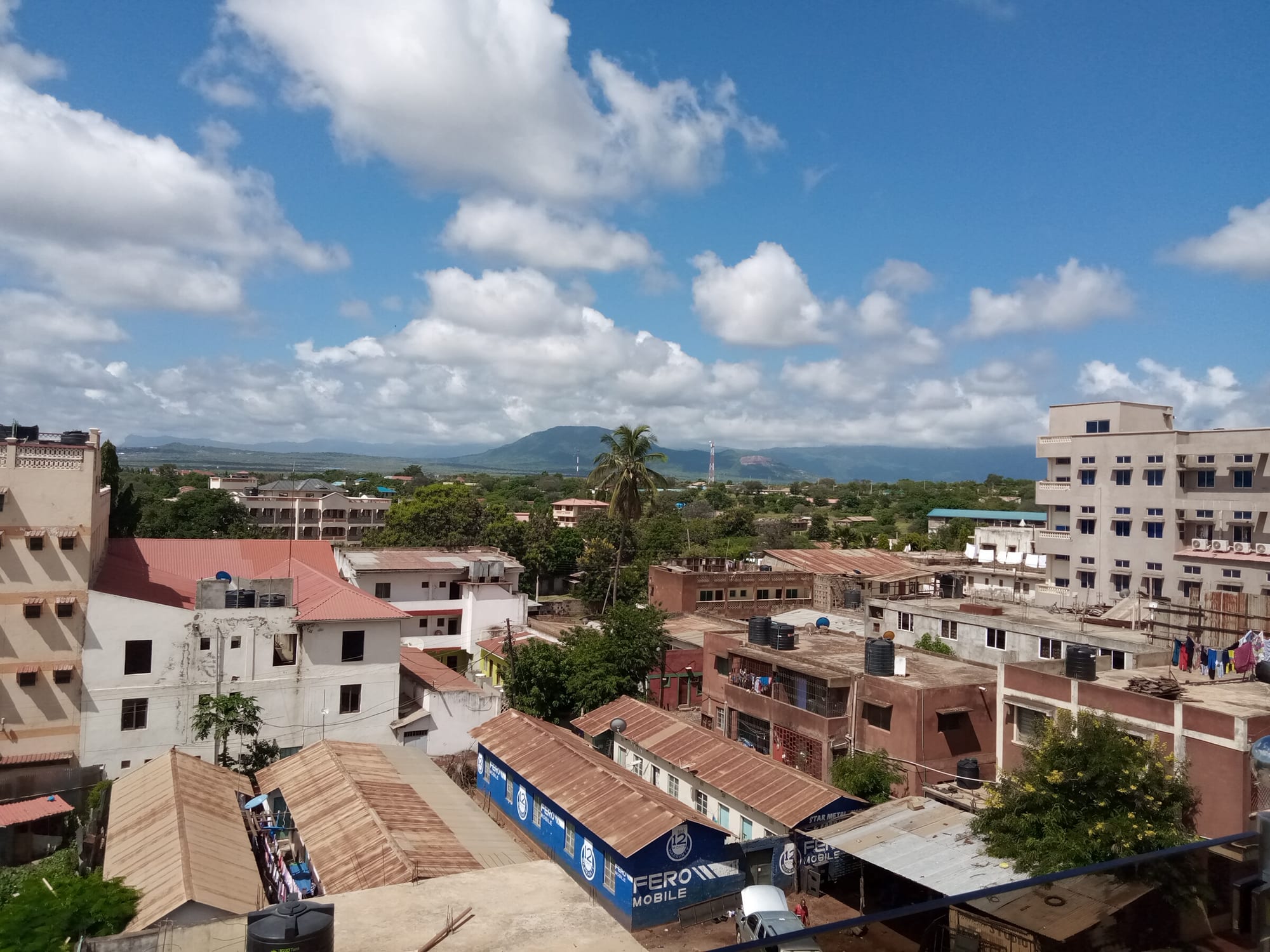
Rooftops and low blocks of a small town among trees, with a line of dry hills rising on the horizon under a cloudy blue sky

Mombasa & the Coast, Kenya

Voi

The centre of Voi, looking west towards the Taita Hills. (TTC dude / Wikimedia Commons · CC BY-SA 4.0)

A highway and railway town in Taita-Taveta County, halfway between Mombasa and Nairobi, that grew from a station on the Uganda Railway in the 1890s. It is the main gateway to Tsavo East National Park, whose boundary begins a short drive from the town, and the road junction for the green Taita Hills and the Tanzanian border at Taveta.

Neighbourhoods

  • The town centre
    • First-time visitors
    • Markets
    • Close to public transport

    A compact grid of shops, banks, lodgings, butcheries and a busy market around the bus park and the old railway line. Almost everything in Voi is here, and buses between Mombasa and Nairobi stop at its edge through the day and much of the night.

    Open in Maps
  • The highway strip
    • Close to public transport
    • Quiet and residential

    The service area along the Mombasa–Nairobi road, with filling stations, truck stops, guesthouses and eating places used by drivers breaking the journey. It is convenient and noisy, and a short drive from the park gate.

    Open in Maps
  • Towards the Tsavo gate
    • Wildlife
    • Quiet and residential

    The southern edge of town where housing thins into bush and the road runs on to the national park entrance. Safari lodges and camps lie along and beyond it, and elephants sometimes move close to the boundary.

    Open in Maps

Things to do

In and around the town

  • Voi marketmarket

    The town's produce market beside the bus park, selling fruit and vegetables from the Taita Hills, maize, beans and household goods to a wide rural hinterland.

    Open in Maps
  • Sagallaviewpoint

    A hill rising south of the town, with farms and villages on its slopes and long views over the Tsavo plains from the road that climbs it.

    Open in Maps

Short trips from the town

  • Tsavo East National Parkpark

    One of Kenya's largest parks, gazetted in 1948 and entered at Voi Gate, its main gate, on the edge of town — red-dusted plains with large elephant herds, lions, the Galana river and the dam at Aruba.

    Open in Maps
  • Taita Hillsattraction

    A range of forested hills rising sharply from the plains north-west of town, cooler and greener than Tsavo, with terraced farms and rare cloud-forest birds.

    Open in Maps
  • Wundanyineighborhood

    The county's hill town, reached by a climbing road from Voi, a base for walks among the terraced slopes, waterfalls and remnant forest patches of the Taita Hills.

    Open in Maps
  • Taita Hills Wildlife Sanctuarypark

    A private sanctuary of about 110 square kilometres, established in 1972 on the plains next to Tsavo West, with elephants, giraffe and plains game.

    Open in Maps
  • Tsavo West National Parkpark

    The hillier, greener half of the Tsavo complex west of the highway, with volcanic cones, lava flows and views towards Kilimanjaro.

    Open in Maps
  • Mzima Springsattraction

    Pools fed by rain that percolates for years through the volcanic rock of the Chyulu Hills, emerging exceptionally clear, with resident hippos and Nile crocodiles.

    Open in Maps

Eat and drink

Long-standing places and food districts in Voi. Hours, ratings and directions come from your maps app, always current.

Voi staples

  • Nyama choma and butcheriesrestaurant

    Goat or beef roasted over charcoal and sold by the kilo at butcheries around the town centre, eaten with kachumbari salad and ugali.

    Open in Maps
  • Highway caféscafe

    Simple kitchens serving the bus and truck trade all day — ugali with stew, pilau, beans, chapati, mandazi and strong milky chai.

    Open in Maps
  • Voi marketmarket

    Fruit and vegetables brought down from the Taita Hills, along with maize, beans, mangoes and the small dried fish traded up from the coast.

    Open in Maps

Experience Voi

History

Voi owes its existence to the railway. When the Uganda Railway was pushed inland from Mombasa in the 1890s, a station and workshops were established here on the edge of the Taita foothills, at a point where the line met the old caravan route between the coast and the interior. The construction years are remembered for the lions that preyed on labourers at the Tsavo river crossing north-west of the town in 1898, an episode that has been written about and filmed many times since.

The station made Voi a trading and administrative point for a district whose people, the Taita, lived mainly up in the hills. Sisal estates spread across the hot plains around the town in the colonial period, and the branch line towards Taveta, since abandoned, made Voi a base during the campaign fought along the border with German East Africa. Farming in the hills, livestock on the plains and work on the railway shaped the town for decades.

Tourism arrived with the parks: Tsavo East and Tsavo West were gazetted in 1948, and the gate on the town's southern edge turned Voi into the main entry point for the eastern half. Gemstone mining in Taita-Taveta, including the green garnet named tsavorite after the park and mined in Kenya since the early 1970s, added another trade. The Standard Gauge Railway from Mombasa opened in 2017 with a station outside town, and Voi has grown steadily as the largest centre in its county.

Culture & Customs

Voi is a Taita town on the plains below the Taita Hills, and the hills are where the county's cultural weight lies. Taita communities farm terraced slopes, speak Kidawida and related languages alongside Kiswahili, and keep a tradition in which patches of forest were preserved as sacred groves — places of ritual and of skull caves where the remains of ancestors were kept. Those fragments of cloud forest are now reduced to a few square kilometres and are among the most closely studied and most threatened habitats in Kenya.

The town itself is mixed and mobile, a place of traders, drivers, railway workers and government staff from across the country, with churches and mosques, Kamba and coastal families, and the matatu and bus culture of any Kenyan junction. Football and athletics are followed closely, and the market is the social centre as much as the commercial one.

Manners are ordinary Kenyan ones: a handshake and a greeting before any request, respect for elders, modest dress, and patience in the heat of the day. Around the parks, wildlife is not a spectacle but a neighbour — crop raiding by elephants is a live grievance, and community conservancies and electric fencing are constant subjects of local debate. Visitors who ask before photographing people, and who use a local guide in the hills, are received warmly.

Daily Life

Voi is the largest town in Taita-Taveta County, with a population in the tens of thousands and a role well beyond its size: it is where the hills come down to shop, where buses and trucks between Mombasa and Nairobi stop, and where the county's administration, schools and hospital are concentrated. The rhythm is set by the highway, which never really goes quiet, and by the market, busiest early.

Work comes from trade and transport, from the parks and the lodges, from government offices, and from farming — maize, beans, vegetables and fruit in the hills, livestock and sisal on the plains. Mining for gemstones employs many people in small-scale operations across the county. Water is the constant problem: the plains are dry, boreholes and piped supply are stretched, and drought years hit both crops and cattle hard.

The town has grown quickly, with new buildings around the centre and along the highway, and it is used increasingly as a base by visitors who once drove straight past. Human-wildlife conflict on the park edge, land and mining disputes, and youth unemployment are the issues that dominate local discussion.

Food

Voi eats inland Kenyan food rather than coastal Swahili cooking. Ugali, stiff maize porridge, with sukuma wiki (braised collard greens), beans or a beef or goat stew is the everyday plate, and githeri, maize boiled with beans, is the standard cheap meal. Chapati and mandazi, lightly sweet fried dough, come with strong chai boiled with milk and sugar.

Nyama choma is the town's social food: goat or beef roasted over charcoal at a butchery, ordered by the kilo, cut up on a wooden board and eaten with kachumbari, a salad of tomato, onion and chilli. Mishkaki skewers are grilled at stalls in the evening, and roadside stands sell roasted maize to bus passengers.

The Taita Hills supply much of what the market sells — bananas, avocados, mangoes, tomatoes, cabbages and beans grown on terraces — and the coast sends dried fish and coconuts up the highway, so coastal dishes such as pilau appear alongside upcountry ones. Fresh juices, sodas and Tusker beer round out the drinking, and in the hills, home-brewed sugarcane and maize drinks remain part of village life.

Planning tools

Budget

Voi itself is inexpensive: town guesthouses, market food and matatus cost little, and it is used by travellers as a cheap base beside an expensive park. Tsavo is where the money goes — park entry is charged per person per day in dollars, and a vehicle with a driver-guide or a lodge inside the gates costs far more than a night in town.

Daily Budget Midrange
USD 95–230 (lodge or good hotel, meals, a park day with a driver-guide)
Daily Budget Shoestring
USD 25–50 (town guesthouse, local cafés, matatus) — park entry and a vehicle extra

Confirm what a safari price includes — park fees, vehicle, guide and meals are often quoted separately.

Best Time to Visit

June to October and January to February are dry, when the bush thins, the dust settles into tracks and animals gather at the waterholes — the best months for Tsavo. The long rains of March to May turn the plains green and the tracks difficult, with shorter rains around November. The hills are cooler and wetter than the town all year.

Suggested Number of Days

A day or two is enough for the town and a first look at the park beside it. Three or four allow a slower stay with the hills and the western parks included. Long distances inside Tsavo, and slow tracks after rain, are what usually add time.

First Visit
1–2 days
With Surroundings
3–4 days

Transportation

Matatus, motorbike taxis (boda bodas) and tuk-tuks work the town and the roads out to Mwatate, Wundanyi and Taveta. Buses between Mombasa and Nairobi call here throughout the day, and the Standard Gauge Railway has a station outside the town on the Mombasa–Nairobi line. Wildlife viewing needs a hired vehicle with a driver-guide, or a self-driven four-wheel drive.

Saloon cars struggle on Tsavo's tracks after rain, and driving on the highway after dark is best avoided because of heavy truck traffic.

Airport & Station Connections

Voi sits on the Mombasa–Nairobi highway, roughly 150 kilometres from Mombasa and about three hours by bus or matatu, with Nairobi some six to seven hours the other way. Standard Gauge Railway trains between the two cities stop at the station outside town. Light aircraft serve airstrips inside Tsavo for lodge guests.

Walkability

The town centre is small, flat and walked easily in twenty minutes, with the market, shops and bus park close together. Pavements are patchy, the highway is busy with trucks, and the heat in the middle of the day is heavy. Anything beyond the centre, including the park gate, means a ride rather than a walk.

Safety

Voi is a transit town, with the risks of one — petty theft around the bus park, opportunistic crime after dark, and heavy traffic on the highway through town. Wildlife is the other consideration: elephants and other animals move across the land around Tsavo, and walking at night on the edge of town or near the park boundary is unwise. Malaria is present in the lowlands.

Avoid walking on beaches or in Mombasa's old town after dark, use malaria prophylaxis, and stay away from the northern Lamu and Tana River border areas. Check current official travel advice before travelling.

Climate

Hot and dry, hotter than the coast in the middle of the day and drier than the hills above it. Rain comes in two seasons, heaviest in March to May with shorter rains around November, and the Taita Hills a short way west are noticeably cooler and greener.

Summer
December–March is hot, often in the mid-30s °C, with dusty, hazy afternoons
Winter
June–September is cooler and drier, around 26–29°C, with cold mornings in the hills

Local Customs

This is Taita country, with Kamba, Swahili and upcountry Kenyan families alongside, and both Christian and Muslim communities. Dress is modest by town standards, greetings come before business, and a few words of Kiswahili are appreciated. In the hills, forest patches known as sacred groves are treated with respect and visited only with a local guide.

Tipping a driver-guide at the end of a safari is customary, bargaining is normal in the market, and photographs of people should be taken only with permission.

Common Payment Methods

The currency is the Kenyan shilling, and mobile money (M-Pesa) is used for almost everything locally. Cards are accepted by lodges and larger hotels but rarely in town, and cash is needed for the market, matatus and small guesthouses. ATMs are in the town centre, and park fees are usually charged in US dollars or by card.