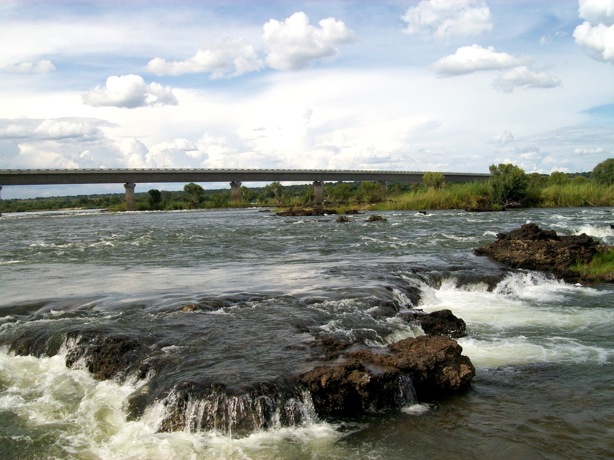
A long concrete road bridge on slender piers crossing a wide river running over dark rocky rapids

Etosha & the North, Namibia

Katima Mulilo

The bridge over the Zambezi at Katima Mulilo, carrying the road to Sesheke in Zambia. (Eugen Zibiso / Wikimedia Commons · CC BY 2.0)

The capital of Namibia's Zambezi Region, on the south bank of the Zambezi River in the far north-east, about 1,200 kilometres from Windhoek. A trading and administrative town at the end of the Trans-Caprivi Highway, it sits within reach of Zambia, Botswana and the wetland parks of the former Caprivi Strip, in a green, well-watered corner unlike the rest of Namibia.

Neighbourhoods

  • The town centre
    • First-time visitors
    • Shops and banks
    • Markets

    A compact grid of shops, banks, government offices, filling stations and a shopping centre around the main road. Almost every errand in the Zambezi Region — supplies, fuel, money, permits — is done in these few blocks, and the open market sits on its edge.

    Open in Maps
  • The riverfront
    • Quiet and residential
    • River views
    • Boat trips

    The strip along the south bank of the Zambezi north of the centre, where lodges, campsites and older government houses look across reeds and channels towards Zambia. Boats leave from here for sunset trips, fishing and birdwatching.

    Open in Maps
  • Ngweze
    • Local life
    • Markets
    • Budget stays

    The large, densely built suburb beyond the centre where most of the town's residents live, with informal markets, bars, churches and small workshops. It is the busiest part of Katima Mulilo and the place where the town's daily trade happens.

    Open in Maps

Things to do

The river and the town

  • Katima Mulilo Bridgelandmark

    The road bridge across the Zambezi, opened in 2004, which linked Namibia directly to Zambia and completed the corridor from Walvis Bay to the interior of southern Africa.

    Open in Maps
  • Caprivi Art Centremarket

    A community-based craft centre selling baskets, wood carvings, drums and beadwork made in the villages of the Zambezi Region.

    Open in Maps
  • Katima Mulilo open marketmarket

    Described as the largest open market in Namibia, where maize meal, dried and fresh fish, vegetables, fabric and cheap household goods from Zambia change hands.

    Open in Maps
  • Katima Mulilo Airporttransit hub

    The regional airport, also known as Mpacha, built as a military airfield and now handling scheduled flights and charters south-west of the town.

    Open in Maps

Short trips from the town

  • Mudumu National Parkpark

    Mopane woodland and reed channels on the Kwando river south-west of Katima Mulilo, known for elephant, hippo and birdlife.

    Open in Maps
  • Nkasa Rupara National Parkpark

    Namibia's largest wetland park, a maze of islands, reed beds and channels on the Linyanti river in the south of the region, reached by 4x4.

    Open in Maps

Eat and drink

Long-standing places and food districts in Katima Mulilo. Hours, ratings and directions come from your maps app, always current.

Markets and river kitchens

  • Katima Mulilo open marketmarket

    Stalls of maize meal, vegetables, dried and smoked river fish, fruit and Zambian produce, with grilled meat and fried fish sold alongside.

    Open in Maps
  • Eating places in the town centreneighborhood

    Takeaways, grill counters and a few sit-down restaurants around the main road and the shopping centre, serving chicken and chips, pap and stew, and grilled bream.

    Open in Maps
  • Riverside lodges on the Zambezineighborhood

    The lodges and campsites along the bank serve whole grilled bream, tigerfish and braai meat on terraces looking across the river.

    Open in Maps

Experience Katima Mulilo

History

The town takes its name from a Silozi phrase meaning "quench the fire", after the rapids in the Zambezi beside it, where boat crews had to put out the fire they carried before hauling their barges up the water. The eastern floodplains lay within the sphere of the Lozi kingdom based at Barotseland to the east, and Subia and Fwe communities farmed and fished along the river long before any European administration reached them. The 1890 Anglo-German agreement gave Germany a narrow corridor to the Zambezi, the Caprivi Strip, but German officials barely governed it; a small post at Schuckmannsburg downstream was surrendered without a fight in September 1914 to British forces from Rhodesia at the beginning of the First World War.

Under South African administration the corridor's administrative centre was moved from Schuckmannsburg to Katima Mulilo in January 1935, and from the 1960s it became a garrison town, with a large military presence and an airfield at Mpacha as the liberation war spread to the north-east. Fighting, movement restrictions and the presence of soldiers shaped the town for two decades, and its roads, water supply and airstrip were largely military works.

After independence in 1990 the town became a regional capital and a customs and trucking stop. A secessionist attack on government buildings in Katima Mulilo in August 1999 was quickly put down and followed by a treason trial that ran for years. In 2013 the Caprivi Region was renamed the Zambezi Region, part of a wider change of colonial-era names. The road bridge to Sesheke in Zambia, opened in 2004, turned the town into a link on the freight corridor from Walvis Bay to Zambia and the Democratic Republic of the Congo.

Culture & Customs

Katima Mulilo feels less like the rest of Namibia and more like the wider Zambezi world it belongs to. Silozi, the language of the Lozi kingdom, serves as the common tongue between Subia, Fwe, Yeyi and Mbukushu speakers, and many families have relatives across the river in Zambia or over the Ngoma bridge in Botswana. The Mafwe and Masubia traditional authorities, each with a recognised chief and council, still deal with land, custom and disputes alongside the regional government.

Music, church choirs and large family gatherings for weddings and funerals are the backbone of social life, and Sunday fills the town's churches. Crafts are a real trade here rather than a tourist novelty: baskets coiled from makalani palm leaf and dyed with bark, wooden bowls, drums and carved animals are made in the villages and sold through the town's craft outlet.

The river governs the calendar. Floods spread across the plains between March and May, fishing camps move, and cattle are driven to higher ground, a rhythm that shapes when people travel, plant and celebrate. Visitors are received politely and with formality: greetings come before business, elders are addressed first, and an unhurried manner counts for more than efficiency.

Daily Life

About 46,400 people were counted in Katima Mulilo at the 2023 census, making it the largest town in the Zambezi Region and the service centre for the whole of it. Most residents live in Ngweze and the surrounding settlements rather than the small formal centre, in a mix of brick houses, older township blocks and self-built homes. The population has grown quickly as people move in from the villages.

Work comes from government offices, schools and the hospital, from shops and transport, and from the traffic on the corridor: trucks bound for Zambia stop for fuel, food and customs clearance. Fishing, cattle and small mahangu and maize fields still support many households on the floodplains around the town, and conservancy and lodge jobs add cash income near the parks. Unemployment is high, especially among young people, and many families rely on remittances and pensions.

Days start early and the middle of the afternoon is quiet in the heat. Cross- border trade is constant, with Zambian traders bringing produce and Namibian shoppers valued on the other side of the river. Seasonal flooding regularly cuts roads and displaces households on the plains, while drought years hit cattle hard; both are ordinary features of life rather than emergencies.

Food

The Zambezi is the town's larder. Bream — tilapia species from the river and its channels — is the everyday fish, grilled whole over coals, fried, or dried and smoked for sale and for the journey inland. Tigerfish, a fighting sport fish, is caught mostly by anglers. Fish is eaten with a stiff maize or mahangu porridge, called pap or oshifima in the shops and nshima by many Silozi speakers, taken by hand and dipped in a relish.

Relishes lean on what grows nearby: pumpkin leaves, wild spinach, beans, okra and groundnuts pounded into sauces, with chicken or goat for occasions. Beef from regional cattle is grilled at market stalls and braais, and the mopane caterpillars gathered in the bush appear dried and fried in season, sold by the cupful. Wild fruits such as marula are eaten fresh and fermented into a strong home-brewed drink.

The market sells maize meal, groundnuts, tomatoes, rape leaves and fish beside imported goods from Zambia, and the town's small restaurants and takeaways serve chicken and chips, stew and pap, and grilled river fish. Lodges along the bank cook bream and steaks for visitors, with Namibian lagers such as Windhoek and Tafel the standard drinks alongside sweet tea and home-made maize drinks.

Planning tools

Budget

Katima Mulilo is inexpensive by Namibian standards for food and everyday goods, and the town has plain guesthouses as well as river lodges that charge safari prices. Boat trips, park entry fees and the fuel needed to reach the parks are the main extra costs, and most visitors arrive with a hired vehicle already paid for.

Daily Budget Midrange
USD 150–400 (river lodge or good guesthouse, restaurant meals, boat trips and guided drives in the parks)
Daily Budget Shoestring
USD 45–80 (campsite or basic guesthouse, market food and self-catering, a shared hire car, park fees)

Fill up with fuel and stock up in Katima Mulilo before heading into the parks — supplies are limited once the tar road ends.

Best Time to Visit

May to October is the driest and easiest time, with cooler mornings, few mosquitoes and good game viewing along the rivers as water shrinks back. The floodplains are at their fullest between about March and May, which is the season for birds and boats. October is very hot, and the rains from November to April bring storms, muddy tracks and a higher malaria risk.

Suggested Number of Days

The town itself is a stop of a day or two, mainly for the river, the markets and supplies. Four to six days suits anyone adding the Zambezi Region's parks or crossing into Zambia or Botswana. Wet-season roads and long driving distances can stretch any plan.

First Visit
1–2 days
With Surroundings
4–6 days

Transportation

The town is small enough to cross on foot, and shared taxis run between the centre and Ngweze for a fixed local fare. Everything beyond the town — the parks, the border posts and the villages along the river — needs a vehicle; the main roads are tarred, but park tracks are sand and need a 4x4. Minibuses connect Katima Mulilo with Rundu and Windhoek along the Trans-Caprivi Highway.

Sand tracks in the Zambezi parks are hard going after rain, and elephants use the same roads, so allow far more time than the distance suggests.

Airport & Station Connections

Katima Mulilo Airport, also called Mpacha, lies south-west of the town and has scheduled flights to Windhoek. By road the town sits at the eastern end of the Trans-Caprivi Highway, about 500 kilometres or six hours from Rundu and a long two-day drive from Windhoek. The Wenela border post north of town crosses the Zambezi bridge to Sesheke in Zambia, and the Ngoma post about 70 km to the south-east leads into Botswana towards Chobe. Many travellers arrive as part of a wider circuit taking in Victoria Falls.

Walkability

The centre is flat, compact and easily walked, and the market and shops sit close together. Distances to Ngweze and to the riverside lodges are longer, pavements are patchy and there is little shade, so short shared taxi rides are normal. Walking outside town after dark is not advised, partly because hippos and elephants move at night near the river.

Safety

Katima Mulilo is a calm town with ordinary petty crime, most of it theft from vehicles and pickpocketing around the market and the border posts. The real hazards are natural and practical: malaria during and after the rains, crocodiles and hippos in the Zambezi, elephants on the roads at night, and long distances between help on the park tracks.

Take malaria precautions in the Kavango and Zambezi, keep to Etosha's gate times, avoid swimming in the rivers and do not drive at night. Check current official travel advice before travelling.

Climate

The wettest corner of Namibia, hot for much of the year, with a clear rainy season from about November to April and a dry season from May to October. Being in the southern hemisphere, summer falls in December to February and winter in June to August. October, before the rains, is the hottest month.

Summer
hot and humid, about 30–35°C by day, with heavy afternoon thunderstorms from November to April
Winter
dry and warm by day at about 25–28°C, with cool nights around 8–12°C

Local Customs

Silozi is the common language of the Zambezi Region, alongside English and local languages such as Subia and Fwe, and a greeting before any request is expected. Traditional authorities remain respected, and the region's cultural links run east towards Zambia and Botswana. Dress is modest in villages and churches, and permission should be asked before photographing people, homesteads or fishing camps.

Tipping of around ten per cent is usual in restaurants and lodges; alcohol is sold widely but drinking in public places is frowned upon, and river banks near villages are working places, not beaches.

Common Payment Methods

The currency is the Namibian dollar, pegged one to one with the South African rand, which is also accepted. Banks and ATMs are in the town centre, and cards work in supermarkets, filling stations and lodges. Cash is needed for markets, shared taxis, craft stalls and anything outside town, and Zambian kwacha is best changed at the border rather than carried.