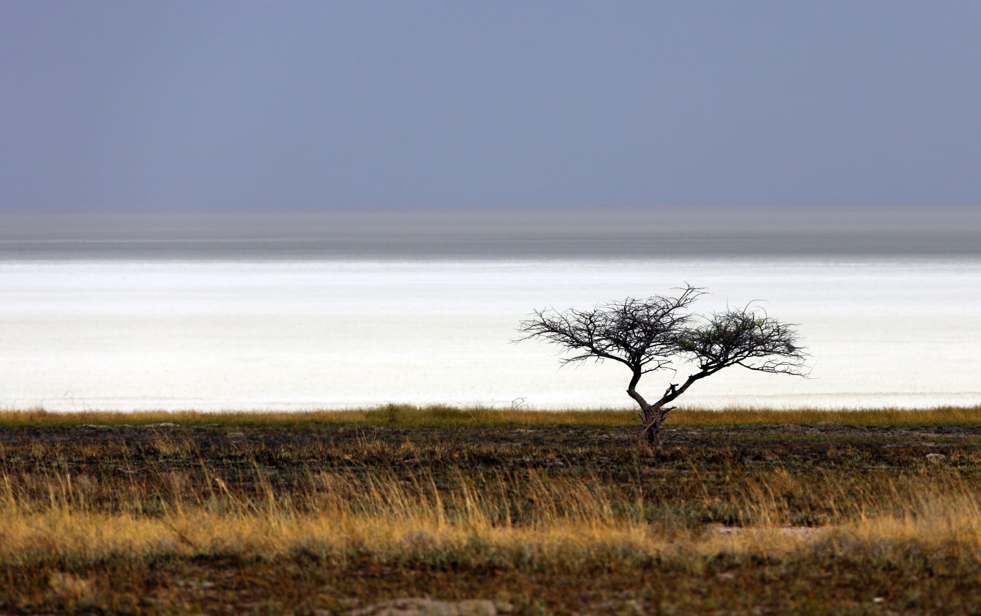
A lone thorn tree in dry grass in front of a flat white salt pan shimmering in the heat

Namibia

Etosha & the North

An umbrella thorn beside the salt-encrusted Etosha pan in the dry season. (Alchemist-hp / Wikimedia Commons · FAL)

Namibia's populous, well-watered north — the four Owambo regions around Oshakati and Ondangwa, the Etosha pan on their southern edge, the Kavango river towns along the Angolan border and the long Zambezi region, the former Caprivi Strip — home to a large share of all Namibians and to landscapes of floodplain, mopane and river quite unlike the desert south.

Explore Etosha & the North

History

The Owambo peoples settled the floodplains between the Kunene and Okavango rivers several centuries ago, farming millet and keeping cattle, and organised themselves into kingdoms such as Ondonga, Uukwambi, Ongandjera and Uukwanyama, the last divided by the later colonial border with Angola. Along the Kavango river five small kingdoms grew up, and the eastern floodplains of the Zambezi fell under the influence of the Lozi kingdom to the east. Finnish Lutheran missionaries arrived in Ondonga in 1870, and their mission at Olukonda became a centre of schooling and of Bible translation into Oshiwambo.

The Germans never ruled the far north directly; it lay outside their "Police Zone", although the odd shape of the Zambezi region comes from the 1890 Anglo-German agreement that gave Germany a corridor to the Zambezi, named the Caprivi Strip after the chancellor Leo von Caprivi. Under South Africa the north became a reservoir of migrant labour for mines and farms, and the contract system provoked the great strike of 1971–72. The Kwanyama king Mandume ya Ndemufayo died in battle against South African forces in 1917.

The liberation war began at Omugulugwombashe in Omusati in August 1966, and the north bore the brunt of the fighting between SWAPO's guerrillas and South African forces until 1989. After independence the region became SWAPO's electoral heartland. In the Zambezi region, a secessionist group attacked Katima Mulilo in 1999, leading to a long treason trial.

Culture & Customs

The four Owambo regions are the country's most densely peopled, and Oshiwambo in its dialects is the language of daily life. Lutheran and Anglican churches are central to community life, a legacy of the Finnish and English missions, and traditional kings and councils still play a role in land and custom. Homesteads are traditionally built as enclosed compounds of huts and granaries within wooden palisades, and many families divide their lives between a town job and the homestead in the village.

Olufuko, a traditional initiation festival for young women revived in Outapi, has drawn both support and criticism in national debate. Owambo weddings are large, colourful affairs, and women's dresses in bold printed fabric are a regional style.

The Kavango regions have their own languages, such as Rukwangali and Thimbukushu, and are known for woodcarving: bowls, drums, masks and furniture sold along the Trans-Caprivi Highway. In the Zambezi region, Silozi is the common language, with Subiya and Fwe communities, and the Mafwe and Masubia traditional authorities remain influential; their cultures look east towards Zambia and Botswana more than towards Windhoek.

Daily Life

Oshakati, Ongwediva and Ondangwa form a near-continuous strip of shops, markets, car dealers, churches and schools along the B1, the busiest urban area outside Windhoek, and the border town of Helao Nafidi does a brisk trade with Angola. Around them, most people still live on homesteads farming mahangu (pearl millet) and keeping cattle and goats, with money from town jobs, pensions and relatives working in Windhoek. Floods from the oshanas and droughts alternate from year to year.

Rundu, on the Kavango river, has grown rapidly into one of Namibia's larger towns, and Katima Mulilo is the capital and market of the Zambezi region and a trucking stop on the route to Zambia. Unemployment is high across the north, especially among the young, and rural poverty is deeper in the Kavango regions than elsewhere in the country.

Tourism is concentrated around Etosha and the rivers, where community conservancies in the Zambezi share income from lodges and wildlife. Tsumeb, on the eastern side of Etosha, is an old copper-mining town known worldwide for its minerals.

Food

The staple of the north is oshifima, a stiff porridge of pounded mahangu, eaten with the fingers alongside a relish of meat, dried fish or ombidi, wild spinach. Oshikundu, a lightly fermented drink made from millet, is served at home and sold in markets, and omagungu, mopane caterpillars, are dried and fried as a seasonal protein.

The marula tree is prized: its fruit makes omaongo, a fermented drink brewed for celebrations, and its kernels are pressed for oil used in cooking. In the rains the giant omajowa mushrooms that grow from termite mounds are gathered and sold at the roadside. Chicken, goat and beef grilled at open-air markets are everyday fast food in the Owambo towns.

The rivers add fish: bream from the Kavango and the Zambezi floodplains, dried and smoked for trade, and tigerfish caught by anglers on the Zambezi. River lodges serve bream grilled whole, and Katima Mulilo's markets sell fish, maize meal and Zambian produce side by side.

Attractions & Natural Wonders

Etosha National Park is one of Africa's great game parks, built around a salt pan that stays dry for most of the year. Its waterholes, some floodlit at the rest camps, draw elephant, black rhino, lion, giraffe, zebra, springbok and gemsbok in the dry season, and the park is easy to explore by ordinary car. Namutoni, a restored German fort at the eastern gate, is one of the rest camps; the park extends south and west beyond these regions. Nearby Lake Otjikoto, a sinkhole lake, and the mining town of Tsumeb with its museum make easy stops.

In the Owambo towns, Ondangwa is the gateway to the Nakambale Museum at Olukonda, set in the old Finnish mission house, and to homestead visits. Further west, Outapi's Ombalantu baobab can be entered, Omugulugwombashe has a memorial to the war's first battle, and Ruacana Falls on the Kunene river flows after good rains.

Rundu sits above the Kavango river, with river lodges, boat trips and woodcarving markets; downstream, Popa Falls is a series of rapids near Divundu. The Zambezi region begins at Bwabwata National Park, where elephants, buffalo and hippos use the Kavango and Kwando rivers, and continues through Mudumu and the wetlands of Nkasa Rupara to Katima Mulilo on the Zambezi.

Cities in Etosha & the North

Planning basics

Budget

The Owambo towns and the Kavango are some of the cheapest places in Namibia to stay and eat, with plain hotels, guesthouses and cheap market food, though few travellers linger there. Etosha costs more: the state-run rest camps inside the park are fairly priced but book out, while private lodges outside the gates charge safari rates. River lodges in the Kavango and Zambezi span campsites to upmarket.

Daily Budget Midrange
USD 150–400 (Etosha rest-camp chalets or lodges outside the park, river lodges, boat trips and guided drives)
Daily Budget Shoestring
USD 45–80 (camping at Etosha or river lodges, self-catering, a shared hire car, park fees)

Book the rest camps inside Etosha well ahead for July to October; staying inside the park allows early and late game viewing.

Safety

The north is generally calm. The towns have ordinary petty crime, and the busy B1 through the Owambo regions has heavy traffic, pedestrians and livestock. Malaria is present, especially in the Kavango and Zambezi regions during and after the rains, and the rivers hold crocodiles and hippos. Inside Etosha, leaving the vehicle outside fenced areas is forbidden for good reason.

Take malaria precautions in the Kavango and Zambezi, keep to Etosha's gate times, avoid swimming in the rivers and do not drive at night. Check current official travel advice before travelling.

Climate

The north is the wettest and hottest part of Namibia. Summer rains from about November to April flood the shallow channels, the oshanas, of the Owambo plains and occasionally part of the Etosha pan, and the Zambezi region receives the most rain in the country. October, before the rains, is fiercely hot. Winters are dry and warm by day with cool nights.

Summer
hot and humid, 30–38°C, with heavy afternoon storms, especially in the Kavango and Zambezi
Winter
dry, 24–28°C by day; nights cool at 8–12°C, colder at Etosha

Transportation

The paved B1 runs north from Windhoek to Etosha's eastern side and the Owambo towns, and Ondangwa has an airport. The Trans-Caprivi Highway runs from Grootfontein through Rundu to Katima Mulilo, which has bridges to Zambia and, via Ngoma, to Botswana's Chobe. Etosha's main roads are gravel suitable for an ordinary car; the Zambezi parks need a 4x4. Minibuses link the towns but not the parks.

Windhoek to Etosha's eastern gate is about six hours by car, and Rundu to Katima Mulilo about five.

Best Time to Visit

June to October is the time for Etosha, when the bush is thin and game crowds the waterholes; September and October are best for sightings but very hot. The Kavango and Zambezi rivers are good in the dry months too, with high water from about March to May flooding the Zambezi floodplains. The rains bring newborn animals and migrant birds, and malaria.