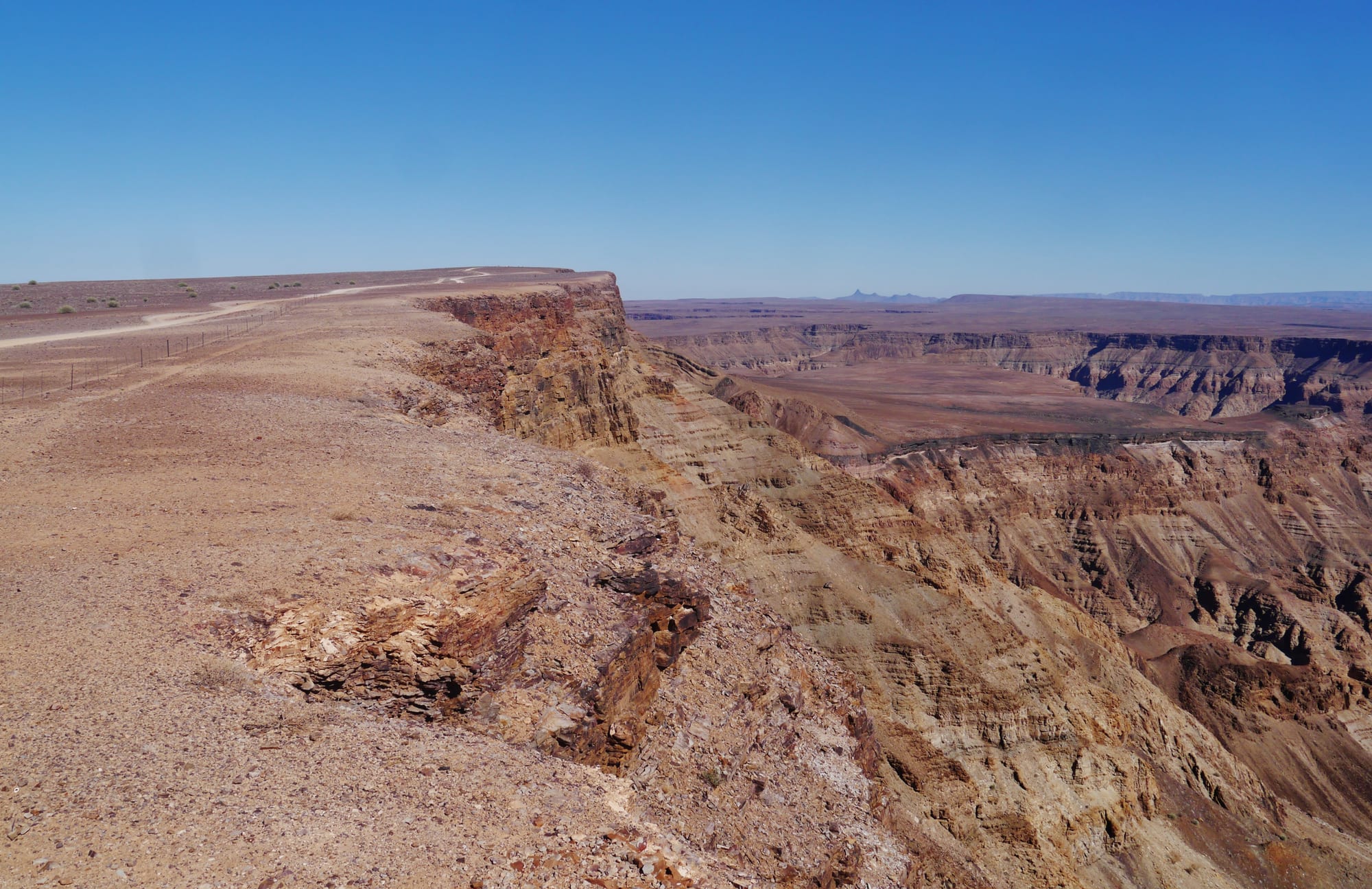
A gravel track along the rim of a deep, layered brown canyon stretching to a flat horizon under a clear sky

Namibia

Sossusvlei, Fish River Canyon & the South

The rim of the Fish River Canyon in the Karas region of southern Namibia. (Zairon / Wikimedia Commons · CC BY-SA 4.0)

Namibia's southern half, the Hardap and Karas regions — the red dunes of Sossusvlei and the Naukluft mountains in the west, the sheep and cattle country of Mariental and Keetmanshoop in the middle, the Fish River Canyon and the Orange river on the South African border, and the diamond coast of Lüderitz and Kolmanskop. It is Nama country and the first part of Namibia colonised by Germany.

Explore Sossusvlei, Fish River Canyon & the South

History

The south was the land of the Nama, Khoekhoe-speaking herders, and of San hunter-gatherers before them. In the 19th century Oorlam groups — Nama-speaking families of mixed Khoekhoe and European descent migrating from the Cape — settled at places such as Bethanie and Gibeon, bringing horses, guns and Christianity, and the Rehoboth Basters, another Cape community of mixed descent, founded Rehoboth in the 1870s. Missionaries followed; the Schmelen house at Bethanie is one of the oldest buildings in Namibia.

German rule began here. In 1883 the Bremen merchant Adolf Lüderitz bought the bay of Angra Pequena, where Bartolomeu Dias had planted a stone cross on his voyage of 1487–88, and in 1884 Germany declared its protectorate. Hendrik Witbooi, the Nama leader at Gibeon, resisted for years and then signed a treaty, but in 1904 he joined the war against German rule and was killed in 1905. Nama and Herero prisoners were held in a concentration camp on Shark Island at Lüderitz, where many died; the killings of these years are recognised as genocide.

In 1908 a railway worker found a diamond near Kolmanskop, and a rush followed. Germany declared a vast coastal Sperrgebiet, or forbidden zone, and the diamond fields made Lüderitz rich for a generation. Under South African rule the south became karakul sheep country, and mining moved to Oranjemund at the mouth of the Orange river. Kolmanskop was abandoned in the 1950s.

Culture & Customs

The Nama give the south its character. Khoekhoegowab, with its click consonants, is spoken alongside Afrikaans, which is the everyday language of much of the region. Nama women's long Victorian-style dresses and headscarves are worn at festivals, and Nama music centres on the guitar and violin and the quick-stepping riel dance, performed by couples raising dust in a circle. Hendrik Witbooi is honoured as a national hero, and Gibeon remains the seat of the Witbooi traditional authority.

The Rehoboth Basters keep a strong communal identity, their own history and a Kaptein, and have long sought recognition of their land rights. Afrikaner and German farming families are an old presence on the large sheep and cattle farms, and Lüderitz and the towns of the south keep German churches and buildings, such as the Felsenkirche on the rock above the harbour.

Religious life is strongly Christian, shaped by the Rhenish and other missions, and church choirs, family gatherings on the farms and small-town rugby and soccer fill weekends. The dry landscape and the long history of land loss are central themes in local memory.

Daily Life

The south is the emptiest part of an empty country. Keetmanshoop, with about 28,000 people, is the regional centre on the B1 and the railway; Mariental and Rehoboth are the main towns of Hardap, and Lüderitz a small fishing and harbour town on the coast. Oranjemund, at the mouth of the Orange river, is a diamond-mining town.

Most land is taken up by huge commercial farms raising sheep, goats and cattle, and karakul pelts, sold as Swakara, were once the south's great export. Diamond mining continues around Oranjemund, while Lüderitz depends on fishing, rock lobster and oyster farming. Along the Orange river, irrigated farms at Aussenkehr grow table grapes for export, employing thousands of seasonal workers who live in informal settlements, and the Hardap dam supplies water to Mariental.

Tourism around Sossusvlei and the canyon provides jobs, but many small towns are shrinking, water is scarce, and droughts hit the farms hard. Green hydrogen projects near Lüderitz are the region's big new hope.

Food

Southern Namibia is lamb country, and lamb from the dry veld, where sheep graze on aromatic shrubs, is the local favourite, grilled as chops at a braai or slow-cooked in a potjie. Game from the farms — gemsbok (oryx), springbok and kudu — is served as steaks, stews and biltong, and farm kitchens bake bread in cast-iron pots over coals.

The coast adds seafood. Lüderitz's cold, clean water produces oysters and rock lobster, and harbour restaurants serve line fish, mussels and crayfish. Nama and Afrikaans home cooking share dishes such as vetkoek, fried dough filled with mince or jam, and mealie pap with tomato and onion sauce, and roosterkoek, bread rolls baked on the grill.

German bakeries in Lüderitz and Keetmanshoop sell Brötchen and cakes, and Aussenkehr grapes and dates grown under irrigation at the Naute dam near Keetmanshoop are local produce. Local lagers and South African wines are the usual drinks.

Attractions & Natural Wonders

Sossusvlei, in the Namib-Naukluft Park, is the south's great sight: clay pans among red star dunes, some rising more than 300 metres, reached through the Sesriem gate past Dune 45. Deadvlei's dead camelthorn trees, Big Daddy dune and the narrow Sesriem canyon are all close by, and the NamibRand Nature Reserve next door is known for its dark night skies. The Naukluft mountains, in the park's north-east, have hiking trails and mountain zebra, and Duwisib Castle, built by a German officer before the First World War, stands near Maltahöhe.

In the Karas region, the Fish River Canyon is the largest canyon in Africa, viewed from the Hobas rim and walked on a multi-day trail ending at the Ai-Ais hot springs; it forms part of a transfrontier park with South Africa. Near Keetmanshoop, the Quiver Tree Forest's tree aloes, once used by the San for arrow quivers, stand beside the Giant's Playground boulders.

On the coast, Lüderitz has the Felsenkirche, German colonial houses, Shark Island and Diaz Point with its replica cross. Kolmanskop, a few kilometres inland, can be explored on tours through its sand-filled houses, hospital and ballroom, and wild horses graze the desert near Aus.

Cities in Sossusvlei, Fish River Canyon & the South

Planning basics

Budget

The south is spread out, so fuel and a hire car dominate costs. The area around Sossusvlei has some of Namibia's most expensive lodges alongside the state campsite at Sesriem, which fills early; elsewhere guest farms, town guesthouses in Keetmanshoop and Lüderitz, and campsites at the Fish River Canyon and Ai-Ais are moderately priced. Park fees apply at Sossusvlei and the canyon.

Daily Budget Midrange
USD 150–430 (guest farms and lodges, a 4x4 or saloon, the Sossusvlei shuttle, a Kolmanskop tour)
Daily Budget Shoestring
USD 45–80 (camping at Sesriem, Hobas or Ai-Ais, self-catering, a shared hire car, park fees)

Staying inside the Sesriem gate lets visitors reach the dunes before sunrise, ahead of those arriving from outside; book it months ahead.

Safety

The south is calm and crime is low; the main hazards are the heat, the distances and the gravel roads, where rollovers are the commonest cause of serious accidents. Visitors walking in the dunes or the canyon need far more water than they expect. Much of the coast around Lüderitz lies in the former diamond Sperrgebiet, entered only with a permit or on authorised tours.

Start dune and canyon walks at dawn with plenty of water and sun protection, drive slowly on gravel, and keep out of restricted diamond areas. Check current official travel advice before travelling.

Climate

Arid to hyper-arid, with very little rain, most of it in summer thunderstorms in the east. Summers are extremely hot inland — the Fish River Canyon floor is one of the hottest places in the country — and winters are sunny with freezing nights. Lüderitz and the coast are cool, windy and often foggy, and the far south-west can get light winter rain.

Summer
very hot inland, 35–42°C at Sossusvlei and in the canyon; coast 18–24°C and windy
Winter
sunny days of 20–25°C inland, frosty nights; coast cool at 12–20°C

Transportation

The paved B1 runs south from Windhoek through Rehoboth, Mariental and Keetmanshoop to the Orange river border at Noordoewer, and the B4 runs west from Keetmanshoop through Aus to Lüderitz. Sossusvlei is reached by gravel roads, about five to six hours from Windhoek; a paved road runs from Sesriem to the dunes, and the last stretch is deep sand for 4x4s or the park shuttle. The Fish River Canyon is reached by gravel from Keetmanshoop.

Distances are long and fuel stops scarce: fill up at every town and avoid driving gravel roads after dark.

Best Time to Visit

May to September is best: cool enough to climb the dunes and walk the canyon, whose main hiking trail is open only in the cooler months. Sossusvlei is busy but beautiful all year, at its best at sunrise and sunset; in a rare wet year the vlei fills with water. Summer heat makes midday walking dangerous from November to March.