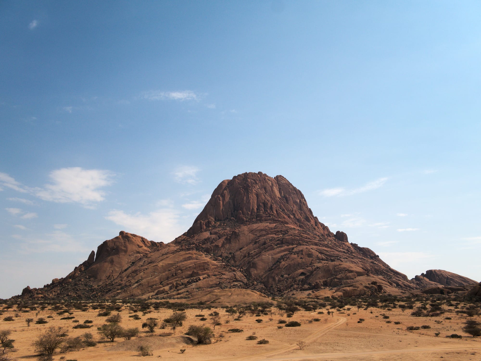
A reddish granite peak rising above flat sandy semi-desert dotted with low shrubs under a blue sky

Namibia

Swakopmund, Damaraland & the Skeleton Coast

The granite peak of the Spitzkoppe rising from the plains of the Erongo region. (Daniel Kraft / Wikimedia Commons · CC BY-SA 3.0)

Namibia's north-west, made up of the Erongo and Kunene regions — the fog-bound Atlantic coast from the port of Walvis Bay and German-built Swakopmund up the Skeleton Coast to the Kunene river, and inland the granite and basalt ranges of Damaraland and Kaokoland, with the Brandberg, Twyfelfontein's engravings, desert-adapted elephants and the Himba.

Explore Swakopmund, Damaraland & the Skeleton Coast

History

The north-west holds some of Namibia's oldest human traces. Hunter-gatherers carved thousands of animals, footprints and symbols into the sandstone at Twyfelfontein and painted the rock shelters of the Brandberg over thousands of years. Later the Damara, Nama-speaking herders and the Herero-speaking Himba settled the interior, and the Topnaar, a Nama group, lived along the lower Kuiseb river near Walvis Bay.

The Portuguese navigator Diogo Cão planted a stone cross at Cape Cross in 1486, but the desert coast deterred settlement for centuries. Walvis Bay's harbour drew whalers and traders, and in 1878 Britain annexed the bay, which later became part of the Cape Colony. Germany, shut out of the only good harbour, founded Swakopmund in 1892 as the port for its colony, built a railway inland to Windhoek and a jetty and mole against the surf. When Namibia became independent in 1990, South Africa kept Walvis Bay until handing it over in 1994.

Under South African rule, the Odendaal plan of the 1960s created the homelands of Damaraland and Kaokoland, names still used for the regions today. The Rössing uranium mine near Arandis opened in 1976 and made Erongo a mining region. Since independence, community conservancies in the Kunene have helped desert-adapted elephants and black rhinos recover from heavy poaching in the 1970s and 1980s.

Culture & Customs

The coast has a strong German-Namibian character: Swakopmund's German speakers, Lutheran church, bakeries and half-timbered buildings make it feel like a seaside town of another era, while Walvis Bay is a working port with a mixed Afrikaans, Oshiwambo, Nama and Damara population. Mondesa and Kuisebmond, the townships built for black workers, are large neighbourhoods of the two towns.

Inland, the Damara speak Khoekhoegowab with its click consonants and look to their own king and traditional council; Damara annual gatherings and choirs are important social events. In the Kunene, the Himba keep a semi-nomadic life based on cattle, goats and seasonal grazing. Himba women coat their skin and hair in otjize, a paste of red ochre and butterfat, and wear leather skirts and elaborate hairstyles that signal age and status. Sacred fires at homesteads link families with their ancestors.

Tourism has created difficult questions in Kaokoland: some villages welcome visitors on paid, community-run terms, while casual visits by tour vehicles are resented. Himba leaders have also opposed plans for a hydroelectric dam on the Kunene river that would flood ancestral land and graves.

Daily Life

Walvis Bay and Swakopmund, close together along the coast, are Namibia's second urban centre after Windhoek and among its fastest growing. Walvis Bay's deep-water port handles most of the country's sea trade and serves landlocked neighbours through road corridors inland, and its fishing fleet and fish-processing plants land hake, pilchard and horse mackerel from the Benguela current. Swakopmund lives from tourism, retirement and the uranium mines at Rössing and Husab in the desert behind it; green hydrogen and port expansion are the new hopes.

Inland Erongo has small towns such as Omaruru, Karibib, Usakos and the old tin-mining town of Uis. In the Kunene, Opuwo, Outjo, Khorixas and Kamanjab are service towns for communal farmers who herd goats and cattle on arid land, and drought regularly forces herders to move stock far from home. Conservancy jobs, lodge work and trophy-hunting fees provide cash, but unemployment is high and informal settlements ring the coastal towns.

Food

The coast eats from the Atlantic, and restaurants in both towns serve kingklip, hake, kabeljou and other line fish, calamari and rock lobster in season. Anglers along the Skeleton Coast's beaches cast for kob and steenbras.

Swakopmund keeps its German cooking: bakeries for rye bread, Brötchen and Kuchen, cafés serving Apfelstrudel and Black Forest cake, and beer halls offering Eisbein (pork knuckle), schnitzel and sausages with local lager. Game meat — oryx, kudu and springbok — appears on menus as steaks, stews and biltong.

Inland food is simpler. The Himba live largely on maize porridge, soured milk and occasional meat, and Damara households add wild foods from the veld. Along the Kuiseb, the Topnaar harvest the !nara melon, a spiny desert plant whose fruit pulp and large seeds are both eaten.

Attractions & Natural Wonders

Swakopmund's colonial buildings, jetty, museum and palm-lined seafront are a pleasant base, and the dunes between it and Walvis Bay, including the tall Dune 7, offer sandboarding and quad-biking. The Walvis Bay lagoon holds flamingos and pelicans, boat trips visit seals and dolphins off Pelican Point, and Sandwich Harbour to the south is reached by 4x4 over the dunes. Inland, the "Moon Landscape" and the ancient welwitschia plants lie along the Welwitschia Drive, and the Spitzkoppe granite peaks rise from the plains.

North along the coast, Cape Cross has a replica of Diogo Cão's cross and a colony of tens of thousands of Cape fur seals. Beyond the Ugab river the Skeleton Coast Park stretches to the Kunene, a coast of fog, gravel plains, shipwrecks and dunes.

Damaraland's highlights lie inland. The Brandberg, Namibia's highest mountain, shelters the "White Lady" painting in the Tsisab ravine at the foot of the mountain, about 30 km from Uis. Twyfelfontein's engravings, a UNESCO World Heritage Site, are shown by local guides, with the Organ Pipes basalt columns, Burnt Mountain and the petrified forest west of Khorixas nearby. Desert elephants move along the dry Huab, Hoanib and Hoarusib riverbeds, and black rhino are tracked on foot in the Palmwag concession. Further north, Opuwo is the gateway to Kaokoland's Himba communities, the Epupa Falls on the Kunene and the remote Marienfluss valley.

Cities in Swakopmund, Damaraland & the Skeleton Coast

Planning basics

Budget

Swakopmund and Walvis Bay have the widest range of accommodation in Namibia outside Windhoek, from backpacker hostels to boutique hotels, and adventure activities — dune tours, sandboarding, kayaking and scenic flights — are the main extra cost. Damaraland and Kaokoland have campsites and a handful of lodges, from community-run camps to expensive conservancy lodges; a 4x4 and fuel over long distances are unavoidable.

Daily Budget Midrange
USD 150–400 (guesthouses on the coast, Damaraland lodges, guided activities and rhino or elephant tracking)
Daily Budget Shoestring
USD 45–80 (hostels or camping, self-catering, a shared 4x4, community campsites)

Fill up with fuel and supplies in Swakopmund, Khorixas, Kamanjab or Opuwo; fuel stations are few and far apart in the north-west.

Safety

Swakopmund and Walvis Bay are relaxed, with occasional theft from cars and beaches. The real dangers are remoteness and the roads: rollovers on gravel, sandy riverbeds and flash floods, breakdowns far from help and almost no mobile signal in the north-west. Desert elephants and lions roam near villages and campsites, and the cold Atlantic has dangerous currents.

Carry extra water, fuel and two spare tyres, tell lodges the route, keep well back from elephants and do not swim on the open coast. Check current official travel advice before travelling.

Climate

Two worlds sit side by side. The coast is cooled by the Benguela current and wrapped in fog on many mornings, mild and grey all year, while a short drive inland the desert is hot and dry. Damaraland and Kaokoland get a little rain in summer thunderstorms and are very hot from October to March. Easterly berg winds occasionally bring sudden heat to the coast in winter.

Summer
coast mild at 17–25°C with morning fog; inland 32–40°C with rare storms
Winter
coast cool and foggy, 12–20°C; inland warm days of 22–28°C and cold nights

Transportation

Walvis Bay has an international airport with scheduled flights, and the paved B2 links Windhoek with Swakopmund in about four hours. A salt road runs north along the coast through Henties Bay to the Skeleton Coast Park, whose northern section is reached only on fly-in safaris. Inland, gravel roads link Uis, Khorixas, Twyfelfontein, Kamanjab and Opuwo, and a 4x4 with experience is needed for Kaokoland's tracks and river crossings.

Salt roads turn slippery in fog; keep speeds moderate and allow a long day for any drive in Kaokoland.

Best Time to Visit

Damaraland and Kaokoland are best from about May to October, when heat is bearable and desert elephants stay near the dry riverbeds. The coast suits any season, and December to January is when Namibians flock to Swakopmund for their holidays, filling accommodation. Summer rains can flood the north-west's riverbeds and cut tracks briefly.