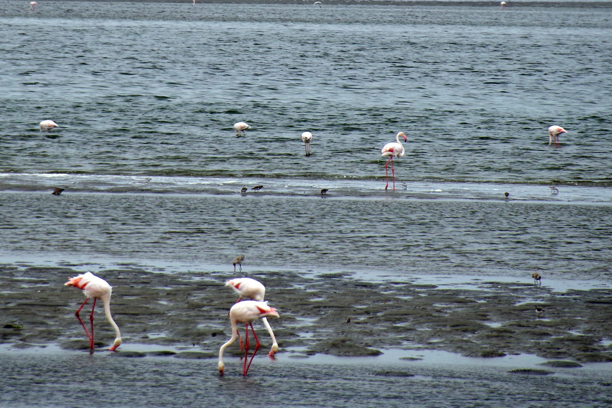
Greater flamingos feeding in shallow grey water and on wet mudflats, with more birds scattered across the lagoon behind

Swakopmund, Damaraland & the Skeleton Coast, Namibia

Walvis Bay

Flamingos feeding on the shallows of the Walvis Bay lagoon. (Balou46 / Wikimedia Commons · CC BY-SA 4.0)

Namibia's main port, on the only deep natural harbour along a long stretch of the Atlantic coast, with the Namib Desert at its back. Long held separately by Britain and then South Africa, it was transferred to Namibia in 1994. A working city of docks, fishing fleets and salt pans, it is known for a shallow lagoon where flamingos gather to feed.

Neighbourhoods

  • The town centre
    • First-time visitors
    • Shops and banks
    • Close to transport

    A flat grid of streets between the harbour and the lagoon, with shops, banks, a small museum, guesthouses and the civic buildings. It is businesslike rather than pretty, and everything is close together.

    Open in Maps
  • The lagoon and the Esplanade
    • Birdwatching
    • Walks and views
    • Quiet and residential

    The waterfront on the south-western edge of the city, where a promenade and a road run beside the shallow lagoon. Flamingos, pelicans and waders feed within a few metres of the path, and houses and guesthouses look over the water.

    Open in Maps
  • The Waterfront and the harbour
    • Boat trips
    • Seafood
    • Sunsets

    The area around the port entrance and the small-boat harbour, where catamarans and kayak operators leave for Pelican Point and where restaurants and the fishing fleet sit beside the working docks.

    Open in Maps
  • Kuisebmond and Narraville
    • Local life
    • Street food
    • Markets

    The residential districts east of the centre, built for black and mixed-race workers under apartheid-era planning and now home to most of the city's people, with churches, kapana grills, bars and small shops.

    Open in Maps
  • Dune 7 and the desert edge
    • Sandboarding
    • Picnics
    • Desert views

    Where the town's outskirts run into the dunes on the road inland, with a picnic site under palms below Dune 7. The airport lies along the same road.

    Open in Maps

Things to do

The lagoon and the birds

  • Walvis Bay lagoonpark

    A shallow, sheltered lagoon protected as a wetland of international importance, where flamingos, pelicans and waders feed on the mudflats beside the town.

    Open in Maps
  • Pelican Pointviewpoint

    A two-kilometre sand spit that shelters the bay, with a lighthouse at its tip and seals hauled out on the sand, reached by boat or by 4x4 across the salt works.

    Open in Maps
  • Bird Islandattraction

    A man-made guano platform standing offshore between Walvis Bay and Swakopmund, where seabirds roost and their droppings are harvested as fertiliser, visible from the coast road north.

    Open in Maps
  • The salt worksattraction

    Large evaporation pans beside the bay that produce about a million tonnes of salt a year by solar evaporation of sea water, their water coloured pink by algae and used by flamingos and waders.

    Open in Maps

The dunes

  • Dune 7viewpoint

    A steep dune about 10 km from the centre, with a picnic site at its foot, popular for climbing, sandboarding and quad trips.

    Open in Maps
  • Kuiseb River deltapark

    The dry river that ends in the dunes south of the city, marking the northern limit of the sand sea and home to the Topnaar communities and their !nara melons.

    Open in Maps

The working port

  • Walvis Bay Airporttransit hub

    The coast's international airport, in the desert east of the city, with scheduled flights to Windhoek and regional connections.

    Open in Maps

Short trips from the city

  • Sandwich Harbourbeach

    A lagoon and wetland where high dunes fall straight into the Atlantic, rich in birdlife and reachable only at low tide across the sand.

    Open in Maps
  • Swakopmundattraction

    The German-founded seaside town up the coast, with colonial architecture, a jetty, museums and the coast's adventure-sport industry.

    Open in Maps

Eat and drink

Long-standing places and food districts in Walvis Bay. Hours, ratings and directions come from your maps app, always current.

From the sea

  • Waterfront seafood restaurantsneighborhood

    Hake, kingklip, kabeljou, calamari and the oysters farmed in the bay, served beside the small-boat harbour and the lagoon.

    Open in Maps
  • Oysters from the bayrestaurant

    Oysters farmed in the cold, plankton-rich water of the bay, a speciality of the restaurants beside the harbour.

    Open in Maps

Markets and local kitchens

  • Kuisebmond kapana and fish stallsneighborhood

    Grilled beef strips with chilli salt, fried fish, fat cakes and pap sold at open stalls in the township east of the centre.

    Open in Maps
  • Town centre bakeries and caféscafe

    German-style bread and cakes alongside pies and strong coffee, a habit shared with Swakopmund up the coast.

    Open in Maps

Experience Walvis Bay

History

The bay is the only sheltered deep-water anchorage on a coast of surf and fog, and it drew whalers, sealers and traders long before any town existed. The Topnaar, a Nama-speaking people, settled along the lower Kuiseb river from the early nineteenth century, harvesting the !nara melon. Portuguese navigators charted the bay in the 1480s, and its name — the bay of whales — comes from the Dutch through Afrikaans.

In 1878 Britain annexed the bay and a small strip of land around it, later attaching it to the Cape Colony. When Germany claimed the surrounding territory in 1884, the one good harbour stayed British, which is why Germany built Swakopmund up the coast as its own port. The enclave passed to South Africa and was administered with the rest of South West Africa for much of the twentieth century, but South Africa kept it when Namibia became independent in 1990, holding the port and its offshore islands until they were transferred to Namibia on 1 March 1994.

Since then the city has grown as Namibia's trade gateway. Fishing and fish-processing expanded on the cold, productive Benguela current; the salt works and guano platforms continued; and the port was enlarged, with a new container terminal completed in 2019 that raised its capacity and its role in corridors serving Botswana, Zambia and the Democratic Republic of the Congo. Talk of green hydrogen and offshore oil has made the coast a focus of national economic hopes.

Culture & Customs

Walvis Bay is a working city and knows it. The rhythms of the port, the fishing fleet and the shift buses shape social life more than tourism does, and the population is mixed: Oshiwambo speakers who came for work from the north, Afrikaans-speaking families with long roots in the enclave, Nama and Damara communities, Topnaar households from the Kuiseb, and a smaller German-speaking presence than in Swakopmund. English is the official language, but Afrikaans is the common street language of the older neighbourhoods.

Its separate history has left a distinct local identity. Until 1994 residents lived under a different administration from the rest of the territory, with border formalities on the road out of town, and that memory still shapes how people here describe themselves. Kuisebmond and Narraville, created under apartheid-era planning, remain the population centres and have their own churches, choirs, football clubs and shebeens.

Angling, boating and birdwatching are genuine local pastimes rather than visitor activities, and the lagoon is treated as public property to be defended: its Ramsar listing and the protection of the tidal flats are points of civic pride. Football is followed closely, and the city's clubs draw strong support from the harbour workforce.

Daily Life

About 100,000 people live in Walvis Bay, most of them in Kuisebmond, Narraville and the informal settlements that have spread on the desert side of the city as migration from the north continues. Housing, water and serviced land are the constant political issues, in a place where rain almost never falls and fresh water has to be brought from outside the desert.

Work centres on the harbour: container handling, ship repair, bunkering, transport companies moving cargo inland, and above all fishing. Trawlers land hake, horse mackerel, sardines and kingklip, and the processing plants that freeze, can and pack them are the largest private employers. Salt production, oyster farming, guano collection and the airport add to it, and construction linked to port and energy projects comes and goes.

The city wakes early, in fog that often burns off by late morning, and quietens in the evening, when the Esplanade fills with walkers and anglers. Weekends mean fishing trips, braais and the short run up the coast to Swakopmund. Unemployment is high despite the industry, and the gap between the settled neighbourhoods and the newer shack settlements is wide and widely discussed.

Food

Fish defines the table. Hake is the everyday fish, fried or grilled and served with chips; kingklip, kabeljou, snoek and steenbras appear on restaurant menus; and calamari and rock lobster are seasonal luxuries. Snoek is often smoked or salted, and anglers' catches are braaied whole. Oysters are a local speciality, farmed in the bay's cold, plankton-rich water and eaten in the restaurants beside the harbour.

Away from the seafood restaurants, the food is Namibian and unfussy. Kapana — thin strips of beef grilled over open coals and dipped in a dry chilli and salt mix — is sold at stalls in Kuisebmond, with fat cakes (vetkoek), pap and beans. Braaied meat, boerewors sausage, biltong and potjie stews are standard at home, and game meat such as oryx and kudu turns up on menus aimed at visitors.

The German-Namibian influence from up the coast shows in the bakeries, with rye bread, Brötchen and cakes, and local lagers are the usual drink. The Topnaar of the Kuiseb valley still harvest the !nara melon, whose flesh is boiled into a cake and whose oily seeds are eaten roasted or pressed — the one truly local desert food of this stretch of coast.

Planning tools

Budget

Walvis Bay is a working city, so rooms are generally cheaper and plainer than in Swakopmund, with guesthouses along the lagoon and a few hotels in the centre. Fish and market food are inexpensive. The real costs are guided trips: catamaran cruises to the seals and 4x4 outings to Sandwich Harbour are the reason most visitors come.

Daily Budget Midrange
USD 150–400 (lagoon guesthouse, seafood dinners, a hire car and a boat or dune trip)
Daily Budget Shoestring
USD 45–80 (backpacker bed or campsite, self-catering and market food, a shared hire car)

Boat trips leave in the morning, when the bay is calmest; Sandwich Harbour trips are tide-dependent, so plans need a flexible day.

Best Time to Visit

The coast suits any season. Flamingo numbers on the lagoon are usually highest in the southern summer, roughly November to March, when migratory waders are present as well. December and January are warm and busy with Namibian holidaymakers; June to August is cool, grey and foggy but quiet and good for dune and desert trips inland.

Suggested Number of Days

A day or two is enough for the city and one trip out on the water. Three or four days suits anyone adding the desert and the coast beyond it. Many visitors base themselves up the coast instead and come down for the day, which works equally well in reverse.

First Visit
1–2 days
With Surroundings
3–4 days

Transportation

The city is flat and laid out in a grid, and cheap taxis run between the centre, Kuisebmond and the lagoon. Shared taxis and minibuses run up the coast to Swakopmund through the day. A hire car is useful for the salt works, Dune 7 and the airport, while Sandwich Harbour and Pelican Point are reached only with a guide.

Sand blows across the coast road and the desert tracks south of town swallow ordinary cars, so unguided driving beyond the salt works is a bad idea.

Airport & Station Connections

Walvis Bay Airport lies in the desert east of the city and has scheduled flights from Windhoek, taking a little over an hour, plus regional services. By road the paved B2 from Windhoek takes about four and a half hours via Swakopmund, which is half an hour up the coast. The port receives cargo ships and occasional cruise calls, and long-distance buses and minibuses serve both coastal towns.

Walkability

The centre and the lagoon front are flat and easy to walk, and the promenade beside the water is the best walk in the city, running for several kilometres past feeding flamingos. Distances between the centre, the waterfront and the eastern suburbs are longer than they look on a map, and the wind off the Atlantic is cold, so many short trips are made by taxi or car.

Safety

Walvis Bay is calm, with theft from parked cars, bag-snatching after dark and occasional street crime the main concerns, more so away from the centre at night. The Atlantic is cold and has strong currents, the desert south of the city is genuinely dangerous to enter without a guide, and tides at Sandwich Harbour cut off the beach route.

Carry extra water, fuel and two spare tyres, tell lodges the route, keep well back from elephants and do not swim on the open coast. Check current official travel advice before travelling.

Climate

Cool, dry and frequently foggy, governed by the cold Benguela current. Rain is rare, temperatures vary little through the year, and fog rolls in overnight and often clears by midday. Being in the southern hemisphere, summer falls in December to February and winter in June to August. Easterly winds occasionally bring sudden desert heat and dust.

Summer
mild, about 17–25°C, with morning fog and afternoon sea breeze
Winter
cool and grey, about 12–20°C, damp with fog and a cold wind

Local Customs

Afrikaans, Oshiwambo, Khoekhoegowab and English are all heard here, and the city feels more Namibian and less German than Swakopmund. This is a working port, so timekeeping around shift changes and boat departures matters. Bird colonies and the lagoon's mudflats are protected, and keeping a distance from feeding flocks is expected.

Tipping of around ten per cent is usual in restaurants, with a small tip for guides and car guards; ask before photographing people or homes in Kuisebmond and Narraville.

Common Payment Methods

The currency is the Namibian dollar, pegged one to one with the South African rand, which is accepted alongside it. ATMs and banks are in the centre, and cards are taken in hotels, restaurants and supermarkets. Cash is needed for taxis, market stalls, tips and car guards.